Dead Horse Point and Canyonlands
After such a great visit to Mesa Verde we weren’t sure how we could top that, but our next destination is the spot that inspired this whole trip to begin with and might just beat it: Dead Horse Point State Park, Utah. Funny name, but it came from a time when horse wranglers used the high desert mesa to corral the mustangs and let them pasture until they were ready to drive them off further north. The sheer cliffs were a natural fence line. It was said that one of the last roundups left the horses to perish, hence the name.
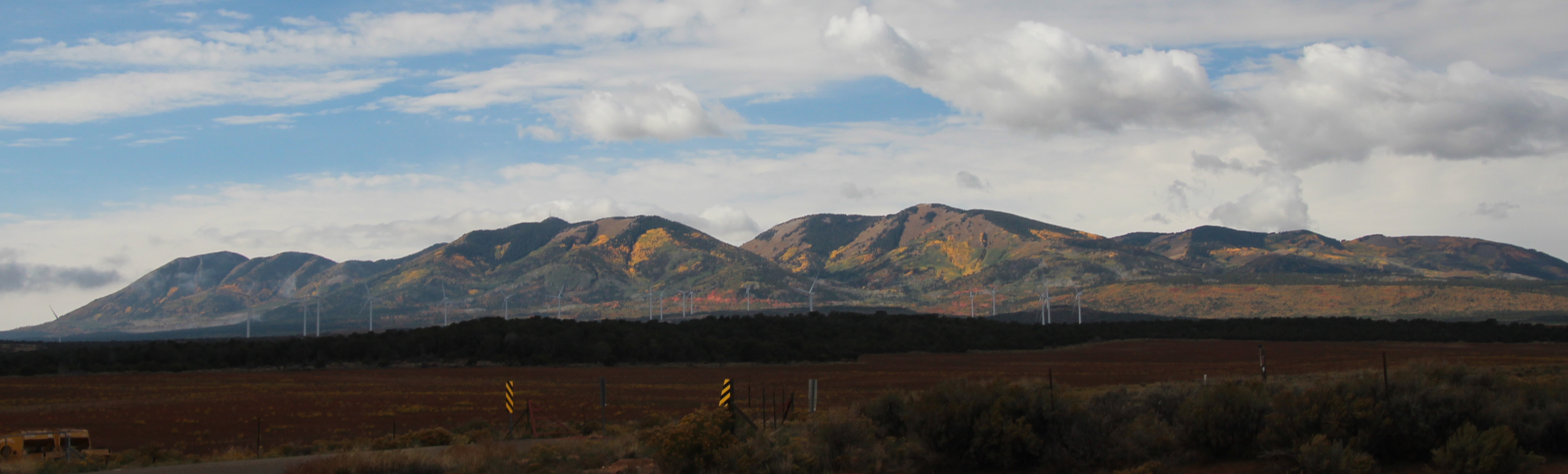
We took nice hot showers in the morning at the Ancient Cedars RV park, since we would have to rely on our own supply of water at DHP and hooked up the Jeep to start the trip from Cortez to Moab. Another amazing drive, with some rain showers tossed in. Every bend in the road brought a new sight. We left the mesas of New Mexico and were suddenly in gently rolling farm fields in Colorado. As the clouds broke off the horizon revealed a gorgeous mountain range of colorful shrubs and trees – a backdrop to the town of Monticello. As we drove closer to Moab the La Sal Mountain range was visible and below it red ridges and cliffs.


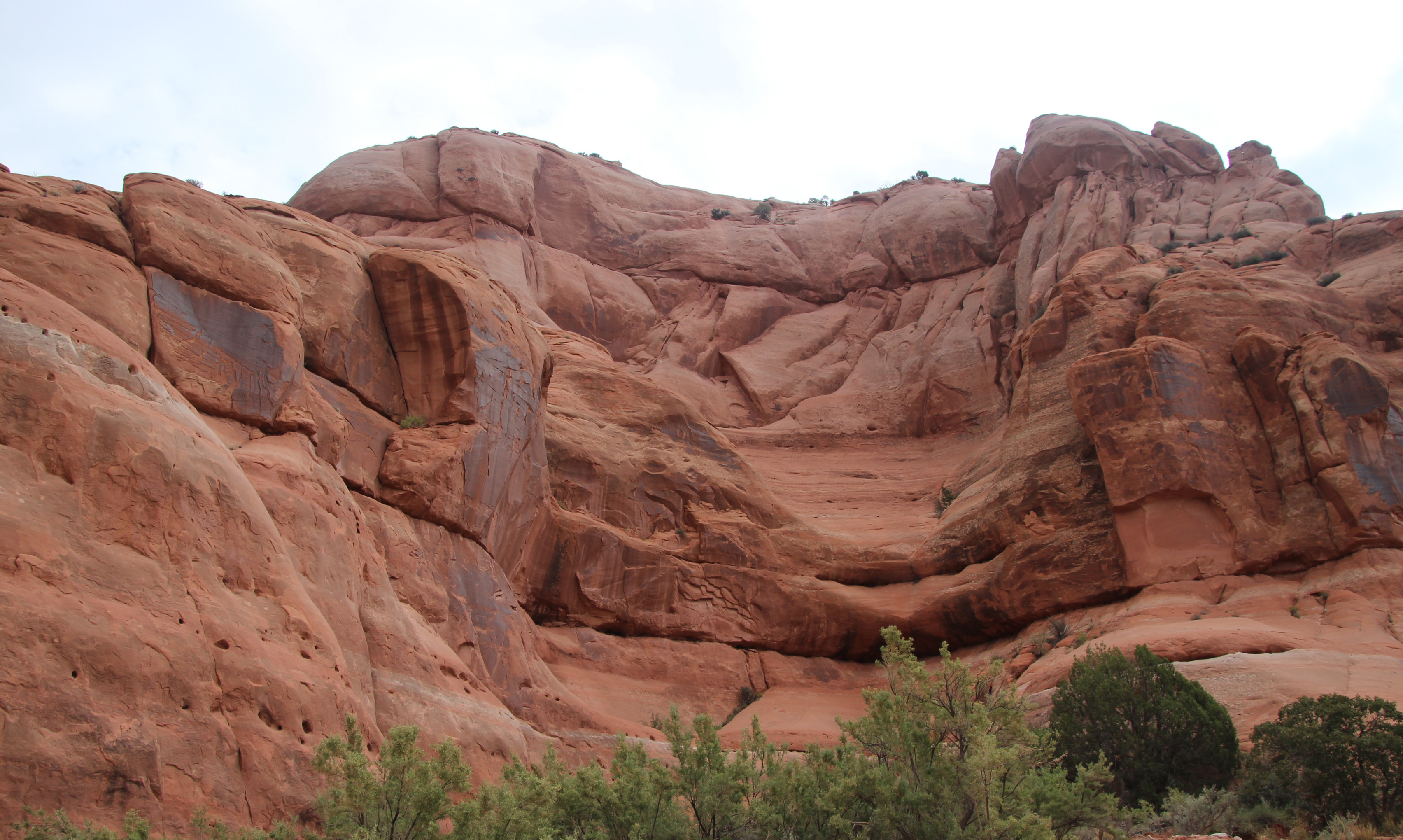
Most of the drive seemed like a long slow incline, but once in a while you would see signs for a 6% downward grade, and suddenly you would drop down into a canyon. That never ceases to amaze me – out of nowhere you suddenly drop into another environment, with plenty of sandstone formations and red rock palisades. One of the odd rock formations that stood out was Church Rock, which was a rounded spire pretty aptly named. Not long after, we stopped at a rest stop to eat lunch that had an amazing backdrop of rock.
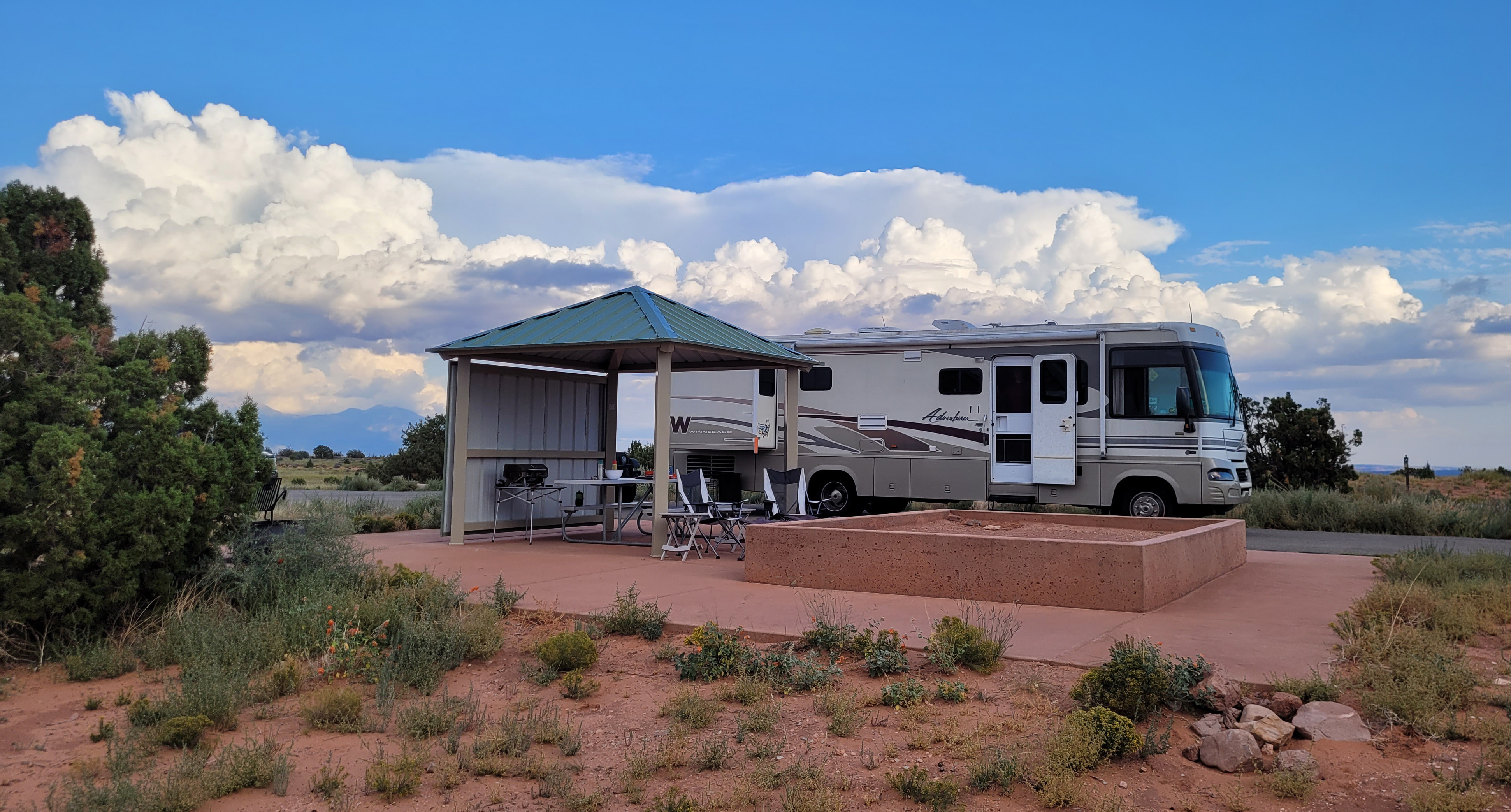
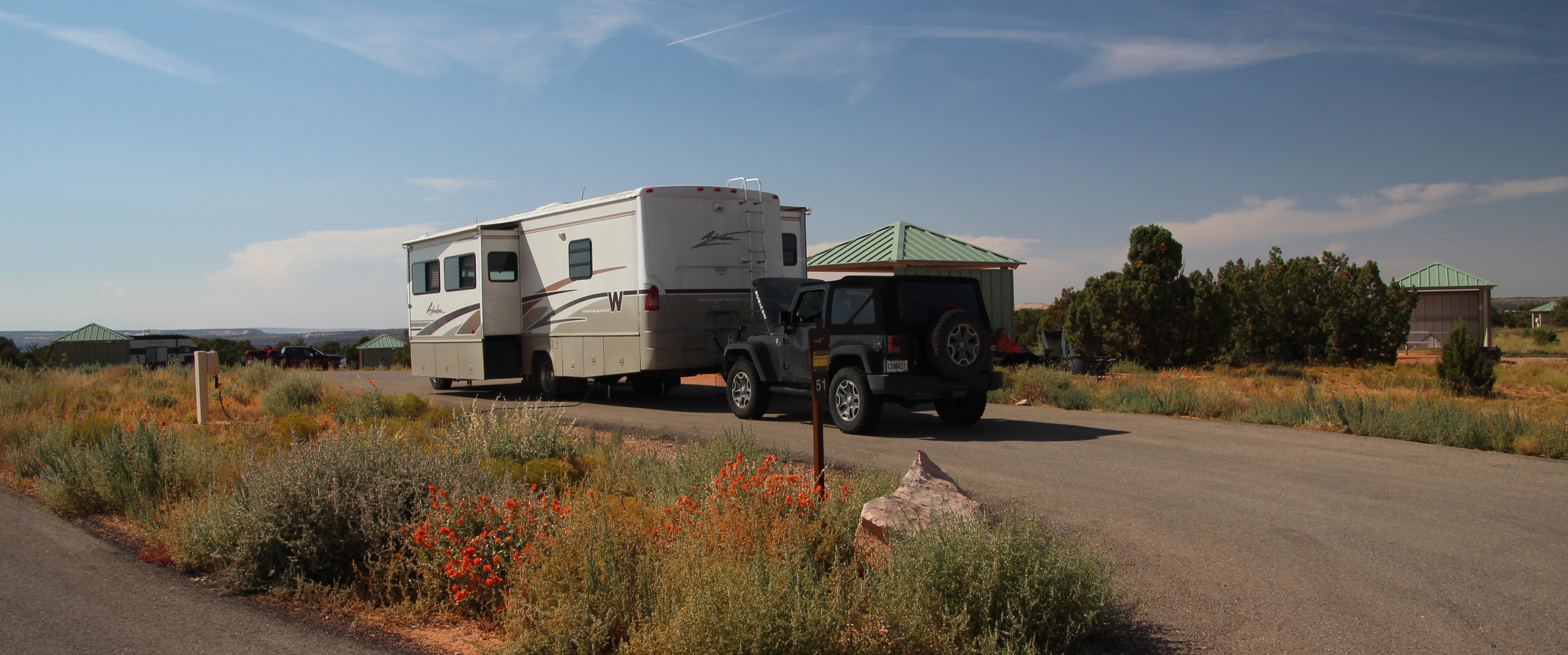
As we approached Moab we stopped to fill both the RV and the Jeep with gas so we would be ready for the next bit of driving and exploring. We drove through town, which looked a lot busier than our last visit, and then past the entrance to Arches National Park, where you could see cars slicing up the rock hillside. A left turn and we were headed uphill to Dead Horse Point, albeit a bit slow with full tanks of gas and water — plus I didn’t want a repeat of the overheating in Hyde Memorial. So, 20 mph suited me just fine up the incline. Another left turn and we were in the park headed to Wingate Campground. And OMG what a wonderful campsite it is. Long, flat and level spot that was so totally easy to disconnect and level. You can see by the pictures that this spot on the top of the mesa is well designed and nicely spaced out. Concrete pad, picnic table, sun/wind shelter and a raised “sandbox” for tents. Wow.


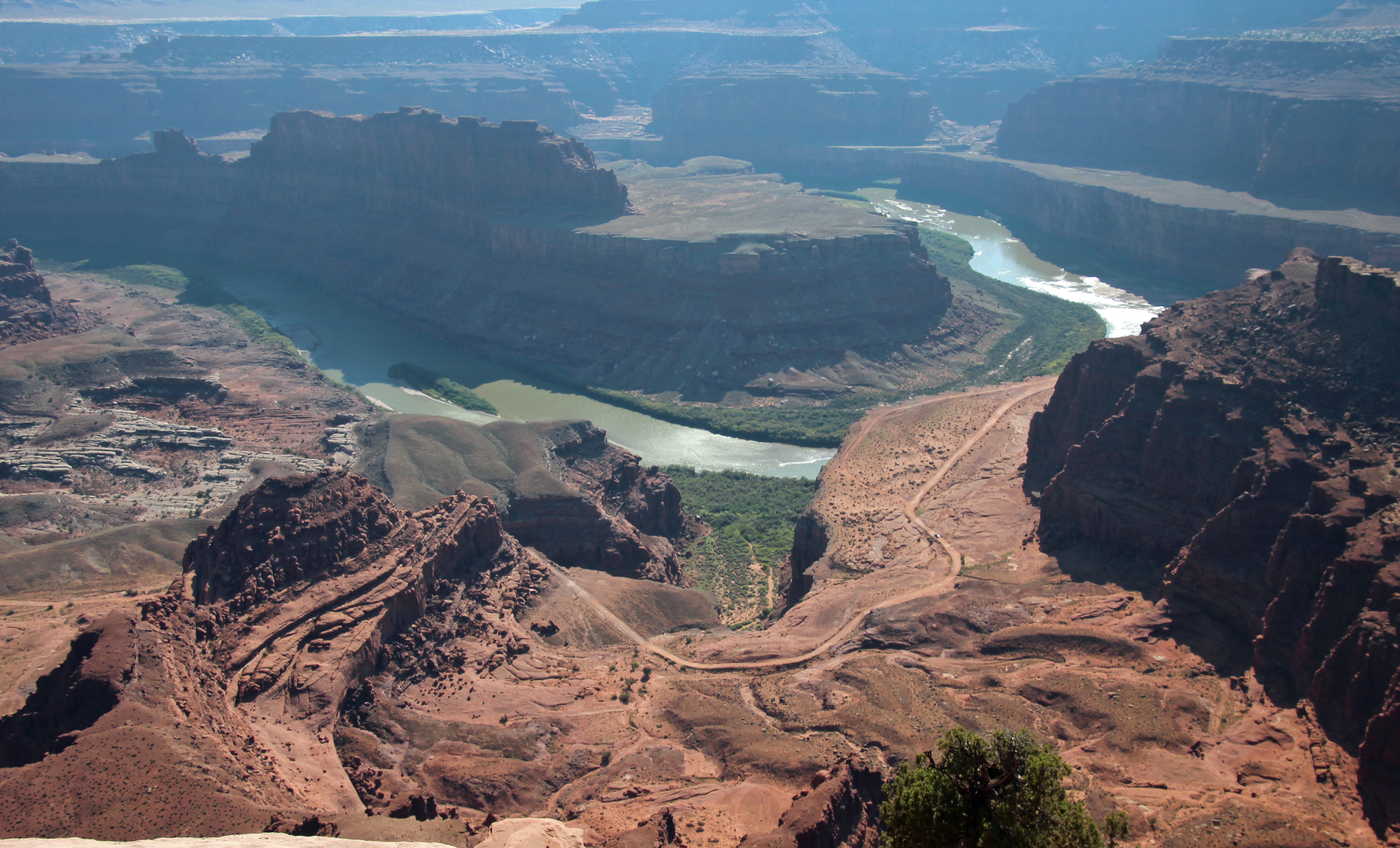

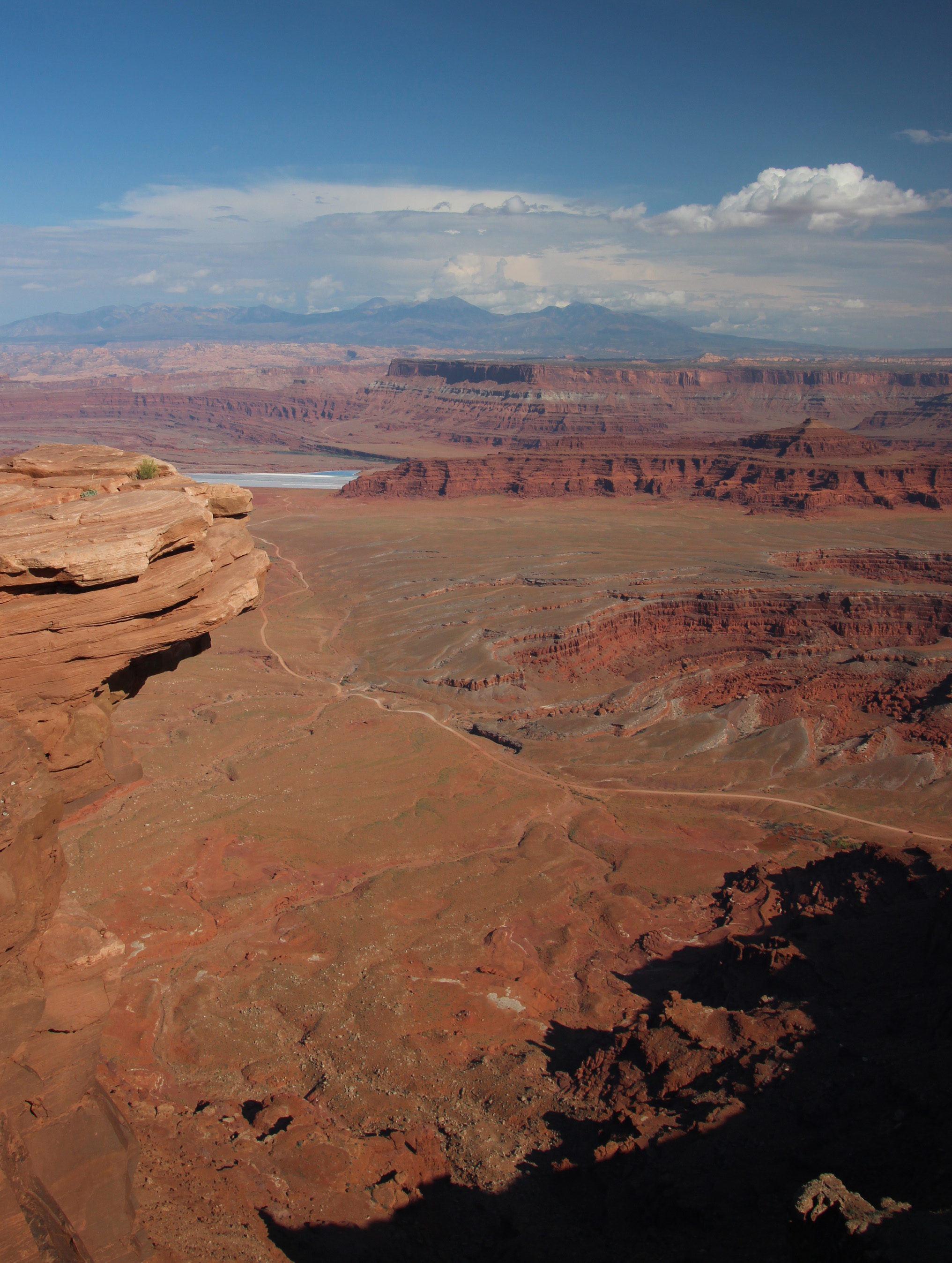

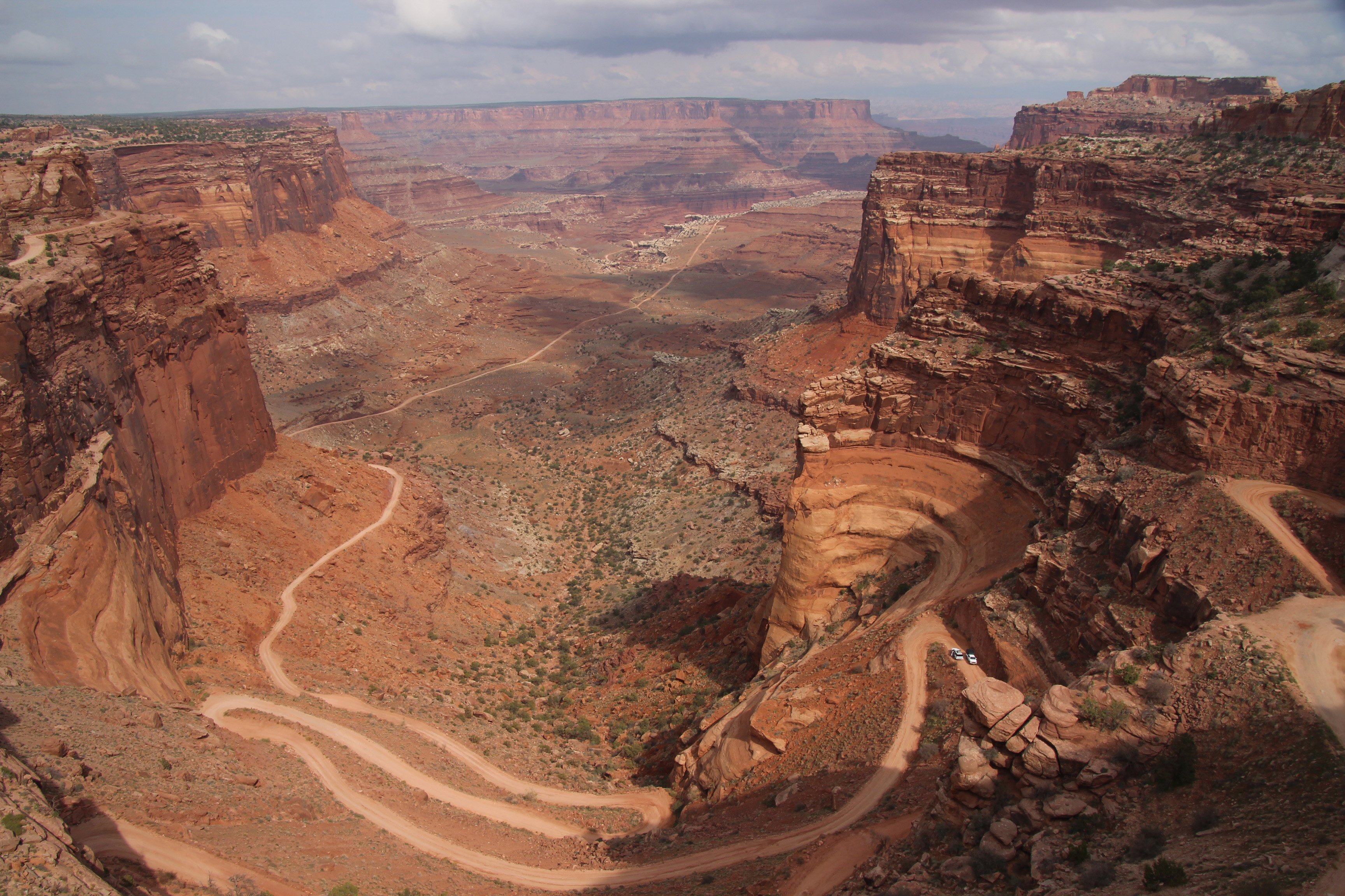
The weather all day was overcast to partly cloudy and the temperature went from 50’s to maybe 70 degrees. Dry air, cool breeze, no bugs! We sat for a bit, had a beer and chatted about what next. Since it was still early, we hopped in the Jeep to ride out to the point to have a look at the canyon. Wow, how amazing. We looked down on the Colorado River, some potash evaporation ponds and the Shafer Trail/Potash Road that we plan to drive in the Jeep. Yippee, we made it to this fabulous spot.
Over dinner at the picnic table (steak and grilled veggies) we discussed the next 6 days here. We have a rafting trip one day and will visit Canyonlands Islands in the Sky section, plus the Jeep drive down the canyon. BTW we are at 6,000 ft elevation in camp. I will have to let you know what it is at the bottom of the canyon after we drive it. There are rainstorms to the left and right, so it won’t be a sunset or dark sky viewing tonight (and yes we got a sprinkle). Texting with Alex, he asked about the looming government shutdown in two days. Well, we really had not been paying attention to news, and yes it looks like we only have one more day before national parks close. That means, despite the forecast for rain tomorrow, we are headed into Canyonlands while we can.
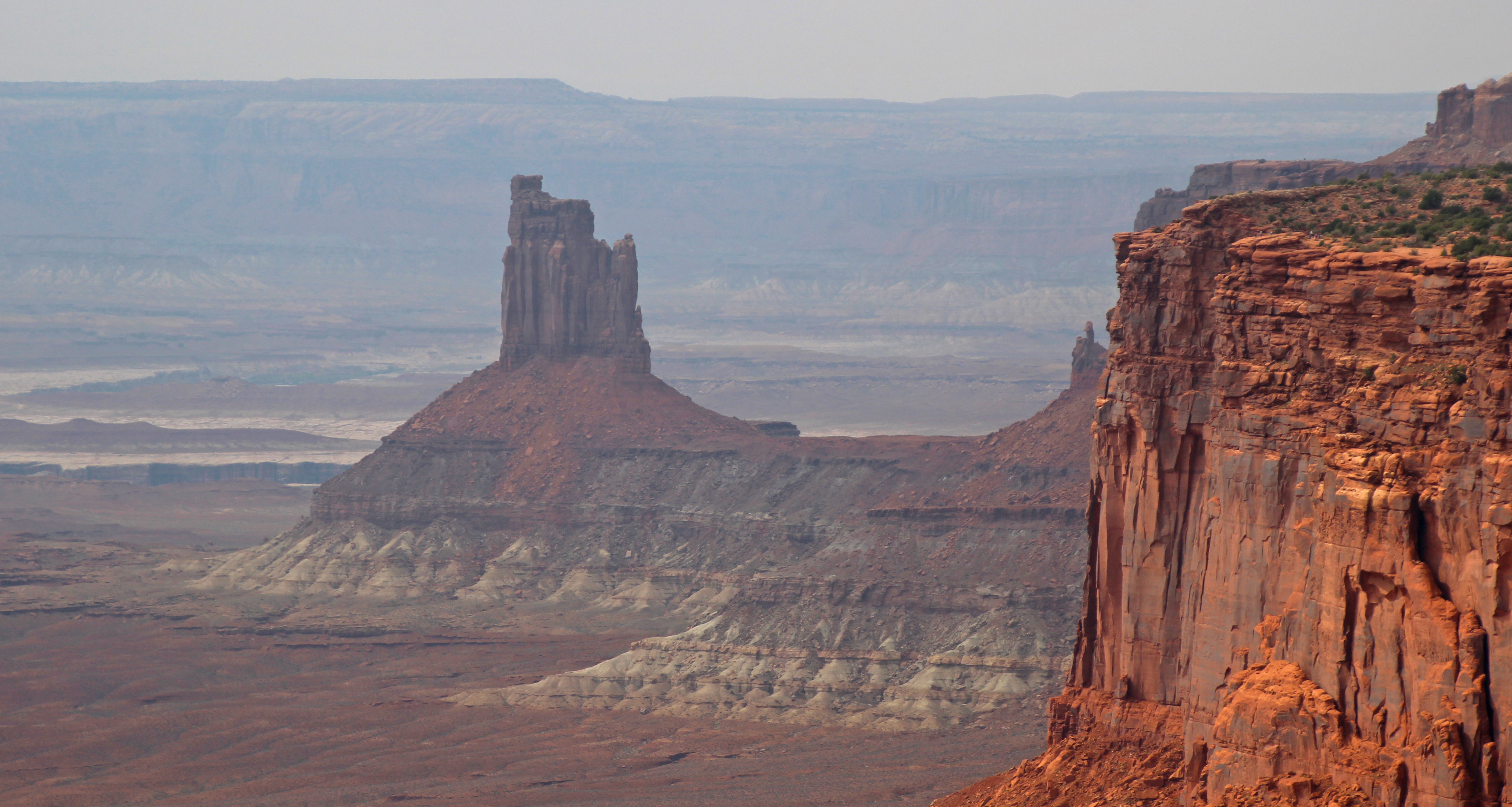
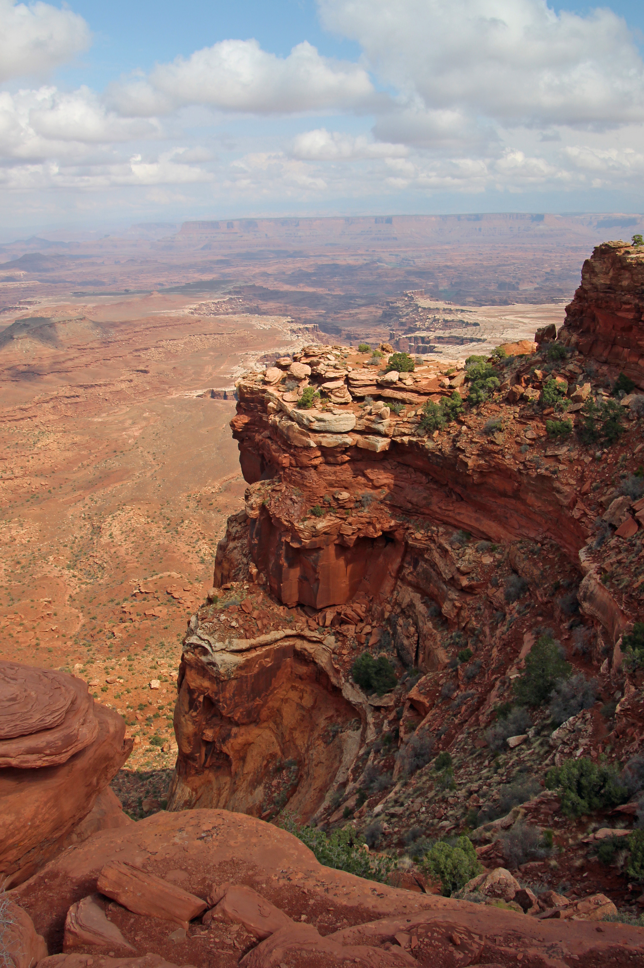
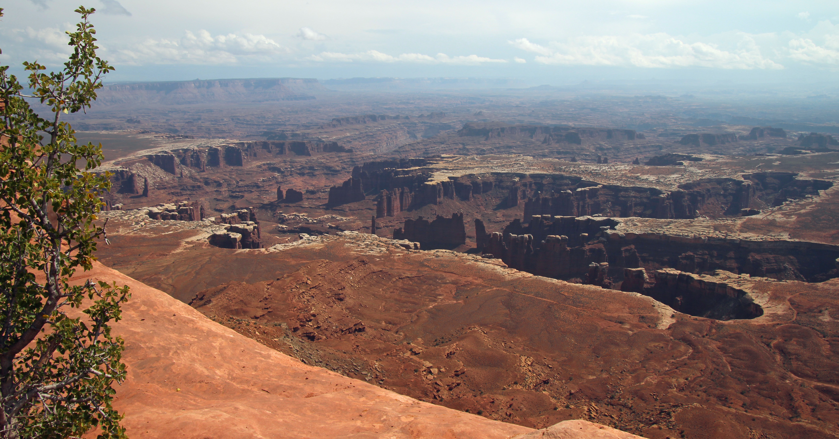

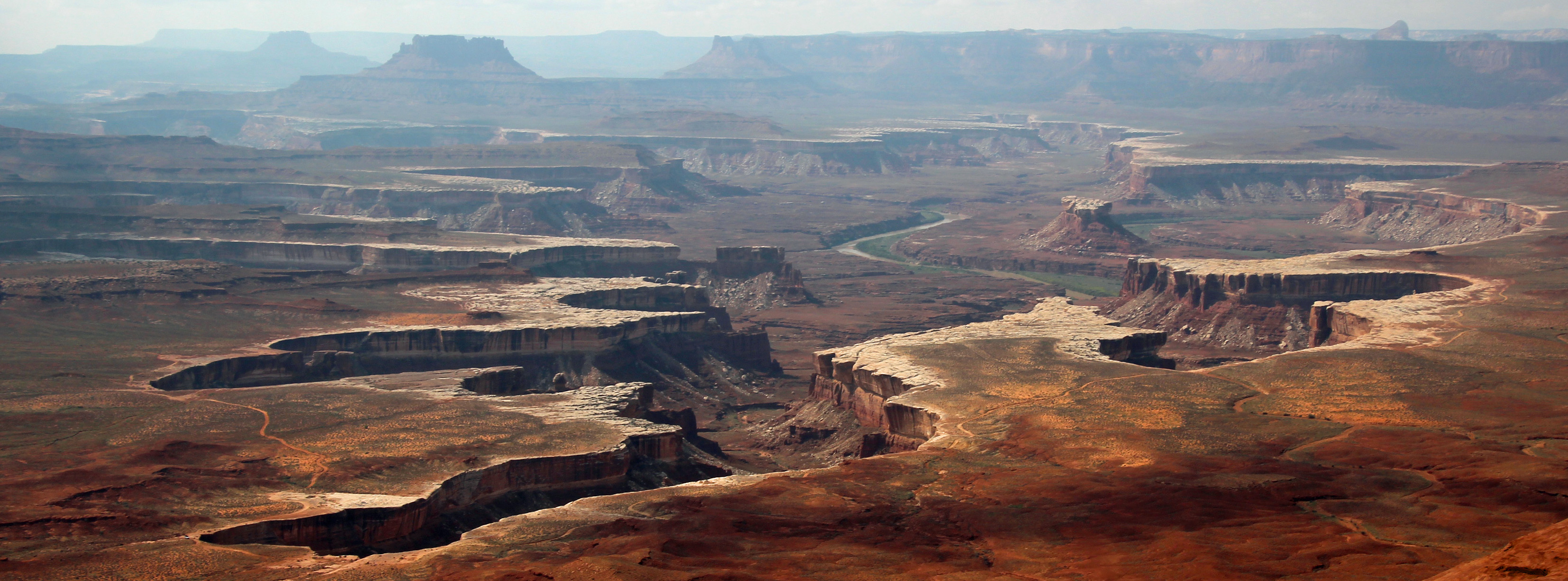
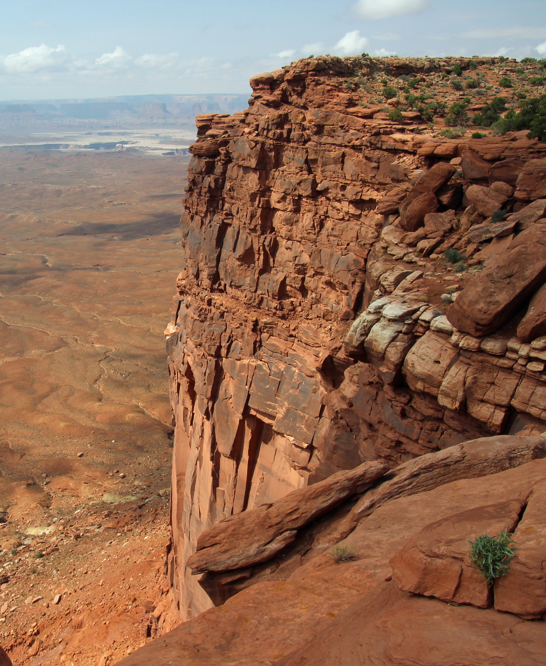


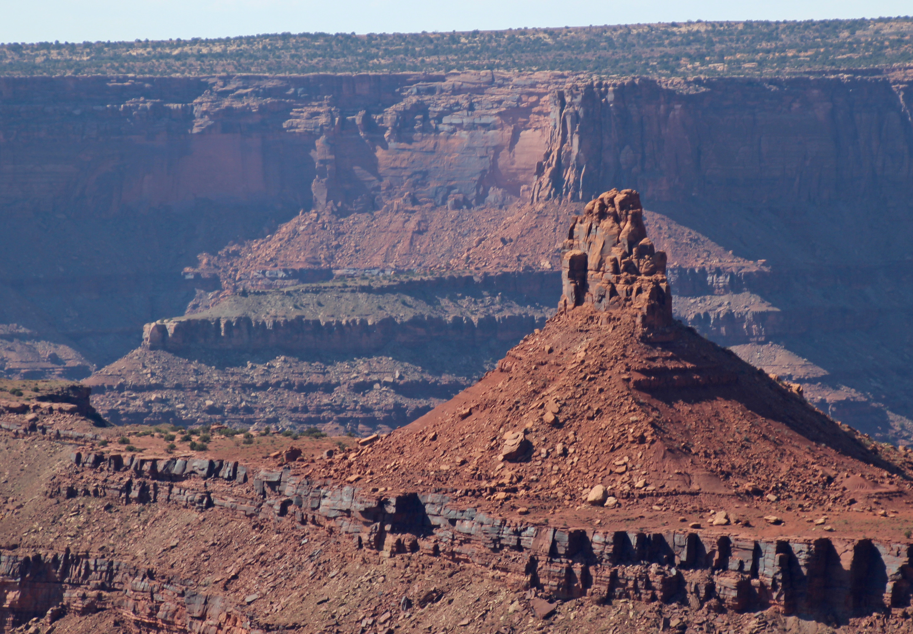
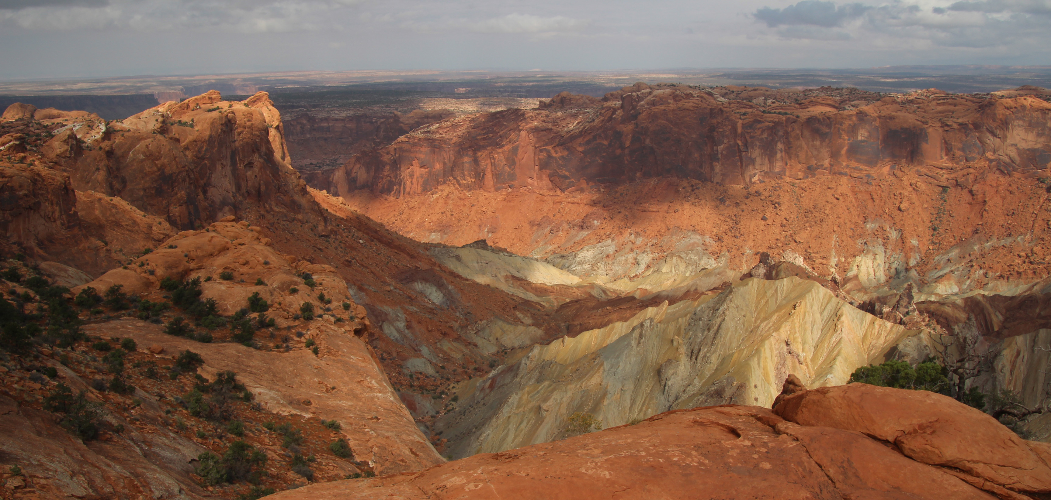
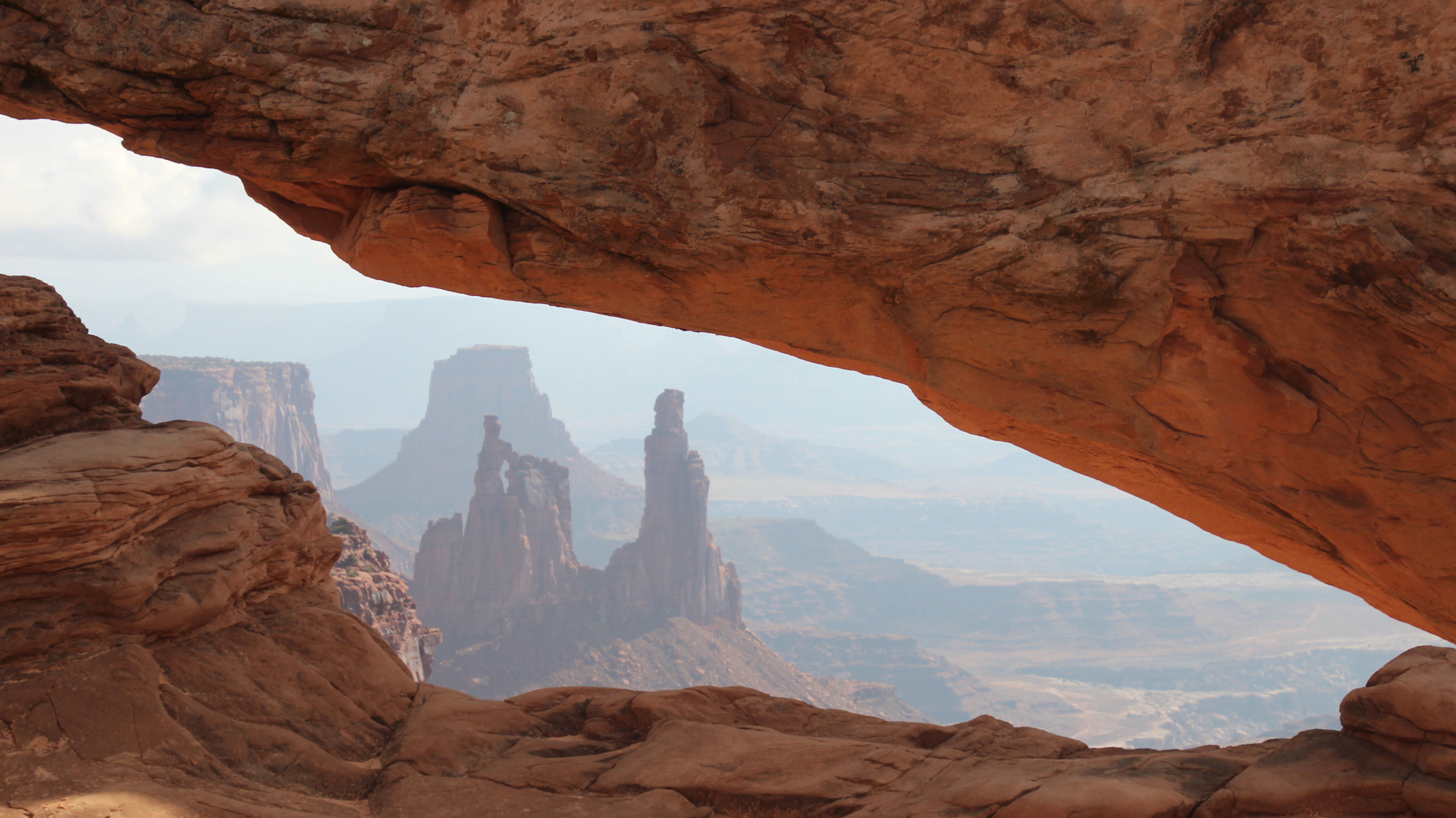
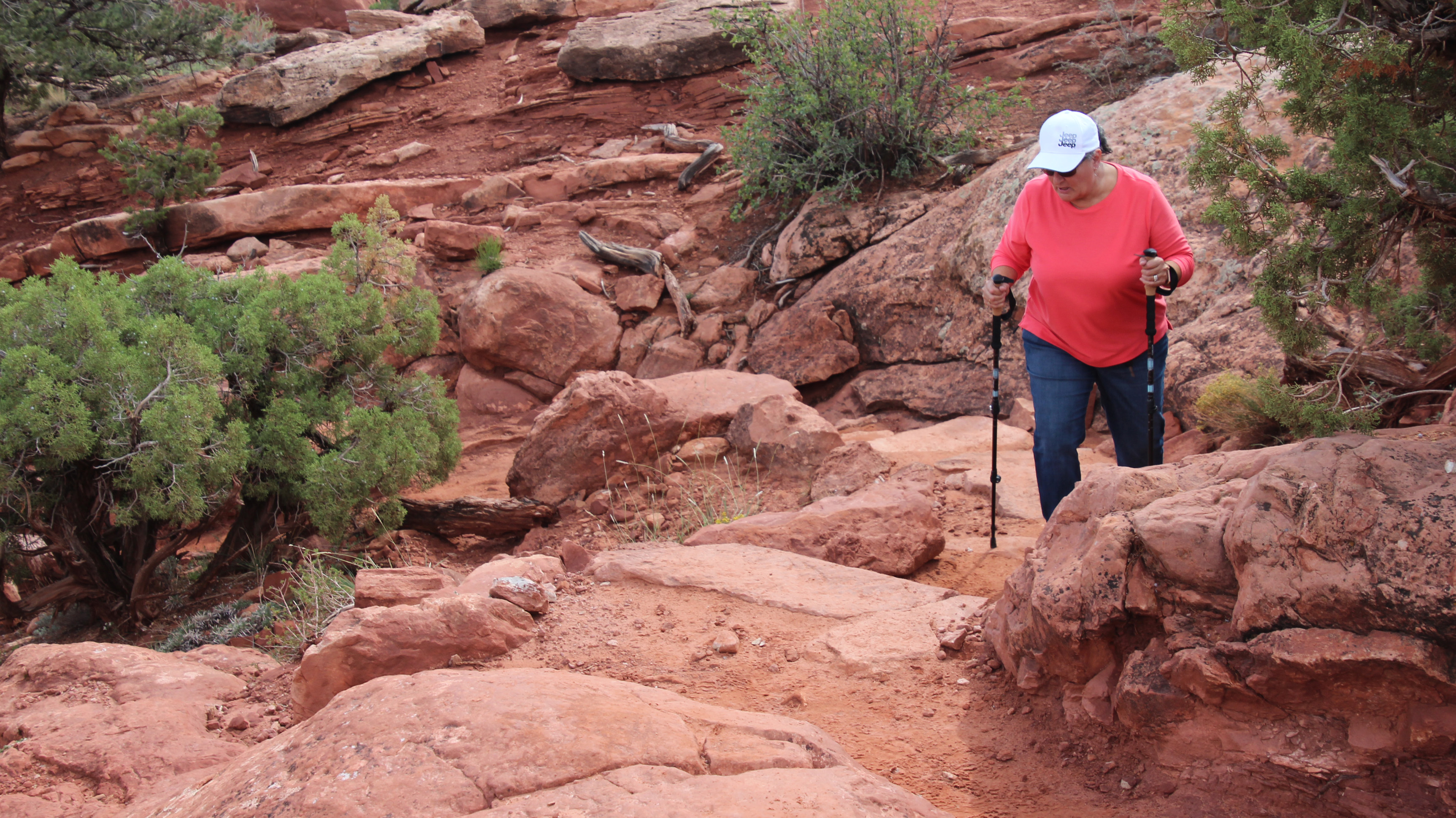
So into the Canyonlands we went and how wonderful it was. At first you see only the relatively flat high desert plateau you are driving across, with some fat red and orange sandstone “lumps” on the landscape, but once the road takes you to an overlook and you look out and across, everything rips open below you. Cliffs drop down, with rubble below them, another plateau extends and then it drops down again to the Colorado and Green Rivers. Amazing and breathtaking. We drove to each of the overlooks, which were pretty easy walks from the Jeep, and one challenging hike. Upheaval Dome is a wild crater with greenish white rock at the bottom that juts upward in a very angular manner. I’m not the geologist here, but the various layers of sandstone are simply amazing. That hike was only a half mile in and half mile back down, but the steps up to the rim made it a pretty slow ascent. That’s ok, we have all day. Worth the hike to see this view. Watch a video here: Exploring Canyonlands Islands in the Sky


On the way back to the visitor’s center and campground we stopped to have a look at the Shafer Trail and Potash Road we will be driving in another day or so. The initial descent down the switchbacks is about 1,500 ft. and it looks like it should be taken slowly. Yippee, we will definitely earn our chops with the Jeep on this drive! I hope to have some video to post when we get home.
Back at camp we watched our first sunset, a nice surprise since we are getting rain and overcast cloud cover nearly every evening. Hope we get some night sky and stars soon. We also packed our things for a rafting trip down the Colorado River in the morning. Since it has been getting into the 40’s overnight and only in the 60’s daytime, plus the likelihood of getting wet, we had to figure out the layers to wear. Next post I will let you know how both of these adventures went, plus when I get back home I will try to edit videos and post them to our YouTube channel. See you again soon.


What a gorgeous area!!!! The campsite and the views are spectacular. This is definitely going on the list of places I must visit.
LikeLike