
La Sal Mountains in Moab
Reporting in from the Wahweap Campground and Marina in Glen Canyon National Park along the shores of Lake Powell here… and maybe just a little confused about the time. When we toured the visitor’s center at Lake Powell Dam (what a feat of engineering, by the way – something I would have shared with my engineering and technology class) I was surprised to see the time as 4:00, not 5:00 closing time. I asked if we had crossed into the next time zone, but was told Arizona does not observe Daylight Savings Time, so we are on Mountain Standard Time. Cool, we gained an hour.
But the campground straddles the Utah/Arizona border, so our cell phones can’t entirely get the time straight. Later in the week we will head to North Rim Grand Canyon, AZ (same time zone), then into Zion NP in Utah (hour ahead), then into Las Vegas (Pacific time) and back across to South Rim Grand Canyon (Mountain Standard), ….fa-get-abbat-it. Retired and off the clock anyway. We have one battery operated clock on board that I keep changing, but I can’t figure how to get my fitbit to change, so that one is useless. In fact, it had me at 10,000 steps just driving from Moab to Page yesterday. But I got off topic.

Great campsite
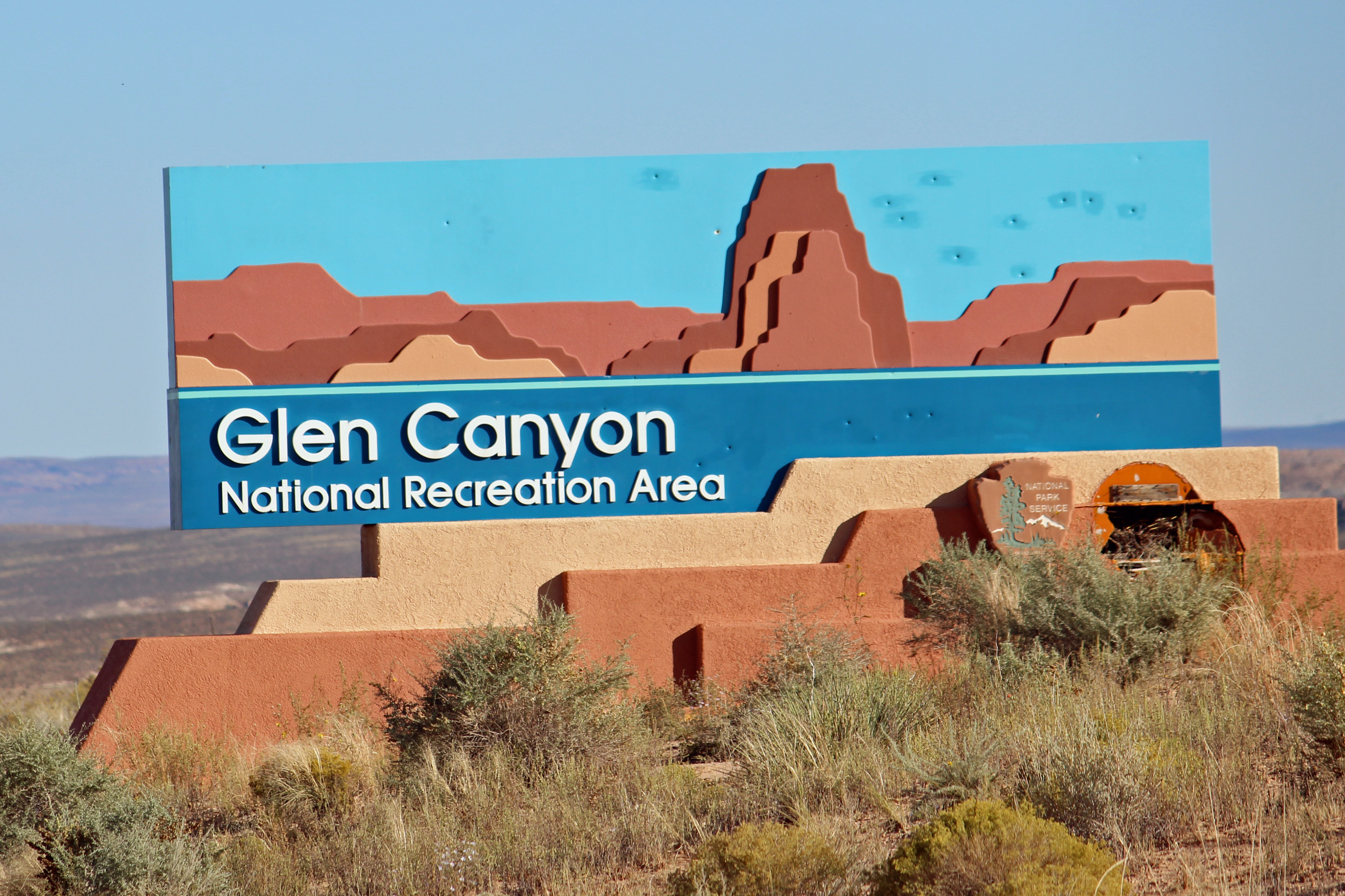
The sign colors match what you see.
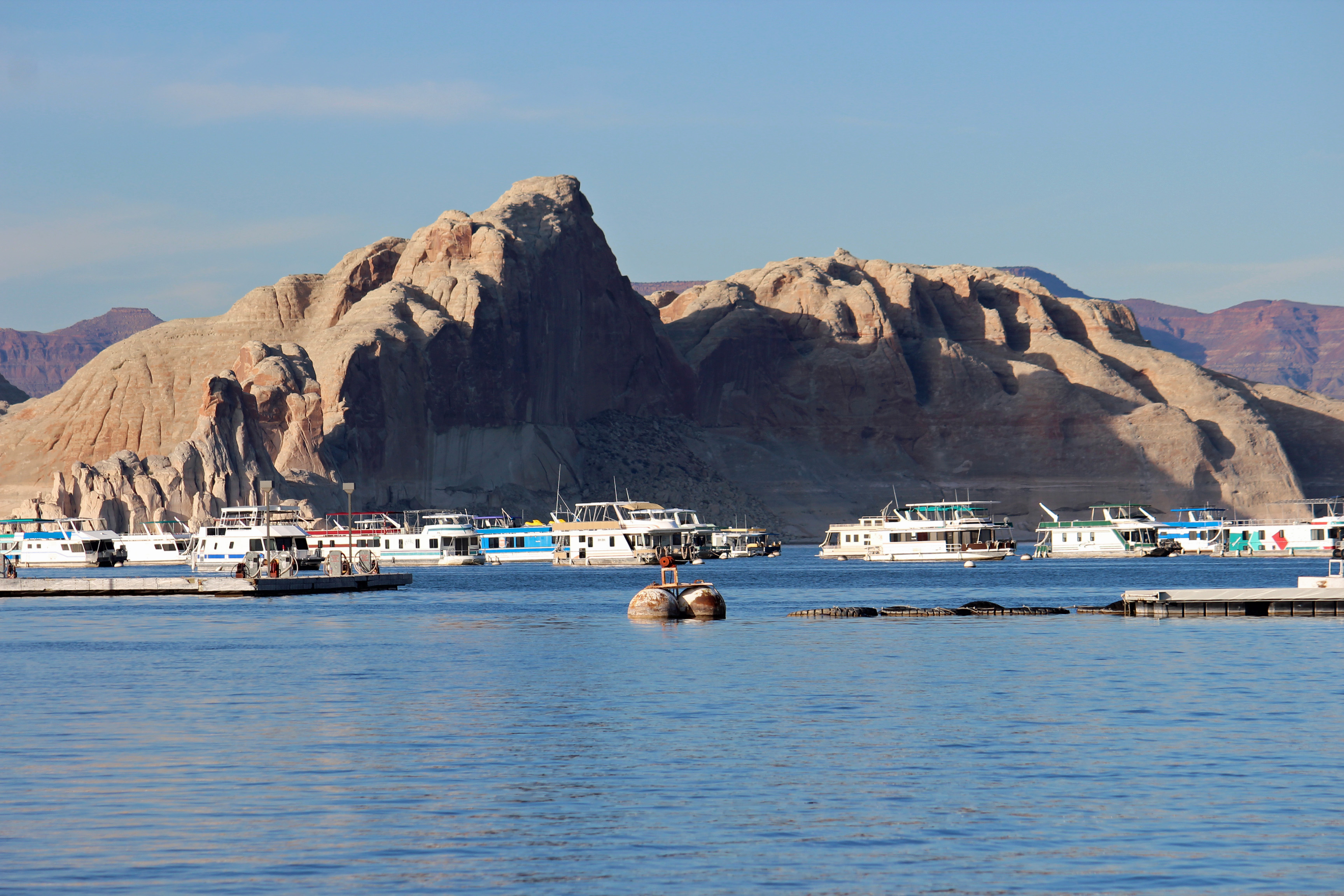

Back to camping on Lake Powell. This is a top-notch campground for full hookups: flat and level sites and a great view of the canyon walls along the lake. You come to appreciate concrete pads and easy hookups after being on the road a few weeks. More about set-up and breakdown in a later post. When we got up close and personal to the Glen Canyon Dam and the bridge that crosses the canyon, it was easy to feel a sense of vertigo – such a huge scale and such a deep canyon. Amazing.

Glen Canyon Dam and Visitor’s Center

Glen Canyon Bridge
So about our animal spotting. Lower Utah has scant wildlife or birds to see. The best we have done is one Prairie Falcon, otherwise mostly ravens and a few magpies. The long drive from Moab along the mesas and through the Navajo Nation looked promising. Road signs with leaping deer kept popping up, then proclaiming “Caution, Deer Crossing” and even “Watch for Deer in Your Lane”. Talk about easy, this was gonna be good – they were going to be IN OUR LANE. Nada. Wait, the next sign had flashing lights, and another said “Caution, Annual Migration Route”. Zip. “Open Range” with cattle symbols and then horse symbols. Nothing. Wait, what’s that? Sheep. One small herd of sheep. No roadkill, not even any interesting bug splats on the windshield. Skunked on wildlife.
Oh, a shout out to big game hunter Adam on two deer kills with two arrows!

Monument Valley

More of Monument Valley

Buttes in Monument Valley
Actually, the drive was fun. You were constantly surprised about what lay just over the horizon. Looked real flat with mountains in the distance, then suddenly you dipped down into a canyon and were surrounded by red sandstone cliffs. A little later you would see flat-topped mesas and buttes around you. The red, brown and beige stripes of rock layers on the canyon walls would change as cloud shadows passed over them. Every outcrop has a name, and copilot Jackie scrambled to find them on the map. We took a scenic byway and a side road that we worried would be tricky for the van, but which turned out to be very easy and scenic. We drove through Monument Valley and recognized iconic scenery from movies and commercials (all those buttes standing out in the red valley). We couldn’t help but start humming songs from our favorite westerns (Bonanza was a favorite).
I will post a few pictures from our Arches hike to Delicate Arch in the rain here, and the traverse of the slickrock. Look very close to see the parking lot waaaaaay in the background, or some of the other hikers waaaaay up on the rock.

Soaked on the hike

Uphill Climb in the rain

Petroglyphs in Arches
So today we are headed on a hike to Horseshoe Bend, then Hanging Gardens and try to book a tour of Lower Antelope Slot Canyon in the Navajo Nation.
Update on the day, as we sit at camp relaxing with an adult beverage. We did head to Horseshoe Bend to hike in to the canyon rim from the parking lot. Probably a mile in – and oh my the tour buses had arrived. Mind you, I am talking about the largest buses you see on the road, filled with tourists. In this case, the Chinese tourists once again, with their umbrellas, sun hats, very well dressed but not always appropriate for hiking. (No offense intended, it’s good to see the visitation at our National Parks). Now we have also seen a lot of German and French tourists, too, but they seem much more prepared for the hikes.
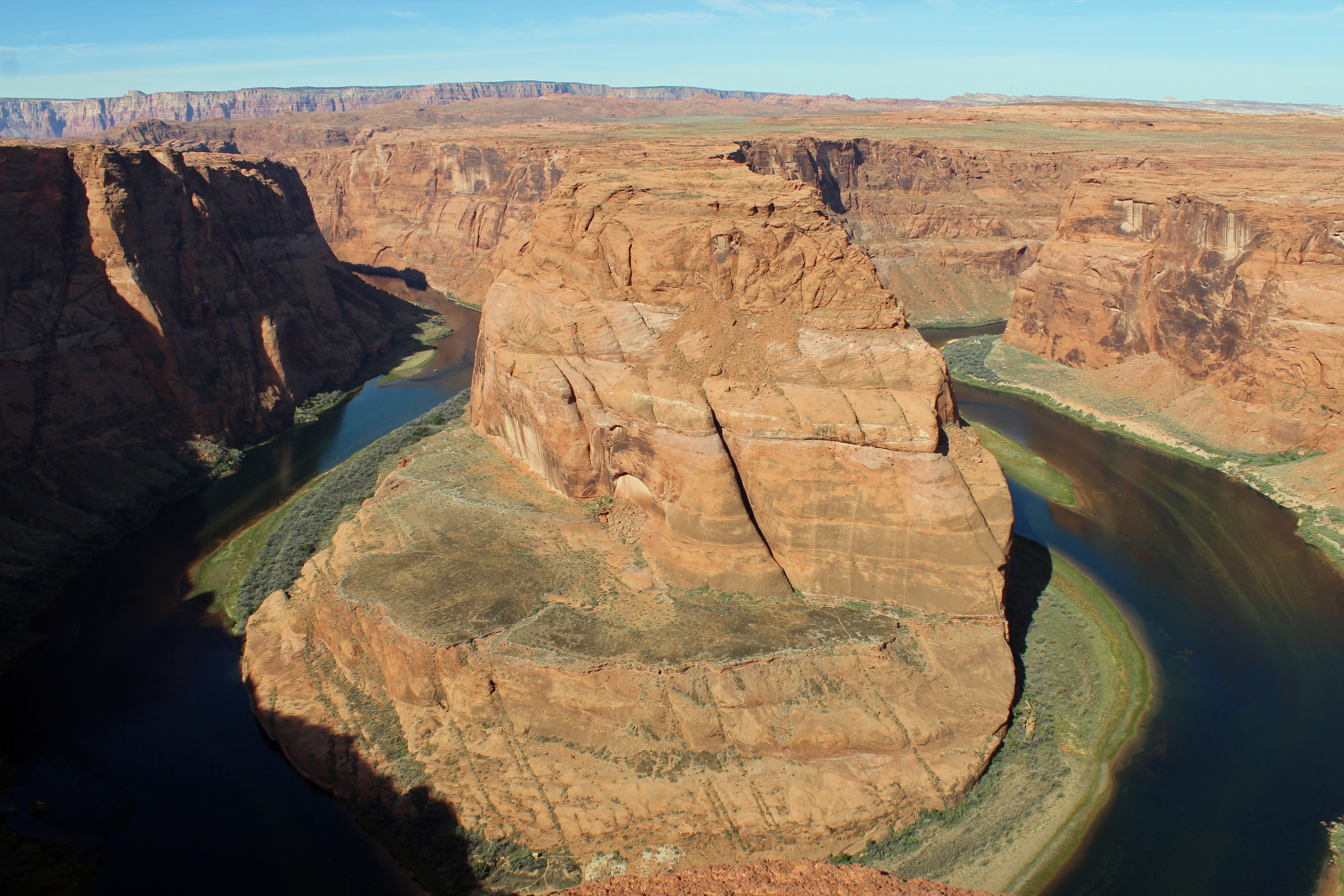
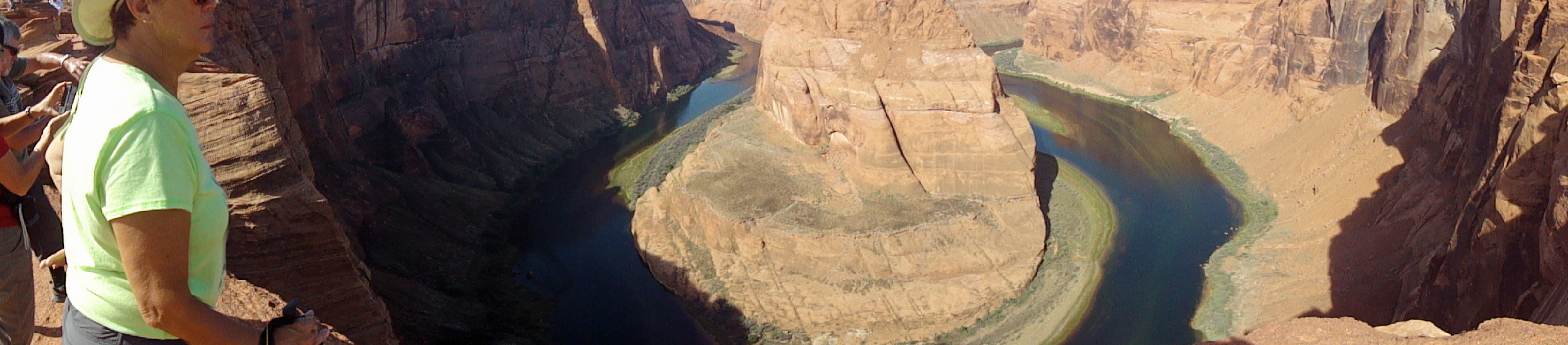
Horseshoe Bend
Mind the edge Jackie!

Back up just a little…
Anyway, once getting to the rim of the canyon and looking at where the Colorado River takes a 270 degree turn through the rock walls was quite the breathtaking experience. Seriously, you stood at the rim looking across and maybe down, and you really did gasp. It was indeed a slightly dizzying experience with a bit of vertigo. We joined the multitude and tried for some selfies, while being a little concerned watching folks literally creeping to the rock edge to sit for a picture. It was a rare sight.
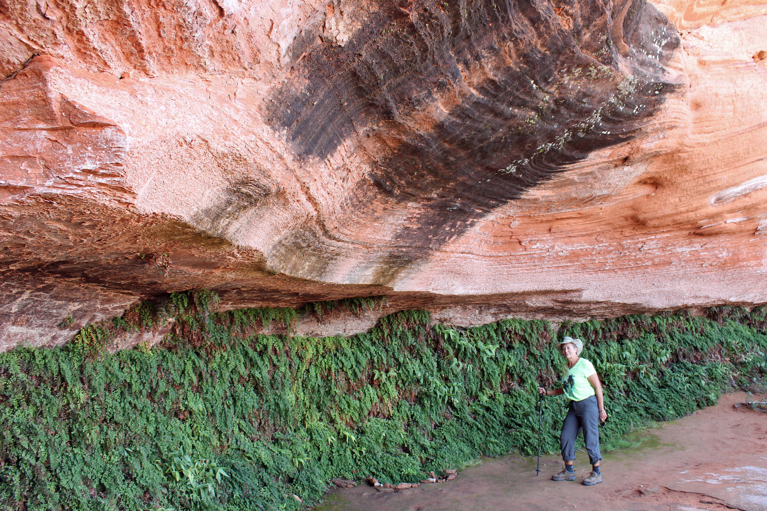
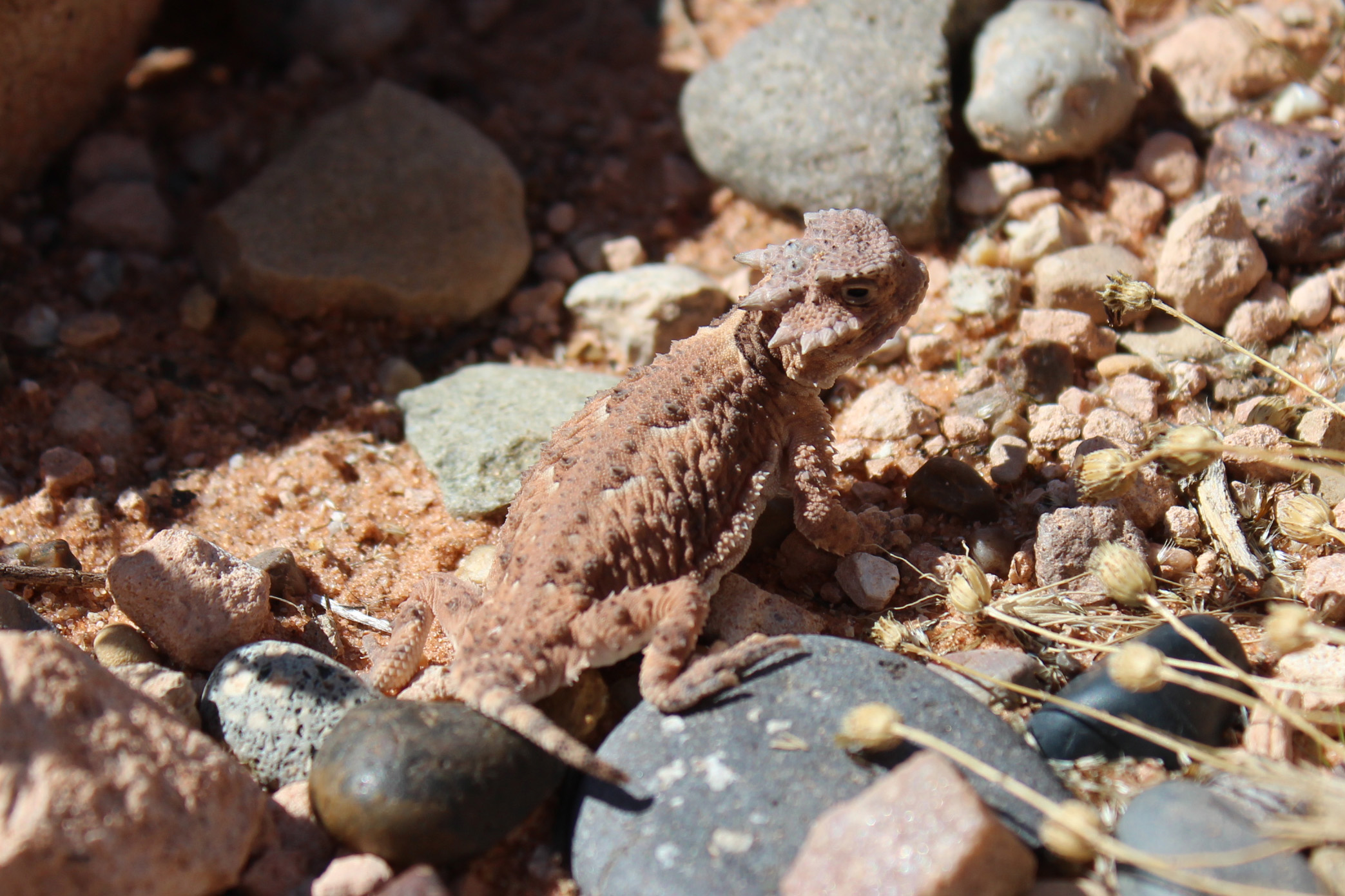

Next stop was to be a hike through a slot canyon in the Navajo Nation, but the rain from yesterday morning had the canyons shut down until the water drained out. We took a relatively short hike to see Hanging Gardens, which was a quiet hike to an overhang where there were lots of maidenhair ferns growing beneath. That was fun and no tour buses were in sight. After lunch we tried what was to be a 3 mile roundtrip up a sandy wash to an arch and then a small slot canyon. This time it was just the two of us following some previous footsteps up through a fun and challenging sand and rock wash. But it registered 6 miles for Jackie’s phone and about the same on my fitbit. Something about these western measurements. We made it to the arch, but not the extra half mile to the slot canyon. Did see some jackrabbits.
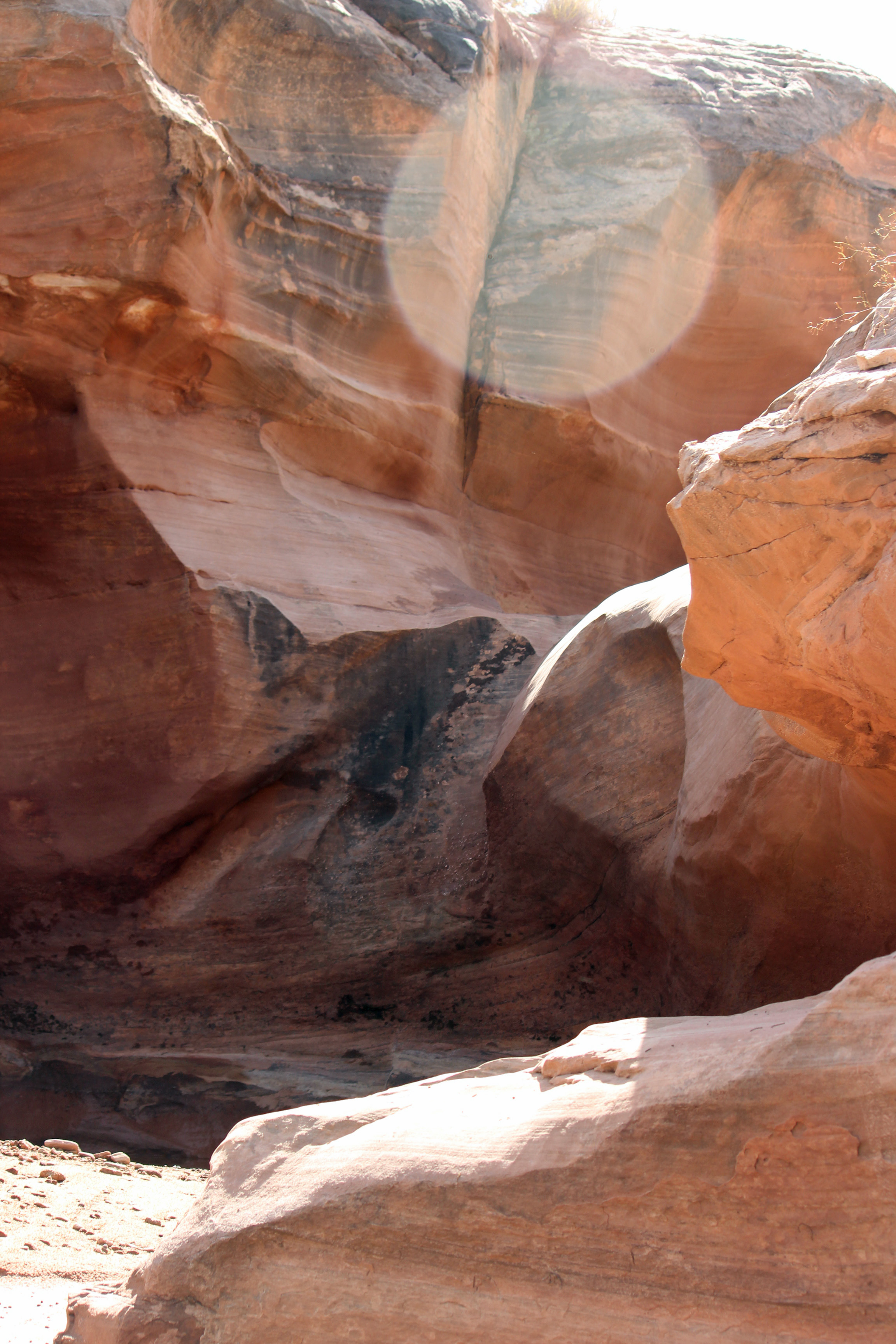
The rocks that surrounded the wash.
We head to the north rim of the Grand Canyon tomorrow, followed by Zion NP. Neither has water, but Zion does have electric. Fill up the tanks and off we go in the morning.

Comments