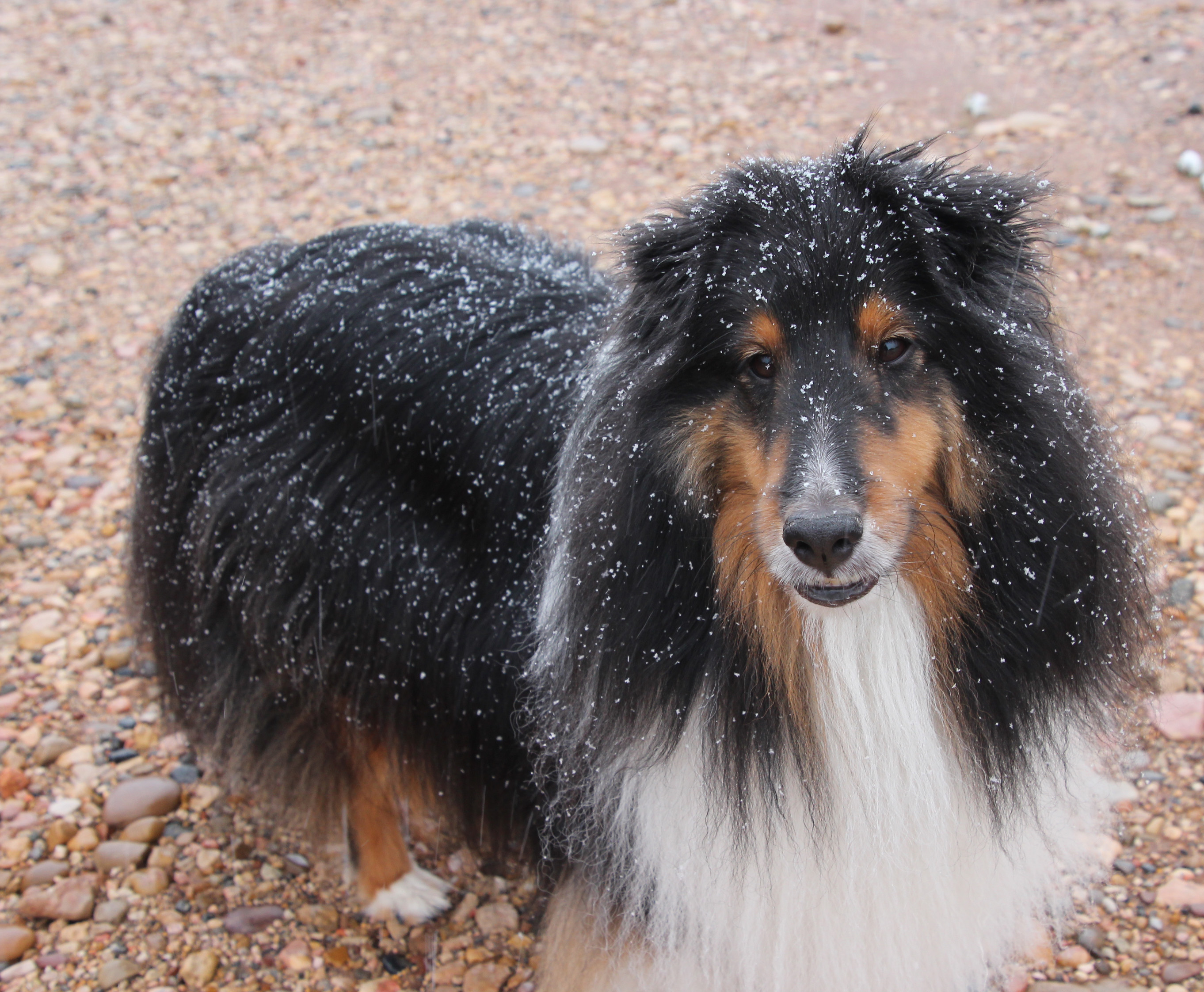
It rained pretty steady our last night in Kodachrome Basin, but by morning it was quiet and Jackie poked me “look out the window.” Oh my! Winter has arrived … there was a big coating of snow on the trees and ground, probably over an inch. I jumped out of bed, put on shoes and grabbed the camera. What a wonderland surrounded us. It was quiet except for the tinkling of the flakes that were still coming down. How wild and crazy.
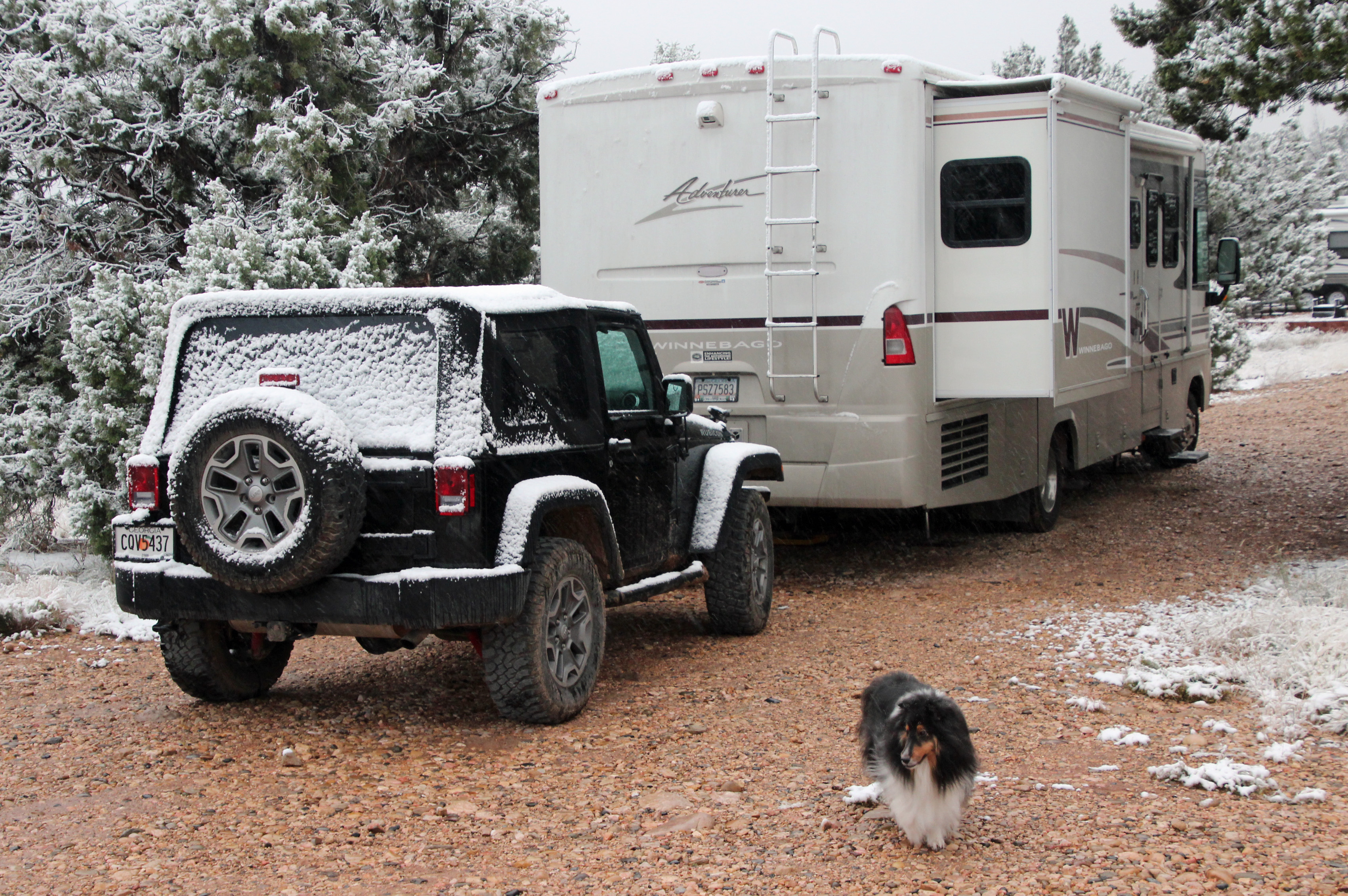
Yep, that excitement was soon replaced by a bit of dread at the thought of the climb up 1,000 feet to Bryce and down through the Red Canyon. But for now it was up and at ‘em, let’s go dump the tanks and then see what’s out there. Well, not so fast there guys, we’ve got the famed “Cows in Road” blocking our way. Oh, and a little further along there were a few mule deer on the shoulder thinking of how to cross the road. But soon we were starting our ascent of 8% grade upward to Bryce. It was a slow go, of course, but at least we had a nice cold 32 degrees outside, no – make that more like 23 by the time we got to the top. Made it to the top and as we approached the Red Canyon descent a snowplow pulled onto the road ahead of us, so we had that to help clear what looked like more than 4 inches of snow.
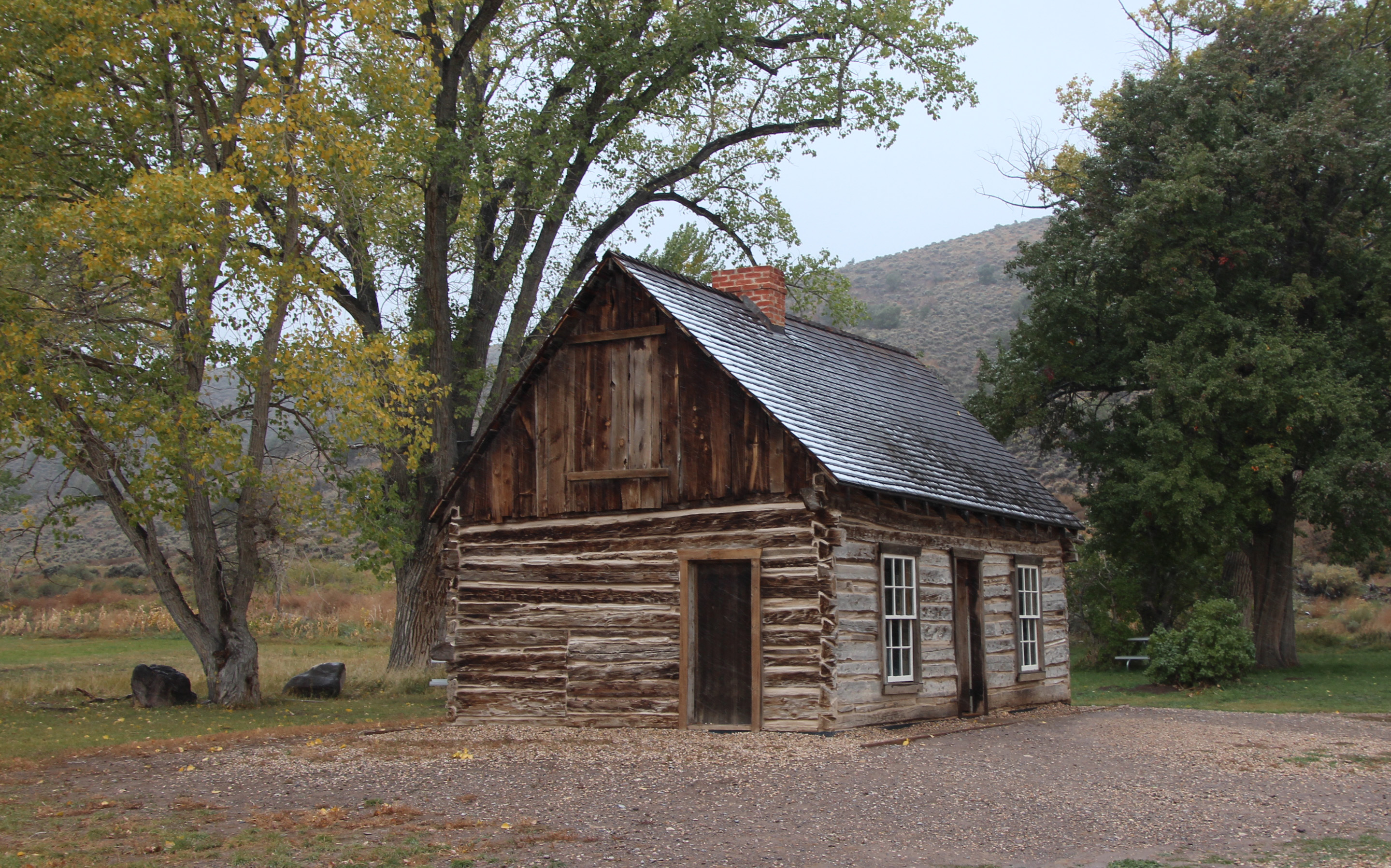
The drive to Richfield was pretty wonderful, too. We seemed to drive out of the snow for a bit – stopped to see Butch Cassidy’s childhood home – then we were back in the snowstorm. One of the really cool mountain passes was through the Big Rock Candy Mountain, a winding path beside the Sevier River that just kept turning left and right between huge, sloping mountains. Neat.
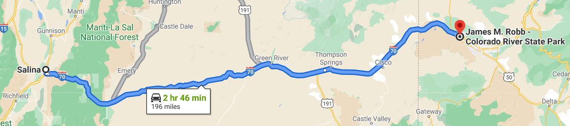
In Richfield we found our first Wal-Mart in weeks, so loaded up on groceries, jumper cables and another jump start battery for the Jeep (just in case). We originally expected to reach Salina, but the planned campground stop was not taking reservations, so we are doing a KOA. As we pulled in we saw that the load of wet snow on the trees had left broken branches all over the camp. It was still in the 30’s with plenty of snow up the mountain sides and a low ceiling of clouds. Predicted overnight low is 20. We head to Grand Junction, Colorado in the morning with various predictions for rain, snow or nothing. We shall see what tomorrow brings. Oh, and yes, the battery in Jeep has run down again, so it is on the charger. Have to figure this one out.
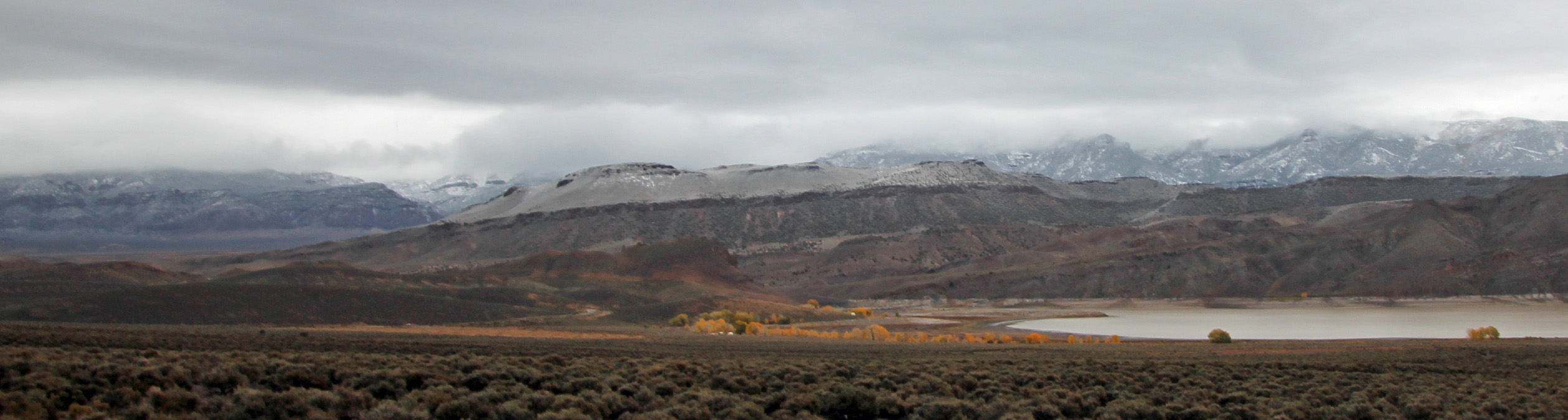
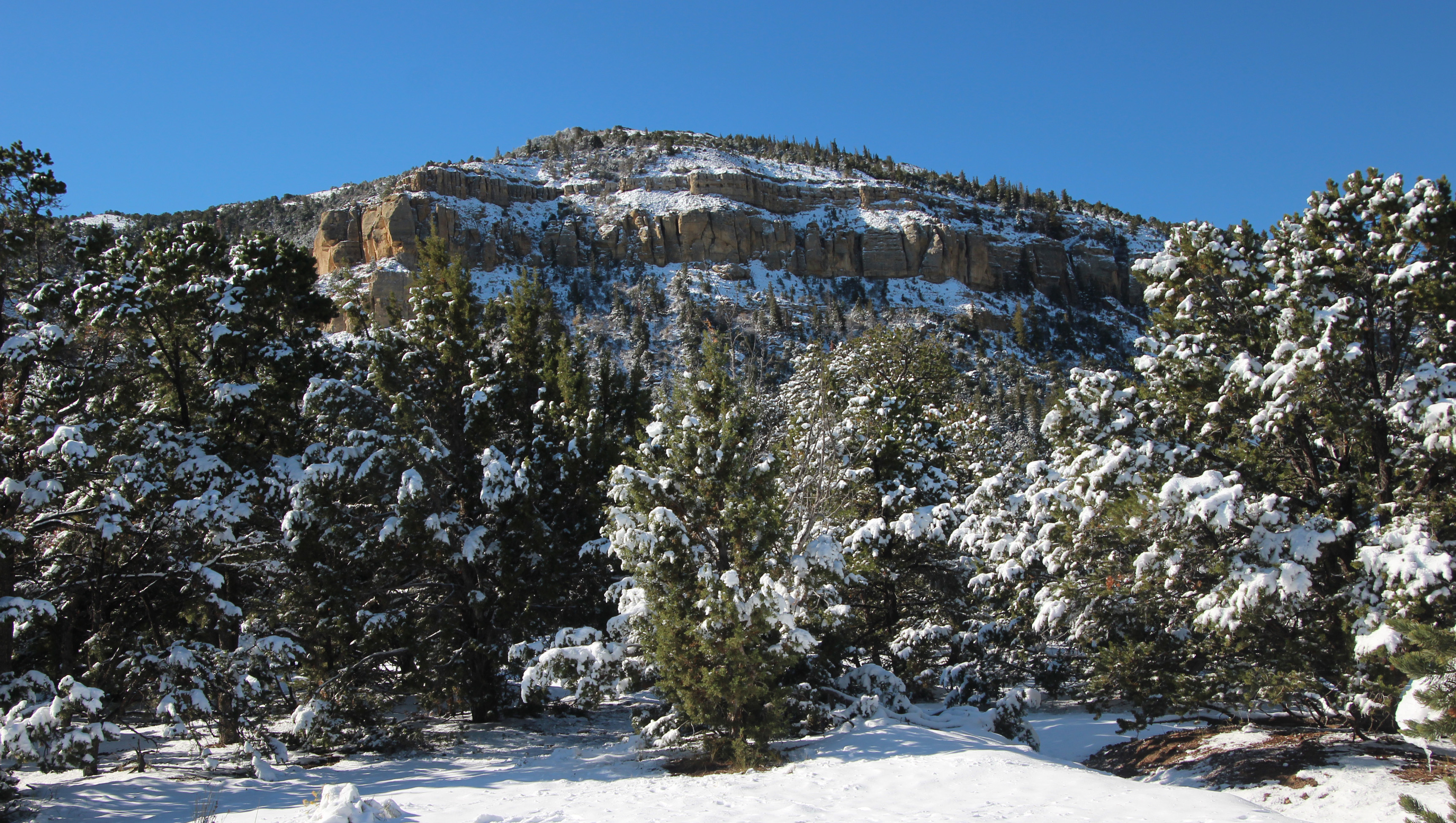
So it only got down to 34 overnight, which was a relief. We got underway for what was a 5 hour drive to Fruita/Grand Junction, Colorado area. I thought it would be a simple drive across I-70 through flatlands, but was I mistaken. The trip was another amazing drive – we drove through areas where the snowfall was still very evident on the mountains and mesas and we passed through some mountain passes and cuts that were mind-blowing. One long cut was maybe 5 miles of a 6% downhill grade that wound between cliffs that towered above you.
Every flat expanse was followed by a drop down into a canyon. Finally, after many elevation changes we dropped down into the valley where the Colorado River winds through and the town of Fruita. We made camp in the James Robb State Park along the river and relaxed just a bit. Of course we had to jump start the Jeep – grrr. But we are in Colorado now, so breweries were on the list!
First stop is Monumental Beer Works, where we are having a flight each and I am posting to the blog. More about our brewery escapades here in town and our trip to the Black Canyon of the Gunnison in the next blog, subject to wifi availability. Thanks for coming on the journey with us and thanks also for all the great comments.
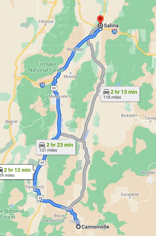
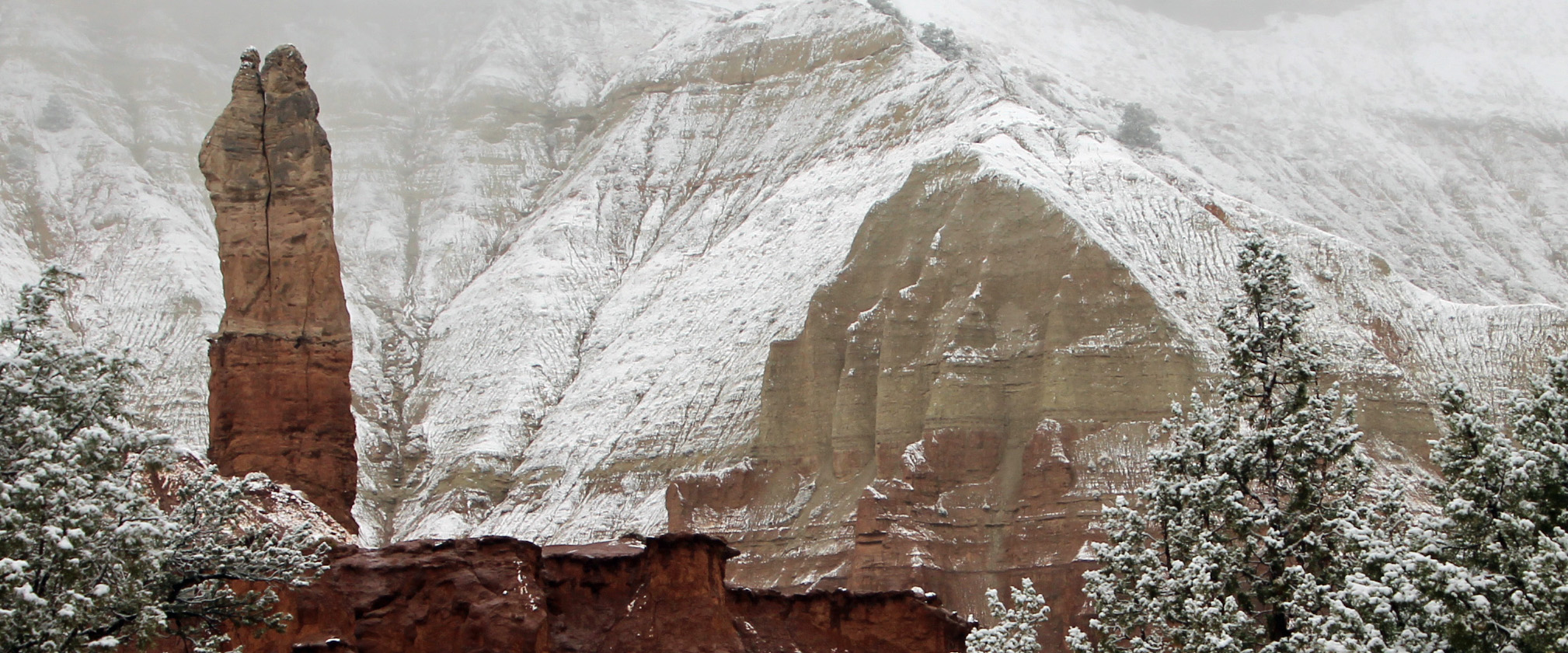
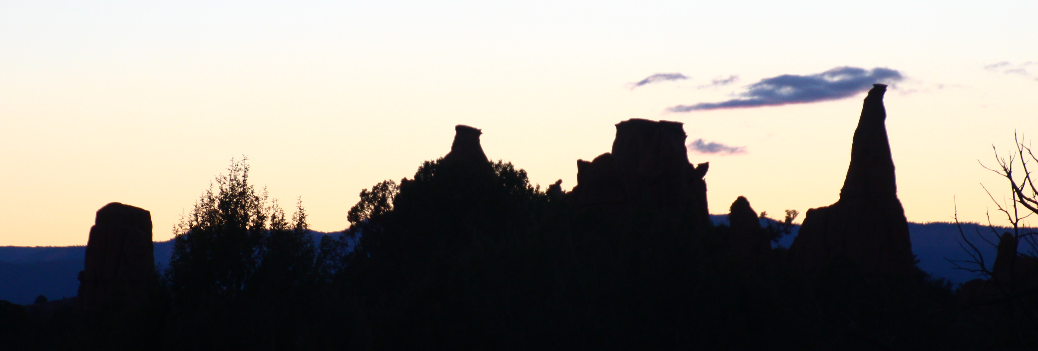
Now it is time to head to our third big stop in Utah, Kodachrome Basin State Park. As I mentioned in our last post, we opted to head west and then south to avoid driving up and over the Dixie National Forest. I am sure the scenic drive along highway 12 is wonderful, but I didn’t need the climb in the motorhome. So around to Tropic, Cannonville and then down to the park. In addition to exploring Kodachrome Basin (named by folks who thought the colors reminded them of the vibrancy of the Kodak film) this will be the take-off point for exploring Bryce Canyon National Park, too.
Alas, as we hook up the jeep and start off it begins to rain and it rained the whole way to Kodachrome Basin. I find it odd we have had so much rain in a high desert zone. It was an easy drive, though, as we stayed mostly in two river valleys: Fremont River and Otter Creek and the road was in great shape. We finally experienced what we have been warned about extensively: cows in the roadway. And they don’t move out of the way, either. Once we got to the campground it was a short drive down a gravel road and we found a level spot to disconnect. Ah but Murphy’s Law kicked in for us, as the Jeep wouldn’t start. Well, we went ahead and got the motorhome situated in camp, hooked up water and electric and pondered the situation. I had a quick charge battery pack that is supposed to jump start you car in an emergency, so I pulled that out … naturally it needed to be charged! I let it charge and we went back to the Jeep to jump start it. No luck, just clicking. Battery was dead, charger was useless.
I walked back to the Visitor’s Center in the rain to see if one of the rangers had a jumper cable. Probably, but it would have to wait just a bit for another staff member to return. I trudged back to the camper, noting to add jumper cables to our supply list for the Jeep. Then Hayley showed up and said, sure she had cables and we jumped the Jeep from her little Nissan. Once back at the campsite I hooked up a battery charger I did have in the motorhome (the kind you use to trickle charge over the winter) and left that hooked up overnight. It started up in the morning just fine. I think what happened is this. Because it was raining I had the headlights on in the motorhome. That must also turn on the lights for the Jeep and it probably runs them off the battery AND since the generator and alternator are not operating to replenish the battery, it dies.
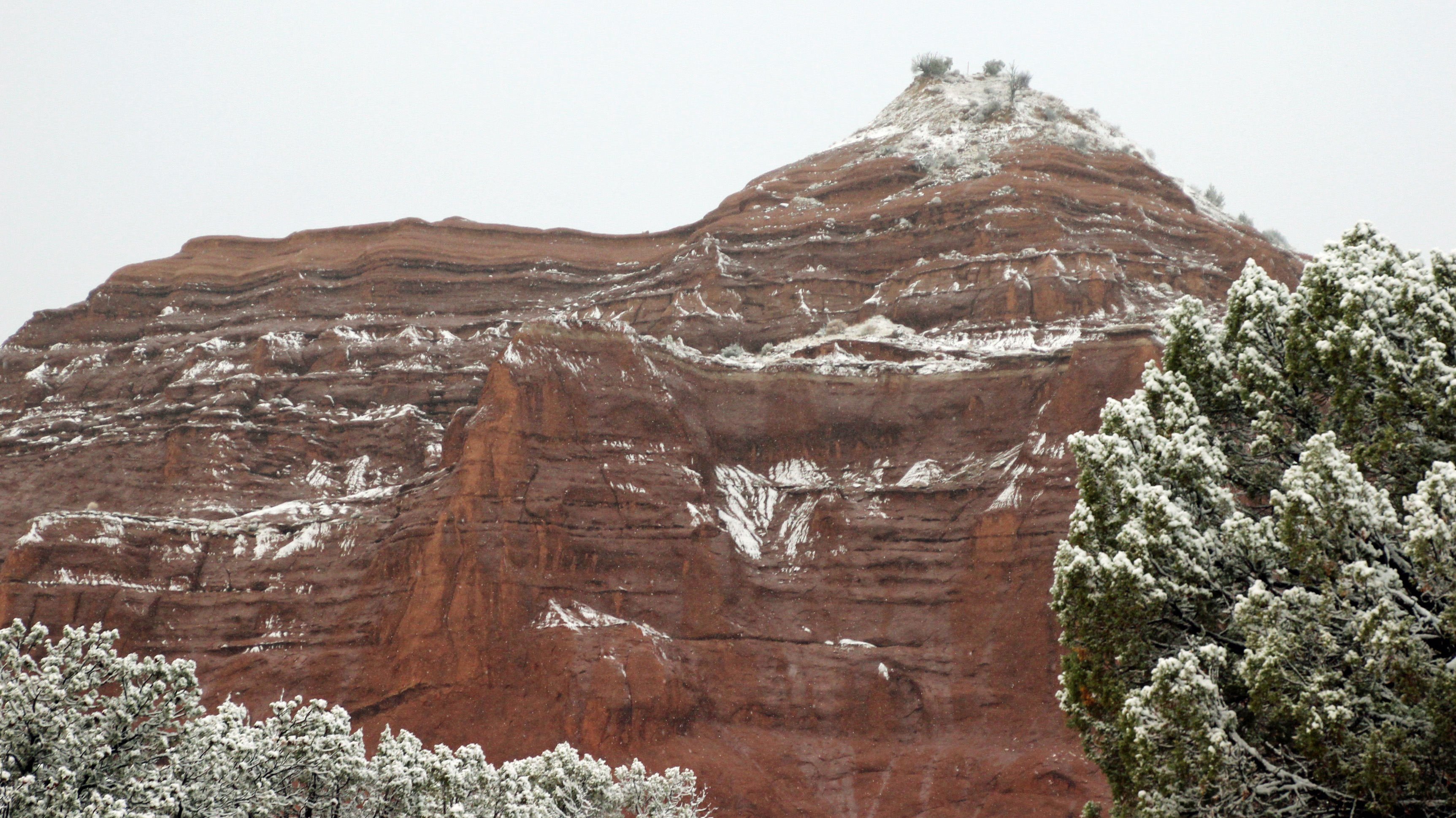
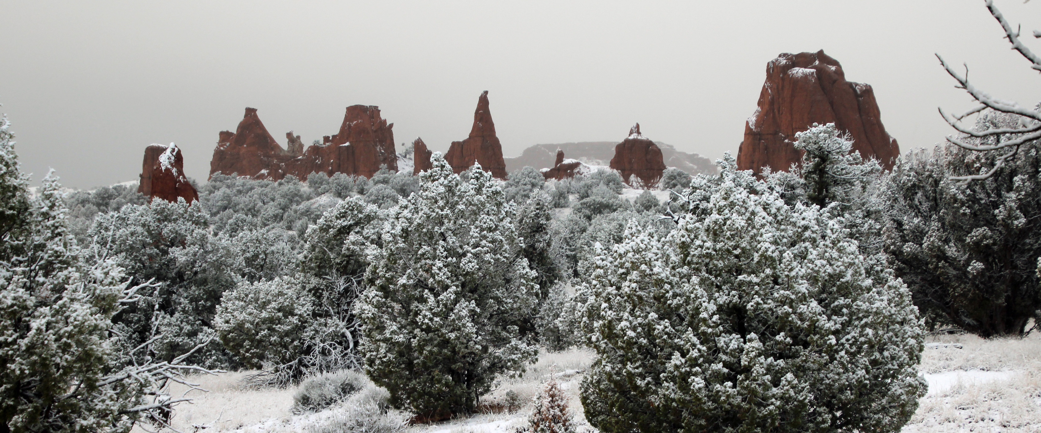
We woke to clear blue skies and 45 degrees – perfect for hiking and exploring the park. We started with a mile and a half hike on Angels Palace Trail and had great views of the park.
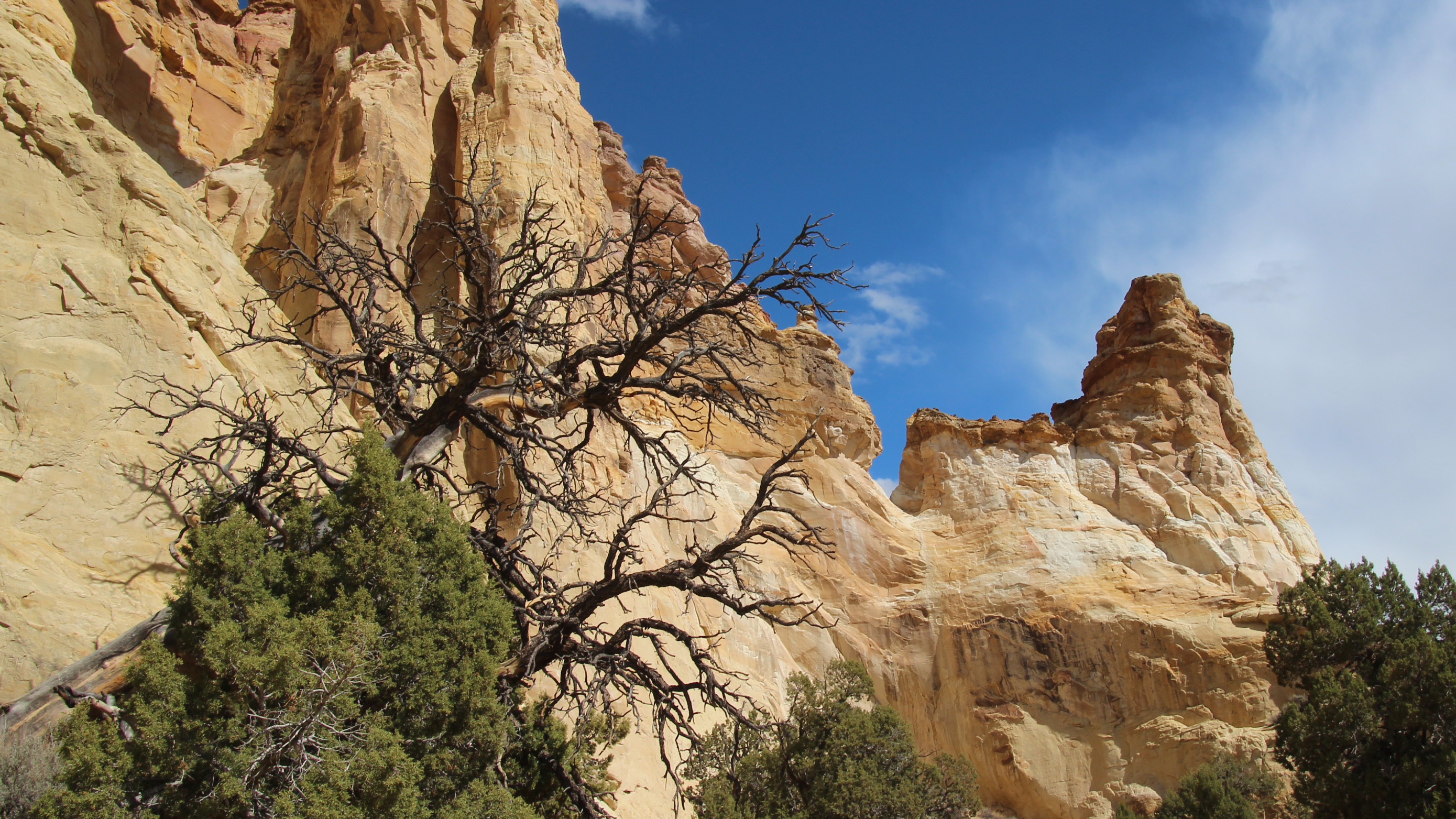
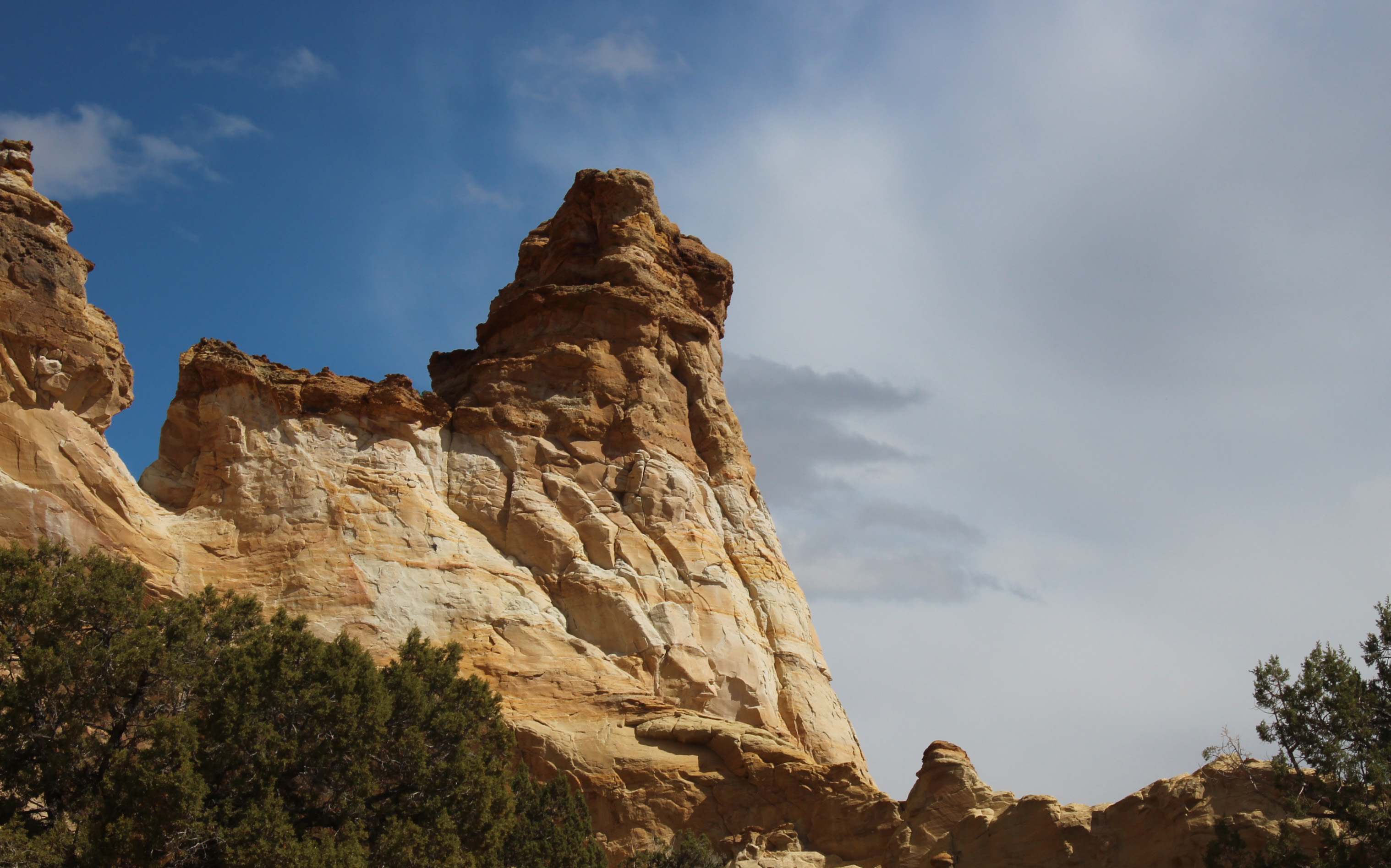
The trail followed several muddy washes up the canyon and opened up on red shale plateaus that were fun to wander. The park is filled with unique pipe structures that jut up out of the red sandstone. Hiking down the canyon wash that wall filled with cedars and pines you could smell the pinyon pine – a definite evergreen fragrance that was wonderful. Altogether it was a very cool morning.
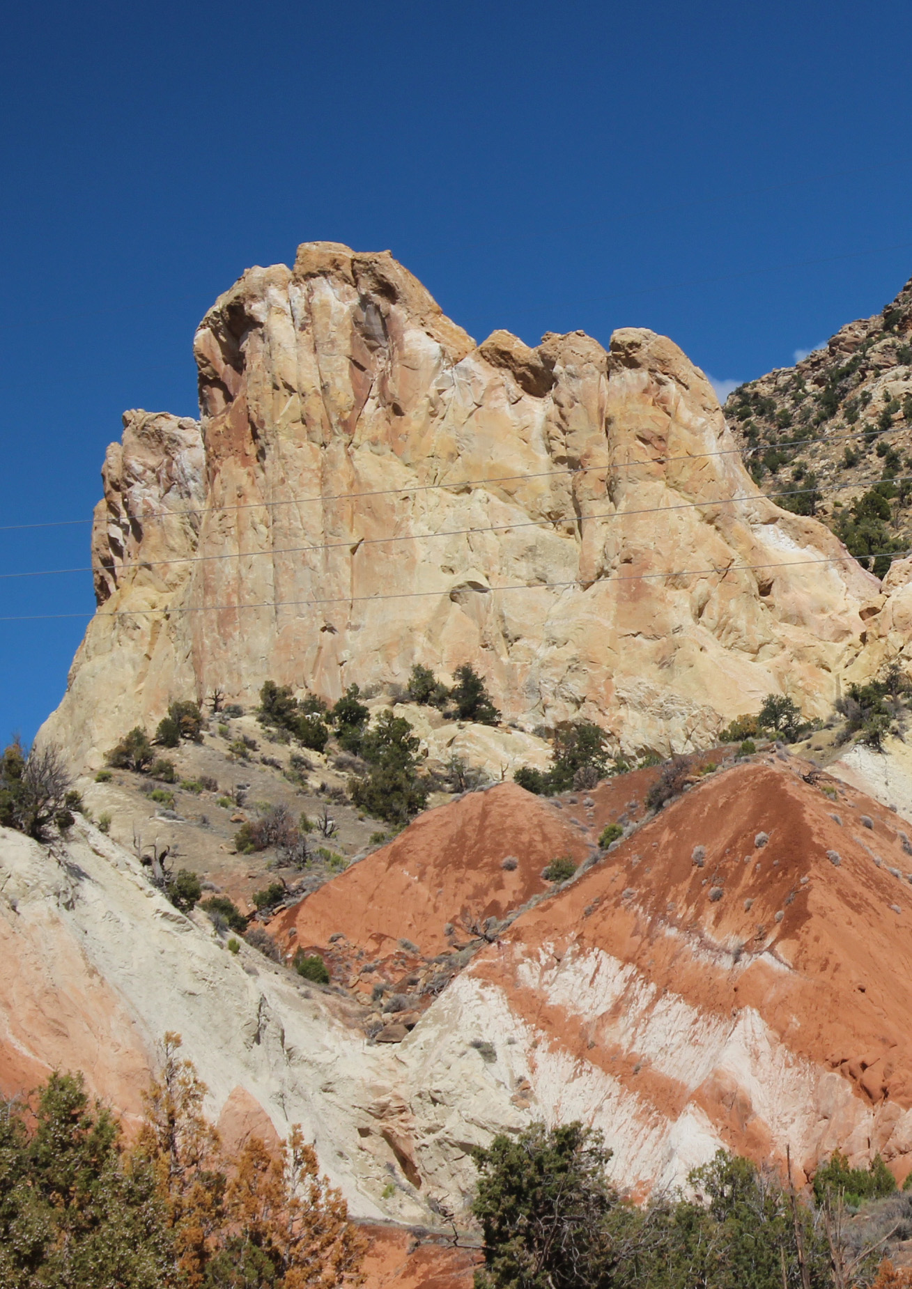
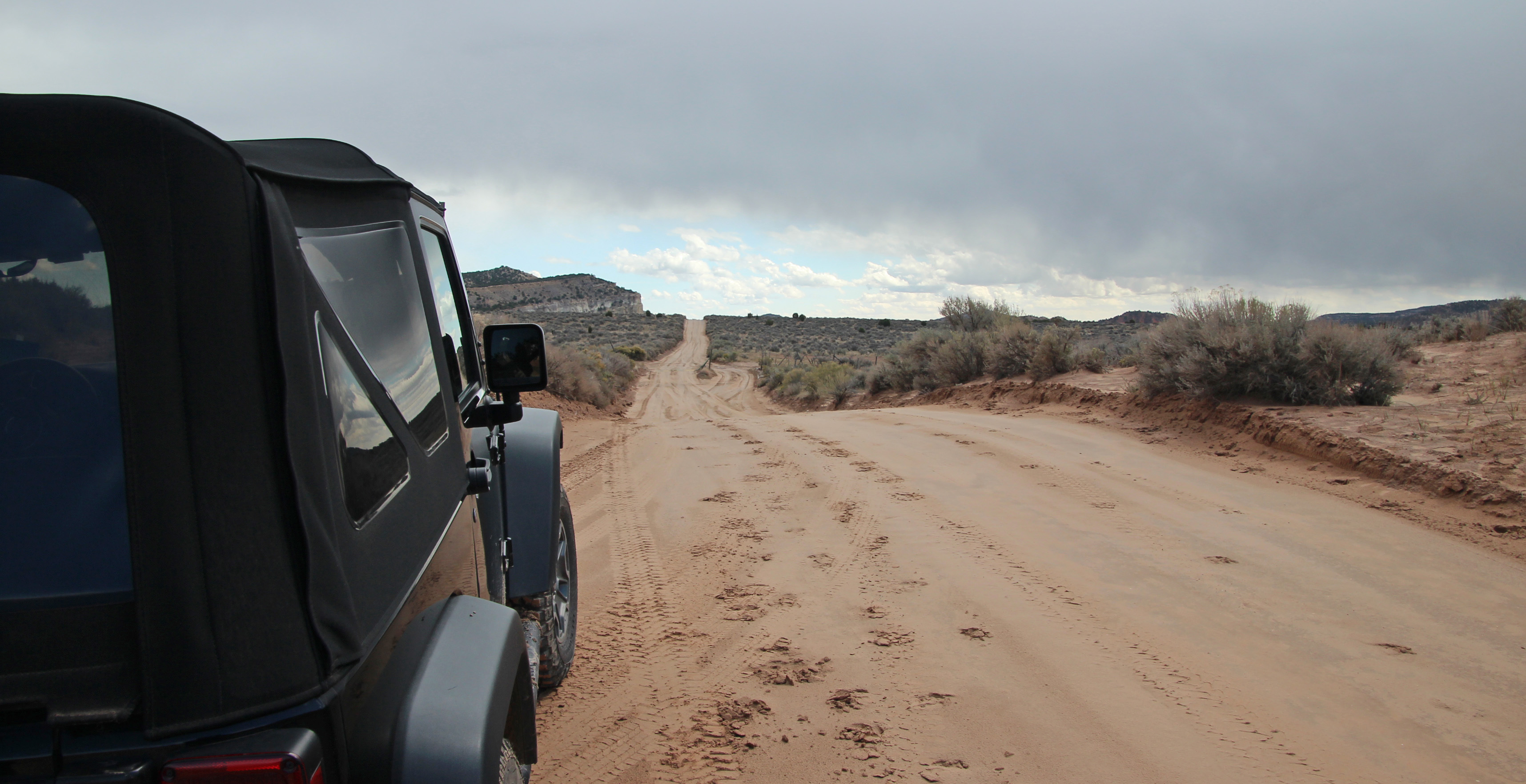
Lunch back in camp and we discussed the afternoon choices. Decided to drive 11 miles further south on a sand/dirt/washboard Cottonwood Canyon Road to see Grosvenor Arch, named for the original president of National Geographic Society and located in Grand Staircase/Escalante National Monument. Pretty amazing double arch of white sandstone that really popped in the afternoon sun. Walking from the parking lot toward the arch there were a couple of folks stopped halfway chatting on their phones. Somehow this spot in the middle of nowhere, a true cell-phone desert, they were able to get a signal right there. Ok, that was crazy.
Jackie drove back to camp on the road and got her first 4WD experience. Hit one muddy ditch pretty hard and splattered mud all over (“hey I’m learning”) but on another creek crossing she maneuvered into the deep mud ruts and drove up and out just fine. “That was fun.” Dinner was just as spicy – a nice taco salad.
We expect good weather for tomorrow, so that is to be our Bryce Canyon day. The final day we might go up Hwy 12 toward Escalante and Boulder City. There is a stretch of road called the Hogsback that runs along the spine of the mountain. Might be fun. Oh, and there are predictions of snow for the day we haul out of here. Really? We shall see, since the weather changes by the hour around here. But, the night sky is clear and filled with stars. A sliver of a moon sets early and the milky way is very evident. How wonderful.
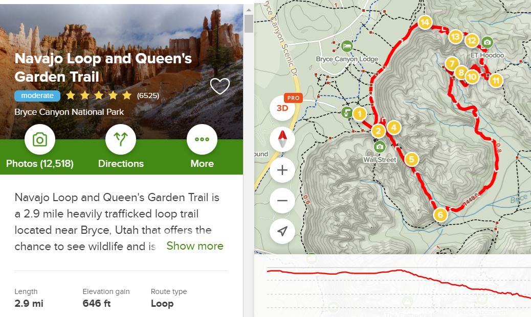
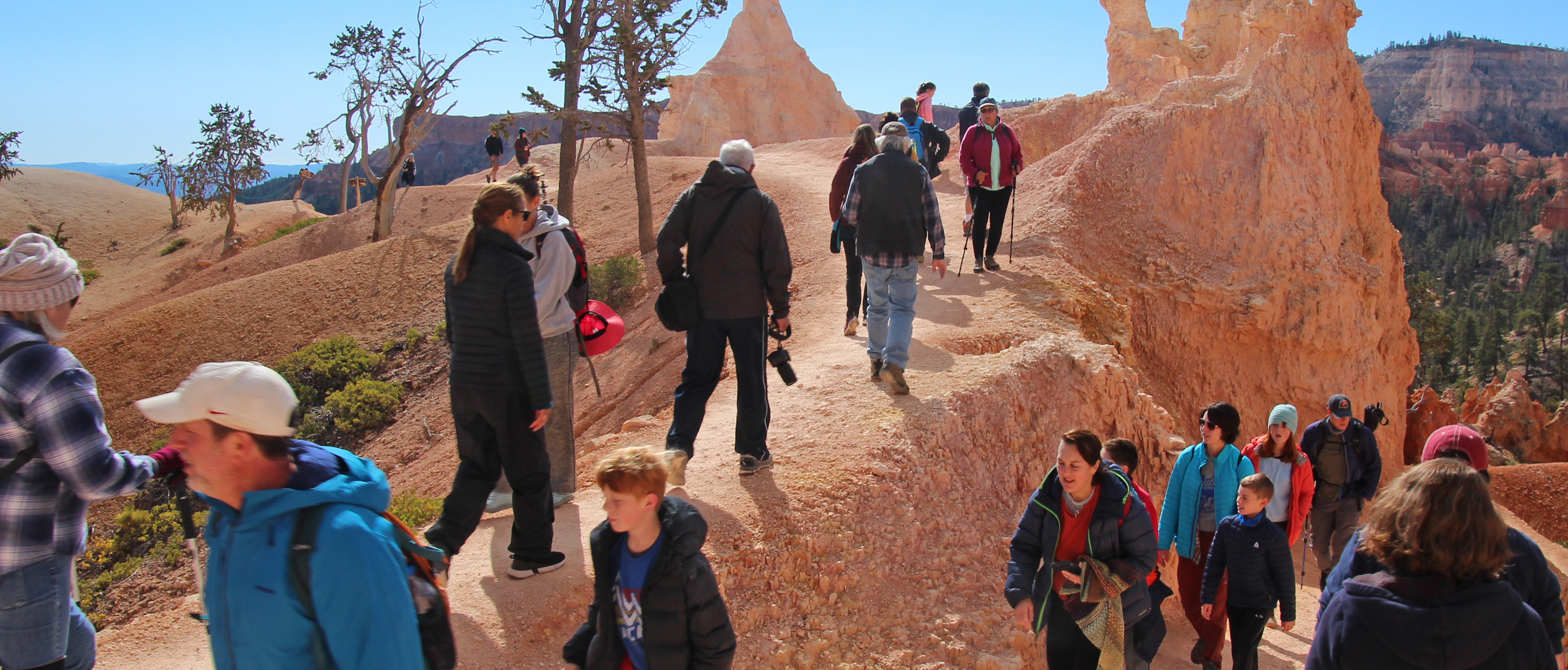
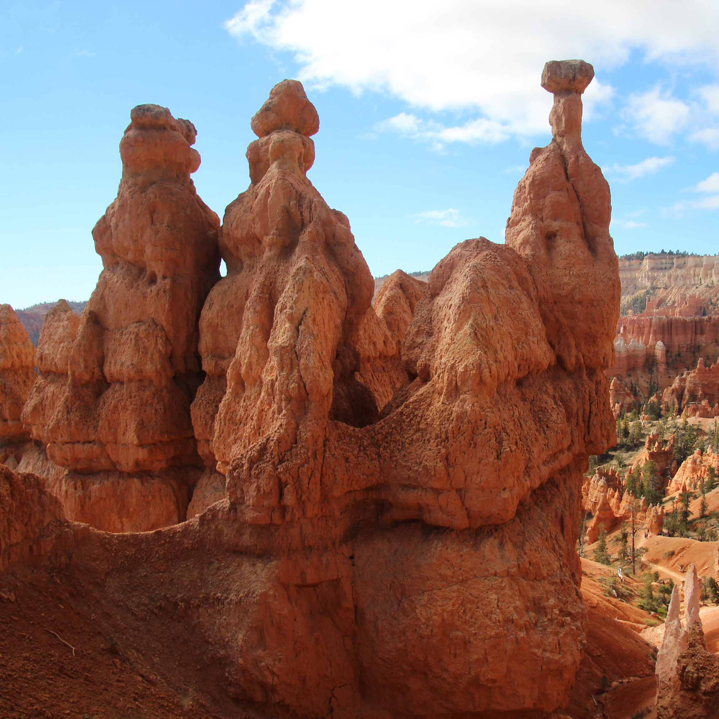
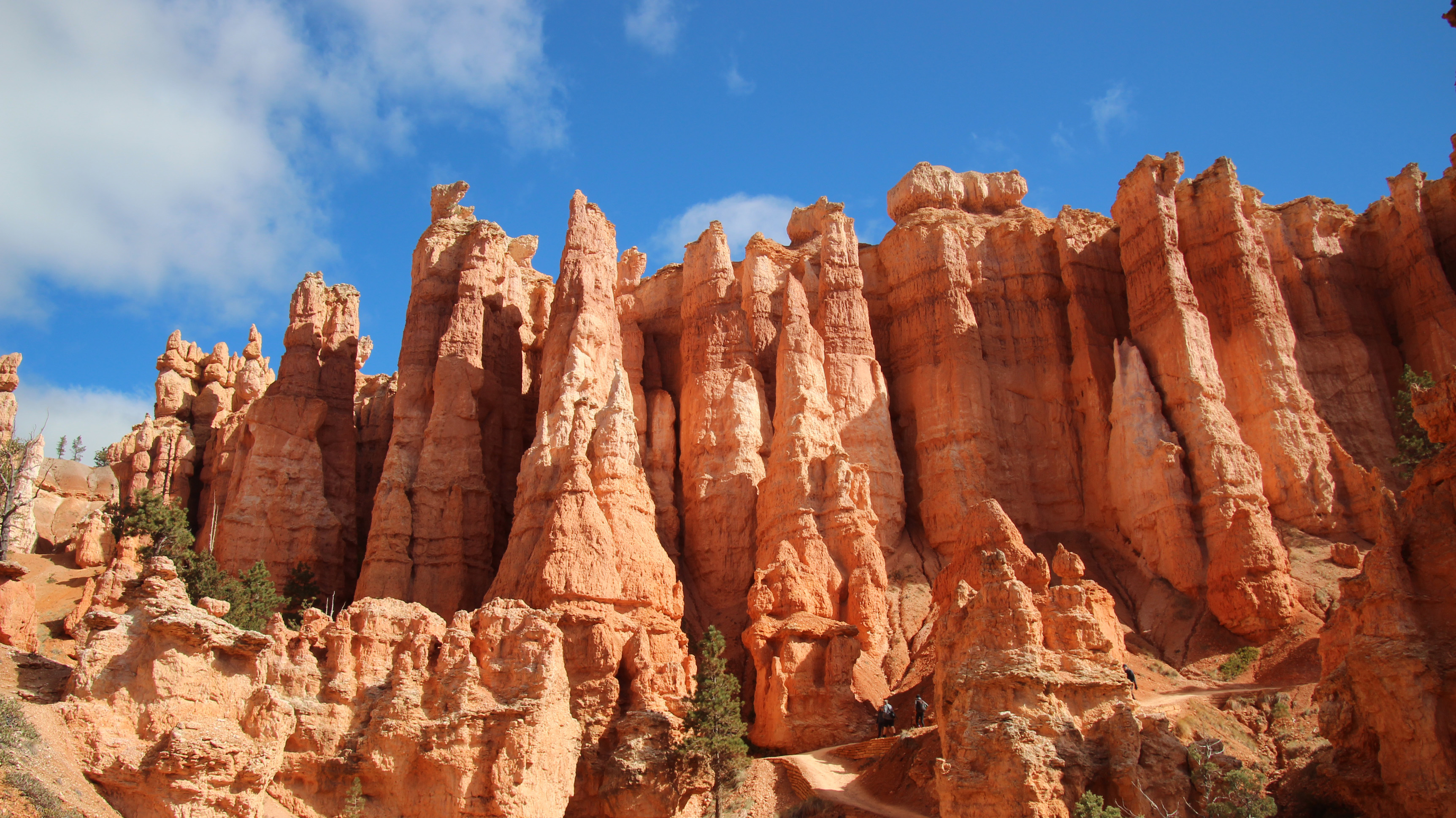
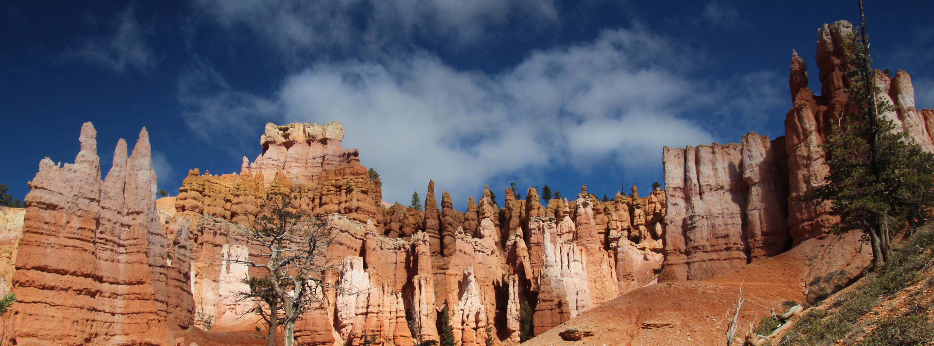
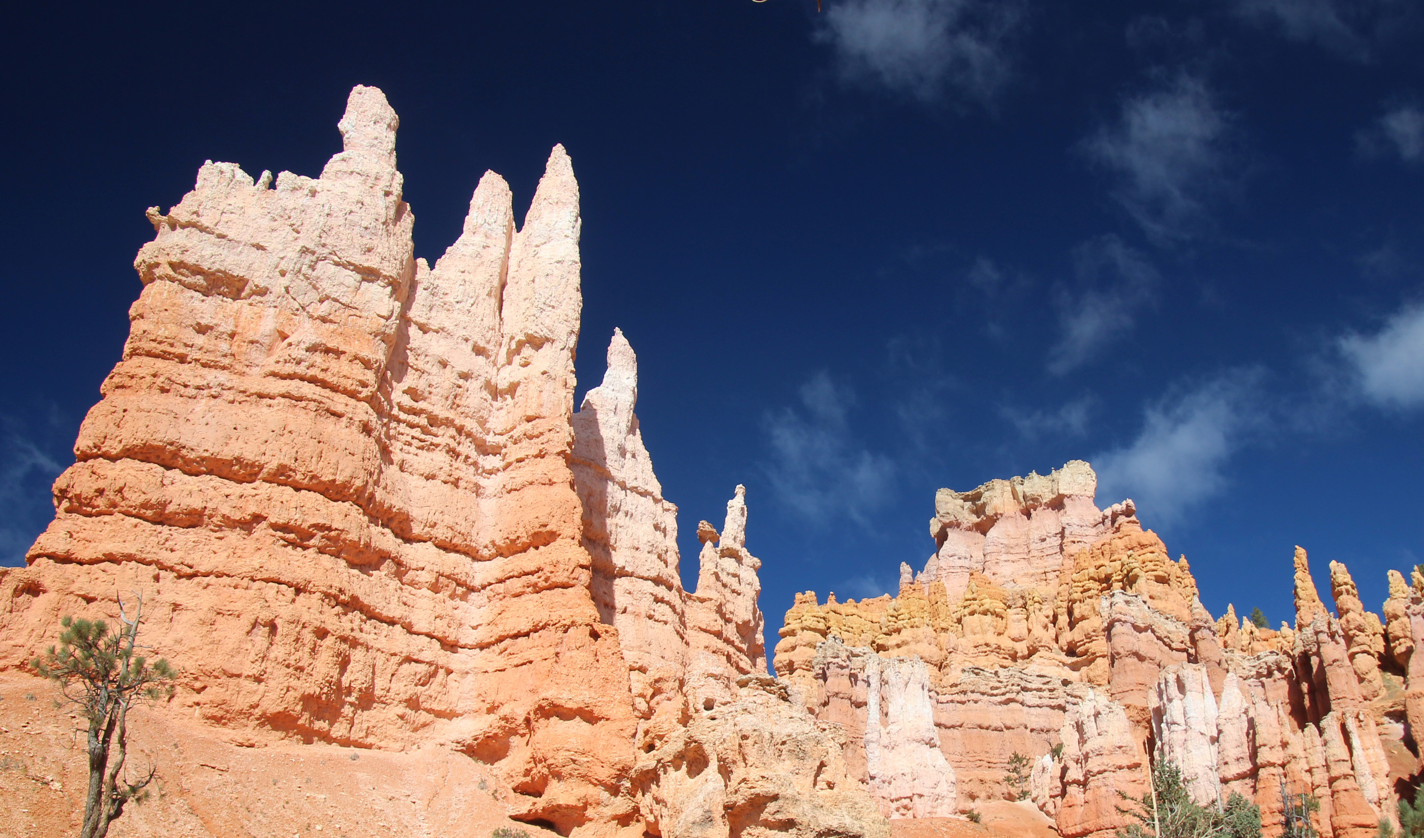
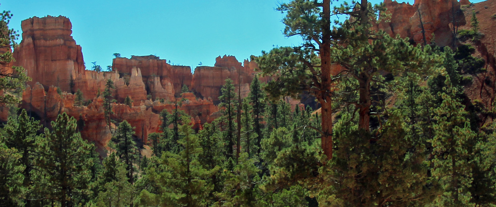
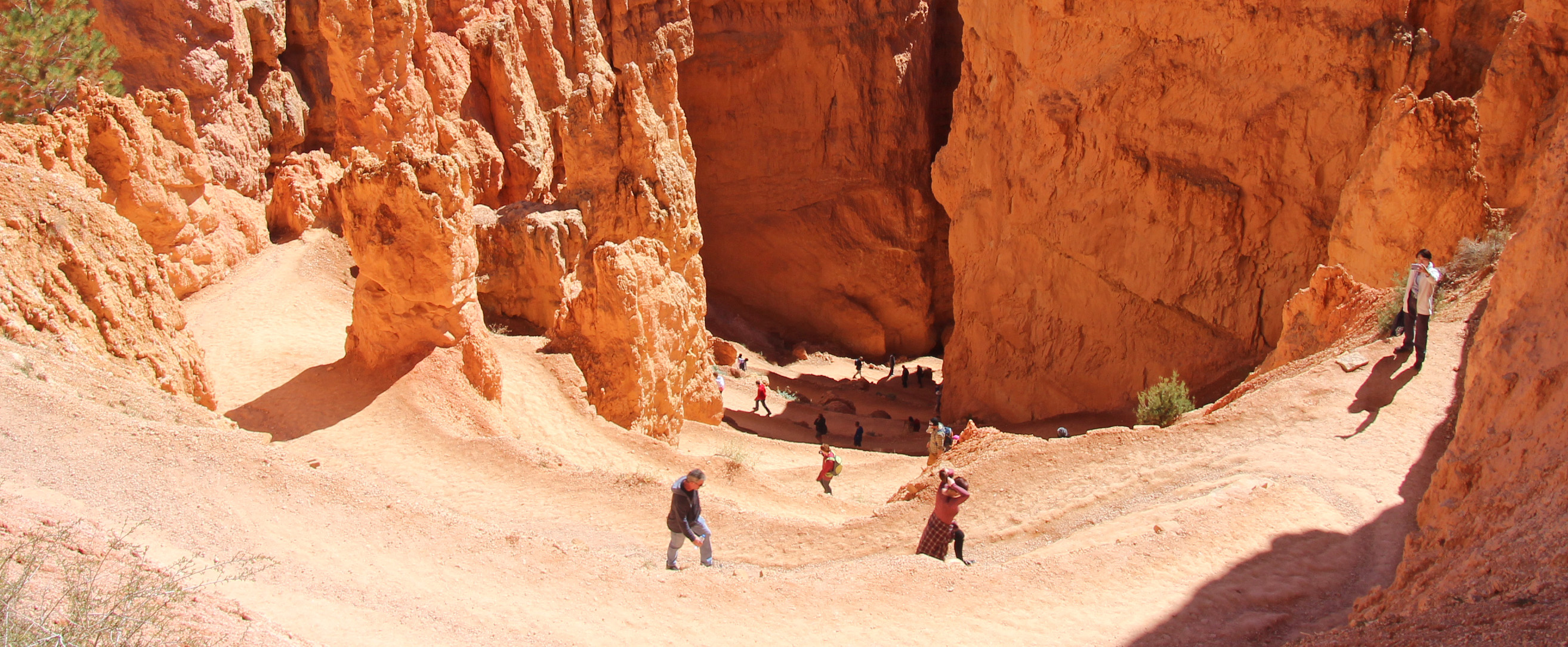
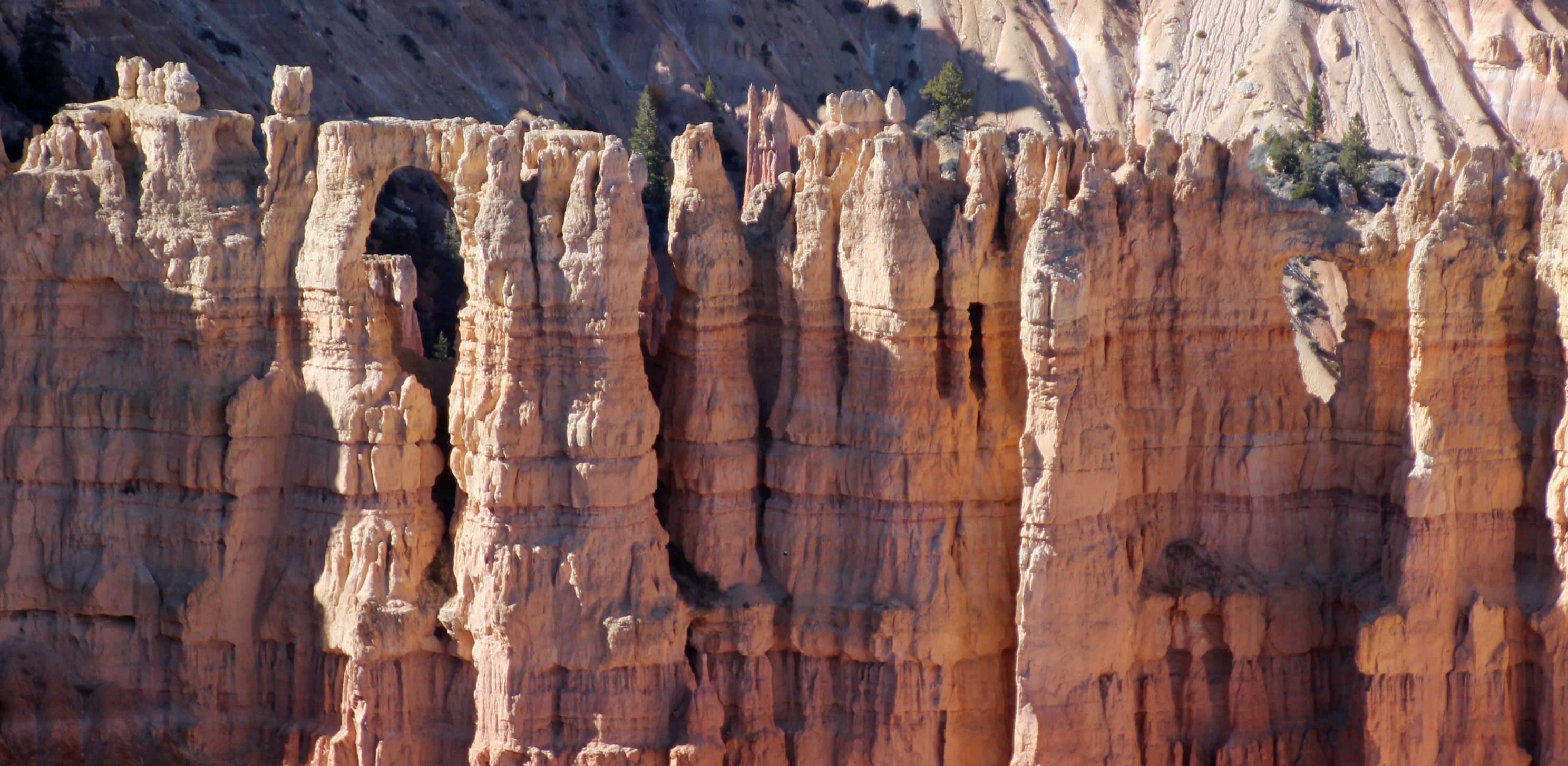
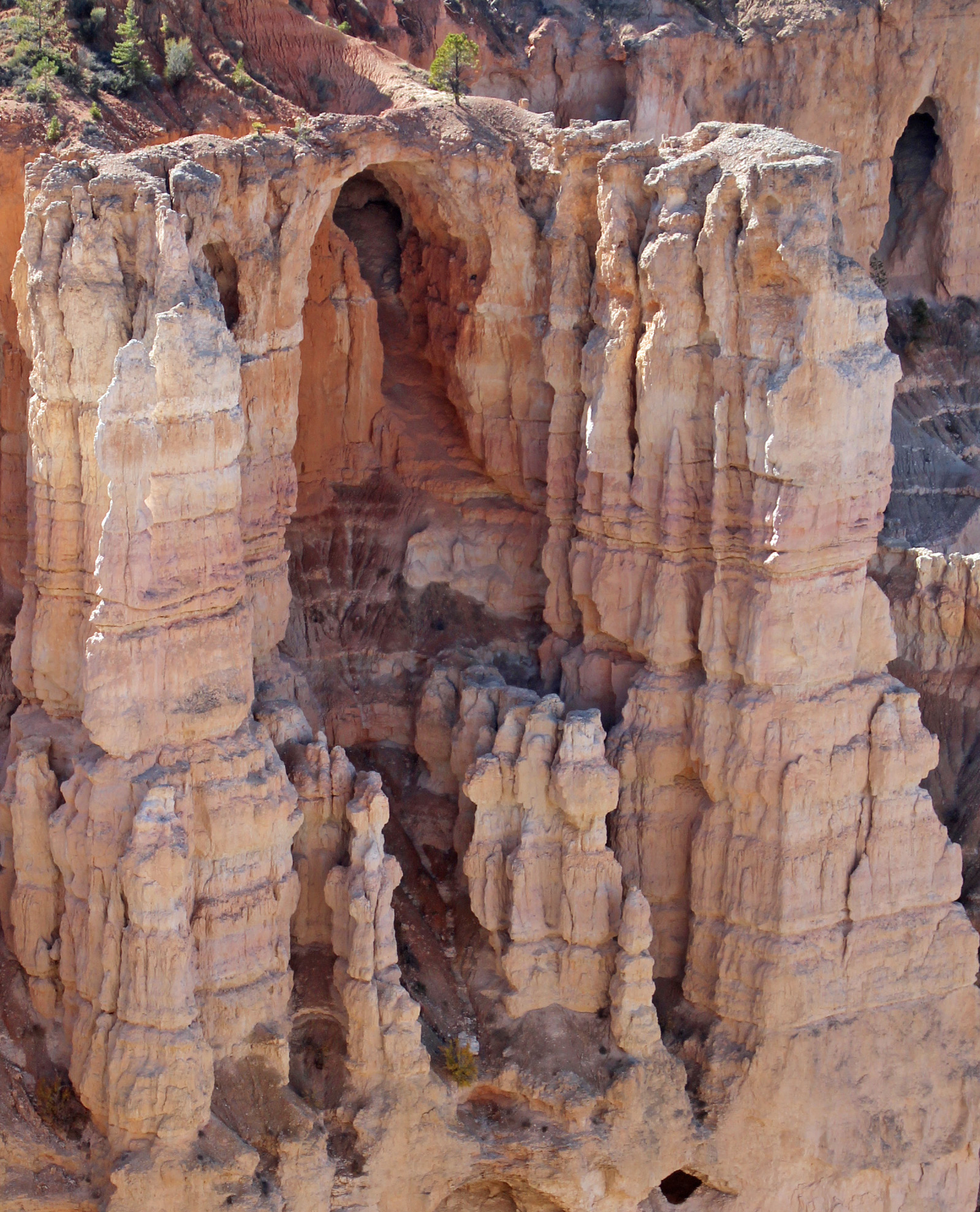
Indeed the weather was beautiful on our second full day, not a cloud in the sky and 41 degrees. Packed a lunch and all our hiking gear and drove the 20 miles or so to Bryce Canyon NP. I figured our toughest hike of the trip would be the one down into Bryce Amphitheater along the Queens Garden Trail, which is a 1.5 mile one way trek down the canyon. Wasn’t sure about the return trip. Well, from the overlook at Sunrise Point we were amazed once again. The famous hoodoos are outstanding – orange, red, white and yellow sandstone spires that spike upward. Down we went along the sometimes very narrow trail, through the fins and spires until we reached the white structure called Queen Victoria. As you can see, even though we got a start before 10 am, we had the place to ourselves (NOT). This was our busiest park and trail so far, reminiscent of Arches and Grand Canyon. As kids and parents and others bounced along and zipped past us, we just took our time and gazed up at a perfectly dark blue sky like you almost never see.
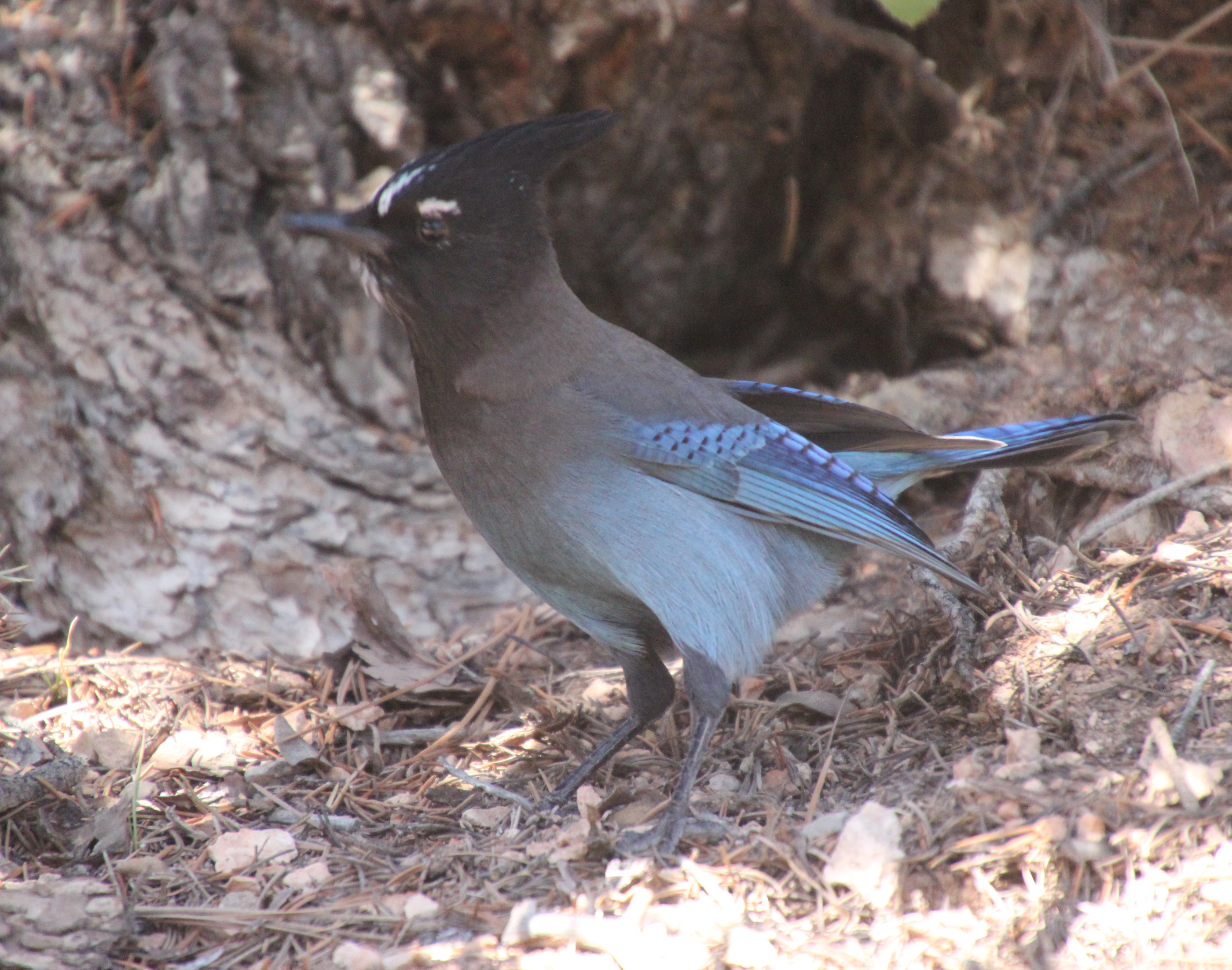
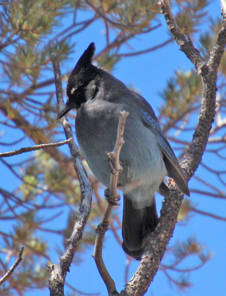
After a few tunnel passes and more meandering, we reached a much more wooded canyon and walked among the spruce, cedar and pine with chipmunks scattered about. There was a pinyon pine that had a couple of Steller’s jays bobbing around eating the pine nuts. Such dramatic blue and black birds. When we reached the end of the Queens Garden Trail we, along with many others, debated the way back. Map said we should link up with the Navajo Trail for a return trip of 1.7 miles, and not wanting to repeat ourselves we pressed on. Another junction offered two ways up: Two Bridges or Wall Street. Again, more debate among all of the hikers pausing there until Jackie declared “Wall Street” for us.
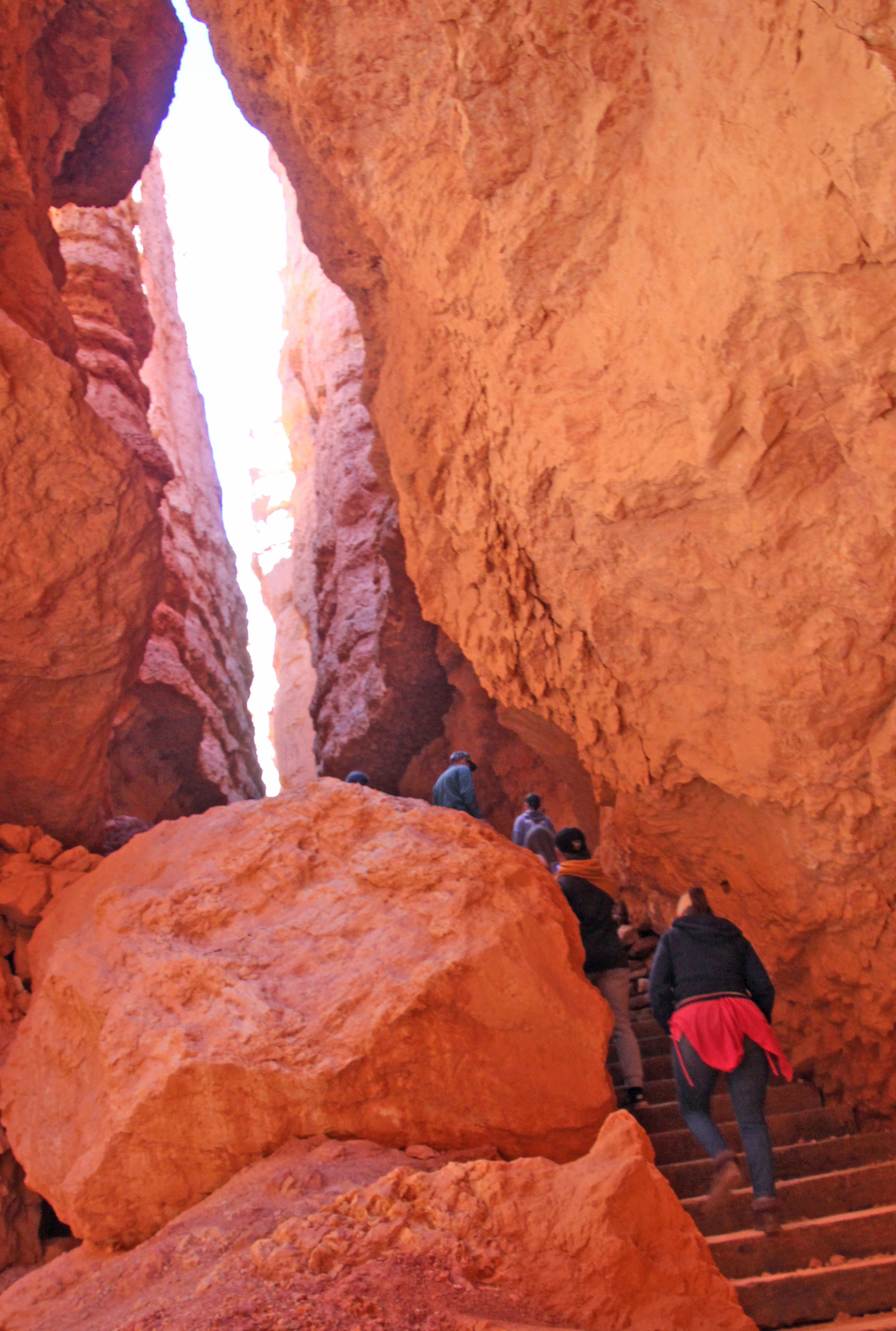
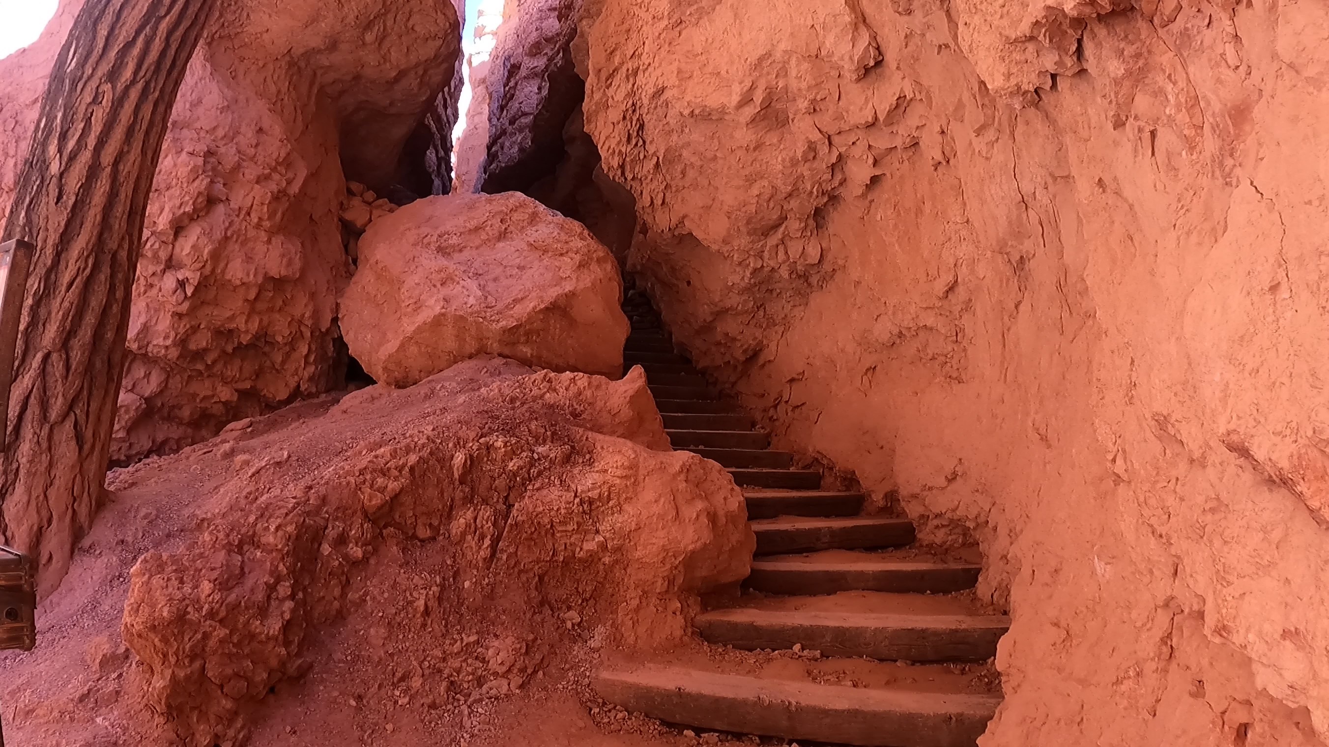
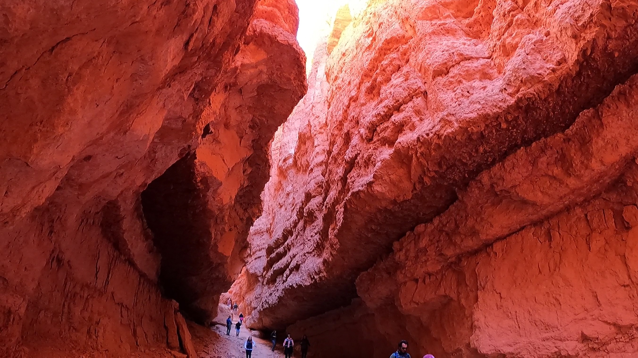
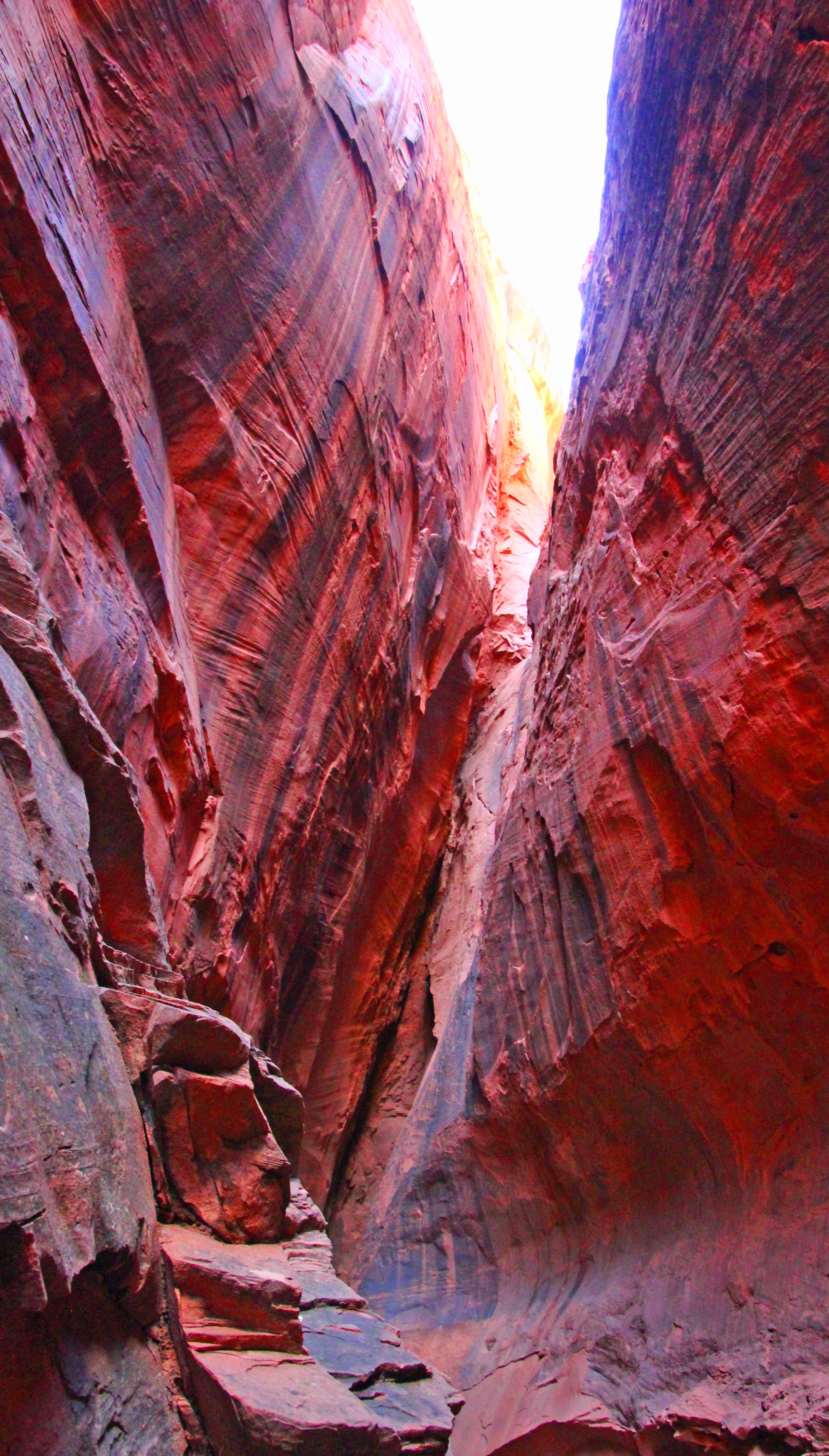
A challenge of an uphill hike until we hit the sweet spot. Crazy. There was a cautionary sign of falling rocks at the start of a stone stairway into a crevasse that really looked intriguiging. We let a larger family group go ahead of us and as we got to the top of the stairway we were speechless. We were standing in a huge slot canyon with sandstone walls that went hundreds of feet up above us. The air in the slight bowl at the base where we stood was rather cold but the experience was goose-bumpy anyway.
This section of trail was the last ascent, and it was amazing. Switchbacks wiggled endlessly up and out of the shady slot canyon and into the sunshine. It was hard to take it all in, since you were mostly watching your feet as you walked. That’s ok, we needed to pause MANY times at the switchbacks to catch our breath. We were pretty much at 8,000 ft, so it did take your breath away.
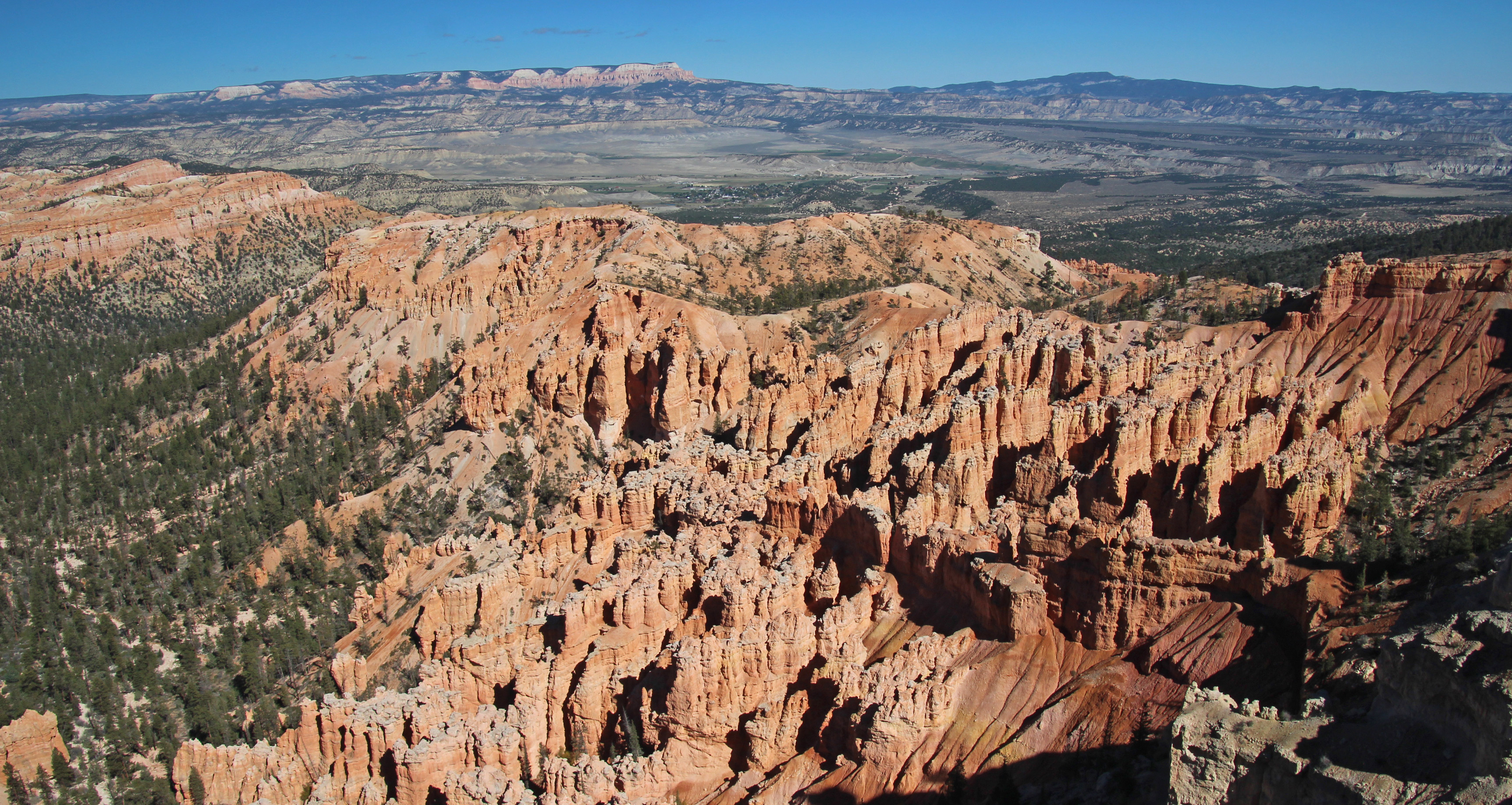
Finally at the top you could look down across the valley of hoodoos we had walked among and back from our spot on Sunset Point to Sunrise Point. Pretty much 3 miles, although our fitbits said closer to 6, but why quibble. It was an accomplishment.
One more drive further into the park to Bryce Point – another amazing overlook, and we sat to have lunch. Wow. Lots of folks here. On the drive out we stopped to watch some prairie dogs (yeah, wildlife!) and made our way back through Tropic to camp. A short nap and “breakfast for dinner” followed. We have heard various weather reports that change with the elevation. At Bryce they are expecting lows in the teens; in our spot, a thousand feet lower, we are expecting 20’s overnight. Everyone says snow for Tuesday, our departure day, so who knows? I unhooked, drained and stored the water supply hose, since we are full in the water tank. Since it is so clear out, it should also be a wonderful night sky filled with stars, planets and constellations that befuddle me, even with a guide.
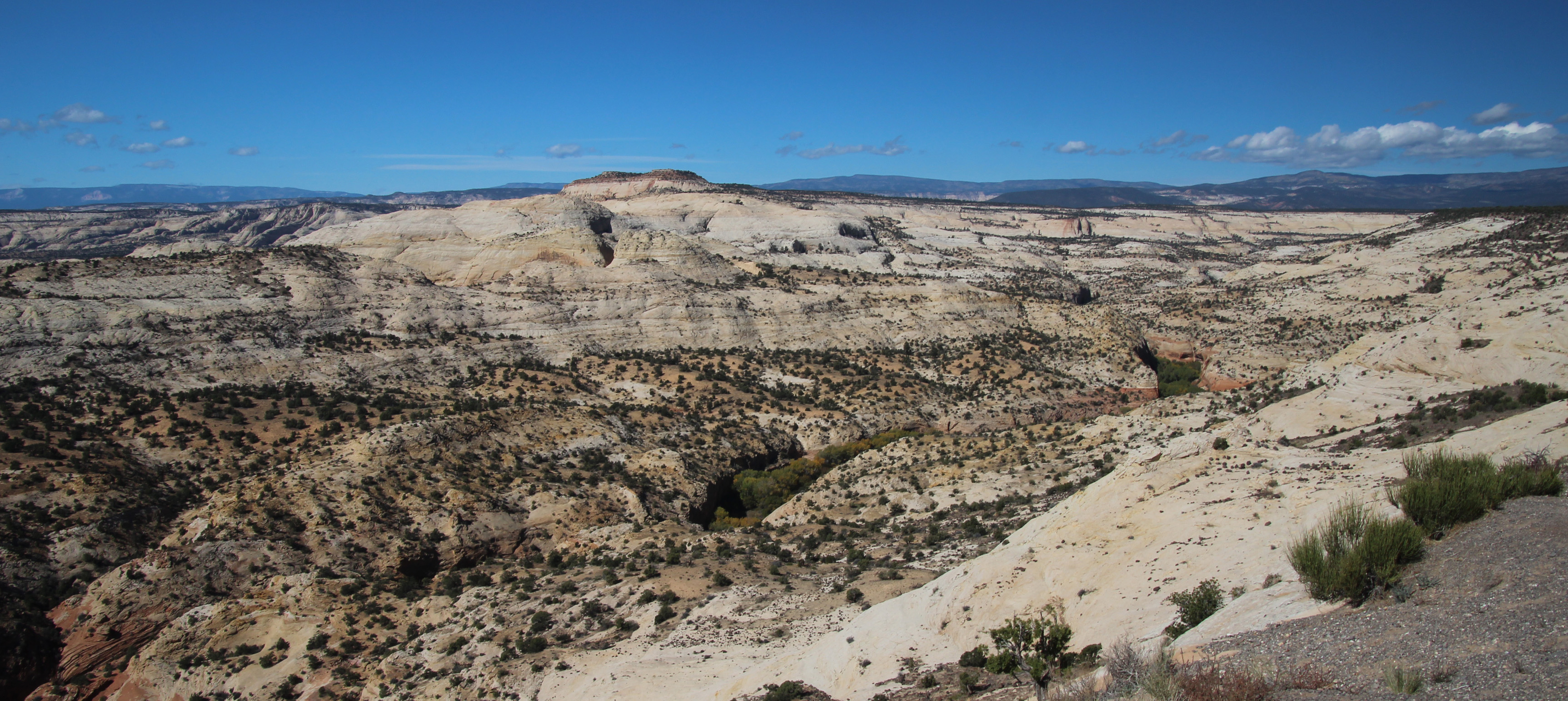
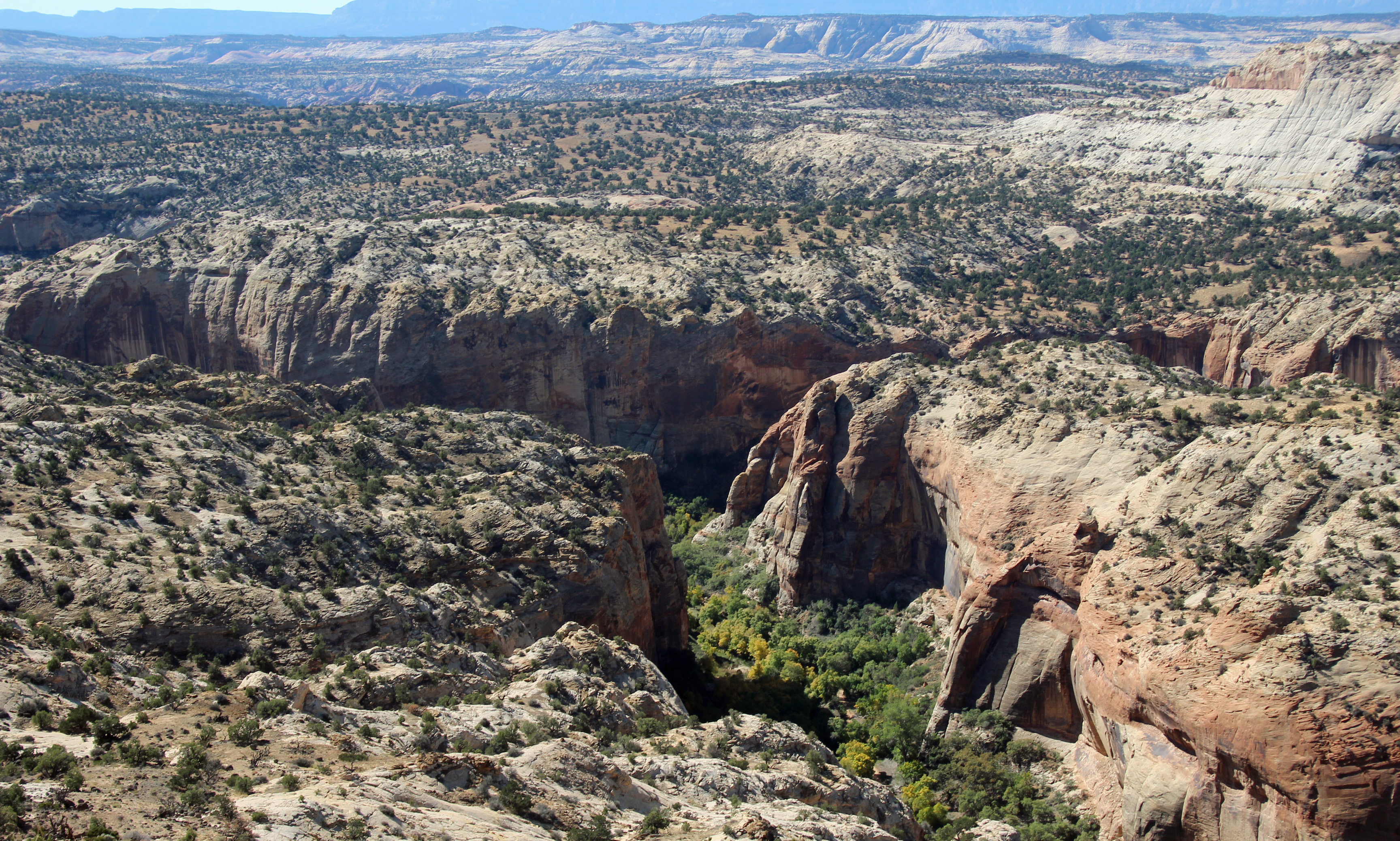
Well our last day in camp started cold, 33 degrees, but we were just looking to complete two things on my checklist: Drive to Escalante and Boulder to find the Burr Trail Road and then find Long Canyon slot canyon. That was just over 60 miles (long distances are nothing out here) and some elevation changes up and down 1,000 to 2,000 feet. Off we went, stopping at the Grand Staircase/Escalante Visitor’s Center in Escalante. Very helpful information about how to find the unmarked slot canyon. Town was cute, just a few markets and eateries along the main road, but it was way bigger than little Boulder. The scenery was the star, however, as the drive wound around, up and down, with the rock formations changing grey shale and stone to white, rather smooth stone mounds and hills to red rock and shale once again. In the canyons the aspen and the cottonwoods were turning a bright yellow-orange.
Once in Boulder we stopped for lunch at the only eatery – the Burr Trail Grill, just at the start of the road. Awesome little place with a delicious lamb burger and some sugar wings. Never had them, but now I know they are hot wings with a sweet coating of sugar. Lips burning kind of hot. They also had homemade hand pies big enough for two, so we bought spicy cherry and caramel apple with cardamon. Should be good later tonight with some hot cocoa.
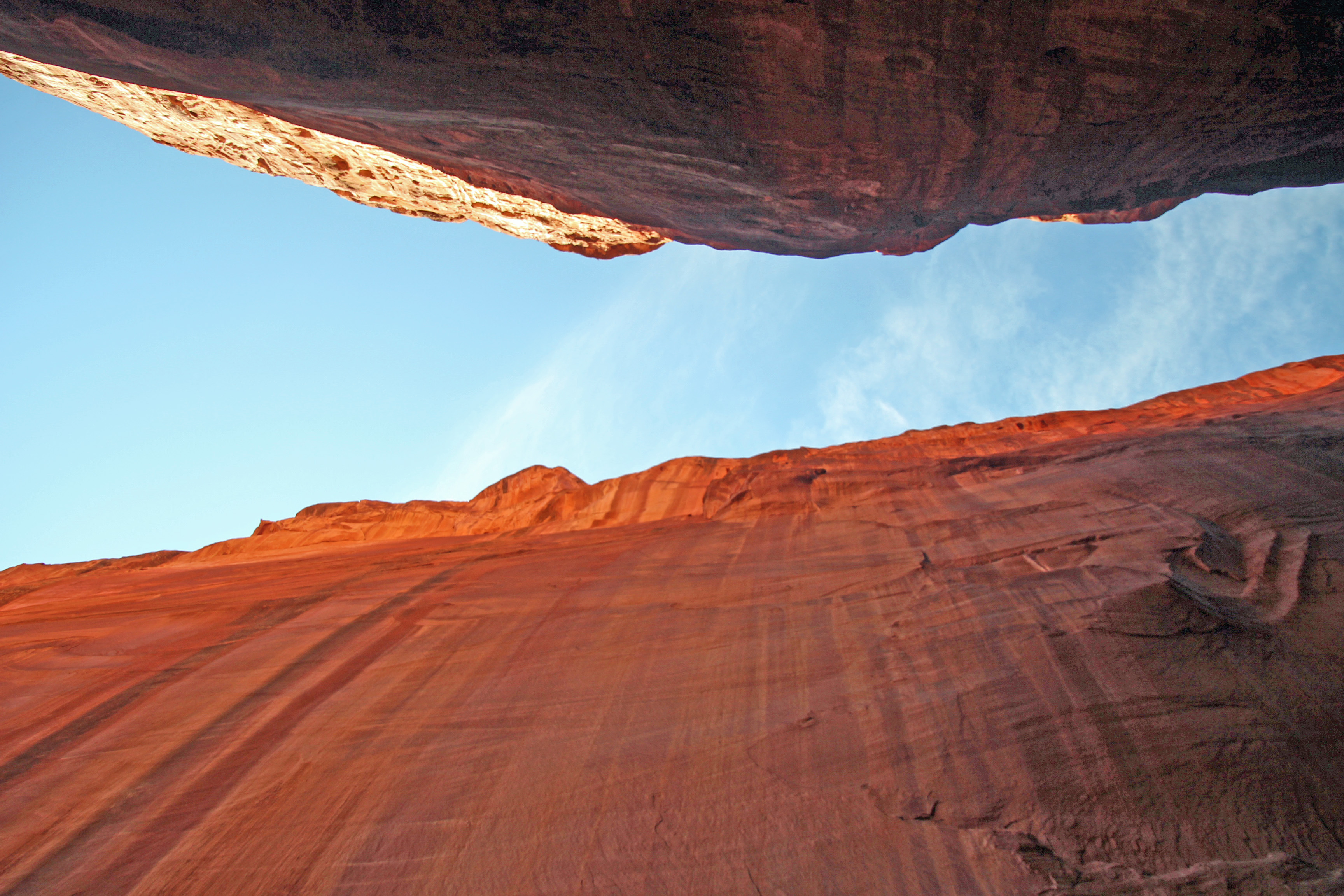
Studying our information closer, it looked as though the Burr Trail was a paved road at least as far as the slot canyon. It turns to gravel/dirt, but much further south. That’s good, because I wasn’t looking forward to 11 miles of washboard again. Soon we found the big cottonwood that stood outside the slot in the red rock and pulled over. Clearly a well-worn stop and the path was pretty obvious. Into the split in the rock we went, the cool breeze blowing outward. How perfectly wonderful! It was maybe only 100 yards in until you reached where the little gap let in only a dribble of water. But the sheer walls rose up hundreds of feet and echoed your voice around the space. Not surprisingly we were followed in by several other folks, but there was room for all and time for plenty of pictures.
On the way back to camp I hooked up the GoPro to the bumper and filmed the Burr Trail Road and parts of Scenic Highway 12 back to Cannonville. Hope to put that on our youtube channel when back home so you have a idea of how this landscape looks. Totally amazing. For the weather tonight there are various reports of rain, snow, mixture and maybe temps in the 20’s. It all depends on your elevation. Bryce is the highest spot around, so on our trip out of here tomorrow, which climbs relentlessly uphill to the Bryce Canyon entrance and then down through the very scenic Red Canyon (with two short tunnels!) we might see some flurries. Yippee! Yet another reason to lose sleep tonight.
Thanks again for joining us on the journey. Shout out to our hardworking teacher daughter Karina and her equally hardworking husband Jason and our two grandsons! And to Alex, Bethany and Jim for teaching us how to get our Jeep all muddy.
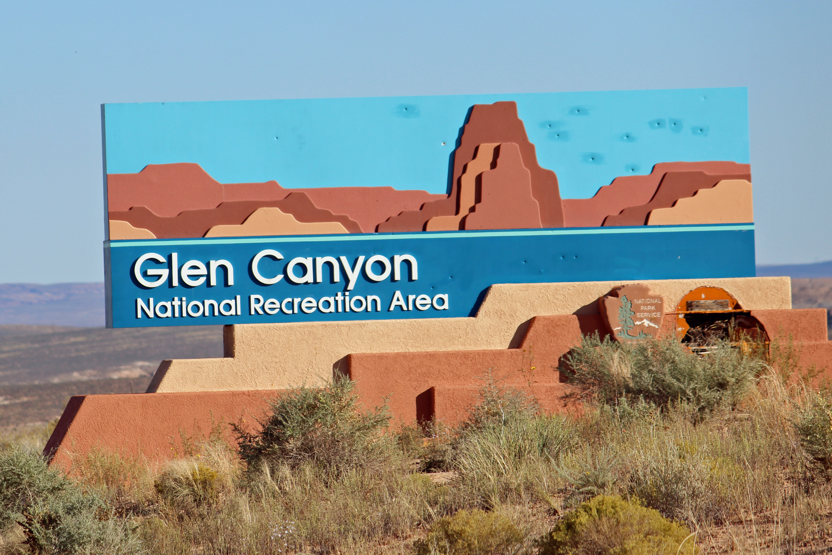
Reporting in from the Wahweap Campground and Marina in Glen Canyon National Park along the shores of Lake Powell here… and maybe just a little confused about the time. When we toured the visitor’s center at Lake Powell Dam (what a feat of engineering, by the way – something I would have shared with my engineering and technology class) I was surprised to see the time as 4:00, not 5:00 closing time. I asked if we had crossed into the next time zone, but was told Arizona does not observe Daylight Savings Time, so we are on Mountain Standard Time. Cool, we gained an hour.
But the campground straddles the Utah/Arizona border, so our cell phones can’t entirely get the time straight. Later in the week we will head to North Rim Grand Canyon, AZ (same time zone), then into Zion NP in Utah (hour ahead), then into Las Vegas (Pacific time) and back across to South Rim Grand Canyon (Mountain Standard), ….fa-get-abbat-it. Retired and off the clock anyway. We have one battery operated clock on board that I keep changing, but I can’t figure how to get my fitbit to change, so that one is useless. In fact, it had me at 10,000 steps just driving from Moab to Page yesterday. But I got off topic.
Great campsite
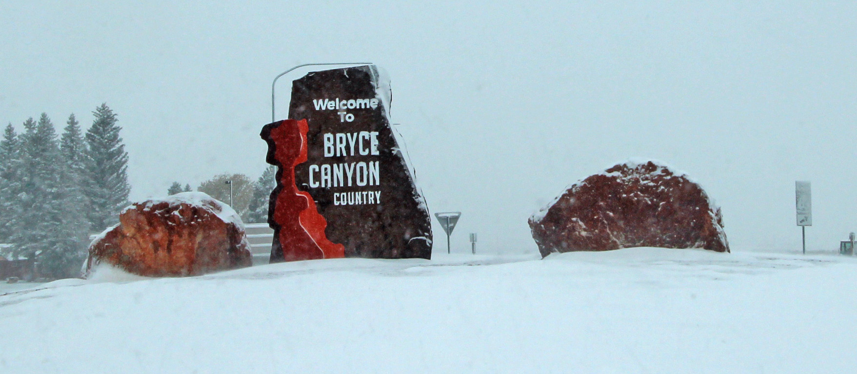
The sign colors match what you see.
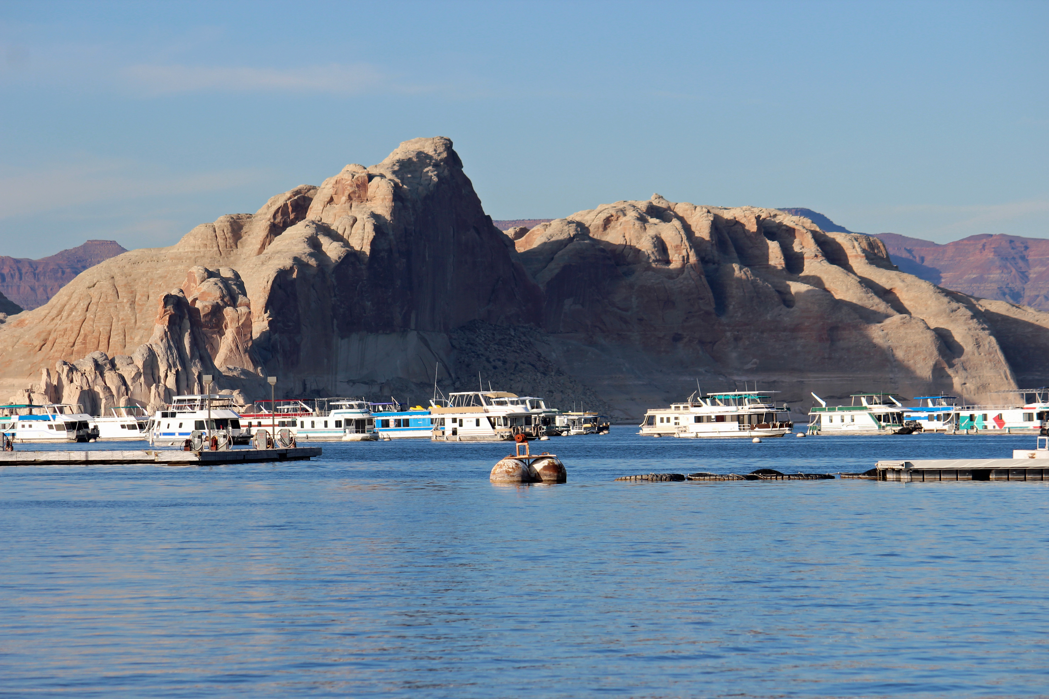
Back to camping on Lake Powell. This is a top-notch campground for full hookups: flat and level sites and a great view of the canyon walls along the lake. You come to appreciate concrete pads and easy hookups after being on the road a few weeks. More about set-up and breakdown in a later post. When we got up close and personal to the Glen Canyon Dam and the bridge that crosses the canyon, it was easy to feel a sense of vertigo – such a huge scale and such a deep canyon. Amazing.
Glen Canyon Dam and Visitor’s Center
Glen Canyon Bridge
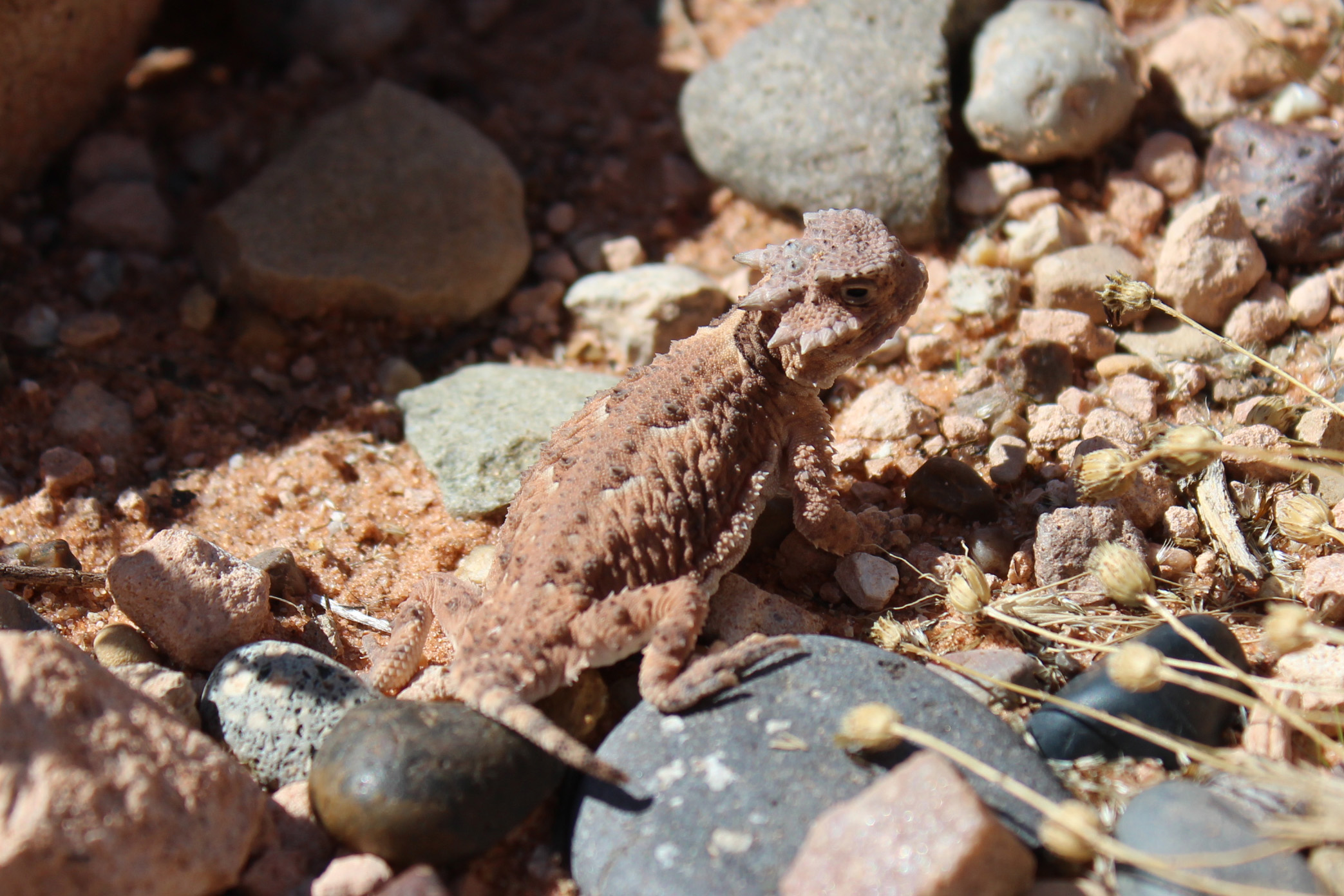
So about our animal spotting. Lower Utah has scant wildlife or birds to see. The best we have done is one Prairie Falcon, otherwise mostly ravens and a few magpies. The long drive from Moab along the mesas and through the Navajo Nation looked promising. Road signs with leaping deer kept popping up, then proclaiming “Caution, Deer Crossing” and even “Watch for Deer in Your Lane”. Talk about easy, this was gonna be good – they were going to be IN OUR LANE. Nada. Wait, the next sign had flashing lights, and another said “Caution, Annual Migration Route”. Zip. “Open Range” with cattle symbols and then horse symbols. Nothing. Wait, what’s that? Sheep. One small herd of sheep. No roadkill, not even any interesting bug splats on the windshield. Skunked on wildlife.
Oh, a shout out to big game hunter Adam on two deer kills with two arrows!
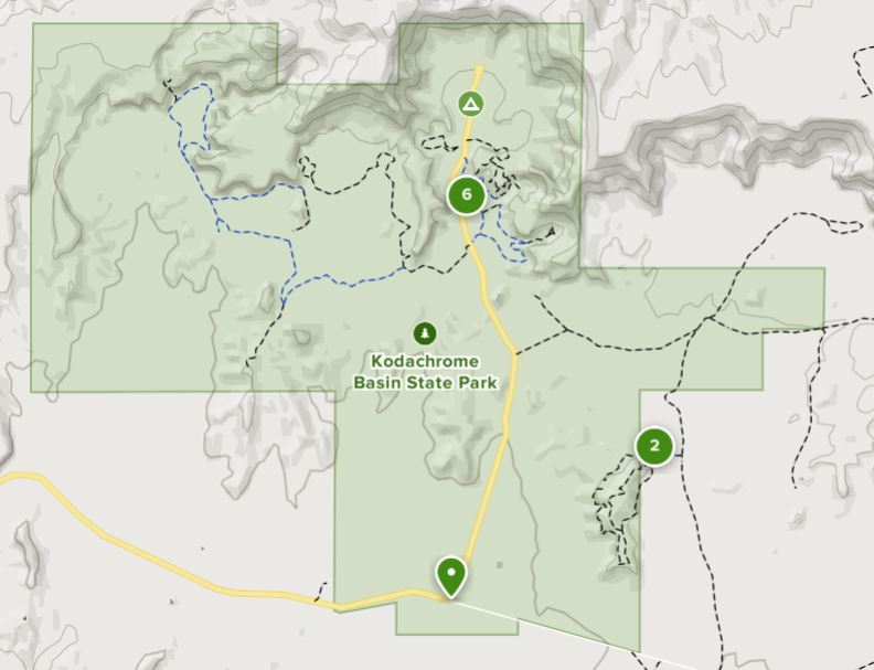
Monument Valley
More of Monument Valley
Buttes in Monument Valley
Actually, the drive was fun. You were constantly surprised about what lay just over the horizon. Looked real flat with mountains in the distance, then suddenly you dipped down into a canyon and were surrounded by red sandstone cliffs. A little later you would see flat-topped mesas and buttes around you. The red, brown and beige stripes of rock layers on the canyon walls would change as cloud shadows passed over them. Every outcrop has a name, and copilot Jackie scrambled to find them on the map. We took a scenic byway and a side road that we worried would be tricky for the van, but which turned out to be very easy and scenic. We drove through Monument Valley and recognized iconic scenery from movies and commercials (all those buttes standing out in the red valley). We couldn’t help but start humming songs from our favorite westerns (Bonanza was a favorite).
I will post a few pictures from our Arches hike to Delicate Arch in the rain here, and the traverse of the slickrock. Look very close to see the parking lot waaaaaay in the background, or some of the other hikers waaaaay up on the rock.
Soaked on the hike
Uphill Climb in the rain
Petroglyphs in Arches
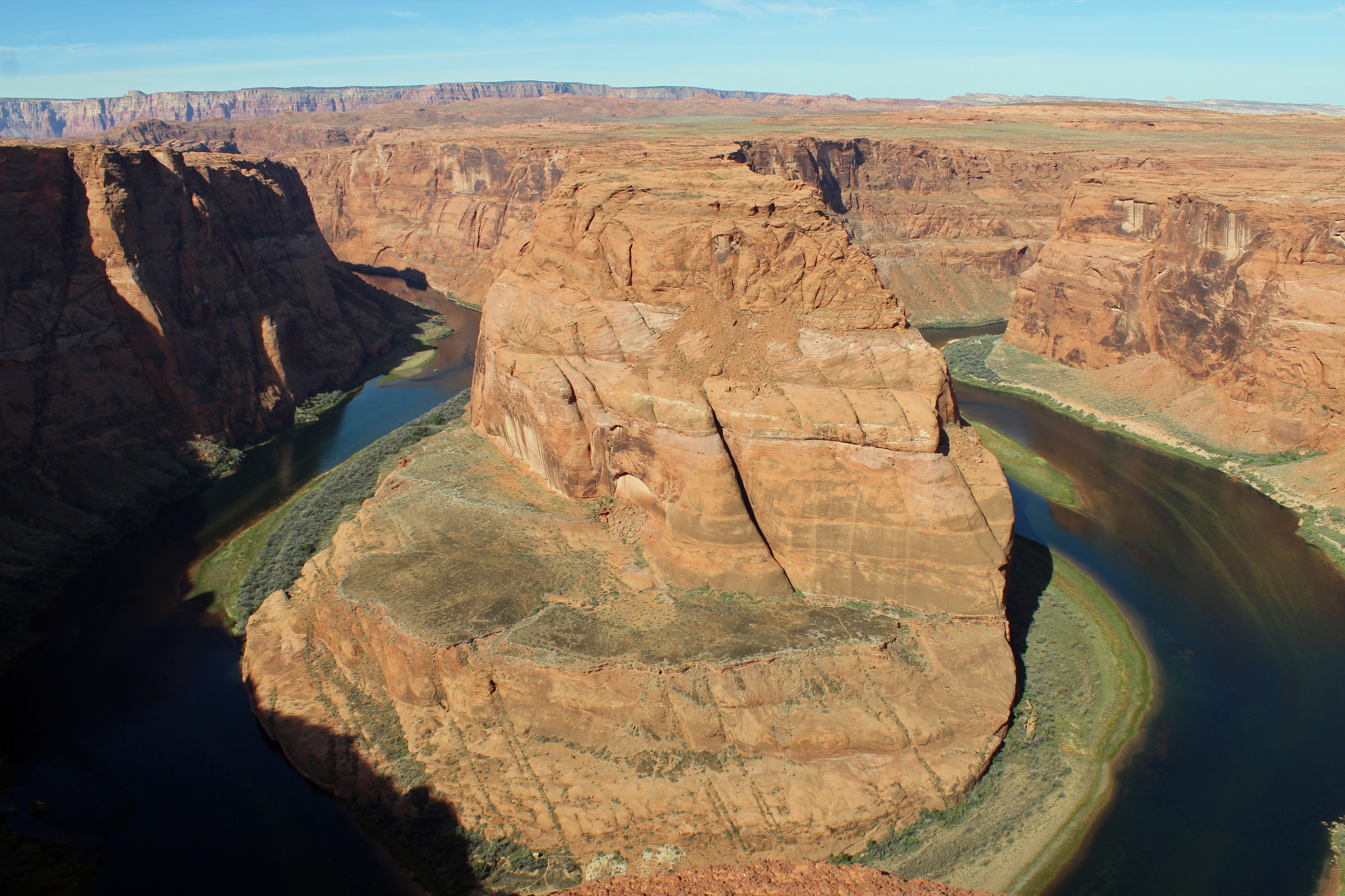
So today we are headed on a hike to Horseshoe Bend, then Hanging Gardens and try to book a tour of Lower Antelope Slot Canyon in the Navajo Nation.
Update on the day, as we sit at camp relaxing with an adult beverage. We did head to Horseshoe Bend to hike in to the canyon rim from the parking lot. Probably a mile in – and oh my the tour buses had arrived. Mind you, I am talking about the largest buses you see on the road, filled with tourists. In this case, the Chinese tourists once again, with their umbrellas, sun hats, very well dressed but not always appropriate for hiking. (No offense intended, it’s good to see the visitation at our National Parks). Now we have also seen a lot of German and French tourists, too, but they seem much more prepared for the hikes.
Horseshoe Bend
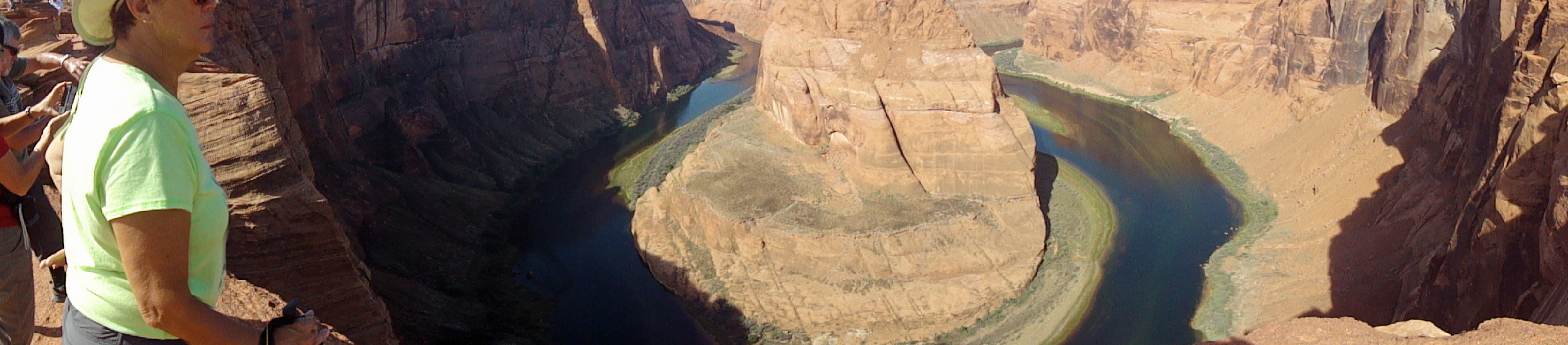
Mind the edge Jackie!
Back up just a little…
Anyway, once getting to the rim of the canyon and looking at where the Colorado River takes a 270 degree turn through the rock walls was quite the breathtaking experience. Seriously, you stood at the rim looking across and maybe down, and you really did gasp. It was indeed a slightly dizzying experience with a bit of vertigo. We joined the multitude and tried for some selfies, while being a little concerned watching folks literally creeping to the rock edge to sit for a picture. It was a rare sight.
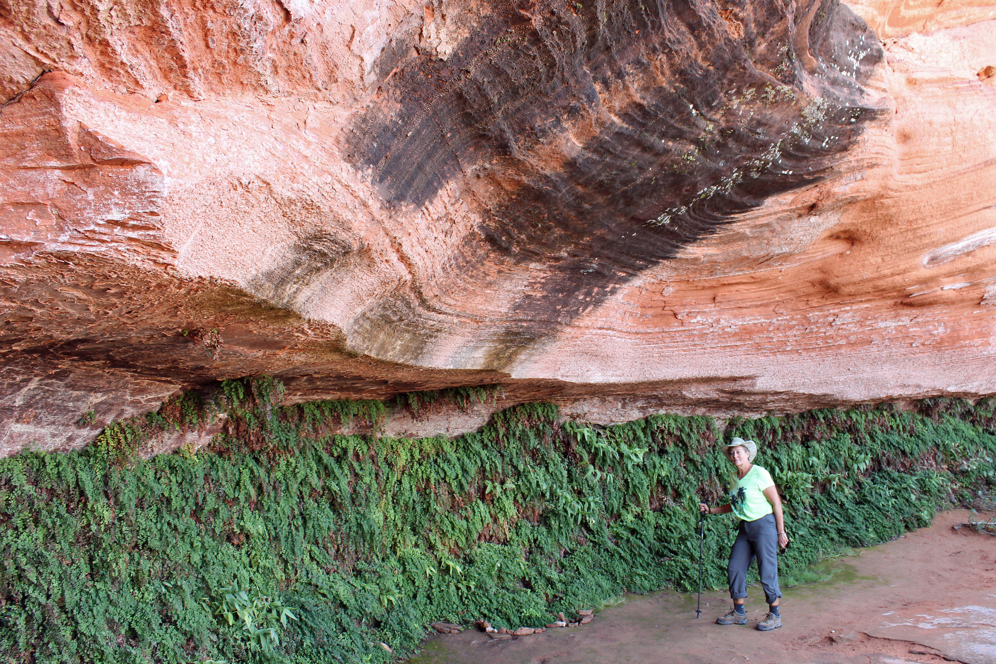
Next stop was to be a hike through a slot canyon in the Navajo Nation, but the rain from yesterday morning had the canyons shut down until the water drained out. We took a relatively short hike to see Hanging Gardens, which was a quiet hike to an overhang where there were lots of maidenhair ferns growing beneath. That was fun and no tour buses were in sight. After lunch we tried what was to be a 3 mile roundtrip up a sandy wash to an arch and then a small slot canyon. This time it was just the two of us following some previous footsteps up through a fun and challenging sand and rock wash. But it registered 6 miles for Jackie’s phone and about the same on my fitbit. Something about these western measurements. We made it to the arch, but not the extra half mile to the slot canyon. Did see some jackrabbits.
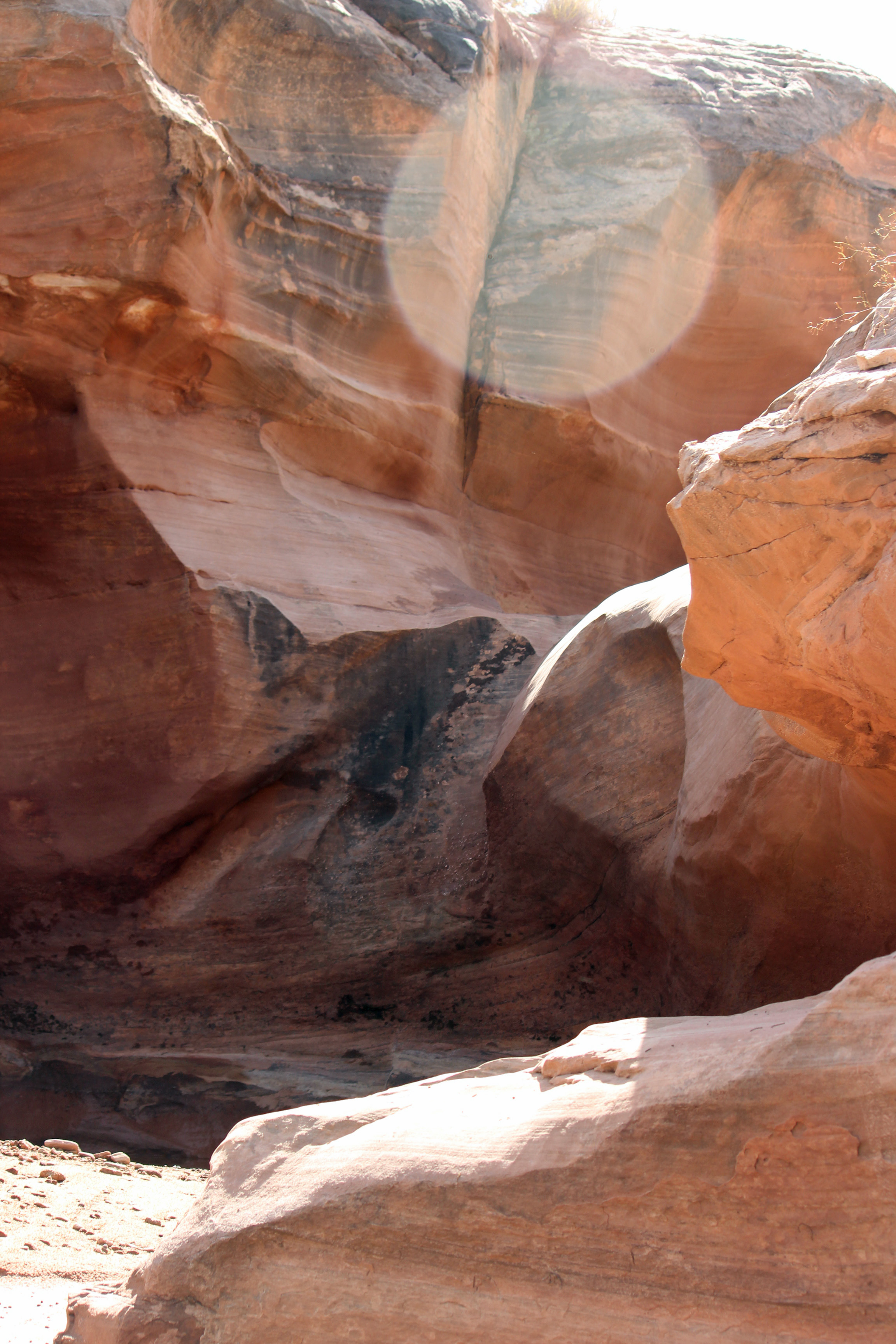
The rocks that surrounded the wash.
We head to the north rim of the Grand Canyon tomorrow, followed by Zion NP. Neither has water, but Zion does have electric. Fill up the tanks and off we go in the morning.


Comments