I finally managed to coax my GoPro Studio to stop crashing and I have some videos of our trip our west this fall (2021). Some pretty amazing sights, a few classic drives and “bucket list” adventures … and yes, some of the driving ones are a bit on the long side. But heck, you want to see the whole experience, right? Put them on your widescreen TV, grab a brew and sit back to enjoy (or chuckle) and maybe plan your OWN adventure!
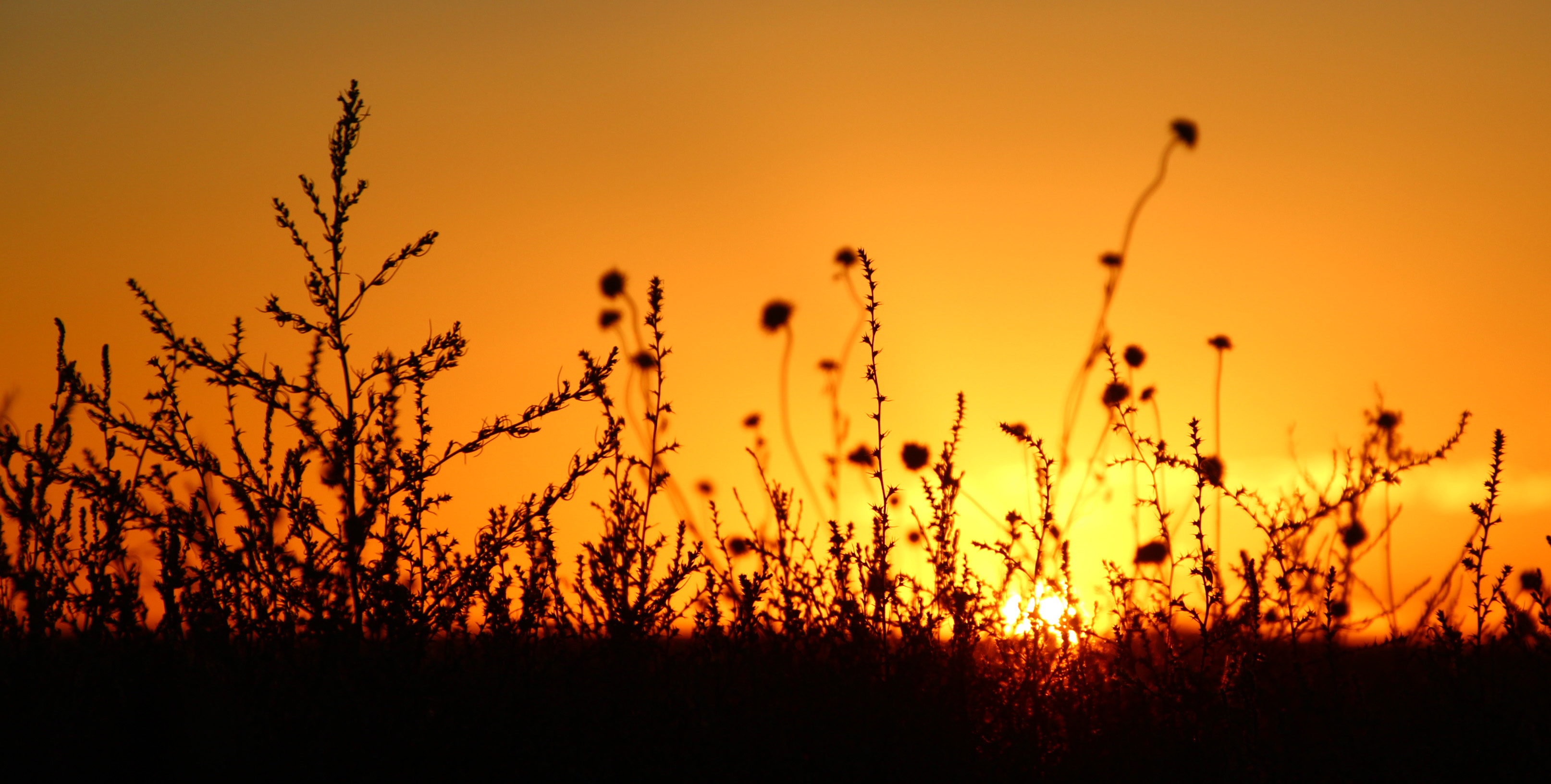
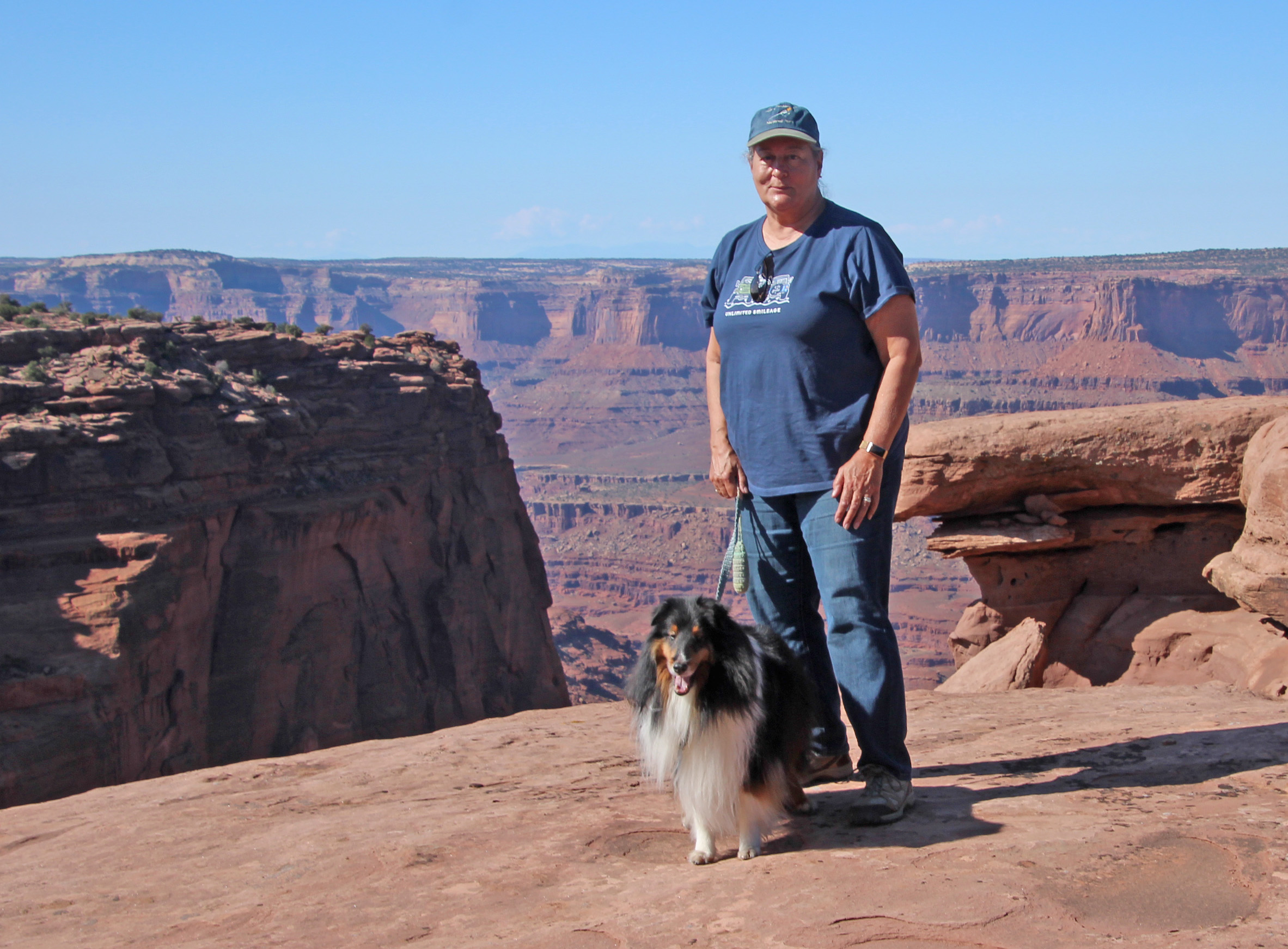
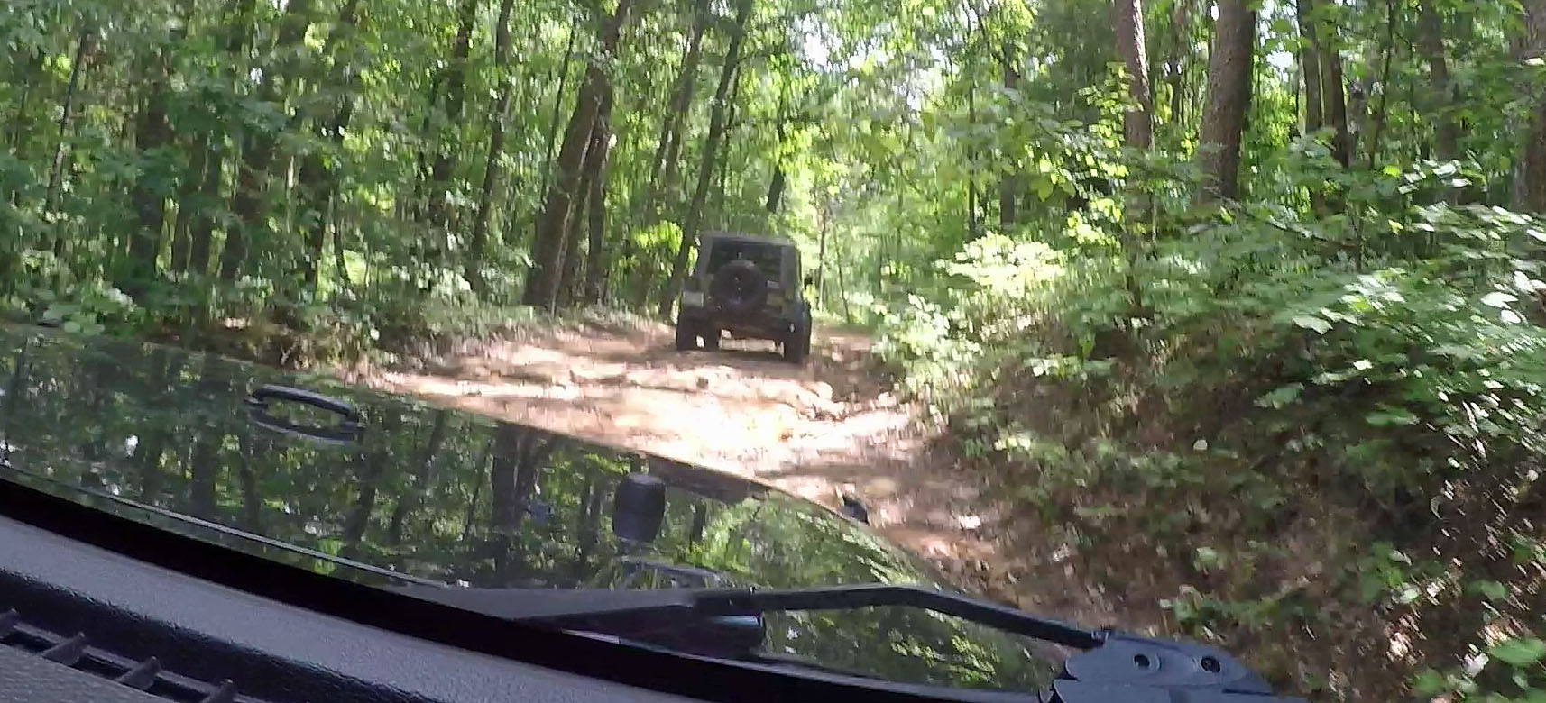
It is hard to describe just how vast and beautiful the landscape of Canyonlands National Park is, even pictures don’t fully capture the breathtaking beauty. Our Western adventure in October 2021 took us to the Moab region of Utah to camp in an amazing campground: Dead Horse Point State Park. We explored the Island in the Sky region of Canyonlands in this video, with a snippet of our drive down the Shafer Trail in our Jeep.
Camping at Dead Horse Point State Park in Moab, Utah was an unforgettable experience for us. This stop on our October 2021 trip to Colorado and Utah was the highlight for sure, with 4-wheeling adventures on Long Canyon Road, Shafer Trail and Potash Road plus grand overlooks and hikes across the mesas and slickrock. This is but one of the videos of that adventure in Canyonlands and more.
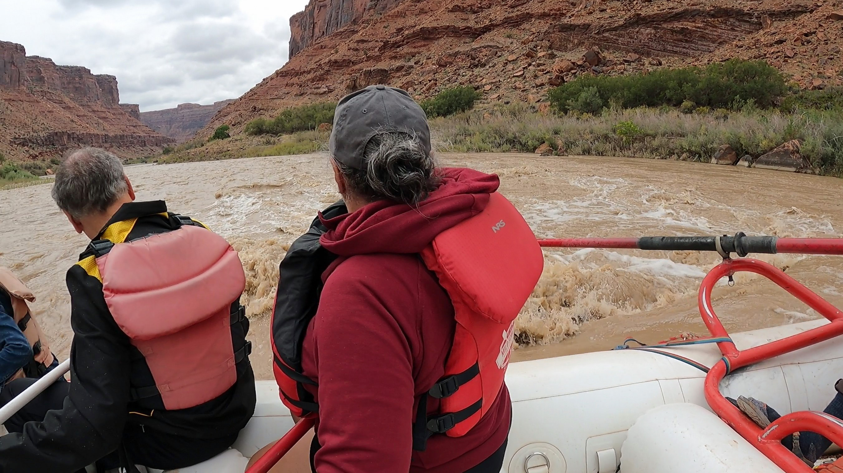
While camping at Dead Horse State Park in Canyonlands we booked a half-day rafting adventure on the Colorado River. It was a pretty amazing trip between the red sandstone cliffs as our guide navigated the muddy rapids and our raftmates had a wet and wild time.
Part of our big western trip in September and October, 2021 – we were camped in Crawford Lake State Park, Colorado and planned to visit the nearby Black Canyon of the Gunnison National Park. But an afternoon sleet storm postponed that till the next day – which turned out to be our second snowy day of the trip. Absolutely gorgeous and made for a nice trip over to the Canyon later in the day. We were a bit worried about the 19 degree overnight temperature, but everything worked out fine.
A fall 2021 hike to the Corona Arch and Bowtie Arch outside Moab, Utah. This 3 mile out-and-back hike was surprisingly tricky for a Sunday morning, traversing some dry washes, rocky climbs and slickrock outcroppings with cables and ladders. But the view and interaction with Corona Arch was worth the effort, though, and in some ways more spectacular than similar ones in Arches. Easy access from a parking lot along the Colorado River and a good addition to a drive along the Potash Road/Shafer Trail.
This was an amazing down-the-canyon drive even the video can’t fully capture. A trip from the Dead Horse Point State Park and Canyonlands National Park to the Colorado River outside Moab, Utah. The GoPro Hero9 is so good at image stabilization that it looks like a smooth ride – and it was anything but. No guard rails, either, so you had to hope you didn’t run into someone coming the other way!
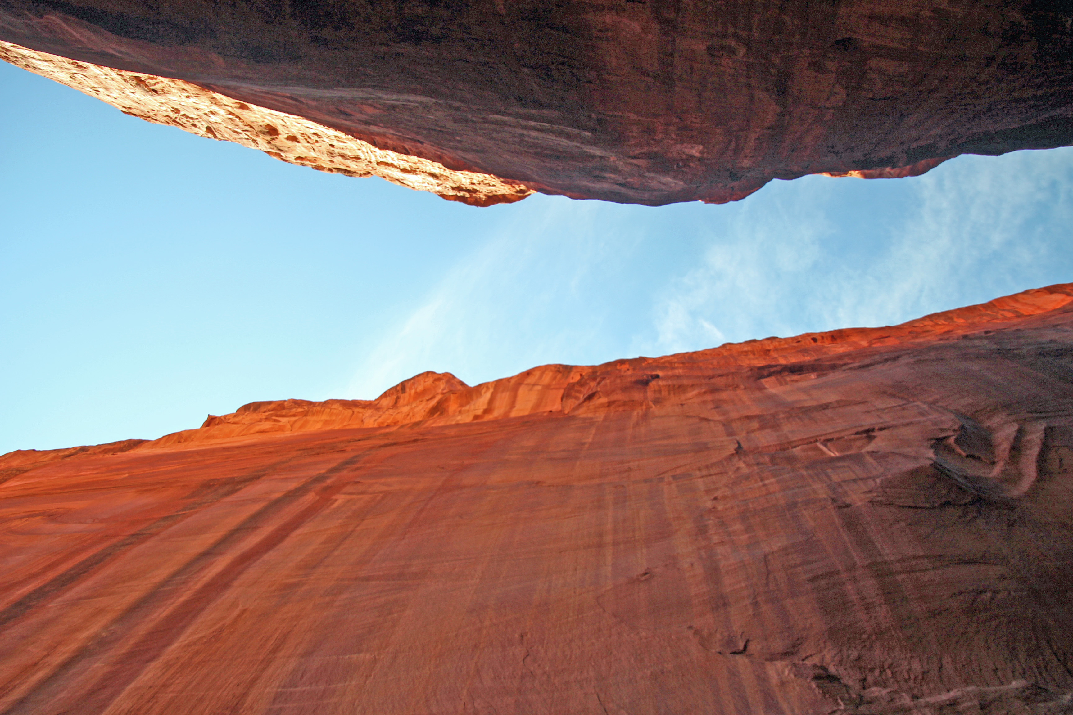
Another “bucket list” off-road drive not to be missed in Canyonlands outside Moab, Utah. Who wouldn’t want to experience “Pucker Pass” and this massive chunk of rock you drive under … very slowly. Watch for Jackie to jump out for a closer look (that I missed on editing). We love our new Jeep.
An otherworldly landscape that we experienced on a beautiful, crisp fall day. The day was perfect and the scenery was breathtaking – literally, since we were huffing and puffing our way along the 3 mile hike that dropped down about 600 feet at the 8,000 ft. elevation — and then back up again along some challenging switchbacks. You don’t want to miss the Wall Street section of the Queen’s Garden/Navajo Loop trail. The next day we left the area in a snowstorm that dropped about 6 inches of snow, so our day turned out to be the best chance for hiking.
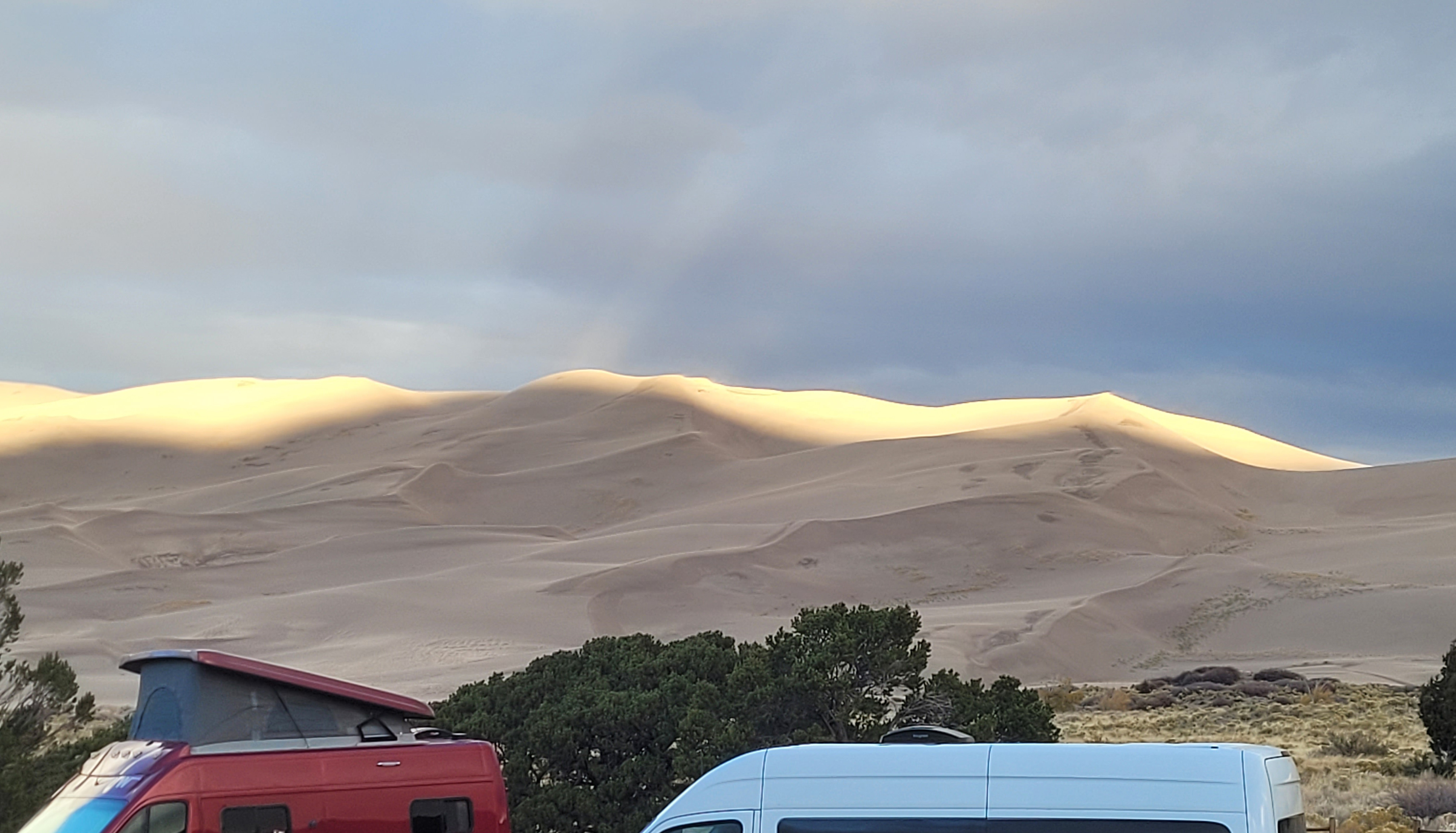
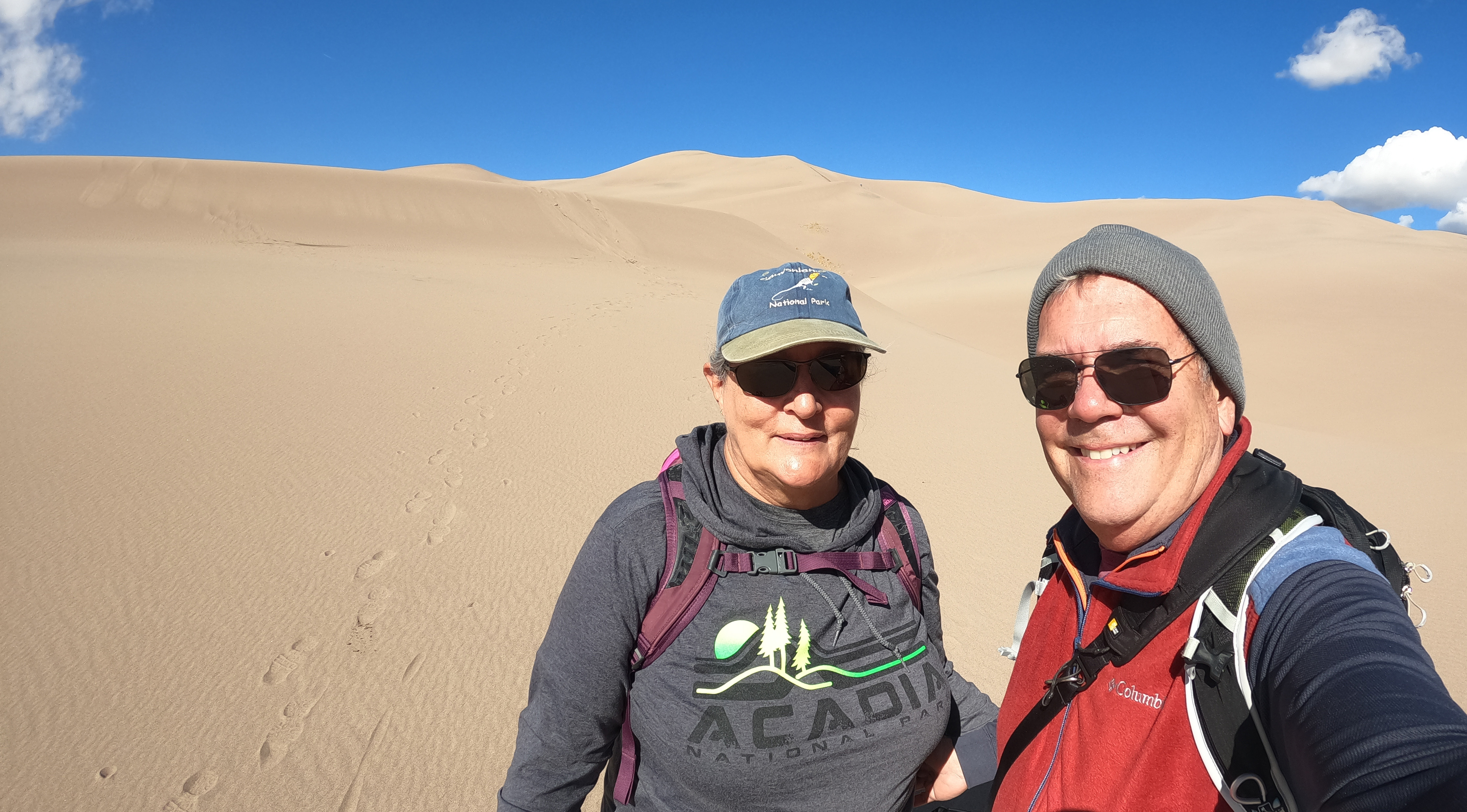
While camping at Great Sand Dunes National Park we headed out to hike up to the summit of the dunes. Well, it was a pretty cold start to the day, about 35 degrees, and gradually became more windy. But we hiked our way about halfway to the top, we figure maybe a 450 foot elevation gain. Given that we were already at about 8,200 feet elevation, it was a surprisingly “breathless” hike – plus, we learned that sand dunes are not the easiest to climb. One unintentional glitch was with the lens shade I put on the GoPro. I was hoping to cut down on lens flare, but in the widescreen mode it caught it in the edges of the picture. Ah well, another learning experience. The hike was worth it though – seemed like something out of Star Wars – how the heck did C3PO do it?
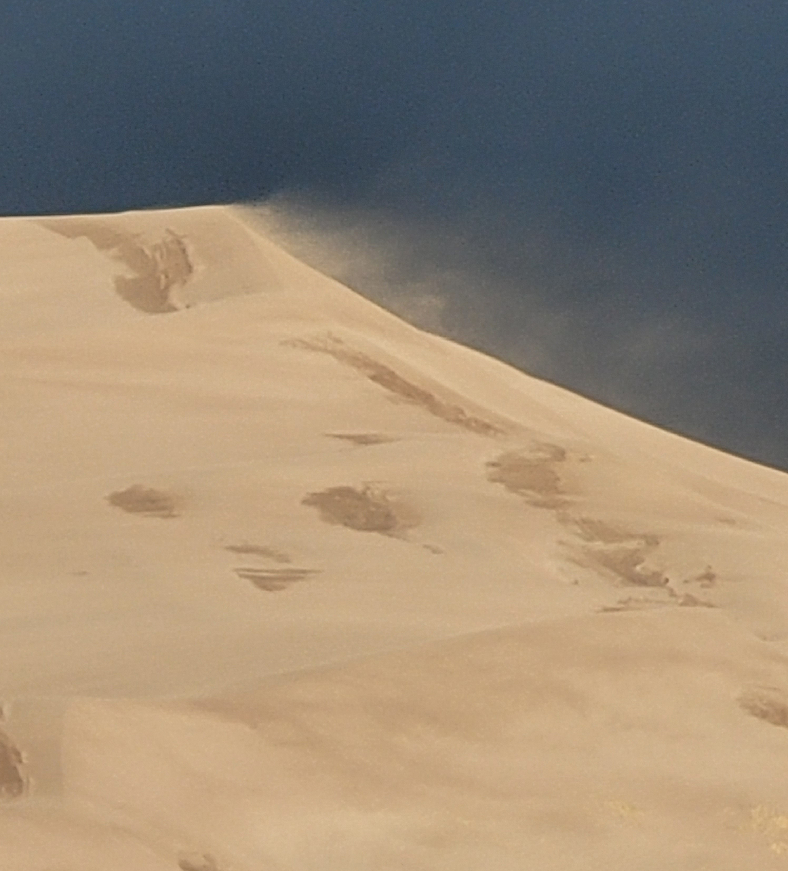
Up early after a windy night, the temp down to 41 degrees, we quickly got dressed, drove to dump wastewater and hooked up the Jeep. The dunes were highlighted by the sun but the backdrop was pretty ominous. The wind was whipping the sand off the tops of the dunes, not a good day to be climbing.
Already the mountain peaks had disappeared as dark clouds drooped over them and tentacles of precipitation (looked like snow) reached downward. Good thing we were headed south, ahead of the incoming cold front, as a wintry mix chased us to our next thrill – a 9,000 ft mountain peak that should finally be our last climb.
Before we started to climb, we unhooked the Jeep at the chain station (emergency brake fully engaged this time) and Jackie drove to the other side where we connected back again. Not nearly as tough as we expected.
We now drove straight and flat across the grasslands to Lamar on a 2-lane road with no shoulders at all. Saw a few pronghorn, but little else. We were pretty much alone, except then an 18-wheeler pulling half a house “wide load” came toward us. Nowhere to go except the white line to the right and “whooosh” it zoomed past, probably with only inches to spare. At 65+ mph. Sigh… until the other half came barrelling down the road toward us. A repeat of the “whooosh” as we white-knuckled it past, holding our breath as if that would help.
But we were soon in Lamar (home to a pretty large cattle feed lot), getting gas and making a quick stop at Walmart (yippee!) for some fresh food. The campsite was nearby and what a cool spot. At Sundance-High Plains RV Park we were given a “deluxe” spot along the grassland, facing the western sunset. Wonderful. Electric and water with a nice shower facility. We are told that pronghorn might be in the grassland along with quail and roadrunners, who apparently eat the quail. Only one night to show yourself, roadrunner! Whoops, just as I am writing this a covey of quail ran across in front of the motorhome… let’s see if I can get a shot. Yep, but they are fast runners.
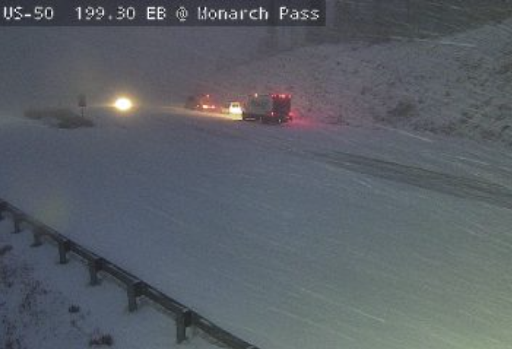
Since we also have great wifi here, I was able to upload two posts to the blog! And saw a news report that the cold front we were out-running had dropped major snow in Monarch Pass – where we drove through just two days ago, Sunday. An overnight Monday photo was posted, and as you can see, we would NOT have made it through that pass in that condition. Yikes.
The overnight temps only got down to low 40’s, but we had some pretty strong gusty winds to start off the evening. This area, due to their drought, has a red flag warning, which means a high risk of wildfires. Since we got up early, we both had a chance to use the showers at Sundance High Plains before heading east toward Wichita, Kansas.
The drive was straight and mostly flat, as you would expect, and very gusty and windy. We were driving a nice 2-lane highway, which gave you a good look at local life. The dry, scrub pastures and high plains of eastern Colorado gave way to irrigated fields of hay, alfalfa and sorghum. It was harvest time for all of that and we saw loads of hay bales in the fields and on trucks, plus sorghum being cut, trucked and massed into huge piles. Trucks of livestock, hay and grains would rush past (speed limit is 65) the motorhome and those with sorghum would splash a blast of grains on the windshield as they passed, quite a jolt. You got a good sense of the scale of work involved in making the harvest of all these crops.
We also passed many feed yards of cattle and a couple of processing plants in towns like Garden City and the outskirts of Dodge City, which explained all of the livestock trailers. We drove through micro-towns like Cimmaron and Ingalls, Ford and Mullinville. So many have the remnants of 1950’s storefronts, motels and gas stations long abandoned. One of the little towns had a crazy display of metal folk art that was spinning in the breeze. Quite the installation, along with some commentary.
Always a Story …
We kept driving east until Wichita, where Jackie called in a reservation inside the city limits at Air Capital RV Park. This was a well-developed spot, all concrete drives with patches of lush green grass between the slips. We asked for a back-in site and at the front office we disconnected the Jeep, ready to follow Melvin in his golf cart. Except that the Jeep would not start again. Tried the instant jump, no good – several times. Took out the jumper cables and hooked to the generator to jump it, not working. By this time we had Melvin looking on, another helpful resident who wanted to jump it from his semi, but it was all to no avail. Battery was dead beyond reviving.
Well, what do you do? Melvin said it was fine to leave the Jeep parked where it was, but we still needed a replacement battery. Two blocks away there was an O’Reilly Auto Parts shop, we were told, so we drove the motorhome there, parked in the next door Dillon’s lot (one of the Kroger stores) and I went over to the auto parts store with a picture of the battery. Hmm, well they had a battery that was recommended for the Rubicon but which was stronger and slightly longer than the one I had. But it was at their other location. Could they get it here today? Yep, would be on the truck and here by 5:30 (it was like 3:30 now). Ok, so you will call me when it comes in? Yep.
Back to RV park, slipped into our spot but only plugged in electric. I went over to unhook the battery, while Melvin looked on, got a call the new battery was ready, Melvin drive his golf cart with me and battery to RV so we could return it for the core refund. Unhooked electric, drove over to O’Reilly’s and swapped batteries. Back to park, dropped battery at Jeep, parked motorhome in site, hooked up electric, leveled and put out slides. Then I went to Jeep to lift and insert the new, slightly longer, slightly heavier battery. A passing dog-walker stopped to help me negotiate the battery into place, I clamped it all down and connected terminals and accidentally set off the car alarm. Ok, it works. Started up, drove to the slip and collapsed on the couch. Maybe we finally solved the battery problem.
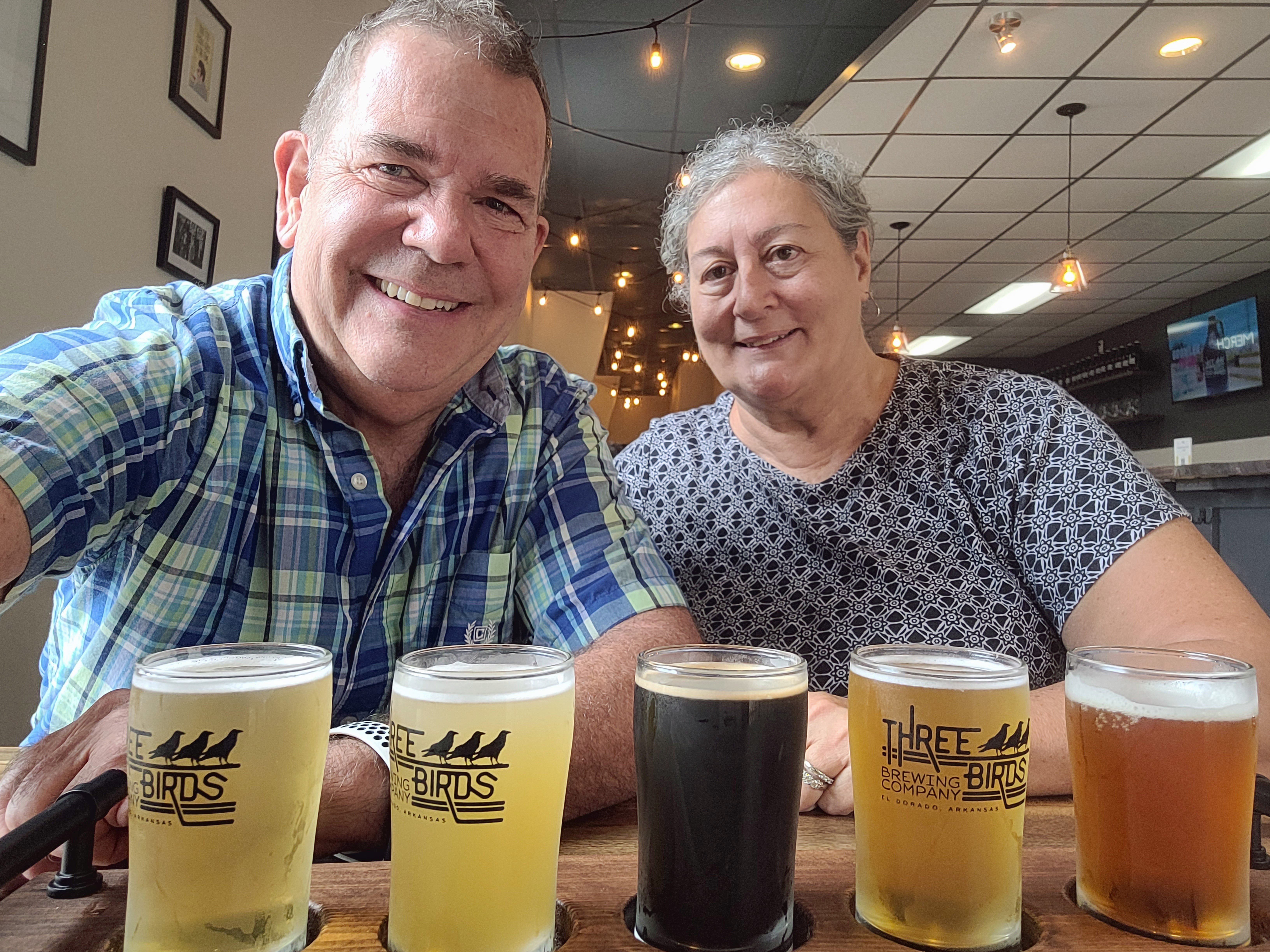
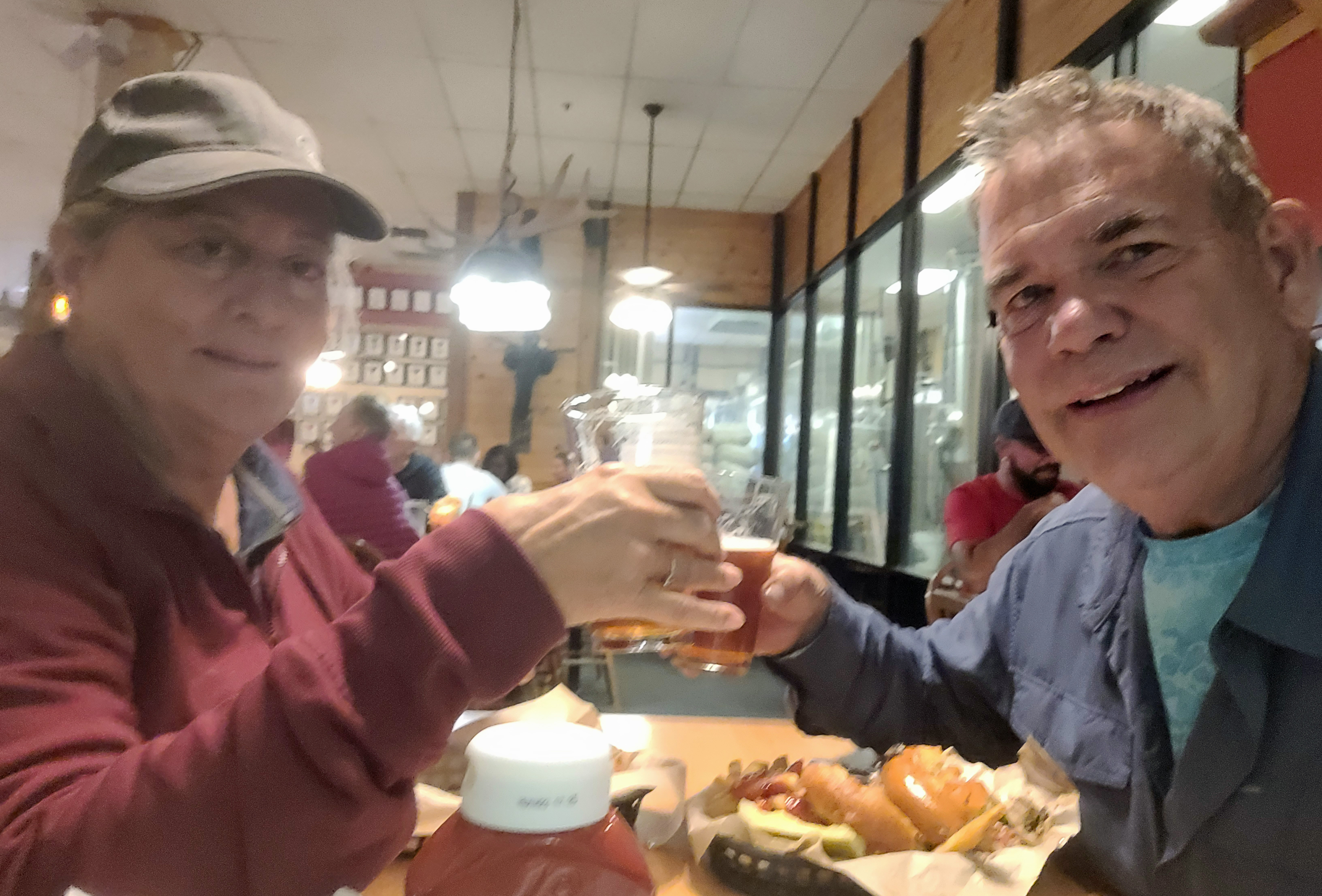
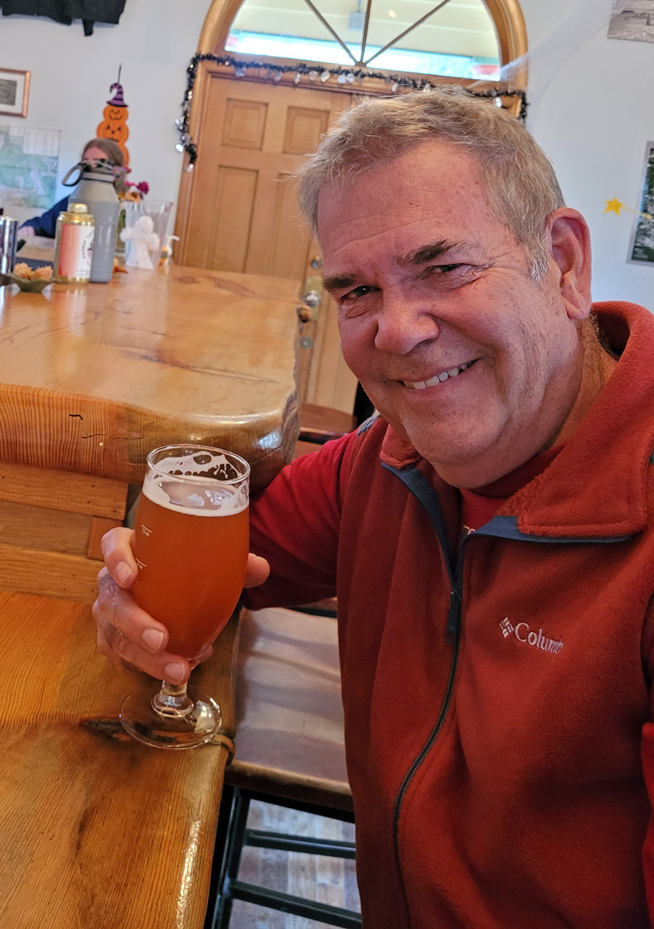
Not for long, though, as we had plans to find breweries in Wichita. Not hard, as we have driven through here before. We went back to River City Brewing in Old Town and soon ordered up Mediterranean Pizza and something I loved before: BBQ Mac ‘n Cheese. Yummy, creamy, smoky flavor that went great with a house Dunkel. Jackie ordered a strawberry kolsch but promptly swapped beers for the Dunkel (which really was good). We later walked a few blocks to Third Place Brewing and had one more beer each. We sampled several they had and then Jackie had a gose she liked and I tried their Red Truck IPA. Good conversation with the bartender (we were the ONLY folks in there) who was a theater major teaching special ed. The stories, the stories … Oh to be retired – we love it!
Back in minutes to our motorhome in a Jeep that runs and we are set for the night. Tomorrow we head to Springfield, Missouri to find an easy spot for the night.
Yes, we drove eastward toward Missouri on the continuation of the 2-lane road from the day before. Early start, but since we are now on Central time, we lost an hour to start with. Pretty much the same flat fields to start with, more hawk sightings on fence posts, electric wires and low flying – I think they were mostly rough-legged hawks. The fields gradually turned to rolling tree covered hills as we traveled eastern Kansas toward Missouri. It began to remind me of northern New Jersey with juniper, oaks and sumac.
Our stop for the night was at Missouri RV Park in Mountain Grove, Missouri just east of Springfield. Actually, for an older park just off the highway it was quite nice. Heck, all we need is a level spot with electric and water, but this had grass and trees and room between sites. Kodi enjoyed some “fetch” for a while and I had time to fix a bucket of soapy water and washed down the Jeep, plus cleaned the bugs off the motorhome windshield. Losing some of the Utah and Colorado dust that is pretty persistent. And Kodi is happy not to be picking up burrs or spikes on his feet. Speaking of dogs and cats, both Kodi and Merlin have been wonderful on the trip. Merlin soaks up the sun on the dashboard (parked) and while on the road, Kodi is great about getting in his crate on the couch and curling up.
Get up, drive, stop, sleep, repeat. This last run home is kind of like that. Our next day goal is just east of Memphis. The drive in Missouri took us through rolling fields and pastures with plenty of green trees and then across the Ozarks in Arkansas. Some uphill climbs, but nothing like the Rockies. Then the drive drops down to the Mississippi River valley and there are plenty of fields being harvested. Mostly cotton, but also soybeans and some hay. The drive was pretty easy and soon we were crossing the Mississippi and circling to the south of Memphis. We were soon in Mississippi heading toward with a couple of good prospects for camping. We stretched the drive to reach beyond Tupelo to stay at Tombigbee State Park. Not far off I-22, but the final 5 miles or so were a narrow, curving squiggle of a road to the park. An absolutely delightful spot in the trees with plenty of room and full hookups, so no complaints at all. Kodi got some fetch time in the playground, which helped get the kinks out from the drive.
This should be our last night in camp, as home is supposed to be four and a half hours away. I know that by the time we reach Birmingham I will want to just press on until we are in the driveway. Then comes the task of unpacking the laundry, the fridge, the bathroom — but it will be just fine, considering the trip we have had. A couple of soapy washings of the Jeep and motorhome and maybe the blower to get the Utah red dust out of the Jeep.
Last Night in Camp
So by the time you read this we will be stretching out at home, not banging into things, taking at least one or two nice long hot showers in something bigger than a phone booth and thinking back to the many hikes, 4WD trails, jaw-dropping scenery, small towns, breweries and just a few minor “learning opportunities” with overheating engines and battery life.
I really do enjoy posting the pictures and stories and hope you enjoy them as well. So, until our next adventure . . .
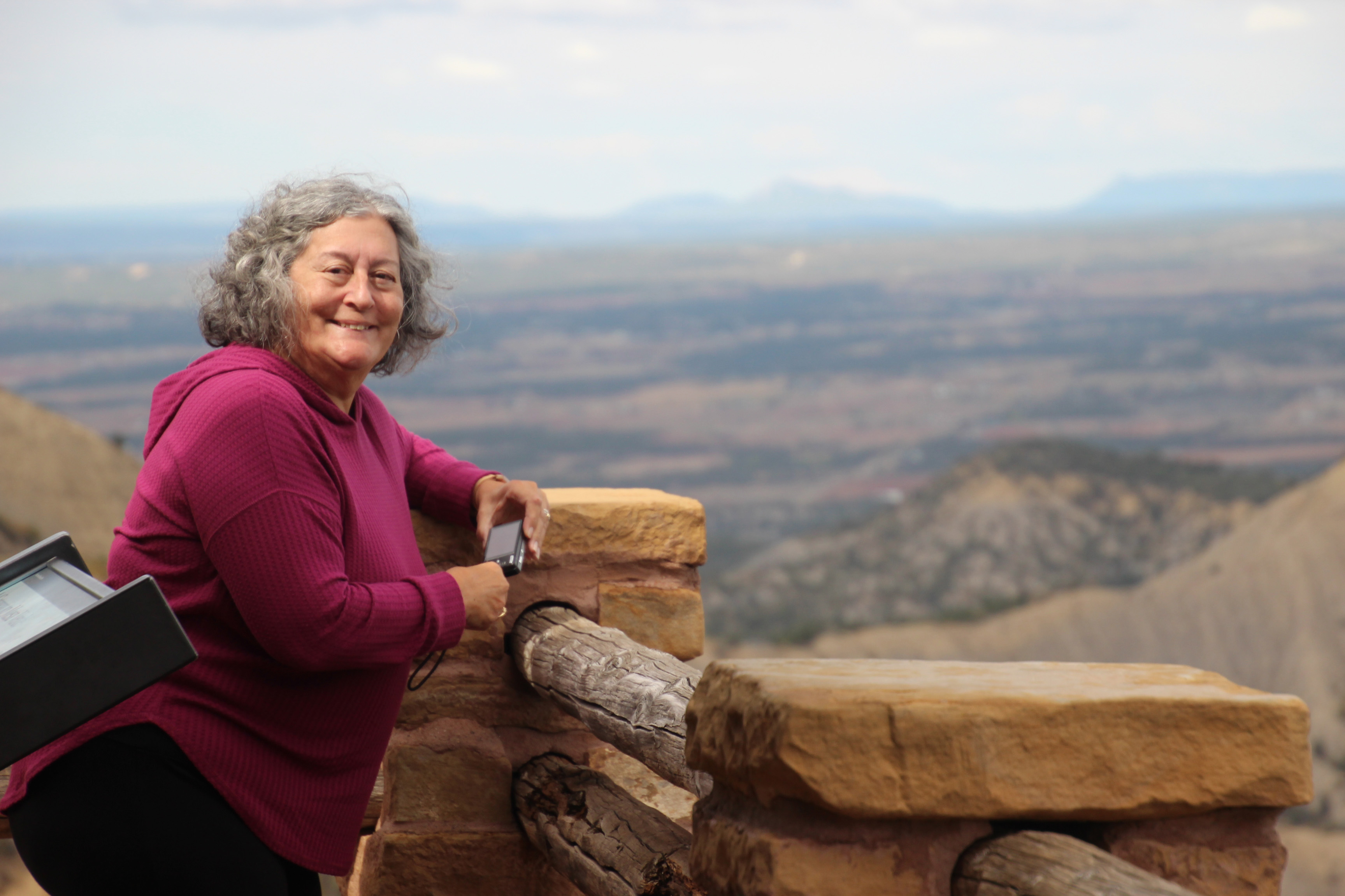
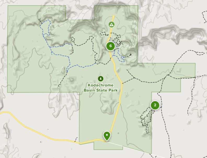
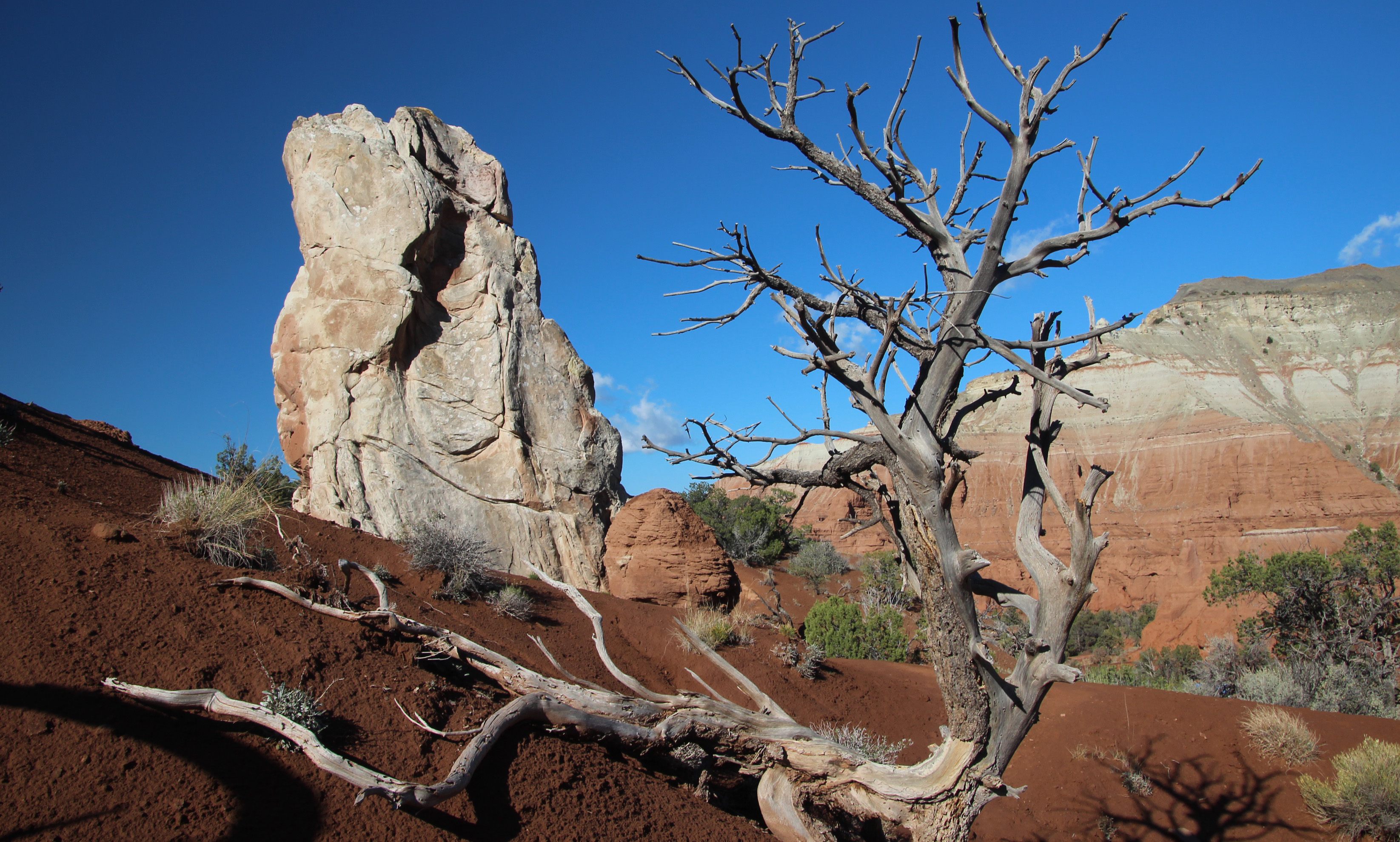
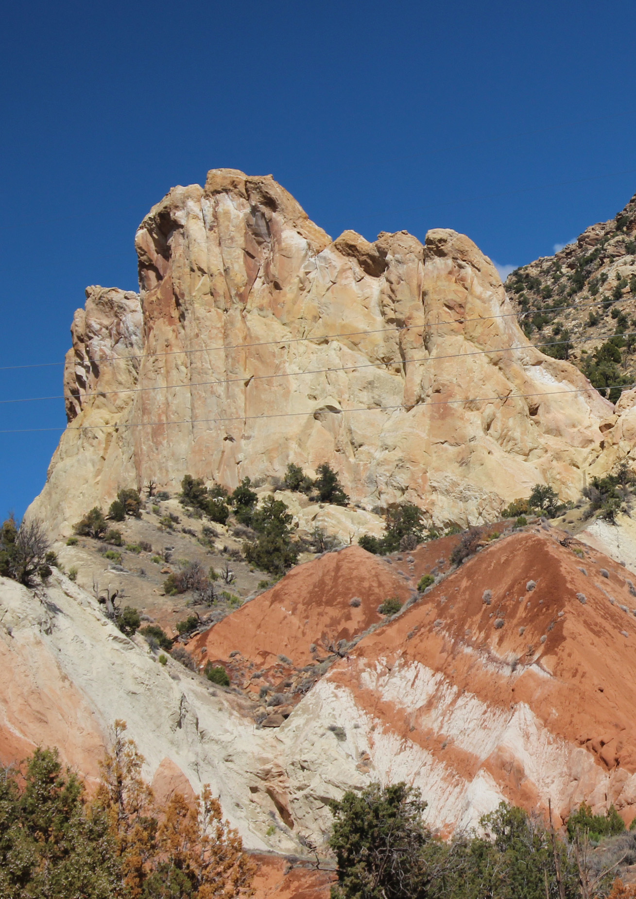
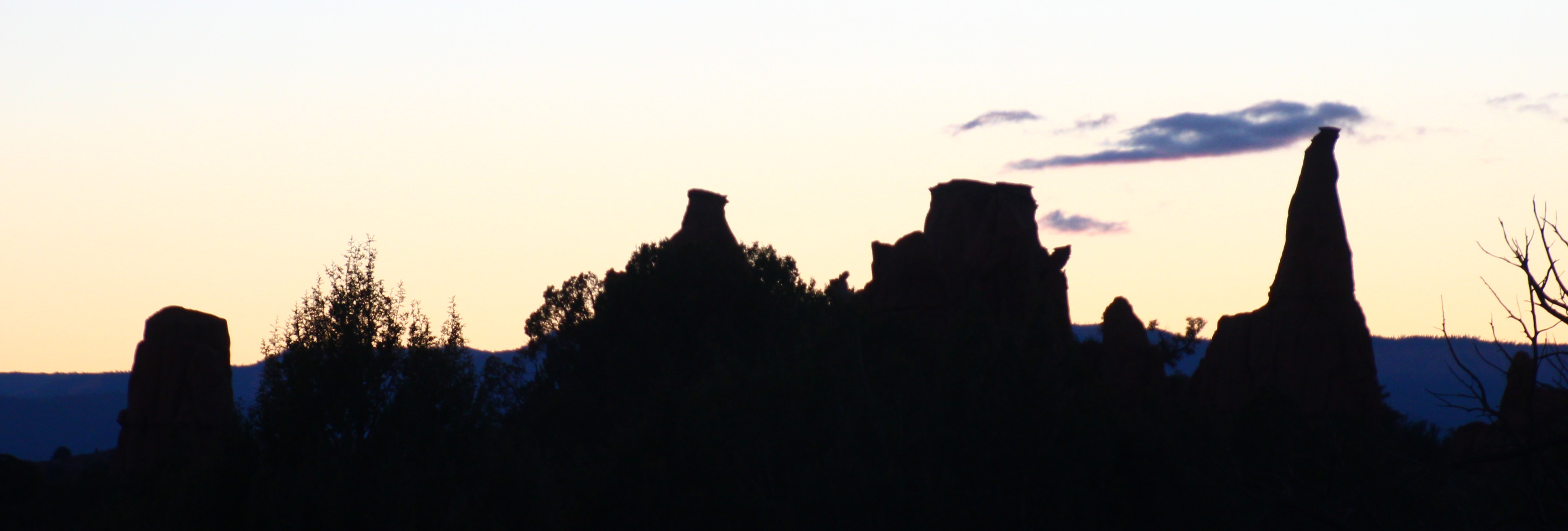
Now it is time to head to our third big stop in Utah, Kodachrome Basin State Park. As I mentioned in our last post, we opted to head west and then south to avoid driving up and over the Dixie National Forest. I am sure the scenic drive along highway 12 is wonderful, but I didn’t need the climb in the motorhome. So around to Tropic, Cannonville and then down to the park. In addition to exploring Kodachrome Basin (named by folks who thought the colors reminded them of the vibrancy of the Kodak film) this will be the take-off point for exploring Bryce Canyon National Park, too.
Alas, as we hook up the jeep and start off it begins to rain and it rained the whole way to Kodachrome Basin. I find it odd we have had so much rain in a high desert zone. It was an easy drive, though, as we stayed mostly in two river valleys: Fremont River and Otter Creek and the road was in great shape. We finally experienced what we have been warned about extensively: cows in the roadway. And they don’t move out of the way, either. Once we got to the campground it was a short drive down a gravel road and we found a level spot to disconnect. Ah but Murphy’s Law kicked in for us, as the Jeep wouldn’t start. Well, we went ahead and got the motorhome situated in camp, hooked up water and electric and pondered the situation. I had a quick charge battery pack that is supposed to jump start you car in an emergency, so I pulled that out … naturally it needed to be charged! I let it charge and we went back to the Jeep to jump start it. No luck, just clicking. Battery was dead, charger was useless.
I walked back to the Visitor’s Center in the rain to see if one of the rangers had a jumper cable. Probably, but it would have to wait just a bit for another staff member to return. I trudged back to the camper, noting to add jumper cables to our supply list for the Jeep. Then Hayley showed up and said, sure she had cables and we jumped the Jeep from her little Nissan. Once back at the campsite I hooked up a battery charger I did have in the motorhome (the kind you use to trickle charge over the winter) and left that hooked up overnight. It started up in the morning just fine. I think what happened is this. Because it was raining I had the headlights on in the motorhome. That must also turn on the lights for the Jeep and it probably runs them off the battery AND since the generator and alternator are not operating to replenish the battery, it dies.
We woke to clear blue skies and 45 degrees – perfect for hiking and exploring the park. We started with a mile and a half hike on Angels Palace Trail and had great views of the park.
The trail followed several muddy washes up the canyon and opened up on red shale plateaus that were fun to wander. The park is filled with unique pipe structures that jut up out of the red sandstone. Hiking down the canyon wash that wall filled with cedars and pines you could smell the pinyon pine – a definite evergreen fragrance that was wonderful. Altogether it was a very cool morning.
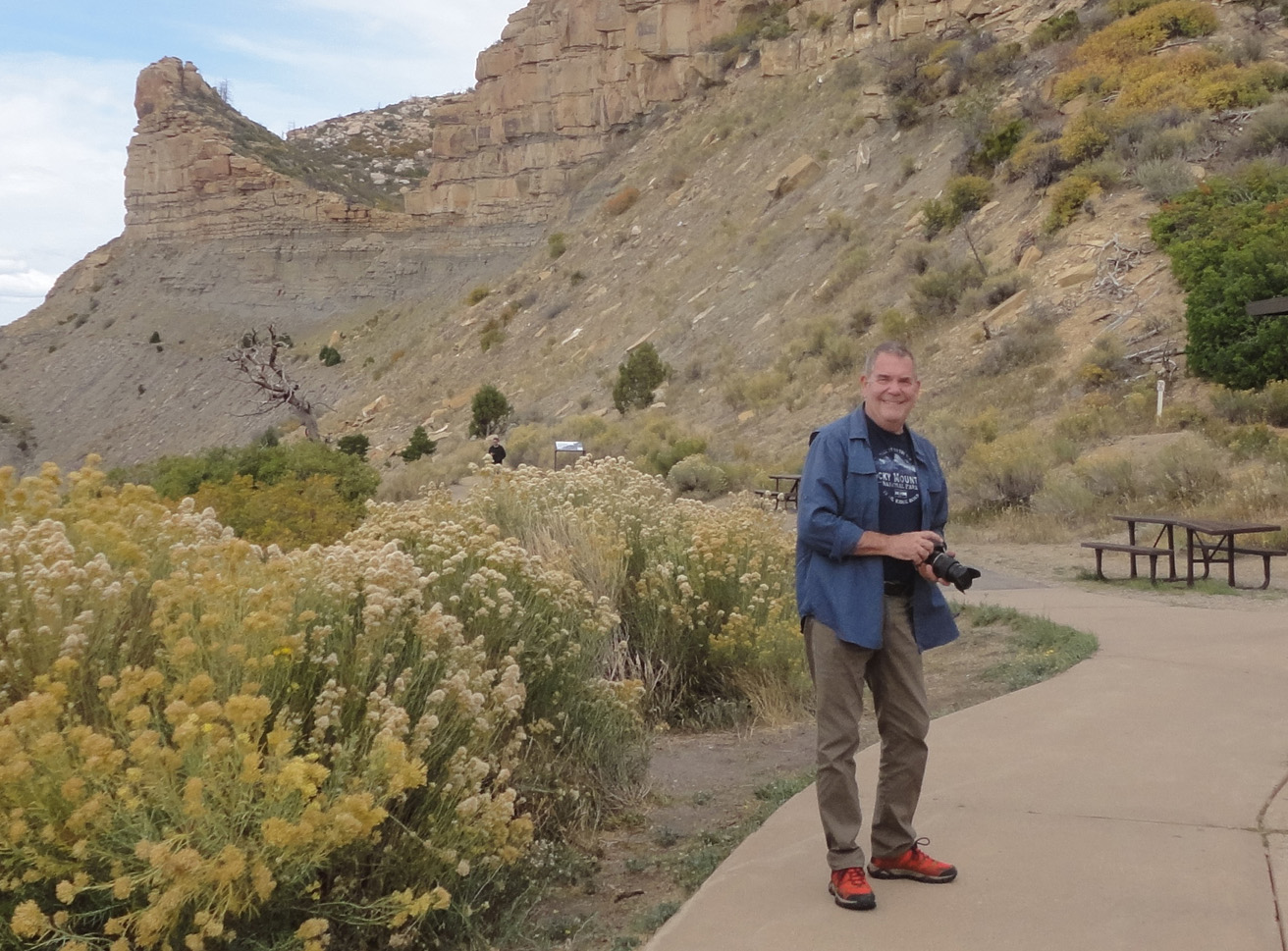
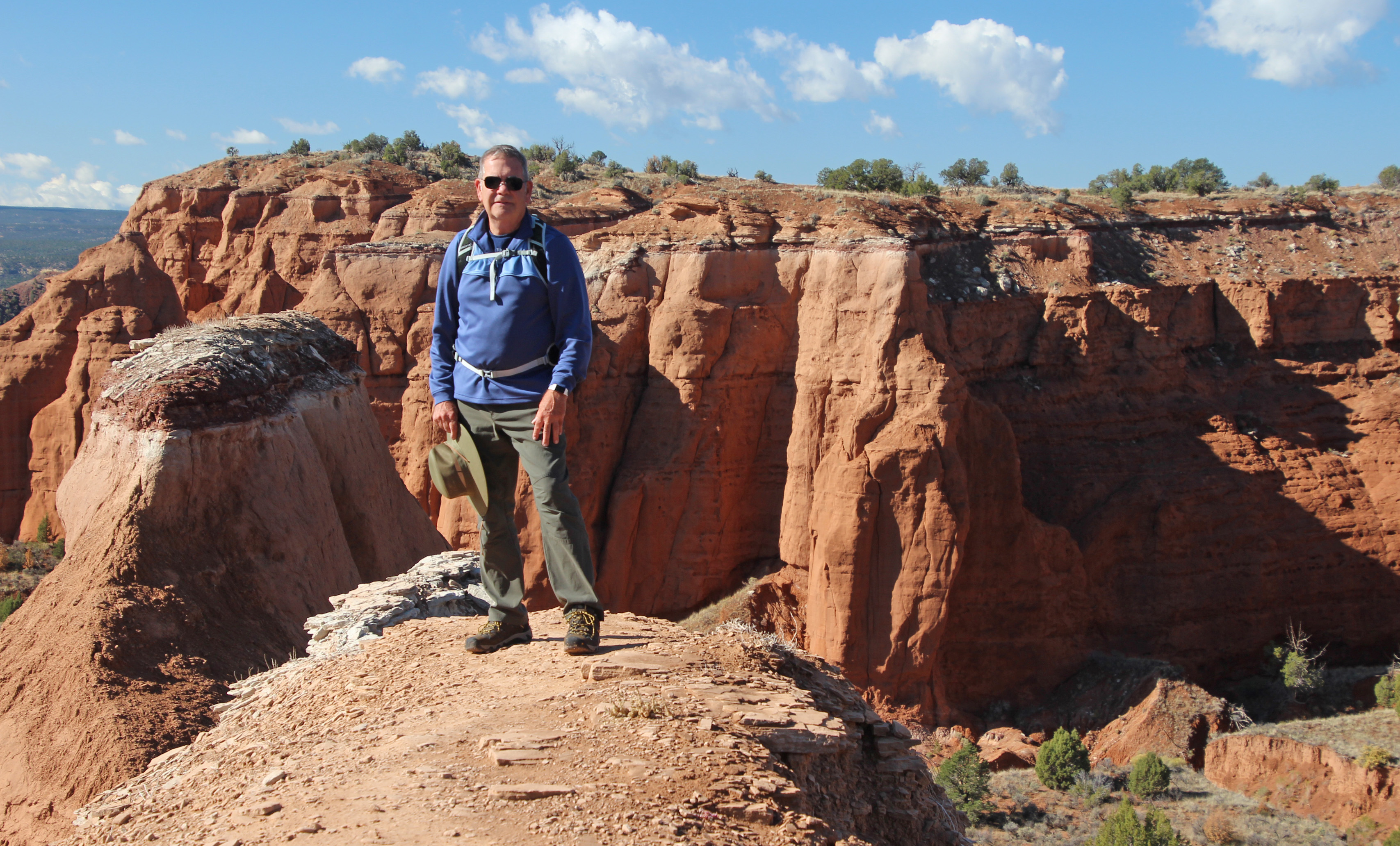
Lunch back in camp and we discussed the afternoon choices. Decided to drive 11 miles further south on a sand/dirt/washboard Cottonwood Canyon Road to see Grosvenor Arch, named for the original president of National Geographic Society and located in Grand Staircase/Escalante National Monument. Pretty amazing double arch of white sandstone that really popped in the afternoon sun. Walking from the parking lot toward the arch there were a couple of folks stopped halfway chatting on their phones. Somehow this spot in the middle of nowhere, a true cell-phone desert, they were able to get a signal right there. Ok, that was crazy.
Jackie drove back to camp on the road and got her first 4WD experience. Hit one muddy ditch pretty hard and splattered mud all over (“hey I’m learning”) but on another creek crossing she maneuvered into the deep mud ruts and drove up and out just fine. “That was fun.” Dinner was just as spicy – a nice taco salad.
We expect good weather for tomorrow, so that is to be our Bryce Canyon day. The final day we might go up Hwy 12 toward Escalante and Boulder City. There is a stretch of road called the Hogsback that runs along the spine of the mountain. Might be fun. Oh, and there are predictions of snow for the day we haul out of here. Really? We shall see, since the weather changes by the hour around here. But, the night sky is clear and filled with stars. A sliver of a moon sets early and the milky way is very evident. How wonderful.
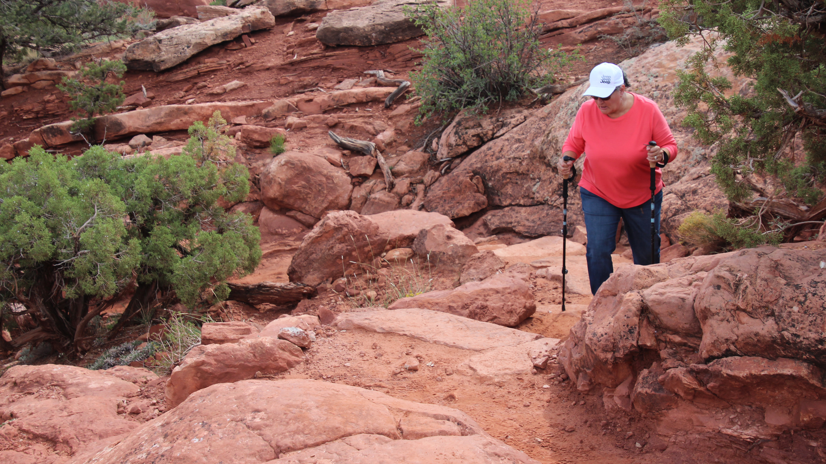
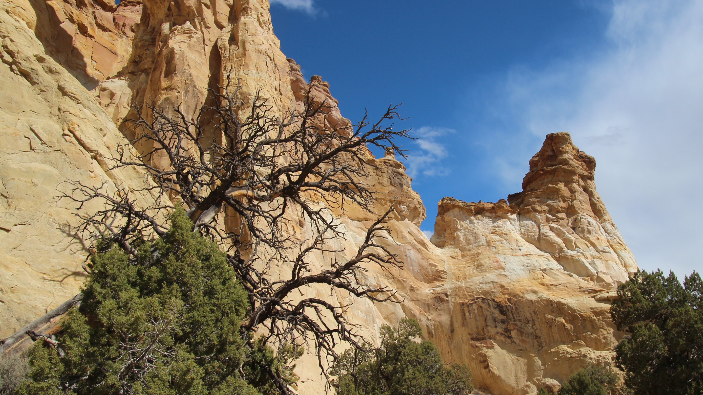
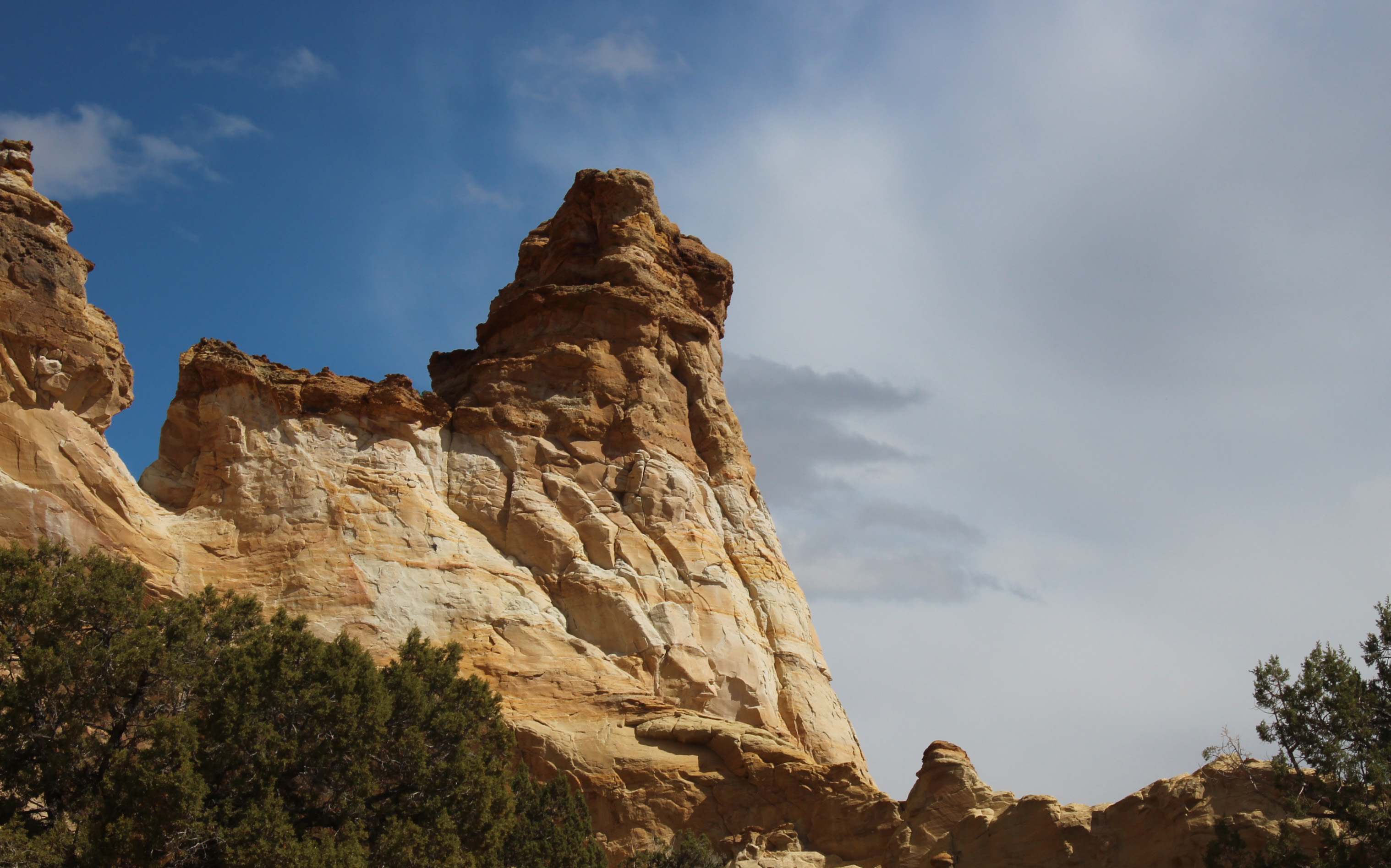
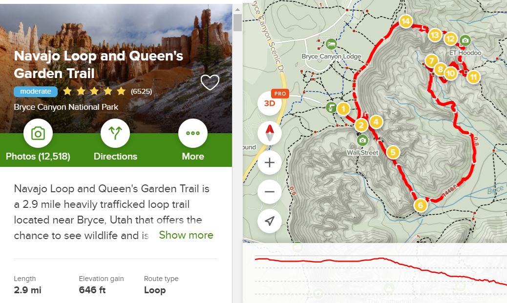
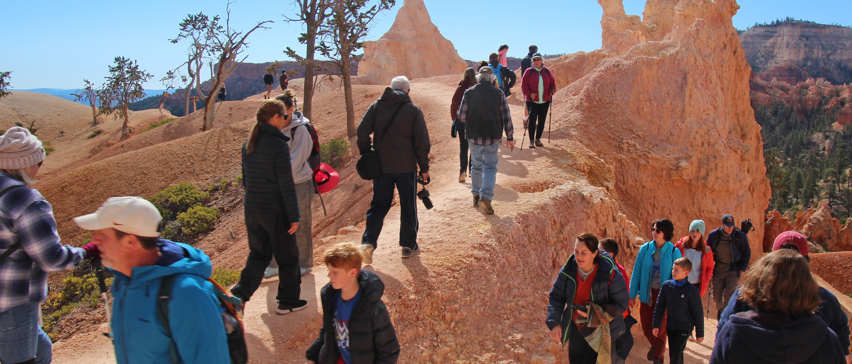
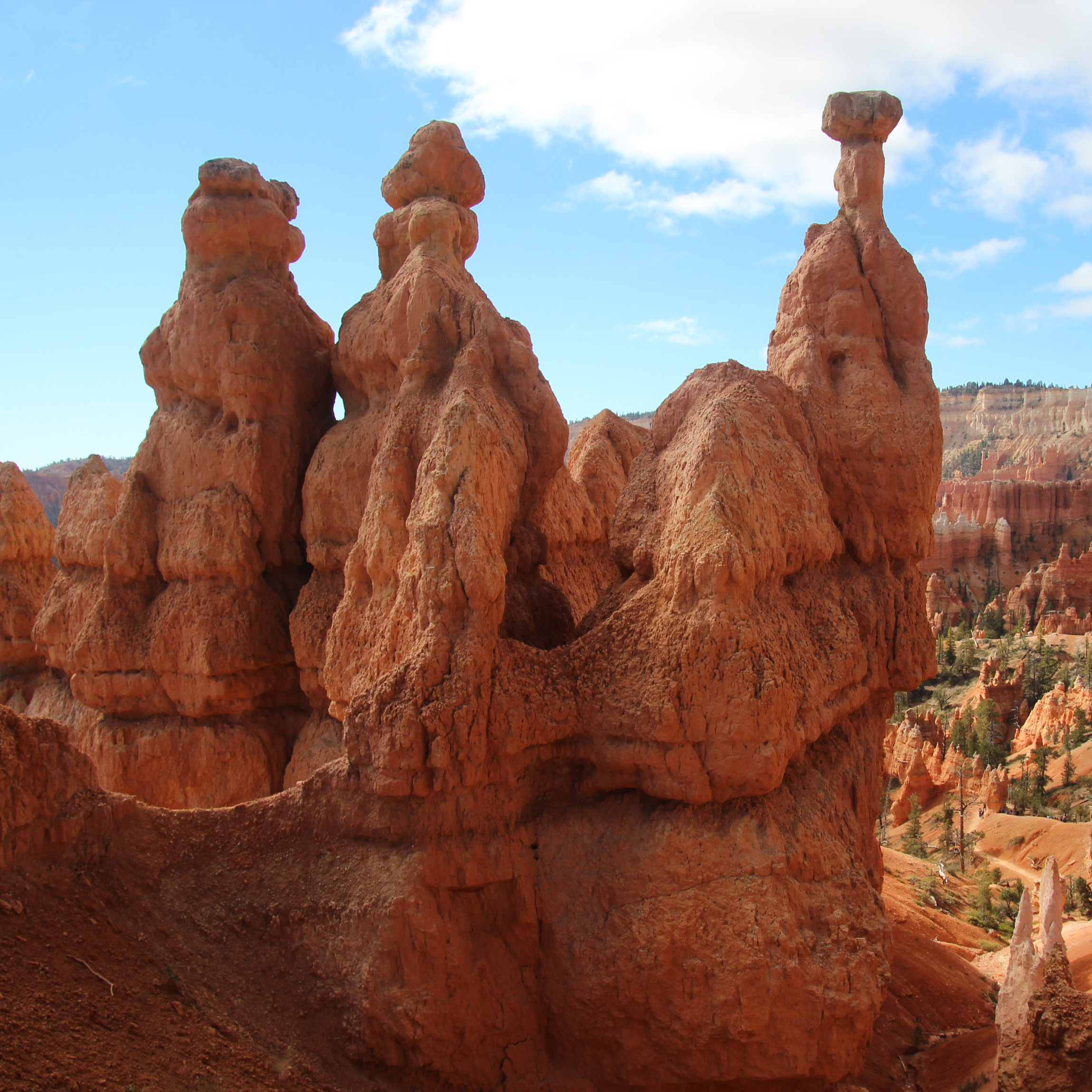
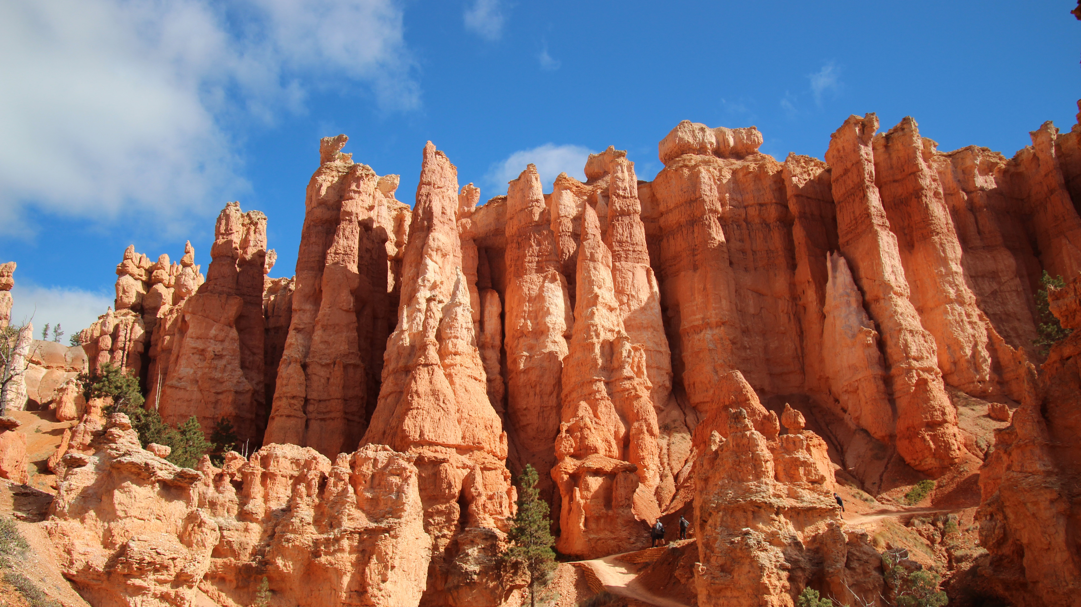
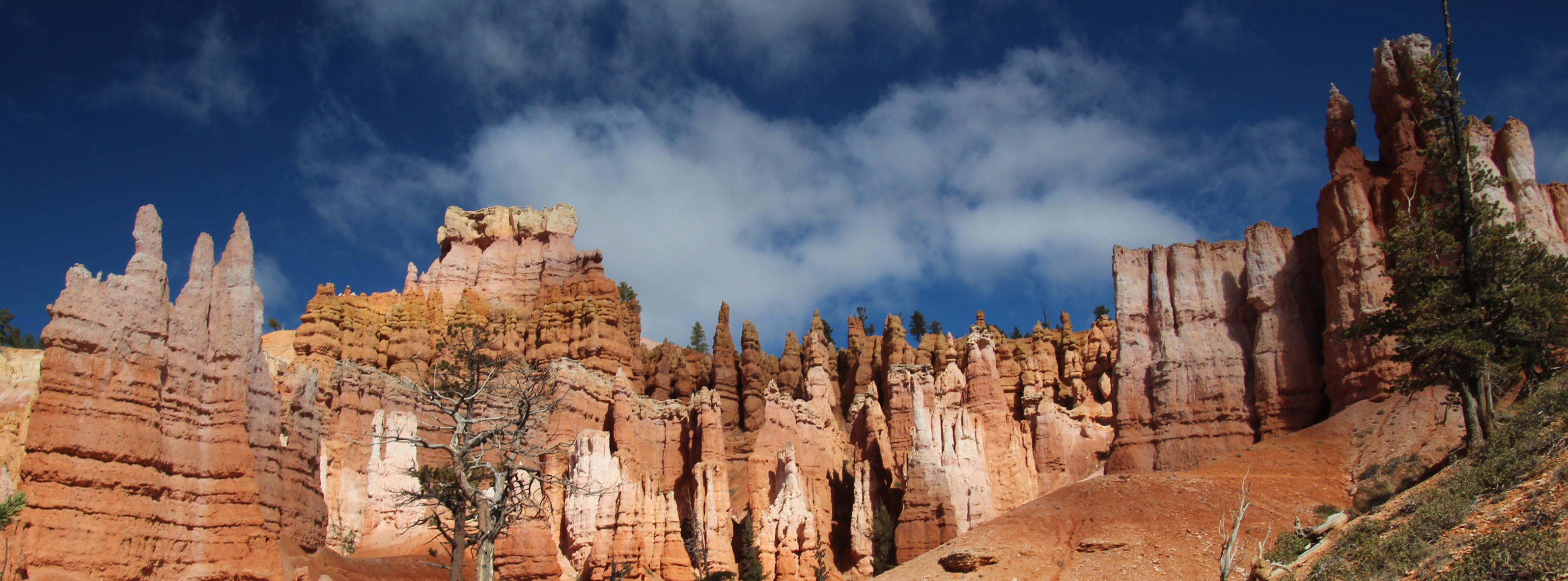
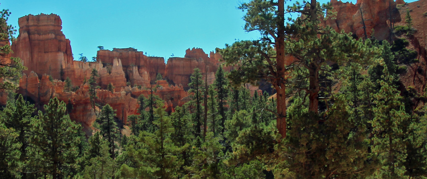
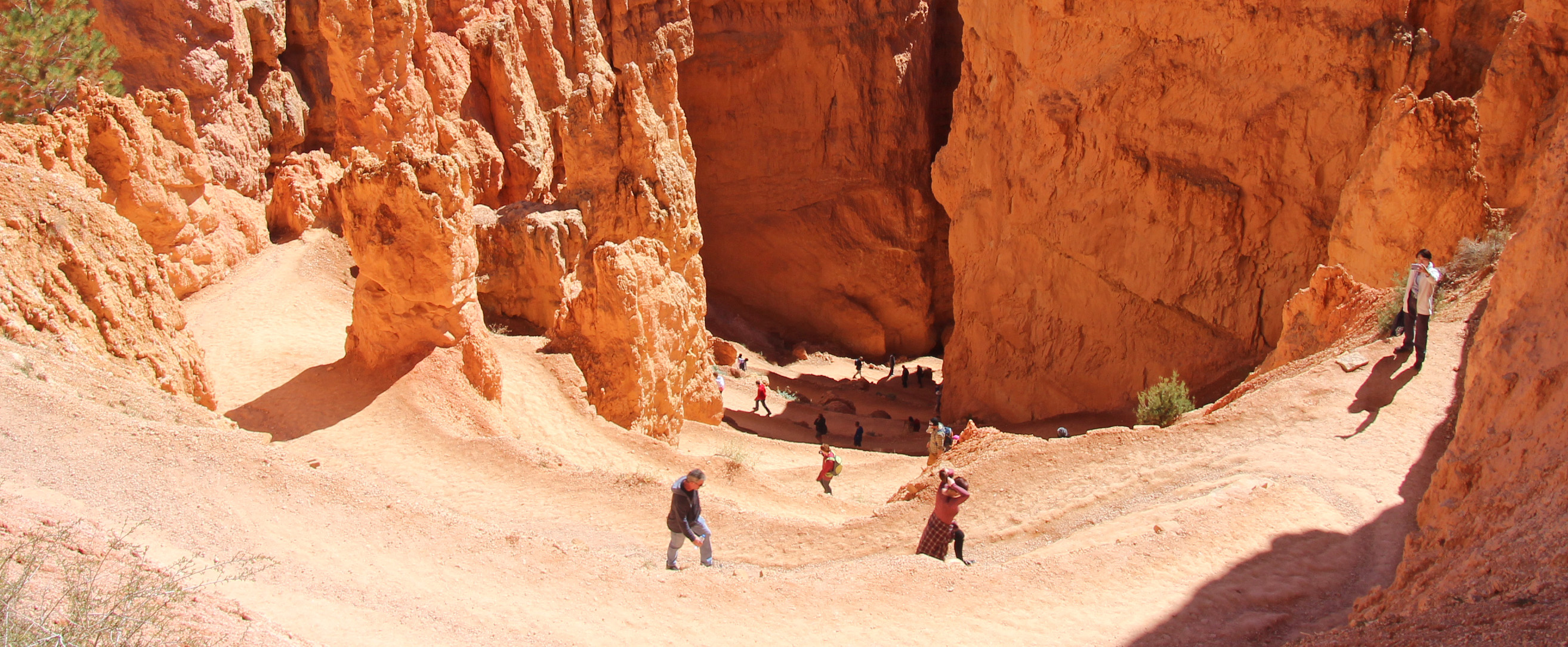
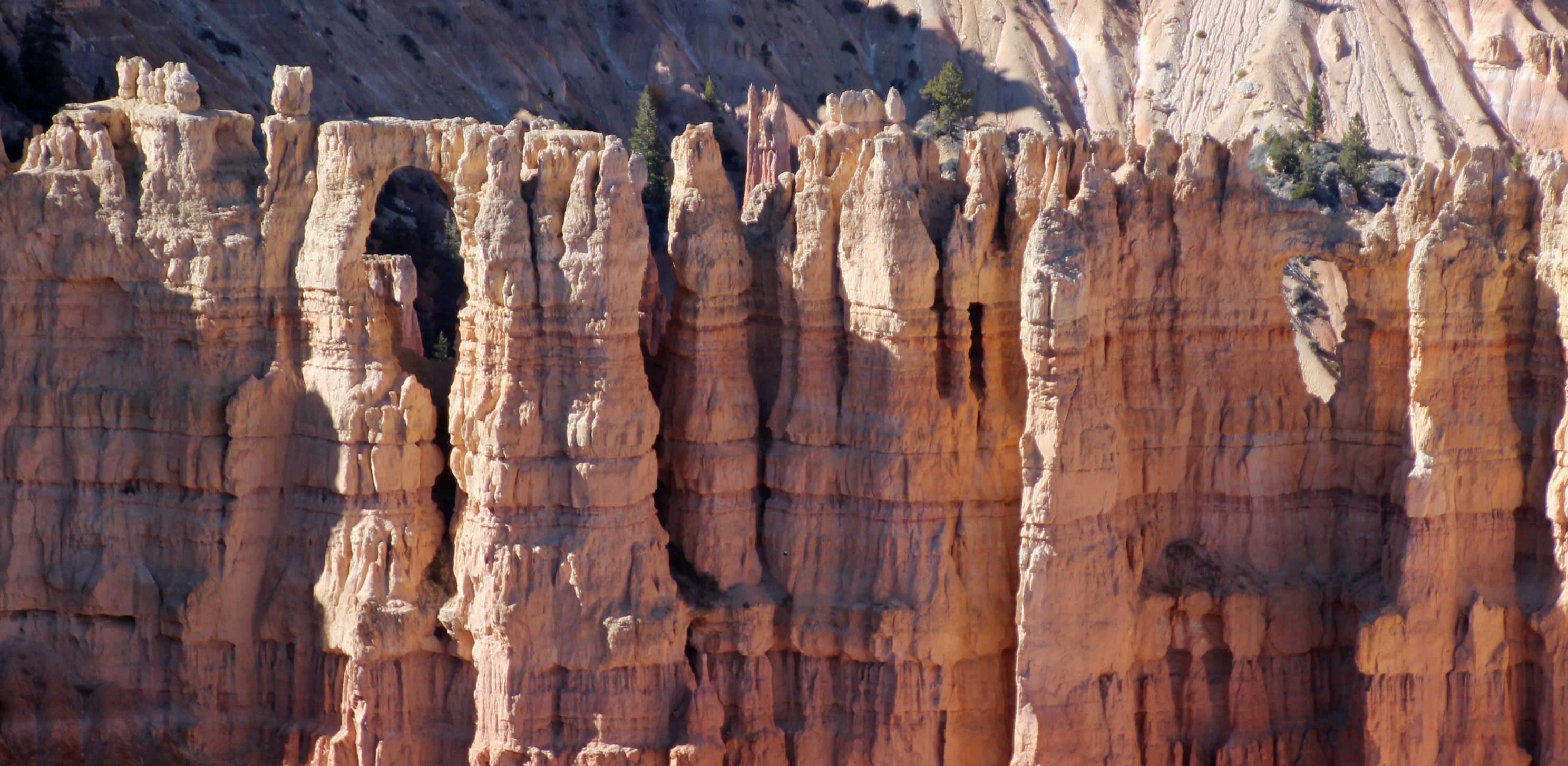
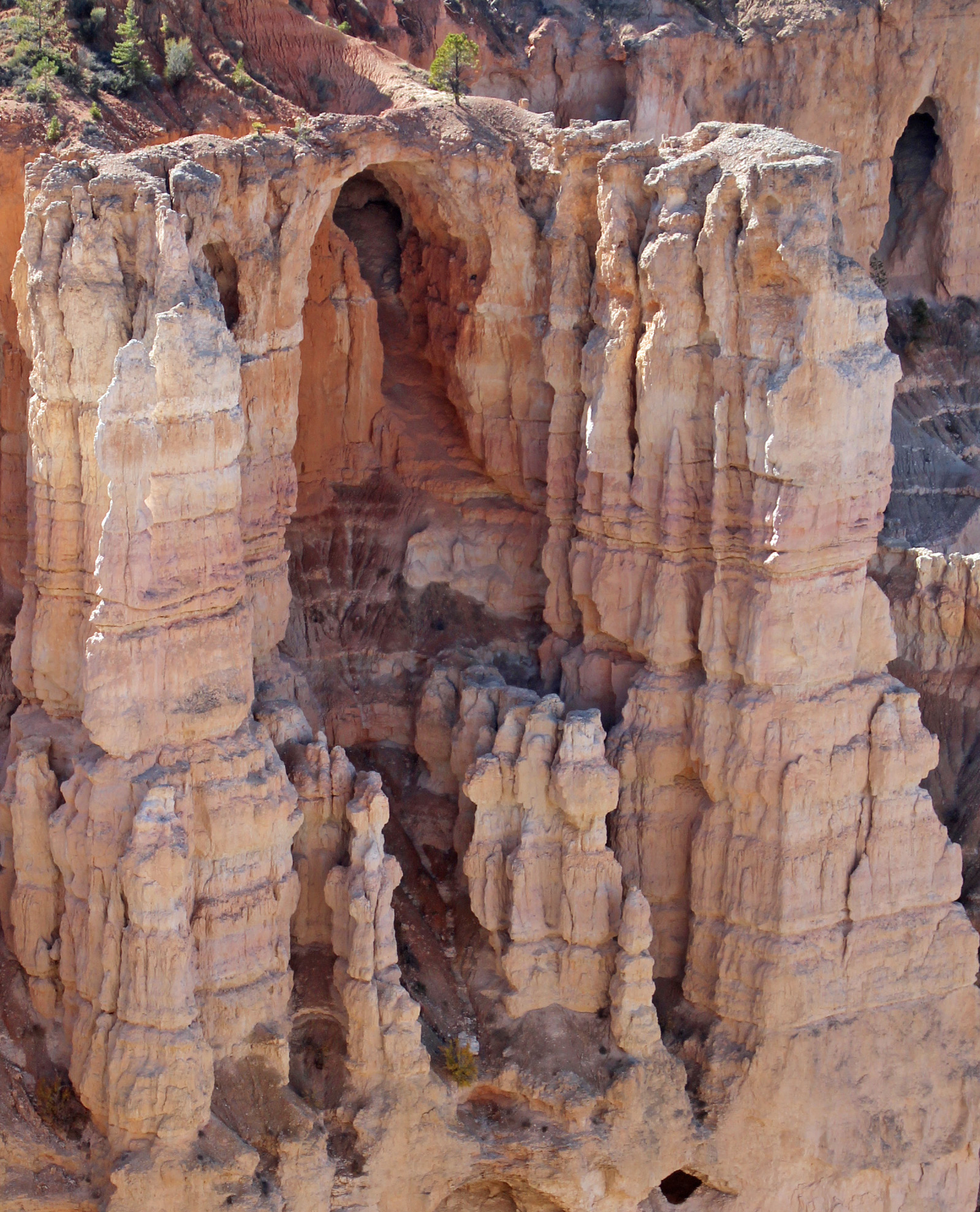
Indeed the weather was beautiful on our second full day, not a cloud in the sky and 41 degrees. Packed a lunch and all our hiking gear and drove the 20 miles or so to Bryce Canyon NP. I figured our toughest hike of the trip would be the one down into Bryce Amphitheater along the Queens Garden Trail, which is a 1.5 mile one way trek down the canyon. Wasn’t sure about the return trip. Well, from the overlook at Sunrise Point we were amazed once again. The famous hoodoos are outstanding – orange, red, white and yellow sandstone spires that spike upward. Down we went along the sometimes very narrow trail, through the fins and spires until we reached the white structure called Queen Victoria. As you can see, even though we got a start before 10 am, we had the place to ourselves (NOT). This was our busiest park and trail so far, reminiscent of Arches and Grand Canyon. As kids and parents and others bounced along and zipped past us, we just took our time and gazed up at a perfectly dark blue sky like you almost never see.
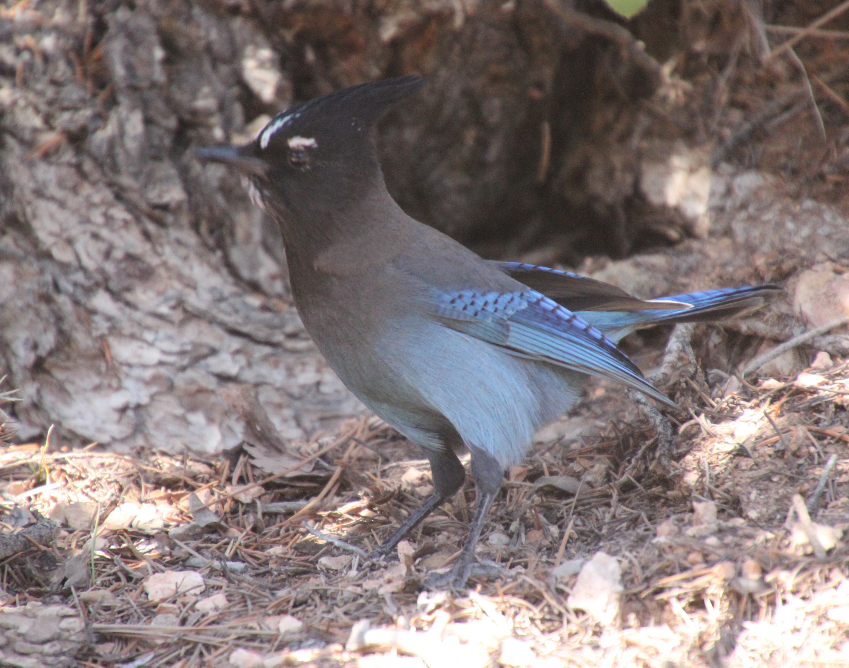
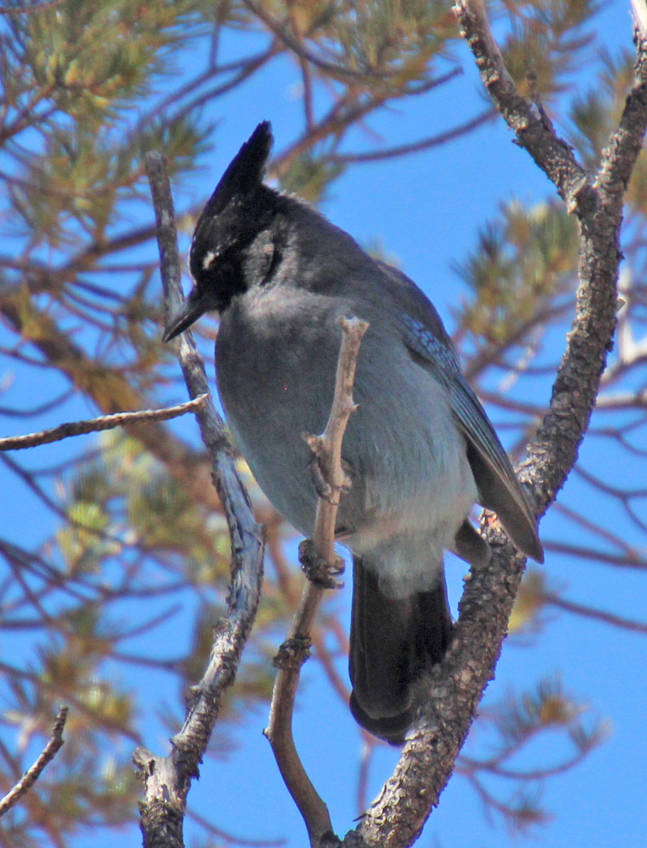
After a few tunnel passes and more meandering, we reached a much more wooded canyon and walked among the spruce, cedar and pine with chipmunks scattered about. There was a pinyon pine that had a couple of Steller’s jays bobbing around eating the pine nuts. Such dramatic blue and black birds. When we reached the end of the Queens Garden Trail we, along with many others, debated the way back. Map said we should link up with the Navajo Trail for a return trip of 1.7 miles, and not wanting to repeat ourselves we pressed on. Another junction offered two ways up: Two Bridges or Wall Street. Again, more debate among all of the hikers pausing there until Jackie declared “Wall Street” for us.
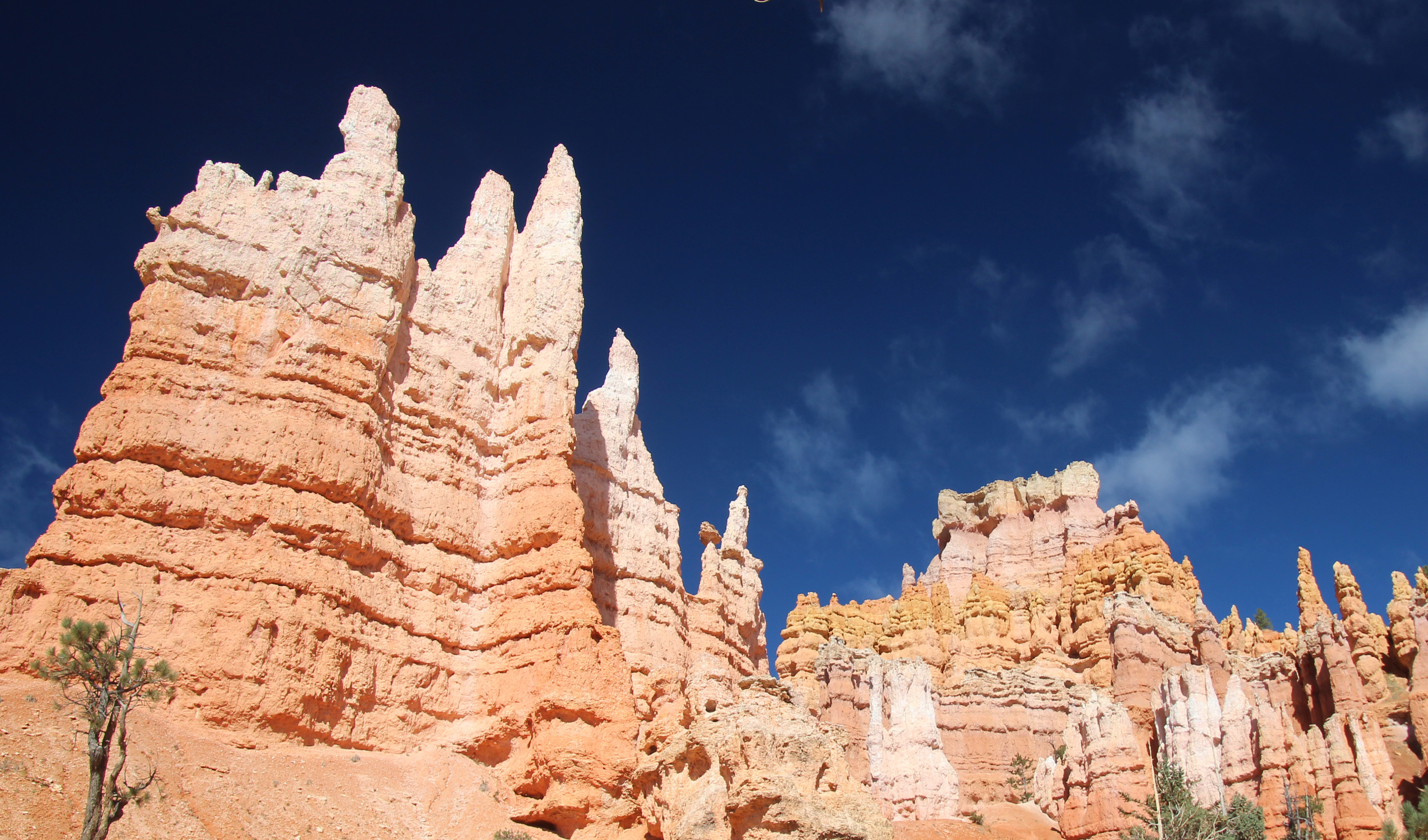
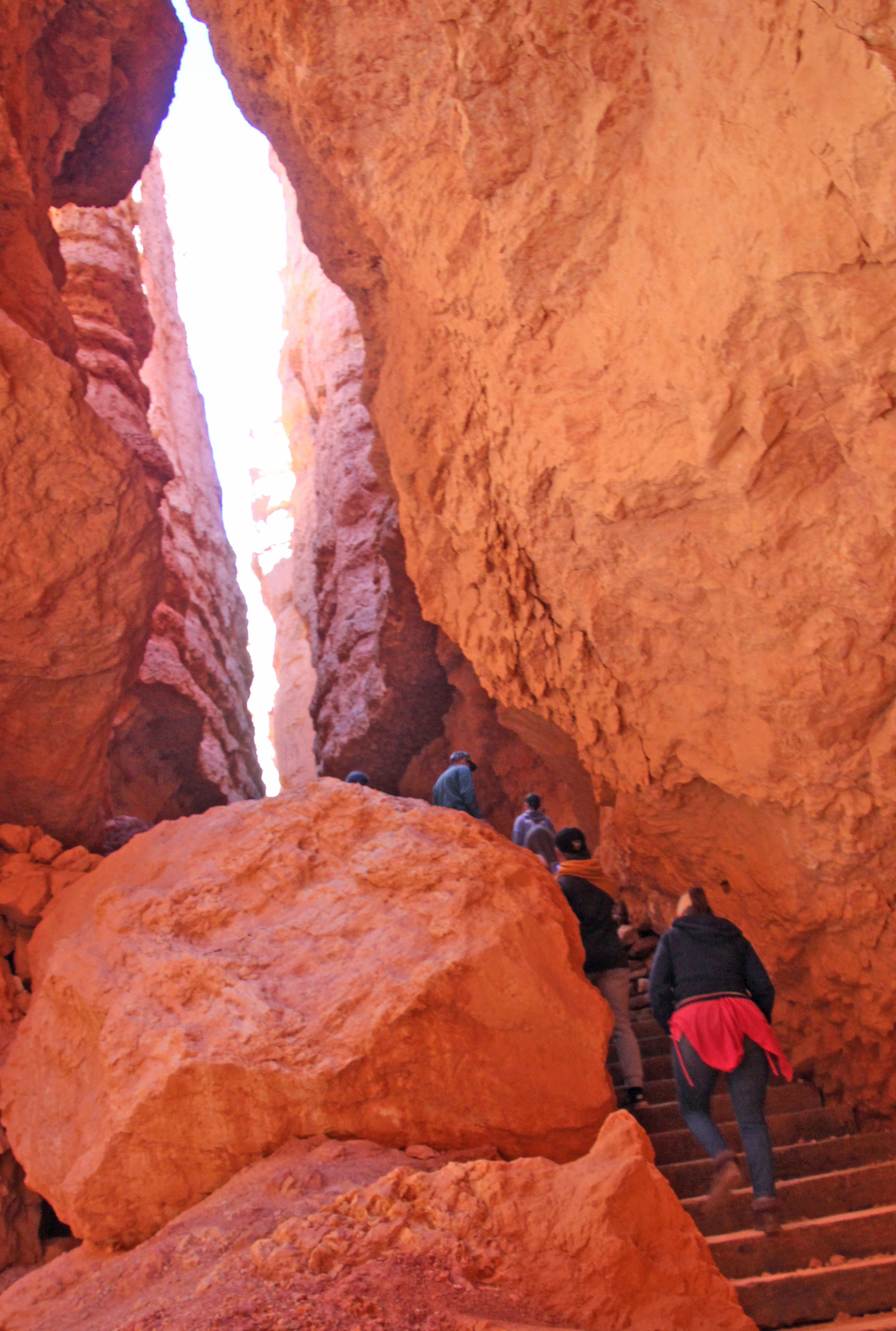
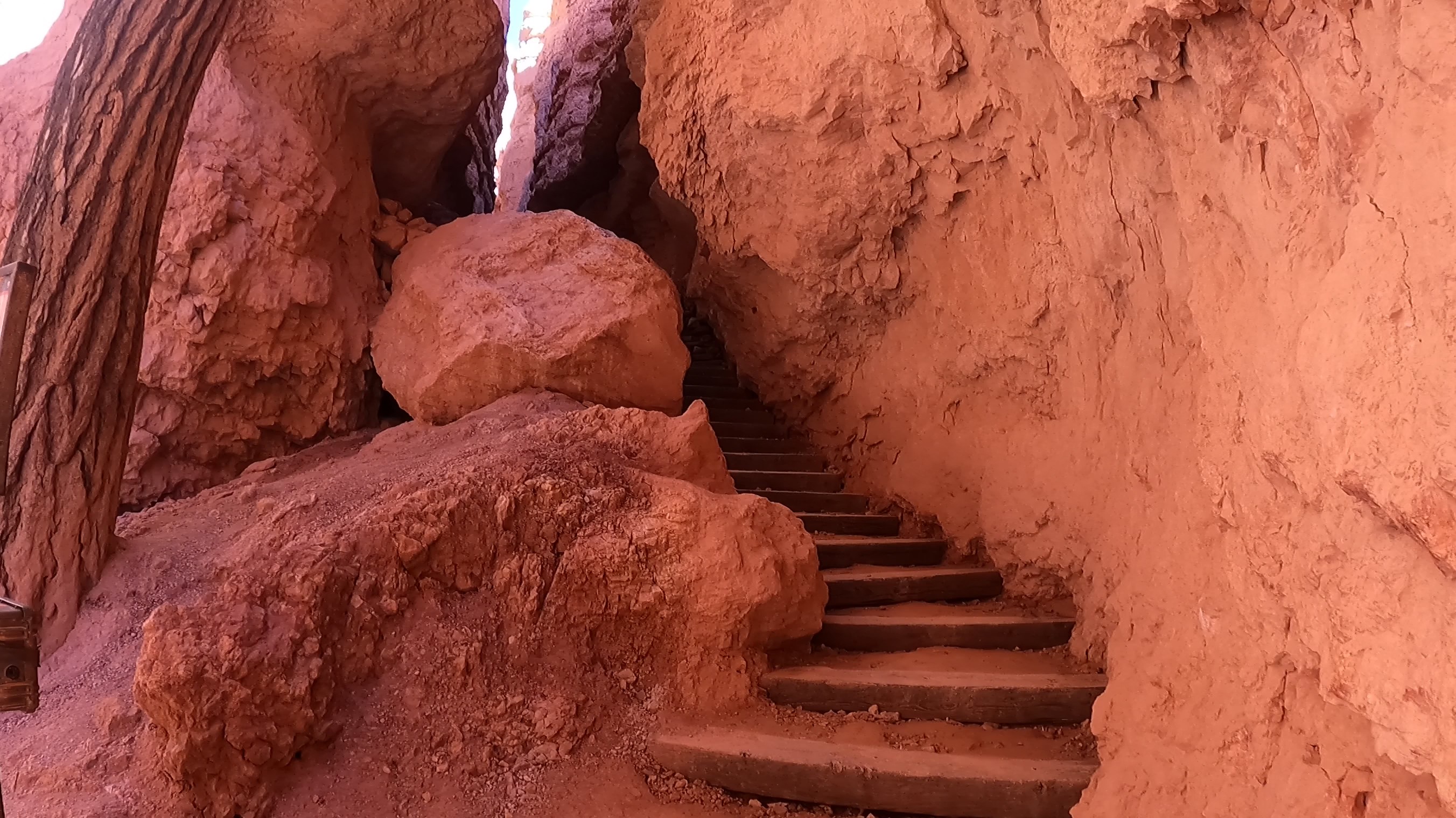
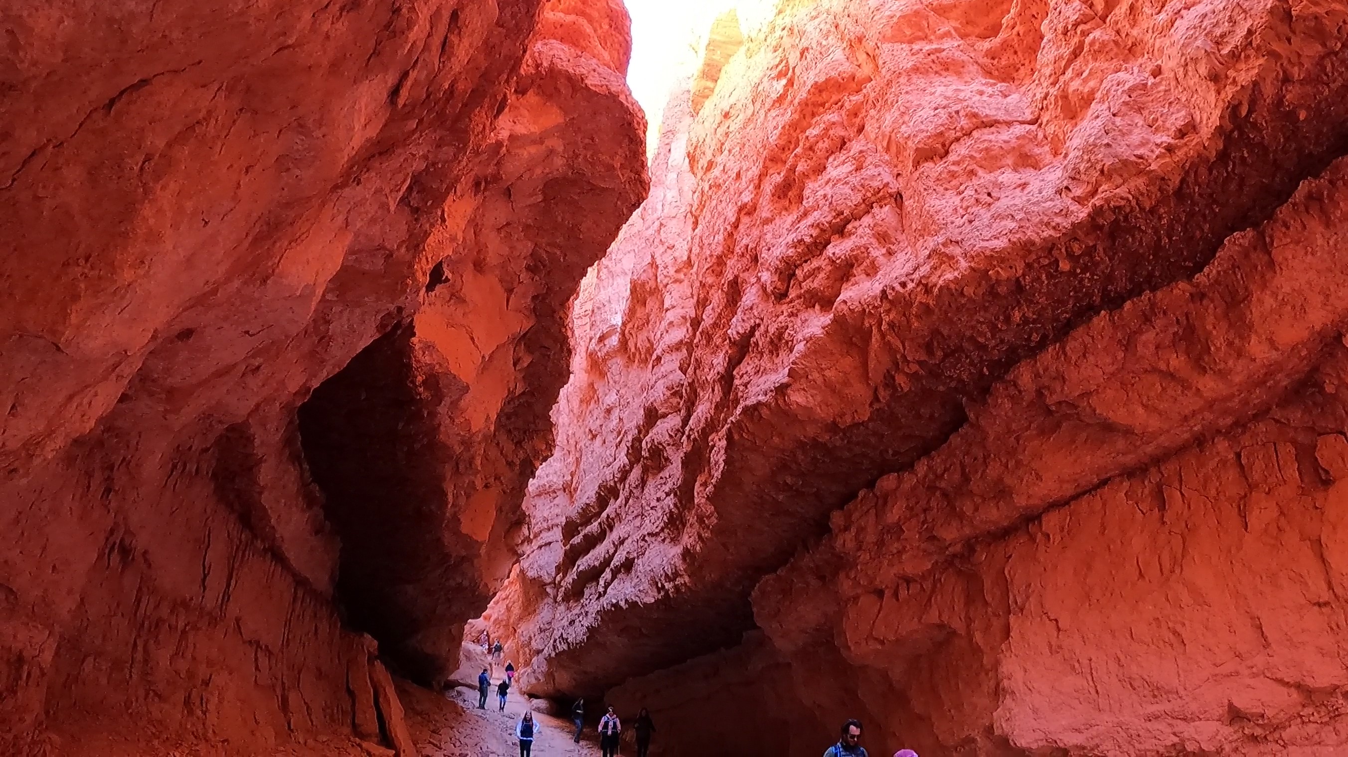
A challenge of an uphill hike until we hit the sweet spot. Crazy. There was a cautionary sign of falling rocks at the start of a stone stairway into a crevasse that really looked intriguiging. We let a larger family group go ahead of us and as we got to the top of the stairway we were speechless. We were standing in a huge slot canyon with sandstone walls that went hundreds of feet up above us. The air in the slight bowl at the base where we stood was rather cold but the experience was goose-bumpy anyway.
This section of trail was the last ascent, and it was amazing. Switchbacks wiggled endlessly up and out of the shady slot canyon and into the sunshine. It was hard to take it all in, since you were mostly watching your feet as you walked. That’s ok, we needed to pause MANY times at the switchbacks to catch our breath. We were pretty much at 8,000 ft, so it did take your breath away.
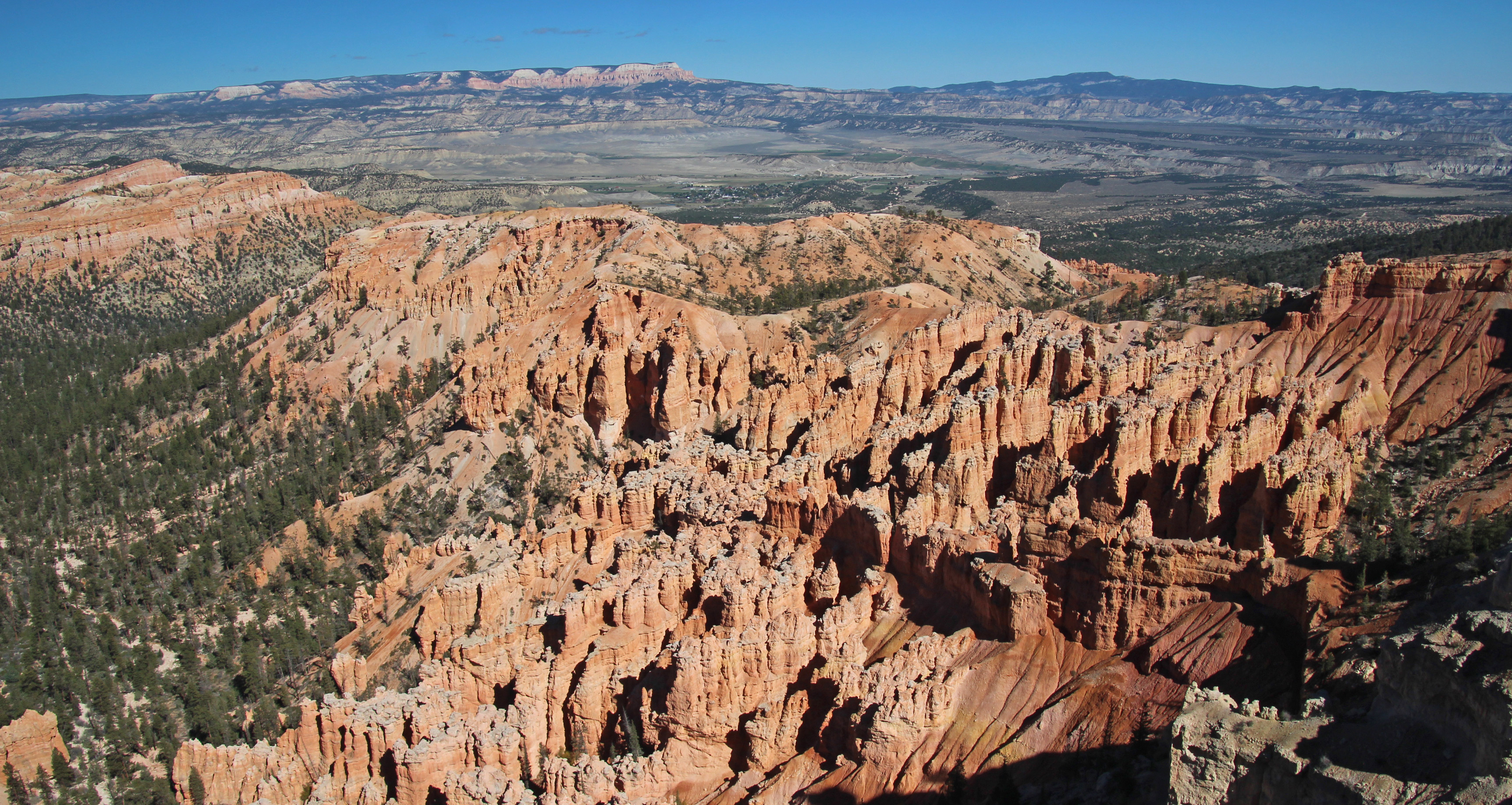
Finally at the top you could look down across the valley of hoodoos we had walked among and back from our spot on Sunset Point to Sunrise Point. Pretty much 3 miles, although our fitbits said closer to 6, but why quibble. It was an accomplishment.
One more drive further into the park to Bryce Point – another amazing overlook, and we sat to have lunch. Wow. Lots of folks here. On the drive out we stopped to watch some prairie dogs (yeah, wildlife!) and made our way back through Tropic to camp. A short nap and “breakfast for dinner” followed. We have heard various weather reports that change with the elevation. At Bryce they are expecting lows in the teens; in our spot, a thousand feet lower, we are expecting 20’s overnight. Everyone says snow for Tuesday, our departure day, so who knows? I unhooked, drained and stored the water supply hose, since we are full in the water tank. Since it is so clear out, it should also be a wonderful night sky filled with stars, planets and constellations that befuddle me, even with a guide.
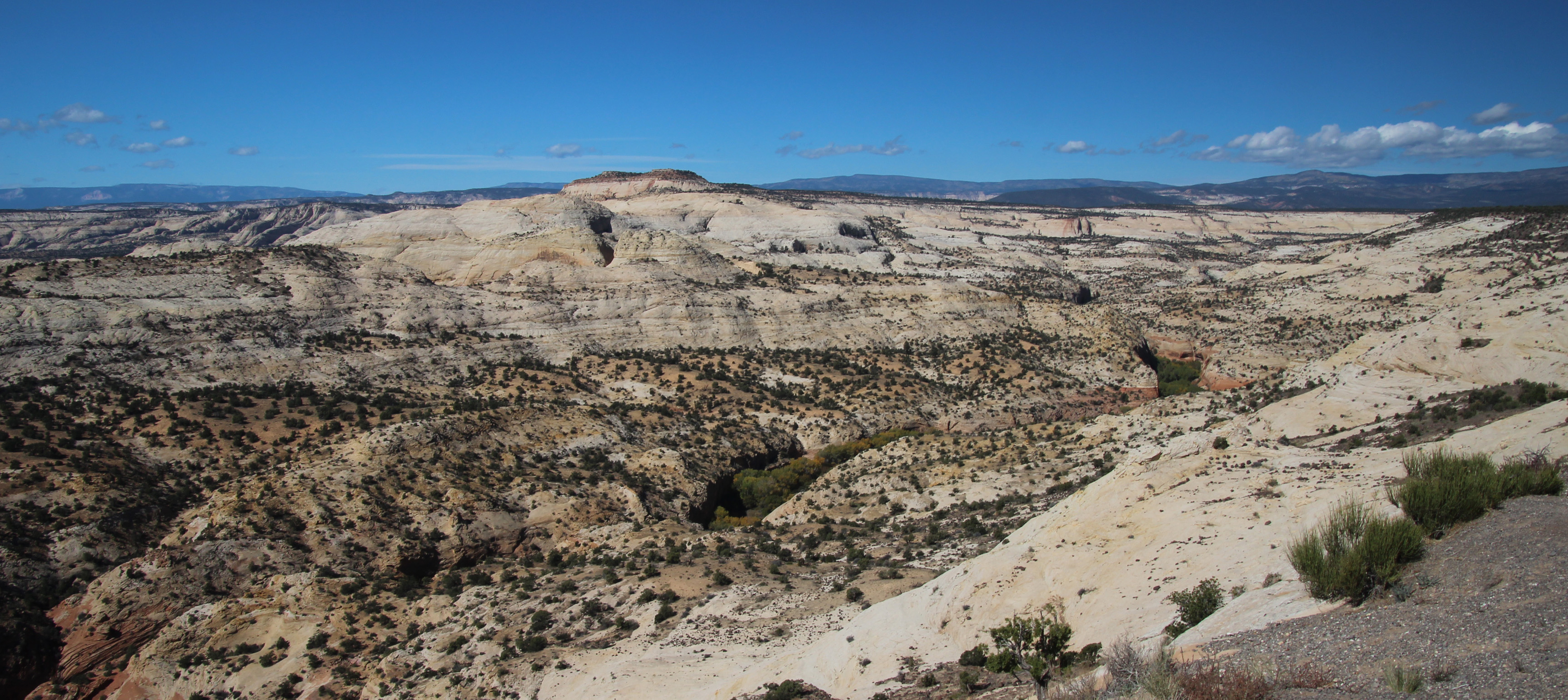
Well our last day in camp started cold, 33 degrees, but we were just looking to complete two things on my checklist: Drive to Escalante and Boulder to find the Burr Trail Road and then find Long Canyon slot canyon. That was just over 60 miles (long distances are nothing out here) and some elevation changes up and down 1,000 to 2,000 feet. Off we went, stopping at the Grand Staircase/Escalante Visitor’s Center in Escalante. Very helpful information about how to find the unmarked slot canyon. Town was cute, just a few markets and eateries along the main road, but it was way bigger than little Boulder. The scenery was the star, however, as the drive wound around, up and down, with the rock formations changing grey shale and stone to white, rather smooth stone mounds and hills to red rock and shale once again. In the canyons the aspen and the cottonwoods were turning a bright yellow-orange.
Once in Boulder we stopped for lunch at the only eatery – the Burr Trail Grill, just at the start of the road. Awesome little place with a delicious lamb burger and some sugar wings. Never had them, but now I know they are hot wings with a sweet coating of sugar. Lips burning kind of hot. They also had homemade hand pies big enough for two, so we bought spicy cherry and caramel apple with cardamon. Should be good later tonight with some hot cocoa.
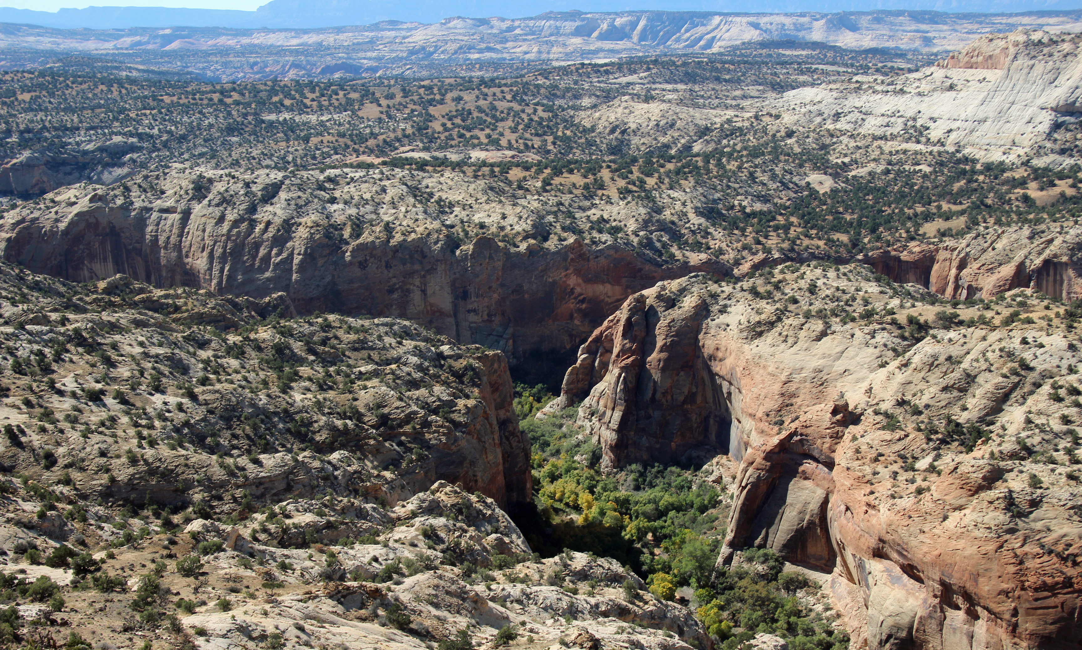
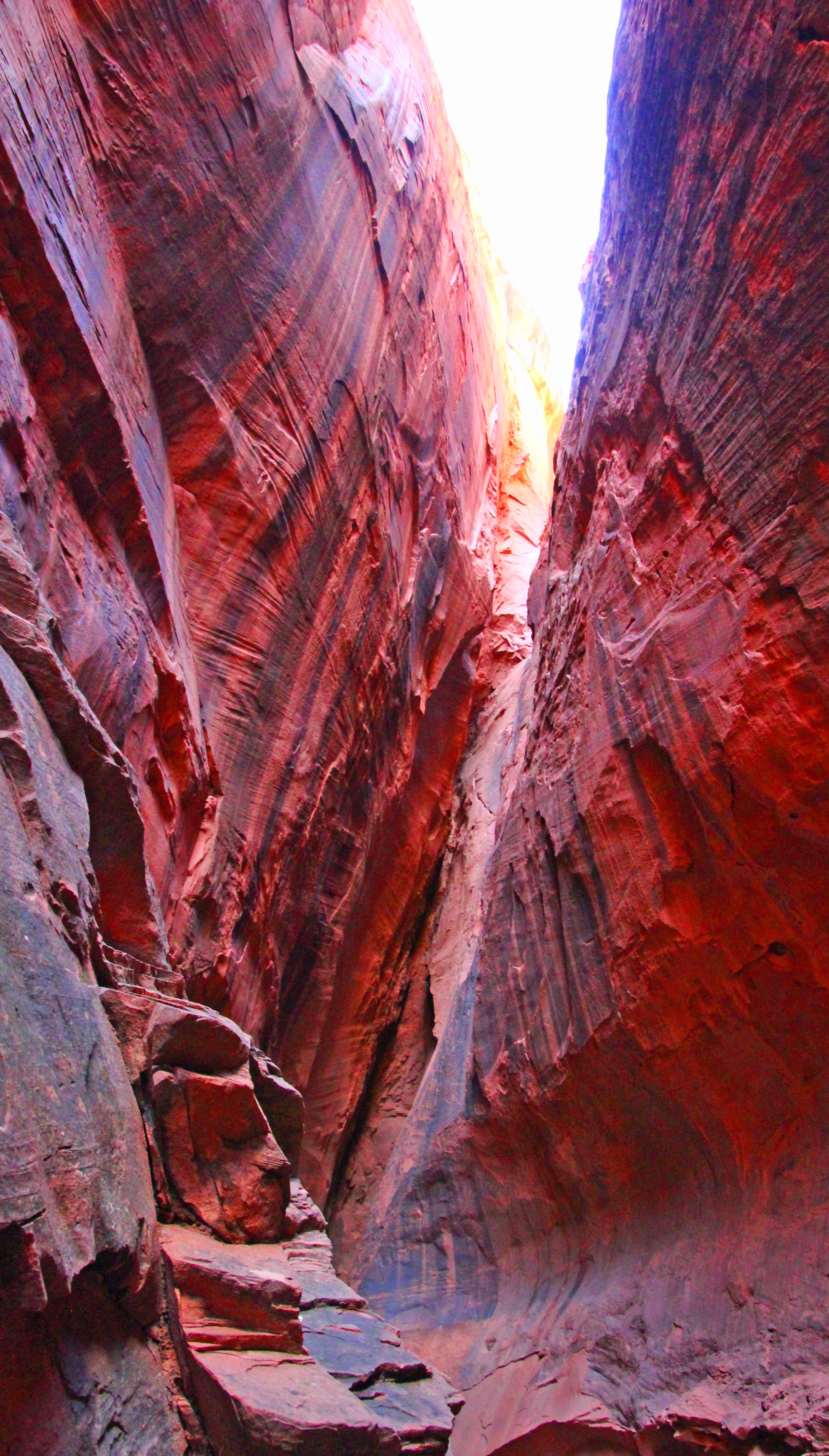
Studying our information closer, it looked as though the Burr Trail was a paved road at least as far as the slot canyon. It turns to gravel/dirt, but much further south. That’s good, because I wasn’t looking forward to 11 miles of washboard again. Soon we found the big cottonwood that stood outside the slot in the red rock and pulled over. Clearly a well-worn stop and the path was pretty obvious. Into the split in the rock we went, the cool breeze blowing outward. How perfectly wonderful! It was maybe only 100 yards in until you reached where the little gap let in only a dribble of water. But the sheer walls rose up hundreds of feet and echoed your voice around the space. Not surprisingly we were followed in by several other folks, but there was room for all and time for plenty of pictures.
On the way back to camp I hooked up the GoPro to the bumper and filmed the Burr Trail Road and parts of Scenic Highway 12 back to Cannonville. Hope to put that on our youtube channel when back home so you have a idea of how this landscape looks. Totally amazing. For the weather tonight there are various reports of rain, snow, mixture and maybe temps in the 20’s. It all depends on your elevation. Bryce is the highest spot around, so on our trip out of here tomorrow, which climbs relentlessly uphill to the Bryce Canyon entrance and then down through the very scenic Red Canyon (with two short tunnels!) we might see some flurries. Yippee! Yet another reason to lose sleep tonight.
Thanks again for joining us on the journey. Shout out to our hardworking teacher daughter Karina and her equally hardworking husband Jason and our two grandsons! And to Alex, Bethany and Jim for teaching us how to get our Jeep all muddy.
Yep, it’s summer and we are staying local, but that doesn’t mean we aren’t busy. This summer in particular is one where EVERYONE hit the road to go SOMEWHERE – but we are trying to avoid those crowds and just enjoy some time with the family. So what did these two busy retirees do, exactly?
A new 4-wheeling adventure?
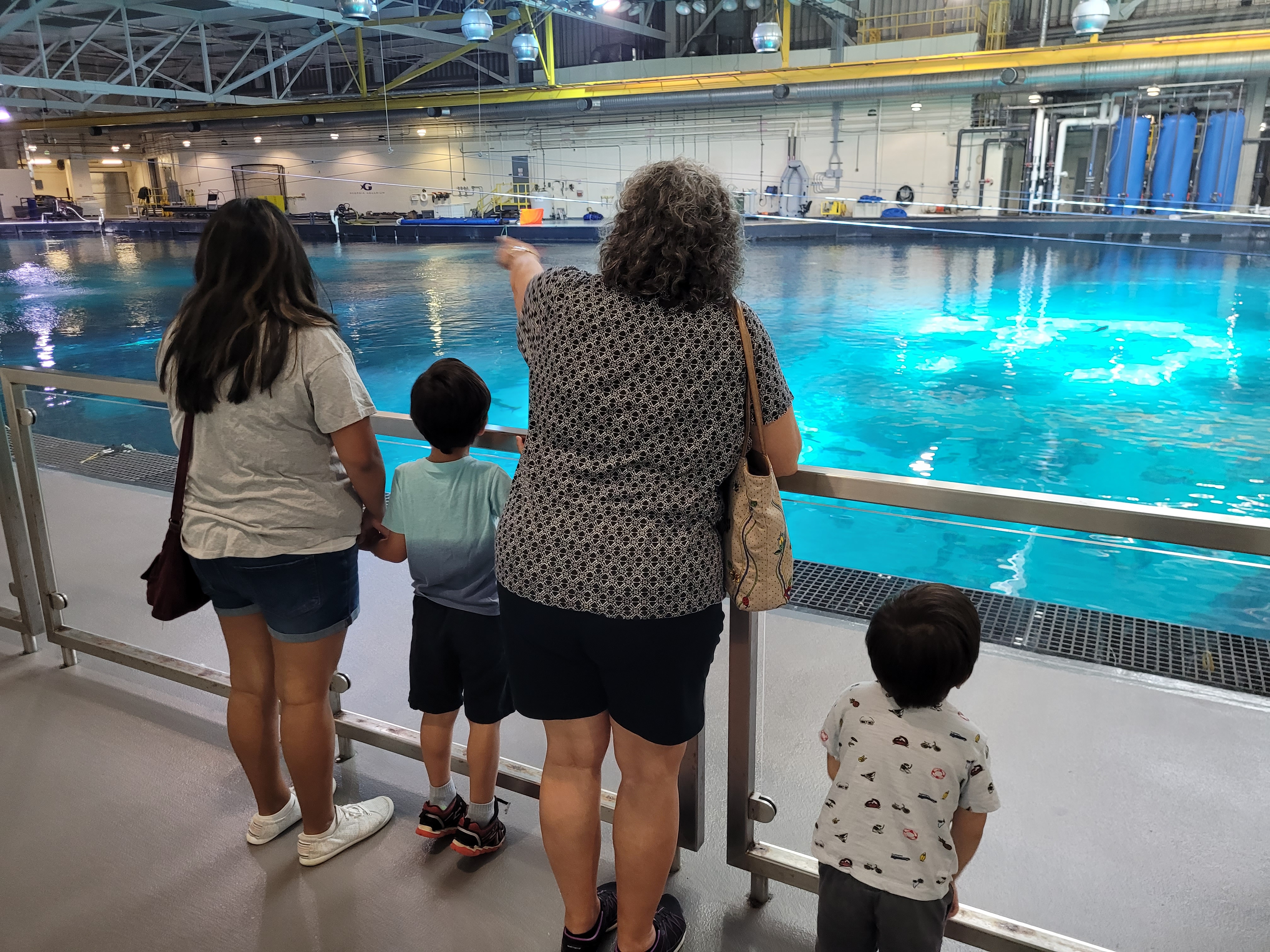
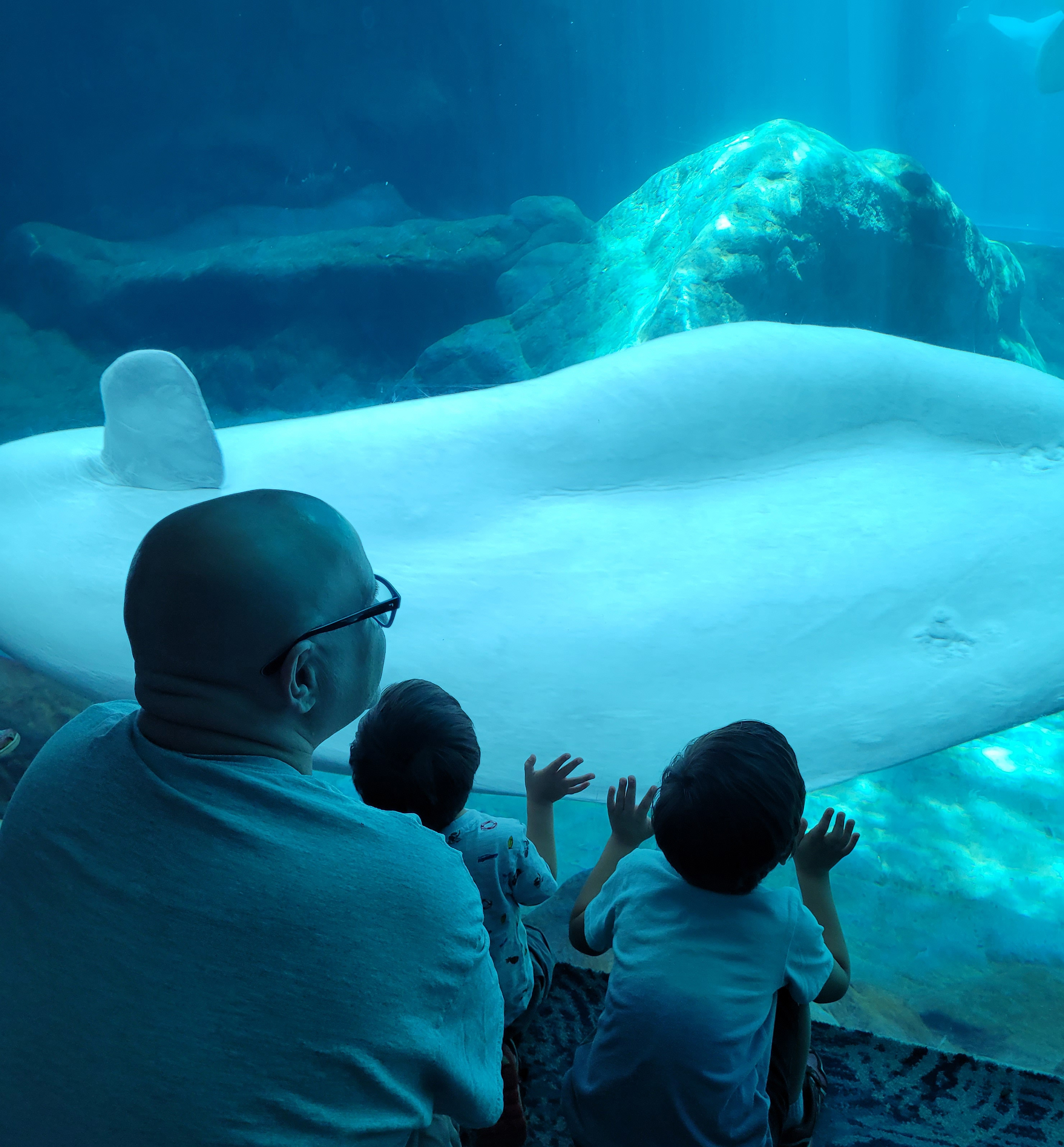
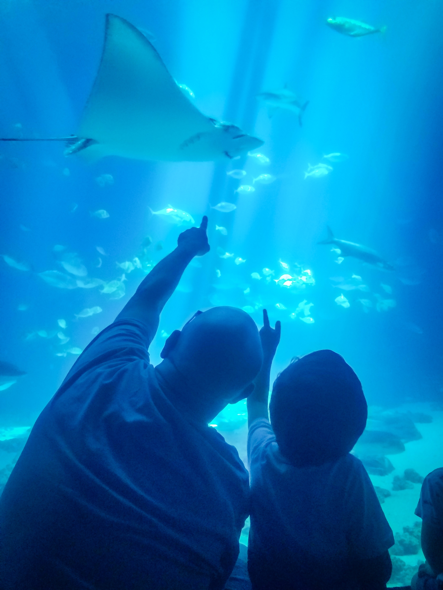
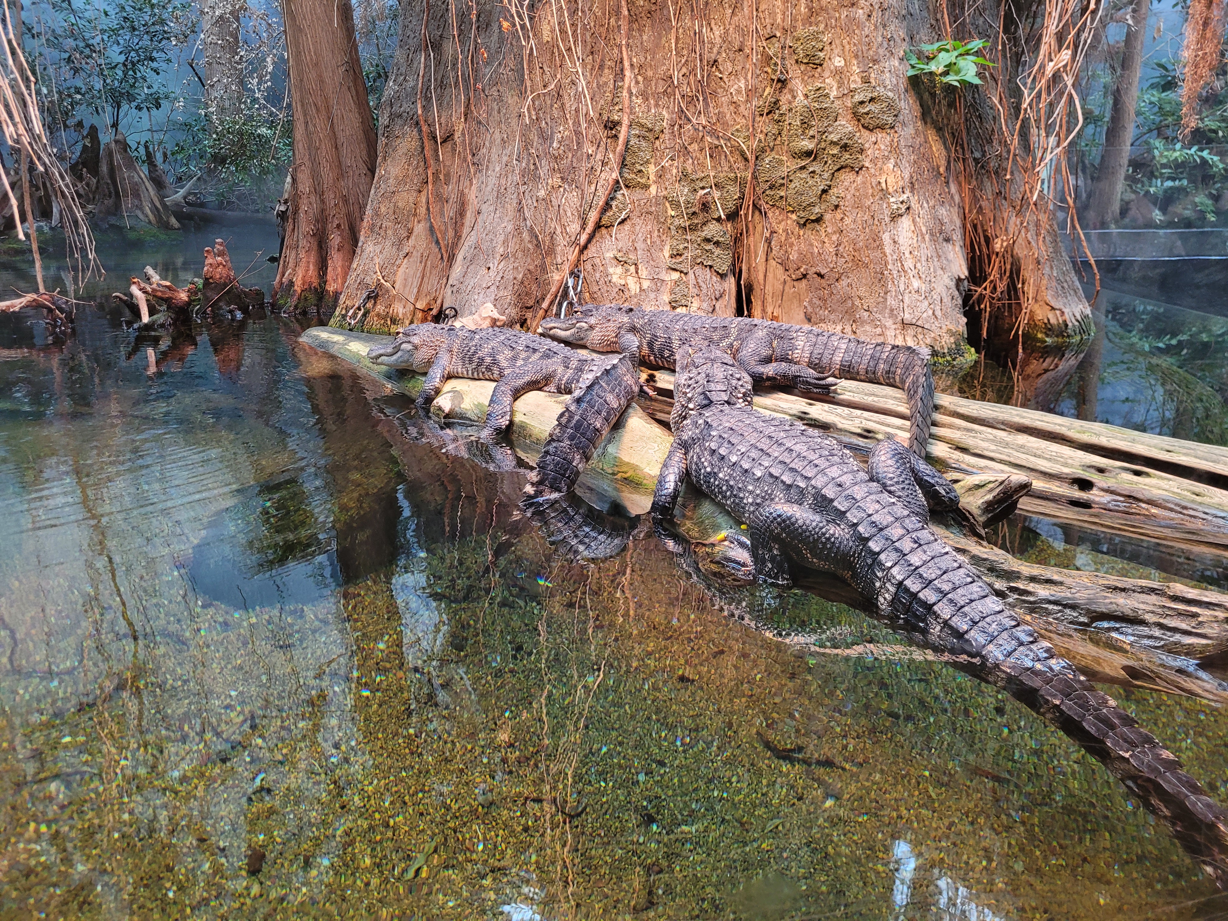
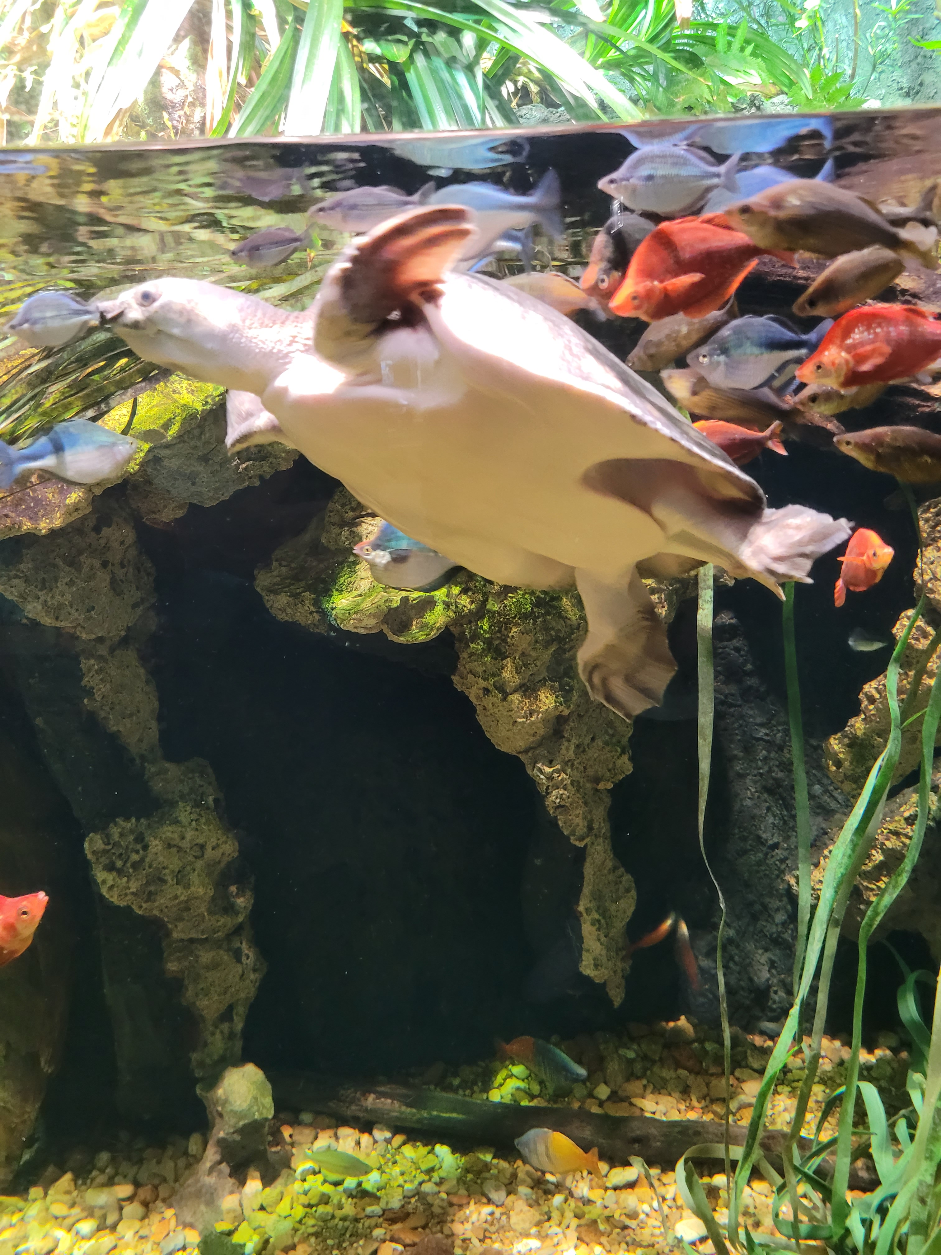
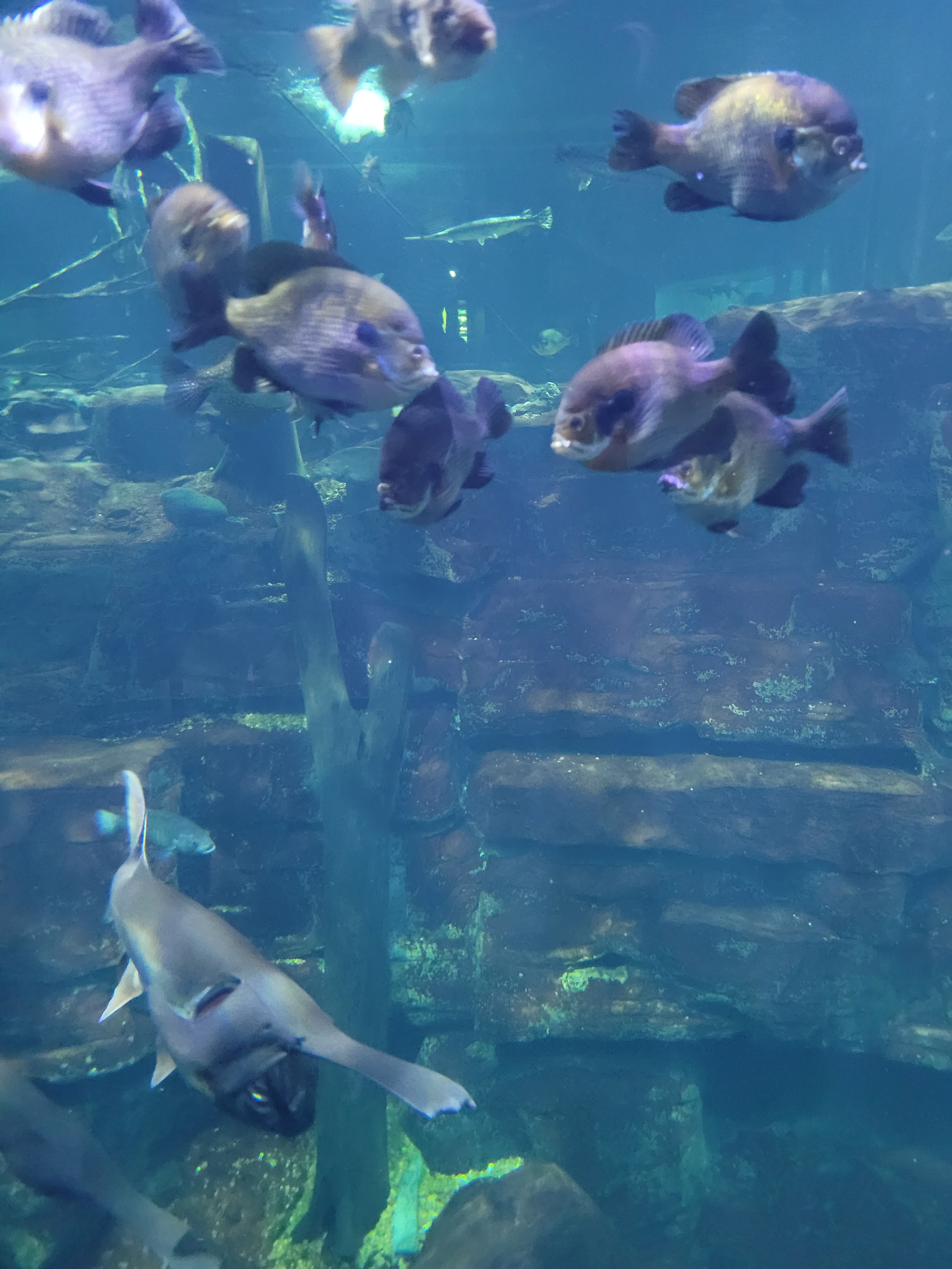
Well, we took our grandsons to the Georgia Aquarium for some underwater adventures. That was an amazing day and we just wowed the boys, sitting in front of the huge tank of fish, with the whale sharks and rays sailing past. They loved the beluga and the sharks and couldn’t stop pointing out all the fish in the underwater tunnel as we were transported along the moving walkway. “More big fish, Pop pop, come on” was heard more than a few times. Crazy moment in the main hall when someone called out to me to stop … turns out it was our former assistant principal Dr. Davis who is now President and CEO of the aquarium (and who also encouraged me to get certified to teach the engineering and technology classes). Well, that led to a behind-the-scenes tour of the big tank and some private viewing moments. What a nice surprise!
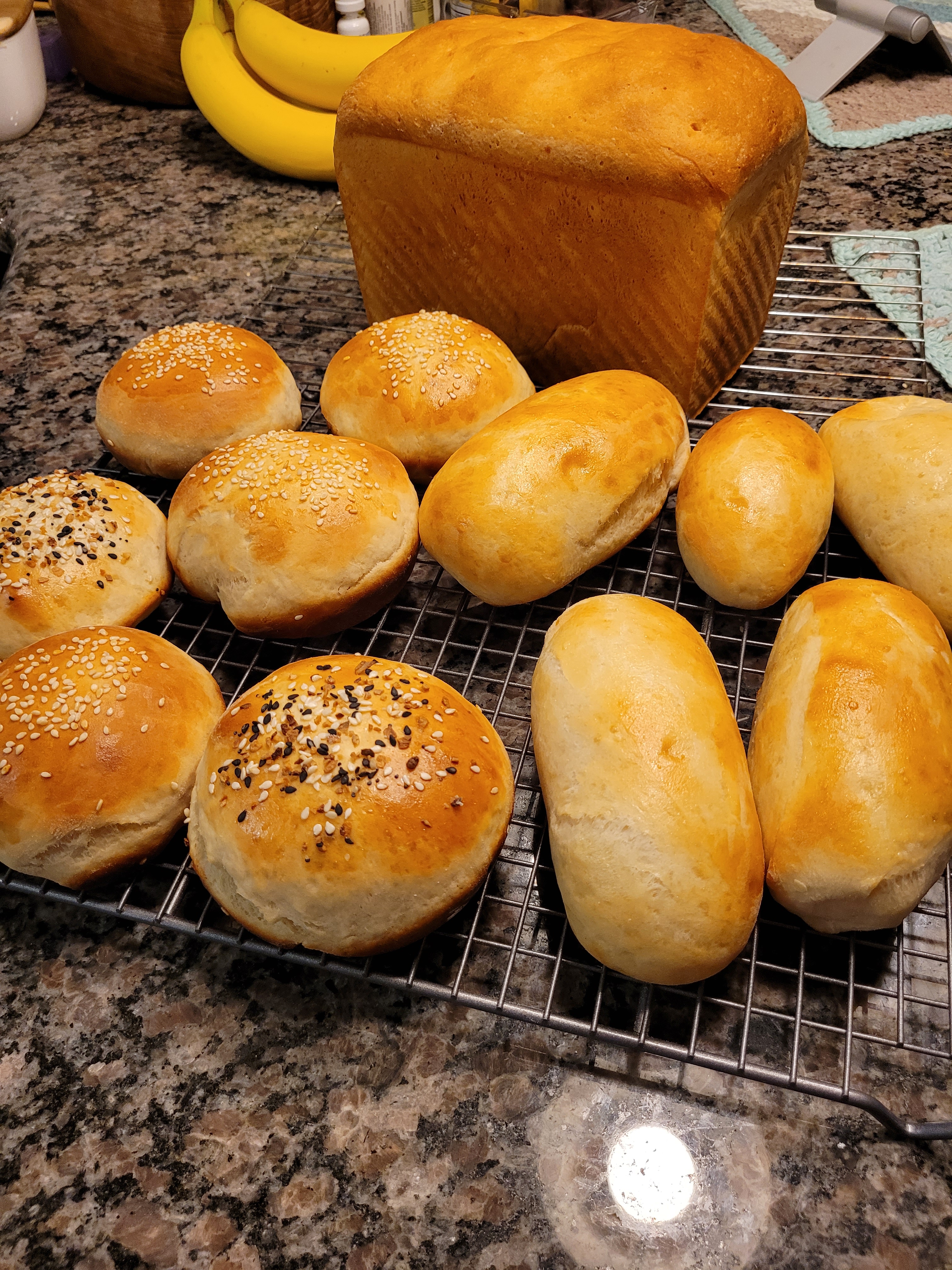
I was back to baking bread, with some camping coming up we needed burger and hotdog rolls and a Pullman loaf for PB&J sandwiches. Had to keep feeding the sourdough, too.
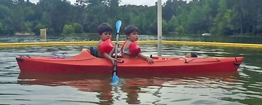
We also camped along the shores of our local Lake Allatoona, something we thought would be a good opportunity for the grandsons to learn what the motorhome and camping are all about. Even though we were in a cycle of daily pop-up thunderstorms, it was a very fun few days at the lake. Our campsite was next to the swimming area, so when the boys, Karina and Jason joined us it was easy to walk back and forth. The boys loved it and Wyatt took to the kayak like a pro. Paddleboards and floats made it fun to splash, paddle and bob in the water, even when the rain came down. Owen and Wyatt stayed the night with us, ate all our snacks plus a hearty pancake breakfast and we all splashed around in the lake the next day.
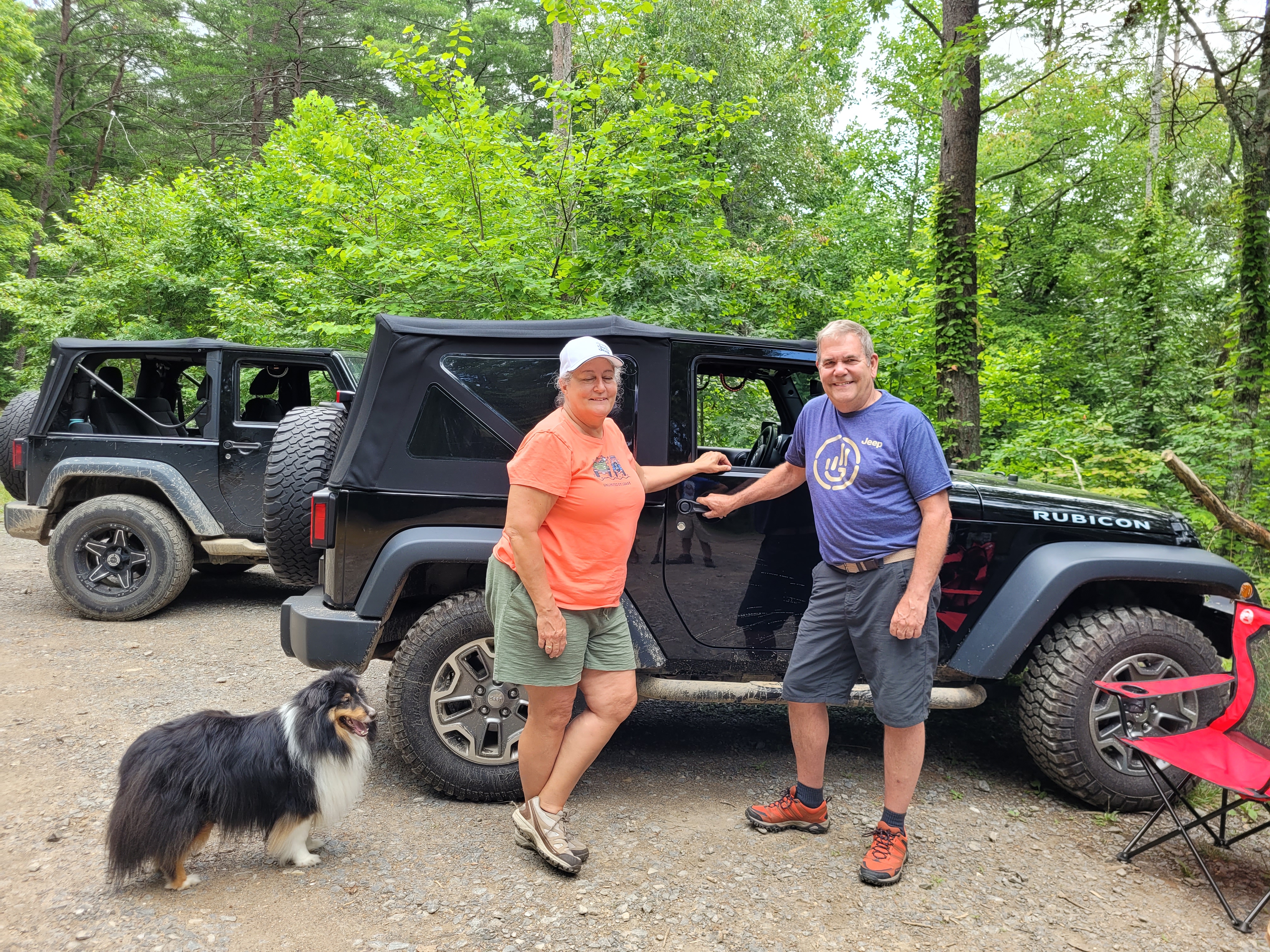
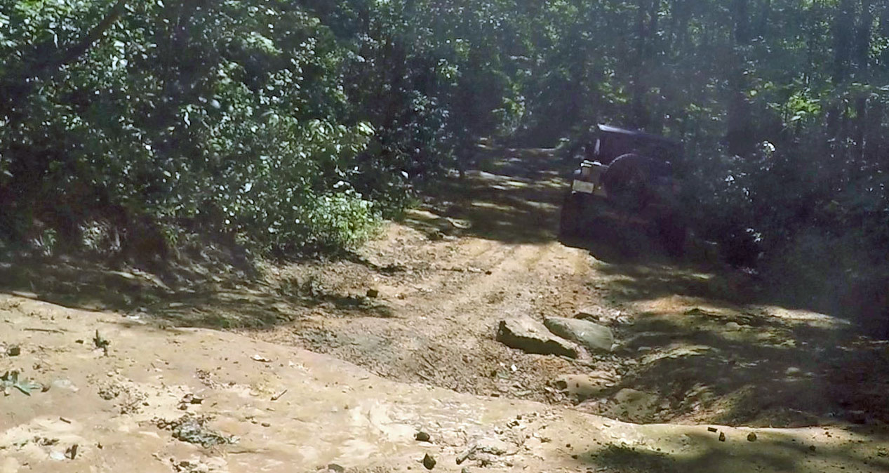
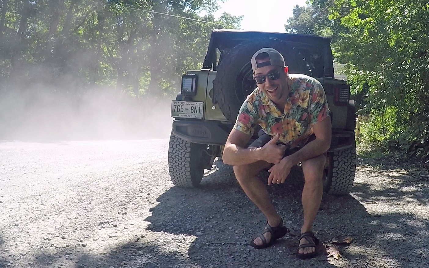
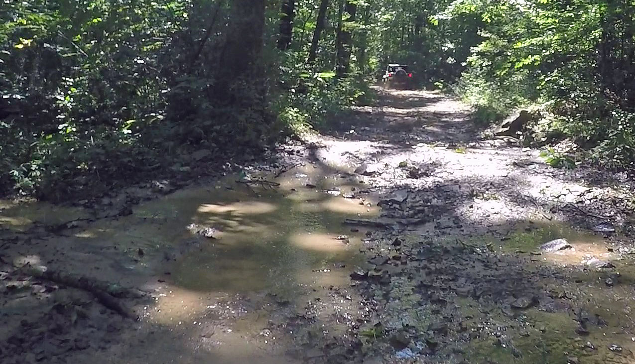
A few days later we drove to Chattanooga to visit with Alex and Bethany and most importantly to go off-road Jeeping with them and some friends. It was important to Alex that we properly break in the Jeep with mud splashes and off-road bumps and bounces – and the long and winding Big Frog Road through the Chattahoochee-Oconee National Forest certainly did that. It was good to learn how to put it in 4-wheel drive, disconnect the sway bar and generally get the feel of off-roading, since we have our fall trip to the canyons of Utah coming up. Kodi seems to enjoy the back seat of the Jeep, at least we heard no complaints.
We added a trip to the Tennessee Aquarium the next day and had fish tacos at Big River Grill (was that wrong?).
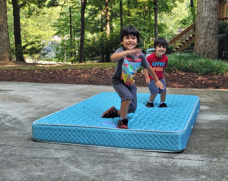
We also had the grandsons over for another night at home, since Karina was busy setting up her classroom for students this school year. This time we pulled out the trusty inflatable pool and our “redneck trampoline” to entertain them (the old RV mattress is awaiting a bulk pickup). We were also dog-sitting Allie, so there was much noise and movement around the house at feeding time.
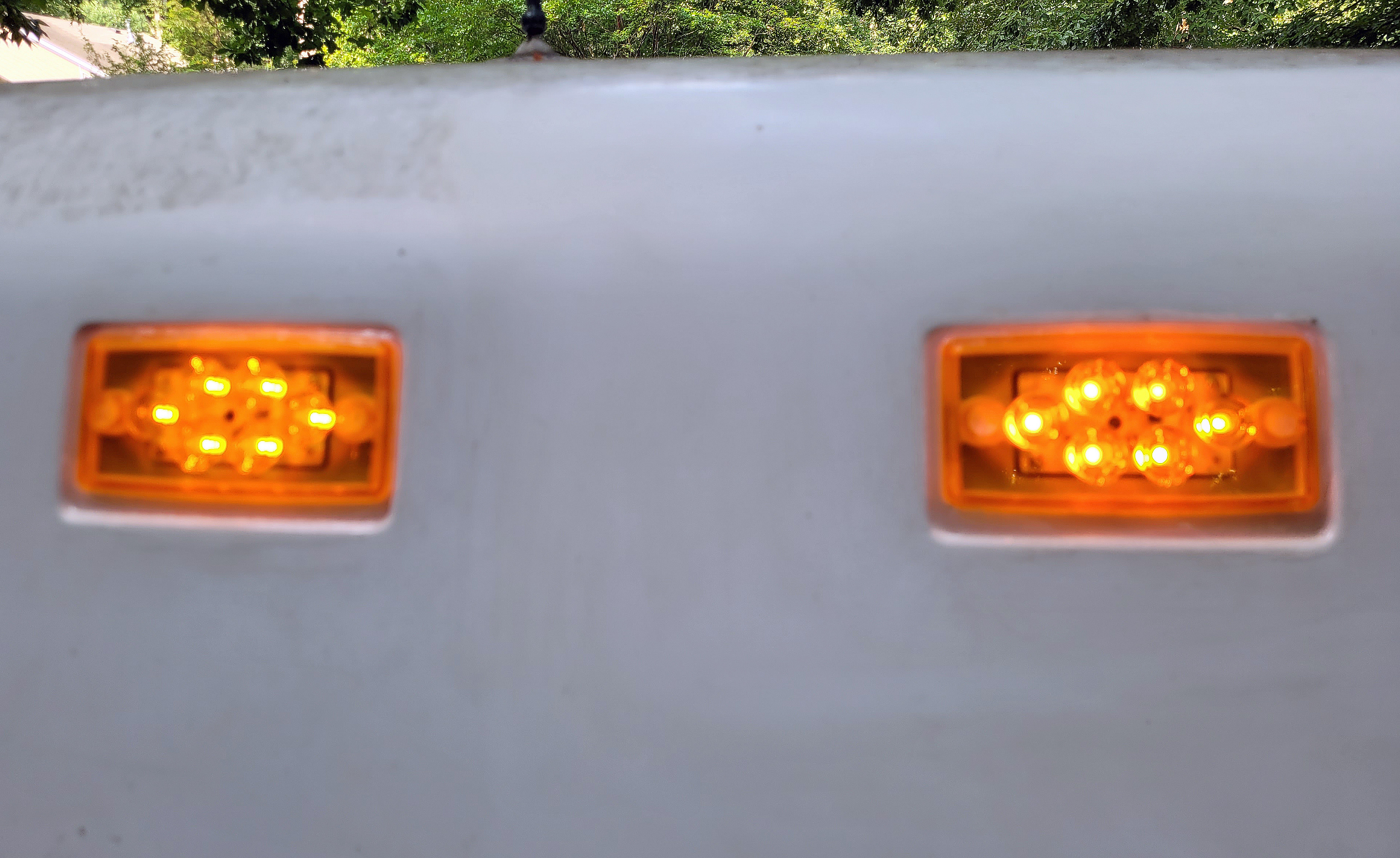
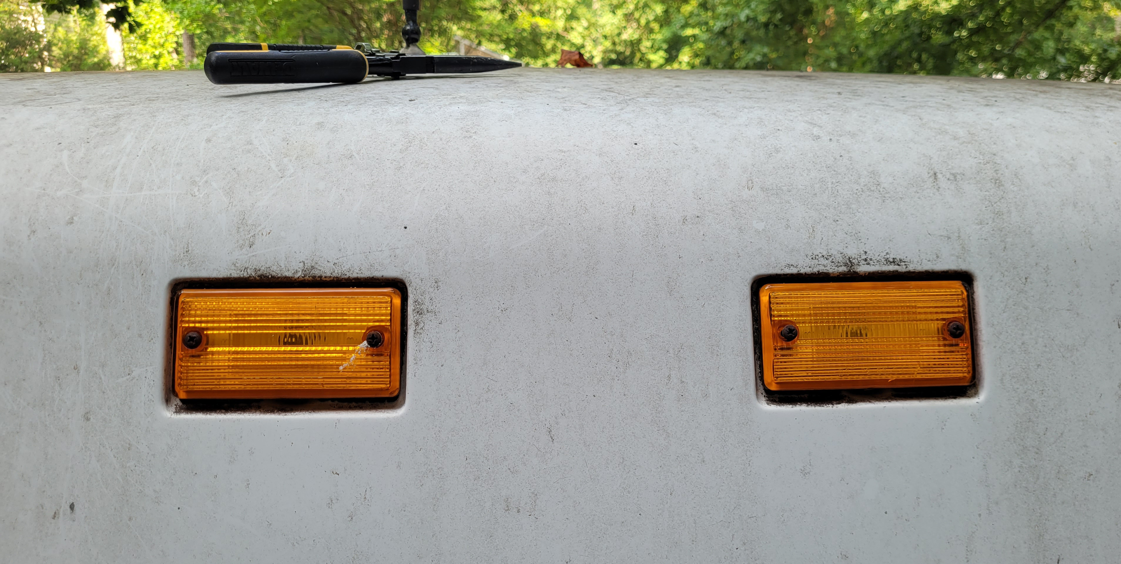
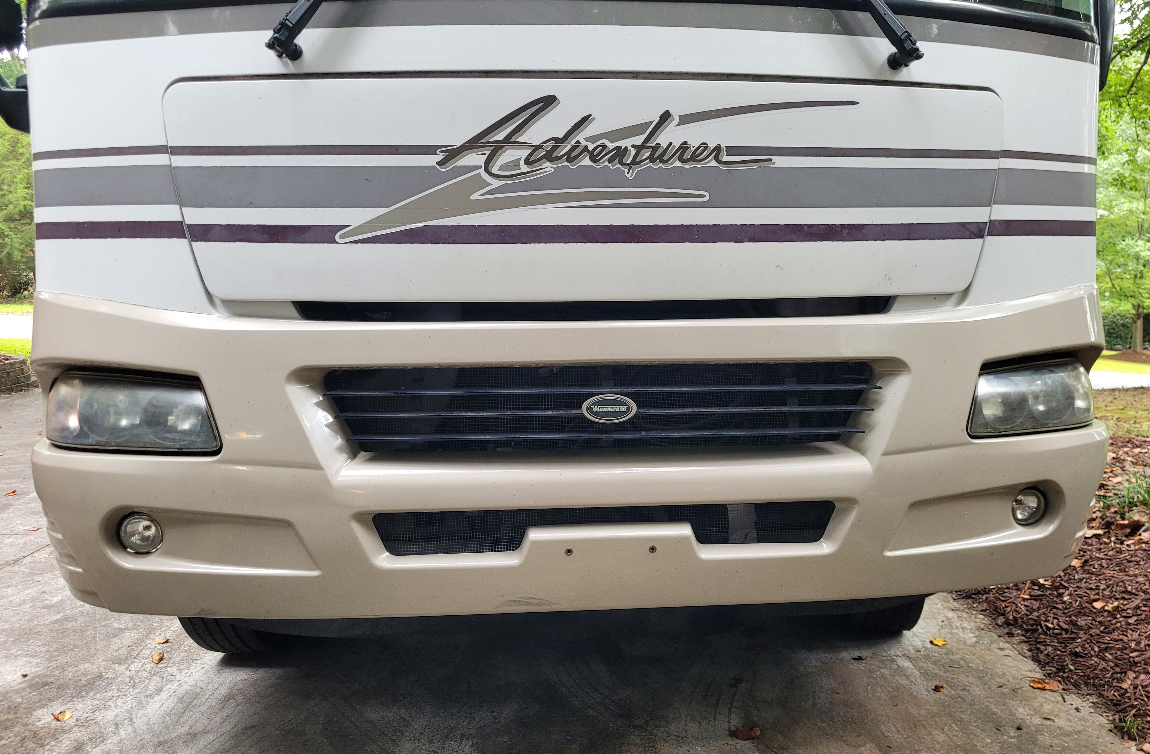
And we are getting everything ready for another big adventure to the Southwest. That meant getting 4 new tires for the motorhome, a check of the brakes, propane fill and new springs on one of the hydraulic leveling jacks (it still retracts very slowly). Replaced a tiny spring in the screen door latch and pulled out and replaced the diverter in the shower faucet. I also replaced the very fogged up and yellowed headlight assemblies, replaced the amber clearance lights on the front with new LED ones and switched to LED bulbs on the red ones in the rear. Even though we rarely drive at night, it just updates the motorhome and certainly improves the look up front.
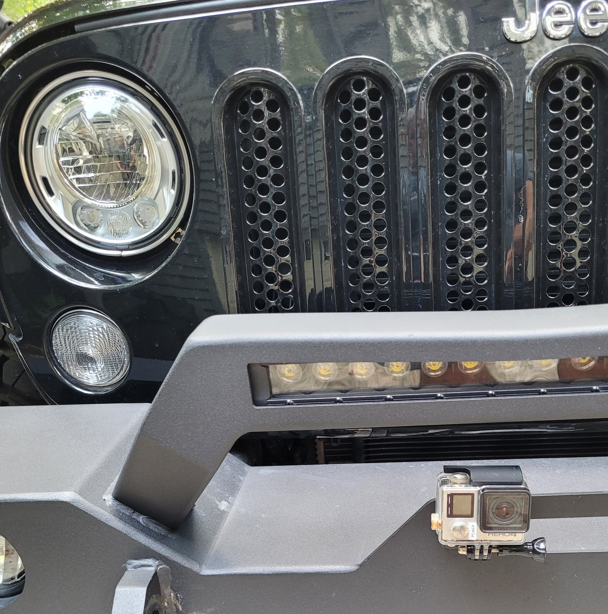
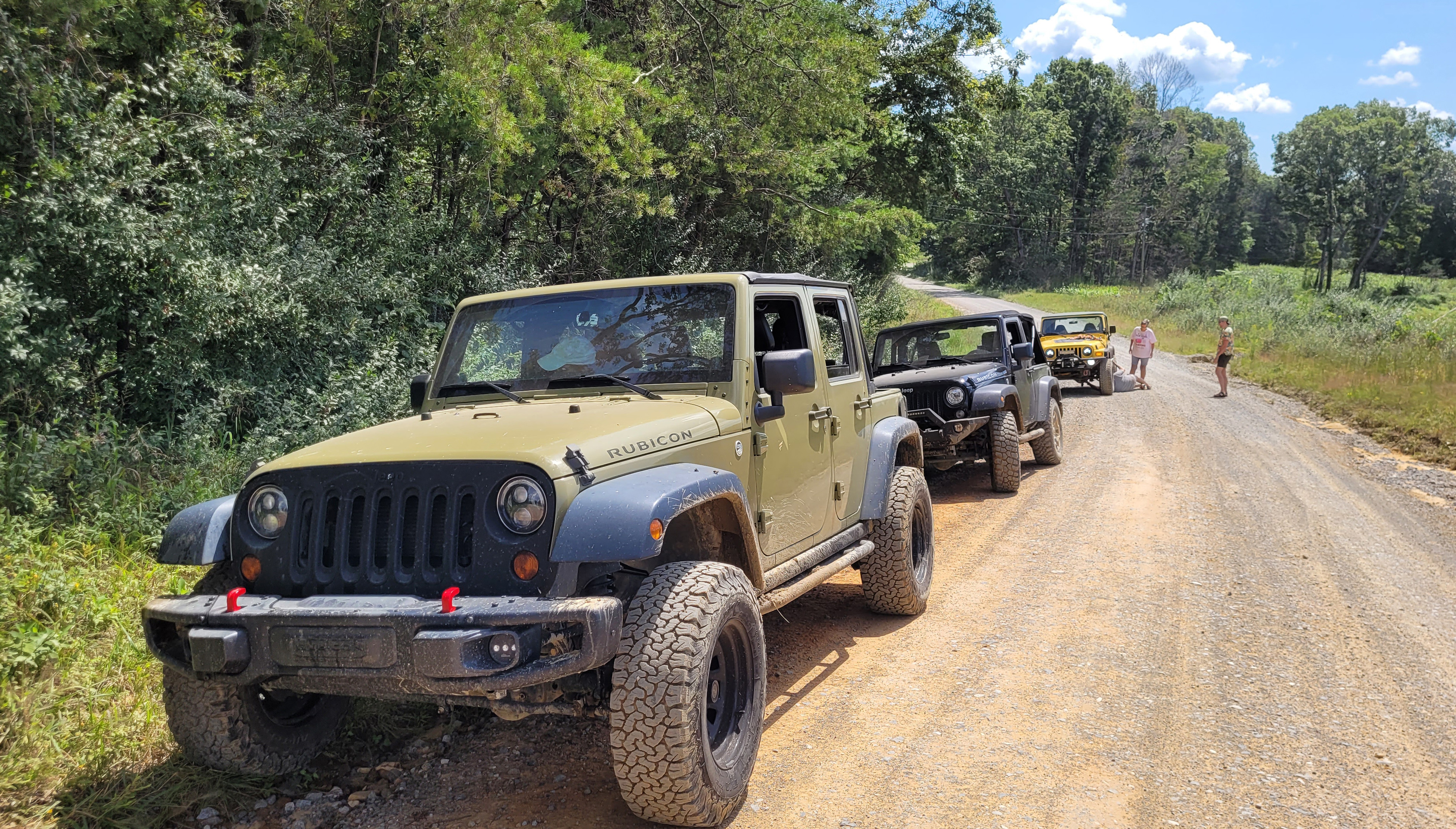
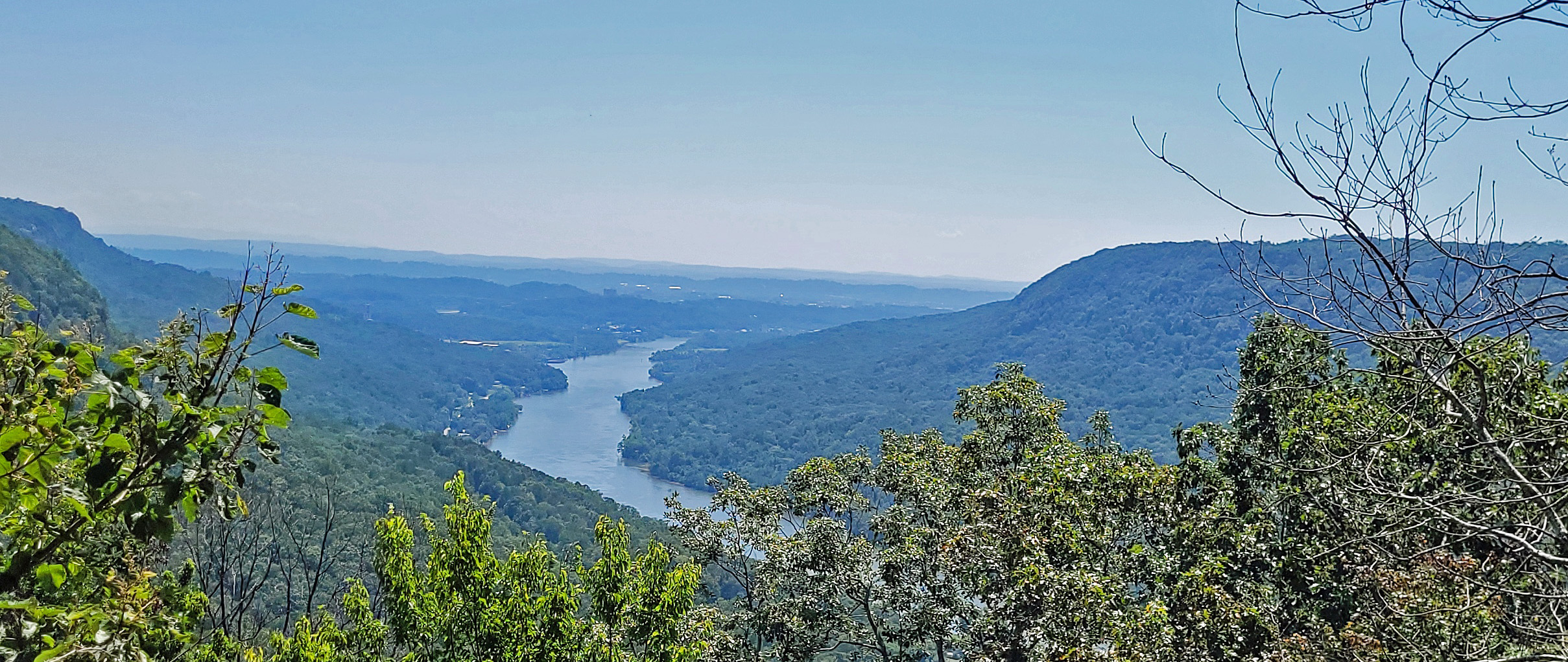
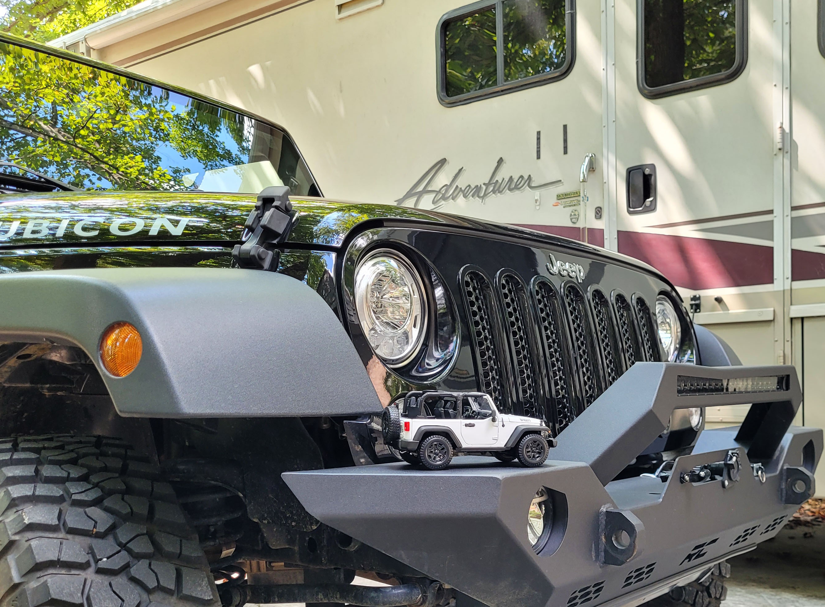
A few extra accessories for the Jeep (storage nets, overnight cover, decent cooler and storage sleeve for the soft-sided windows), a GoPro mount attached to the front bumper and I think it is ready for off-roading. And for Labor Day weekend I got to try it out in the Prentice Cooper WMA in Chattanooga. Alex invited us up to join Bethany’s parents on a trail ride just a few miles from their house and as you can see, it was a bit muddy, bumpy and dusty. We had lunch at an overlook of the Tennessee River with Chattanooga in the distance. Unfortunately the ride was cut short by a front driveshaft breakdown on Jim’s Jeep, which meant we had to go have a beer at Heaven & Ale in Chatt. Not so bad. And yes, I washed off the mud from Tennessee, both trips.
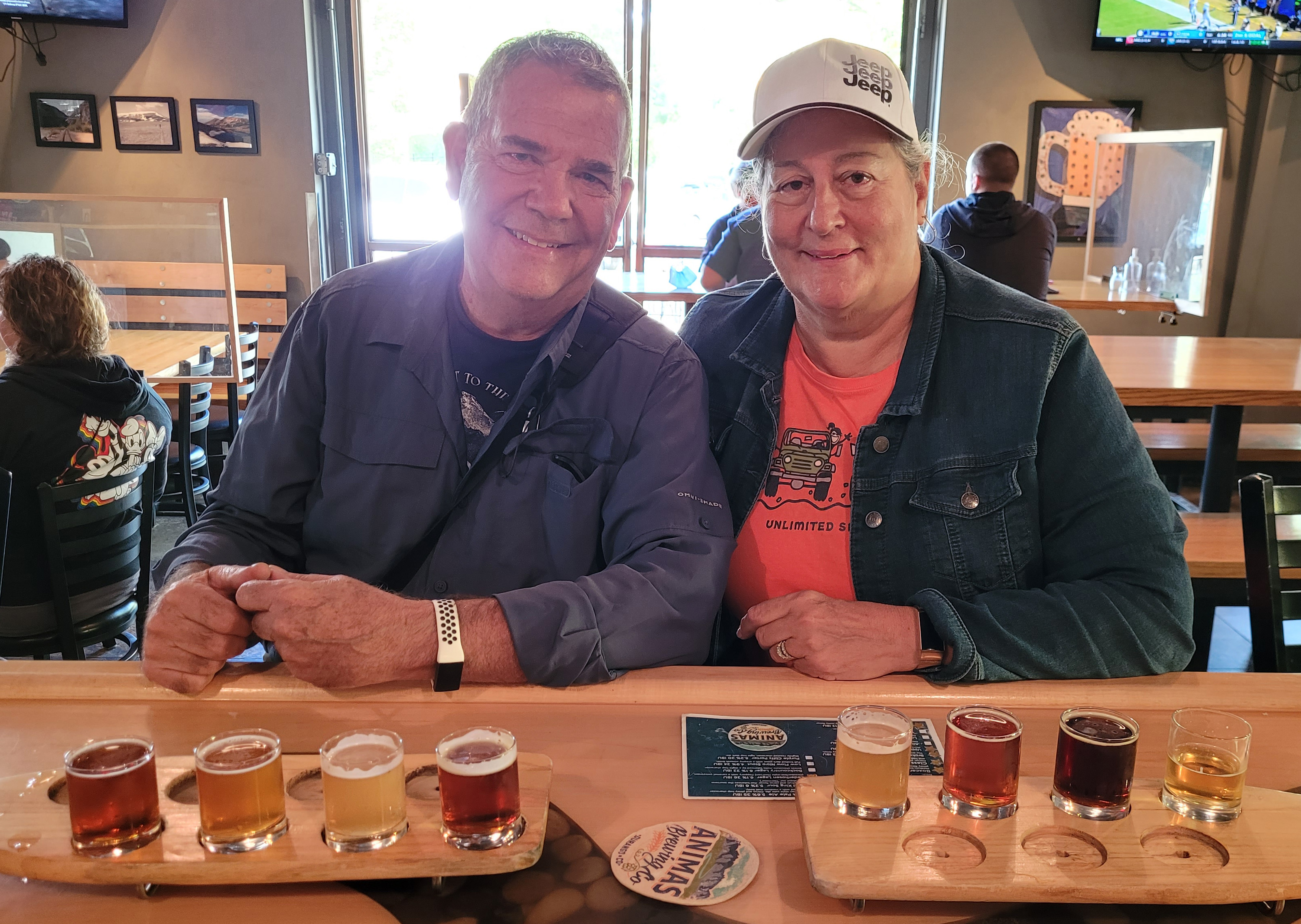
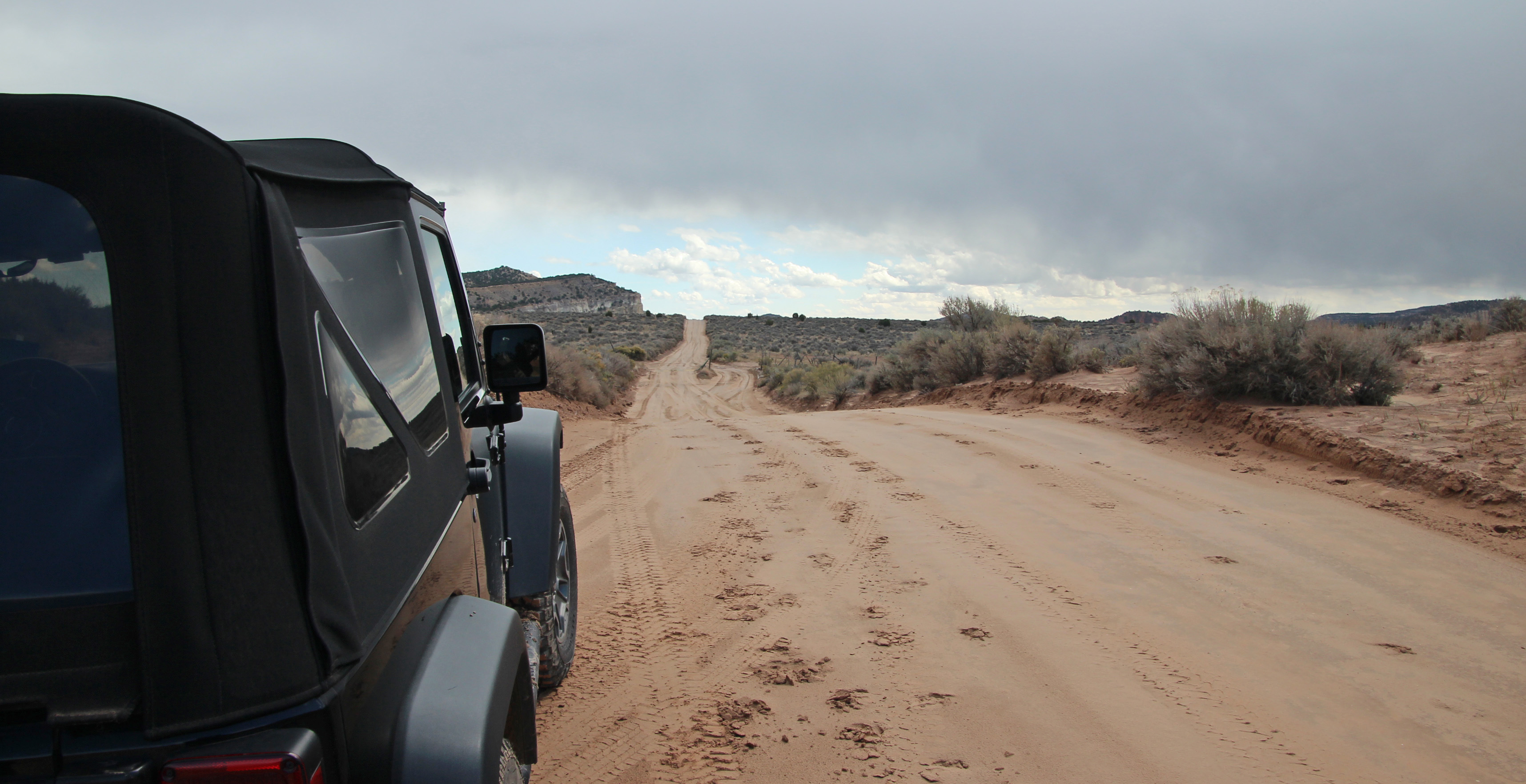
I’ve got my various cameras ready for photos and ran through night-sky and sunset photo settings. We’ve gone through our hiking boots, neoprene booties, trekking poles, backpacks and essentials to be sure we are ready. Watched some great videos of hikes and drives in the areas we are heading (we particularly like “Adventures of A + K”) and feel like we know what to do in Canyonlands, Moab, Great Sand Dunes, Black Canyon of the Gunnison and … well, you will just have to wait for the pictures and stories. Our highlight Jeep drive will be the Shafer Trail from Dead Horse Point State Park to Moab. (I am trying a new app for hikes called AllTrails, which looks VERY helpful).
So, off we go in mid-September for another adventure. Kodi and Merlin will be our back-seat critics, Jackie will navigate and of course we’ll have stories to share. As our good friend Rich said “you always manage to find some cool brewery.” What we won’t find much of is good internet, cell signal and WiFi, so it may be some slow postings on the blog. But I will do my best to share our adventure. (Bit disappointed that Roadtrippers app is now very limited in their free version).
Part One of the Adventure – Atlanta to Canyonlands, mapped on Roadtrippers
Oh, and in case you were just a bit confounded by our 4-wheeling adventure through the sand, pictured as the white Jeep at the top of this post, maybe this will help put it in context for you (look closely):
Just having a little fun, there. Thanks for coming along on the journey as we explore Utah, northern New Mexico and the Gunnison River Valley with our Jeep (the big one) in tow!


Comments