Posts Tagged With: Colorado

New Videos of Western Trip

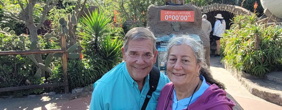
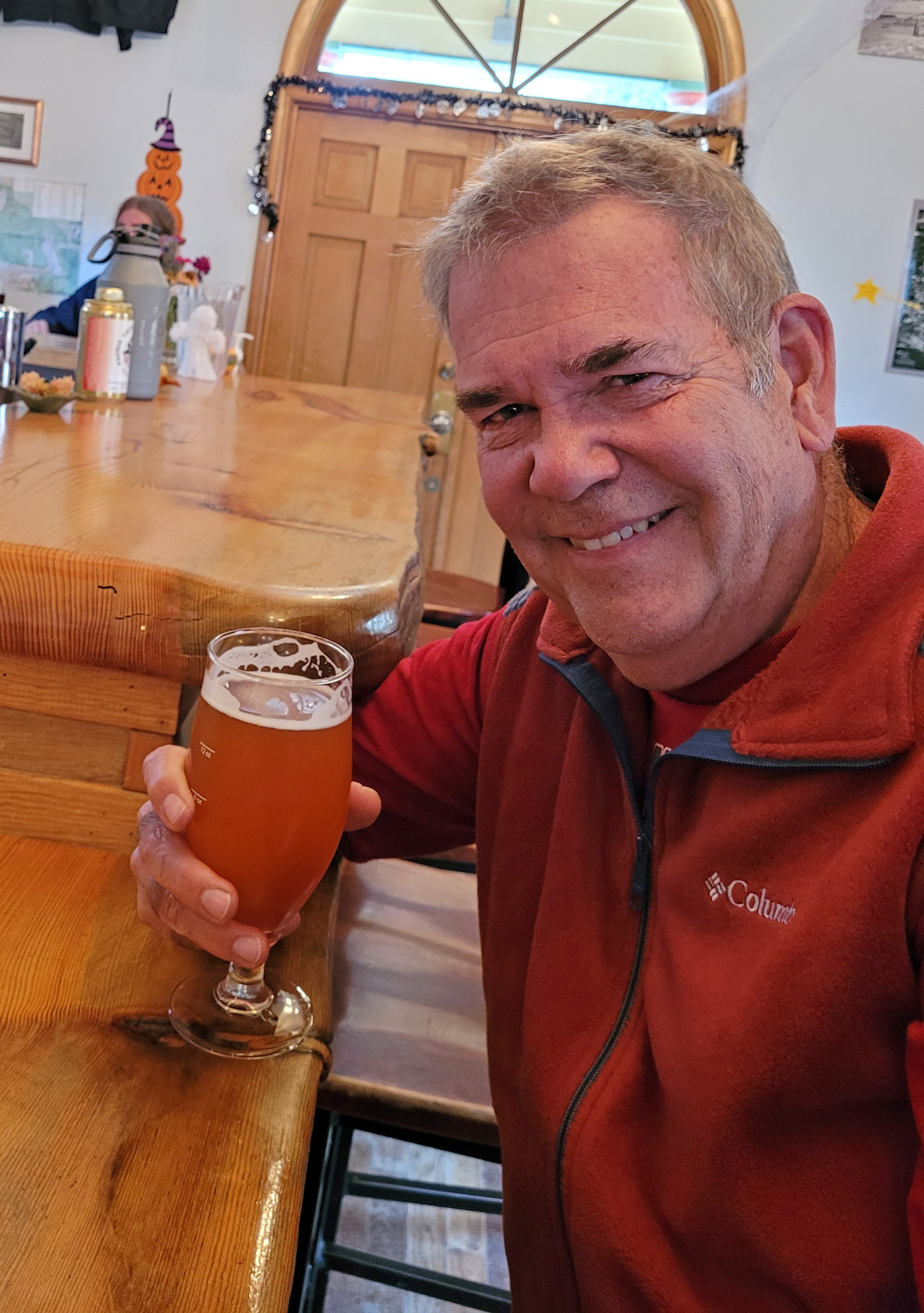
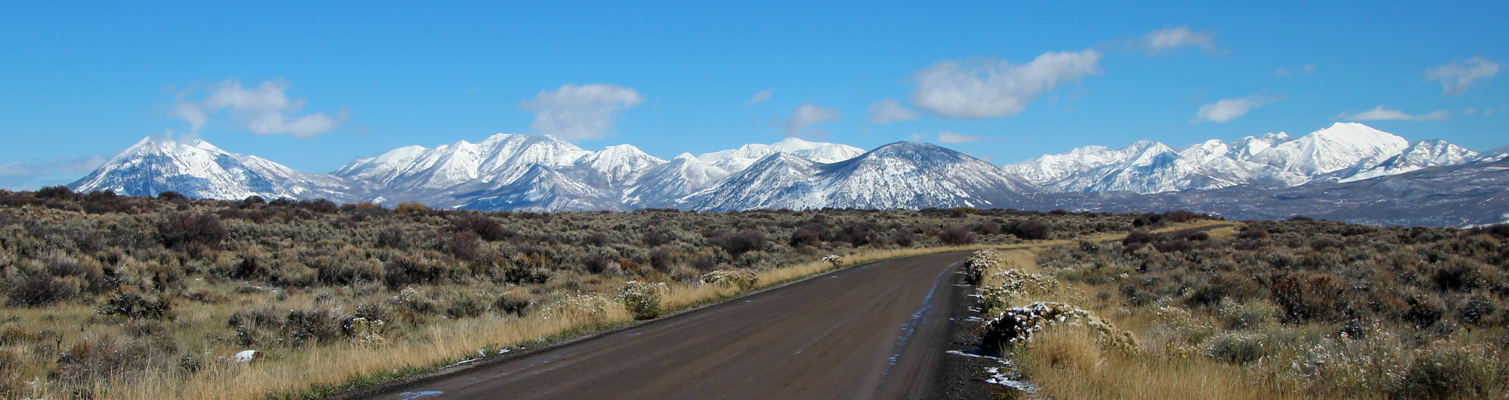
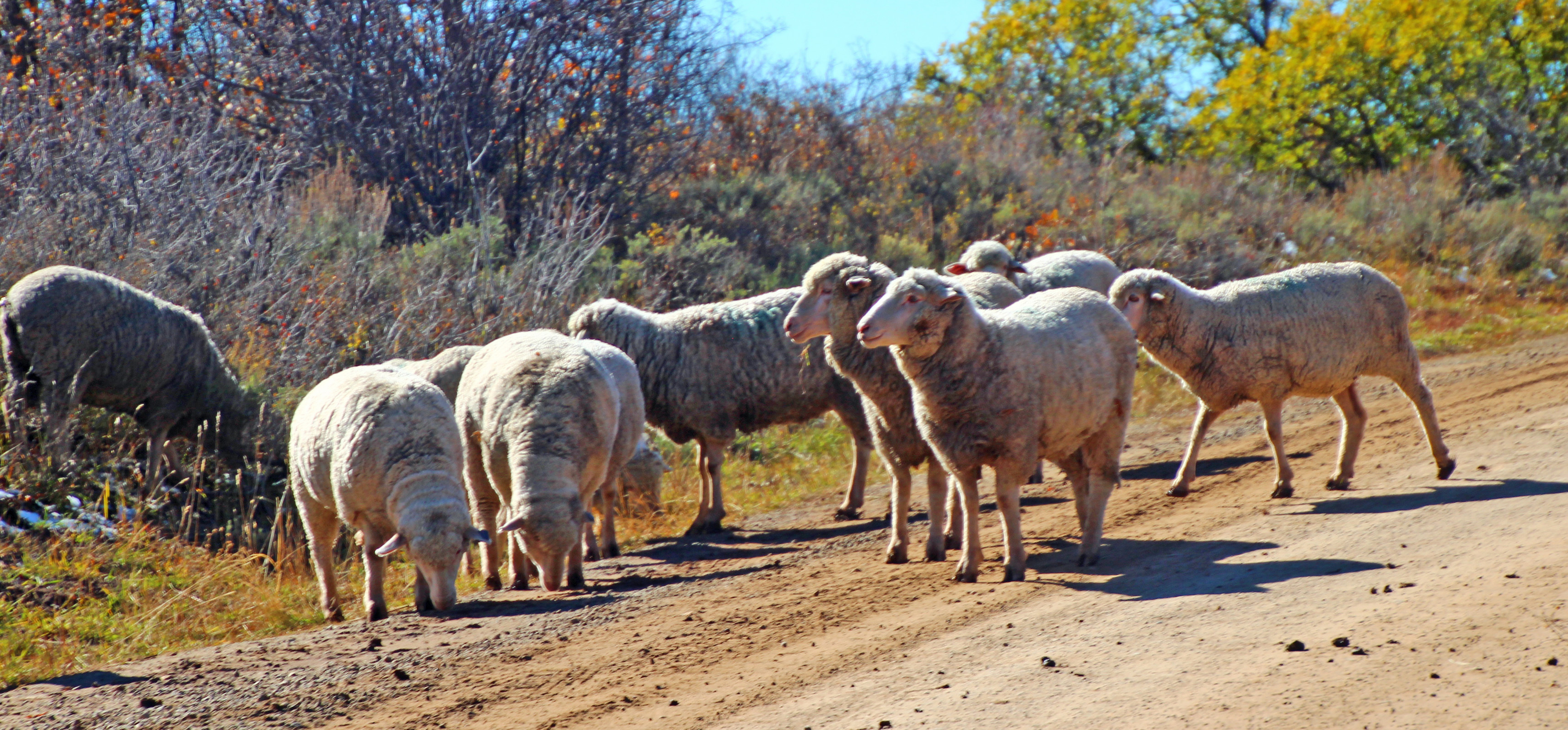
I finally managed to coax my GoPro Studio to stop crashing and I have some videos of our trip our west this fall (2021). Some pretty amazing sights, a few classic drives and “bucket list” adventures … and yes, some of the driving ones are a bit on the long side. But heck, you want to see the whole experience, right? Put them on your widescreen TV, grab a brew and sit back to enjoy (or chuckle) and maybe plan your OWN adventure!

Exploring Canyonlands Island in the Sky

It is hard to describe just how vast and beautiful the landscape of Canyonlands National Park is, even pictures don’t fully capture the breathtaking beauty. Our Western adventure in October 2021 took us to the Moab region of Utah to camp in an amazing campground: Dead Horse Point State Park. We explored the Island in the Sky region of Canyonlands in this video, with a snippet of our drive down the Shafer Trail in our Jeep.

Exploring Dead Horse Point to Moab

Camping at Dead Horse Point State Park in Moab, Utah was an unforgettable experience for us. This stop on our October 2021 trip to Colorado and Utah was the highlight for sure, with 4-wheeling adventures on Long Canyon Road, Shafer Trail and Potash Road plus grand overlooks and hikes across the mesas and slickrock. This is but one of the videos of that adventure in Canyonlands and more.

Rafting the Colorado River in Moab (UT)

While camping at Dead Horse State Park in Canyonlands we booked a half-day rafting adventure on the Colorado River. It was a pretty amazing trip between the red sandstone cliffs as our guide navigated the muddy rapids and our raftmates had a wet and wild time.

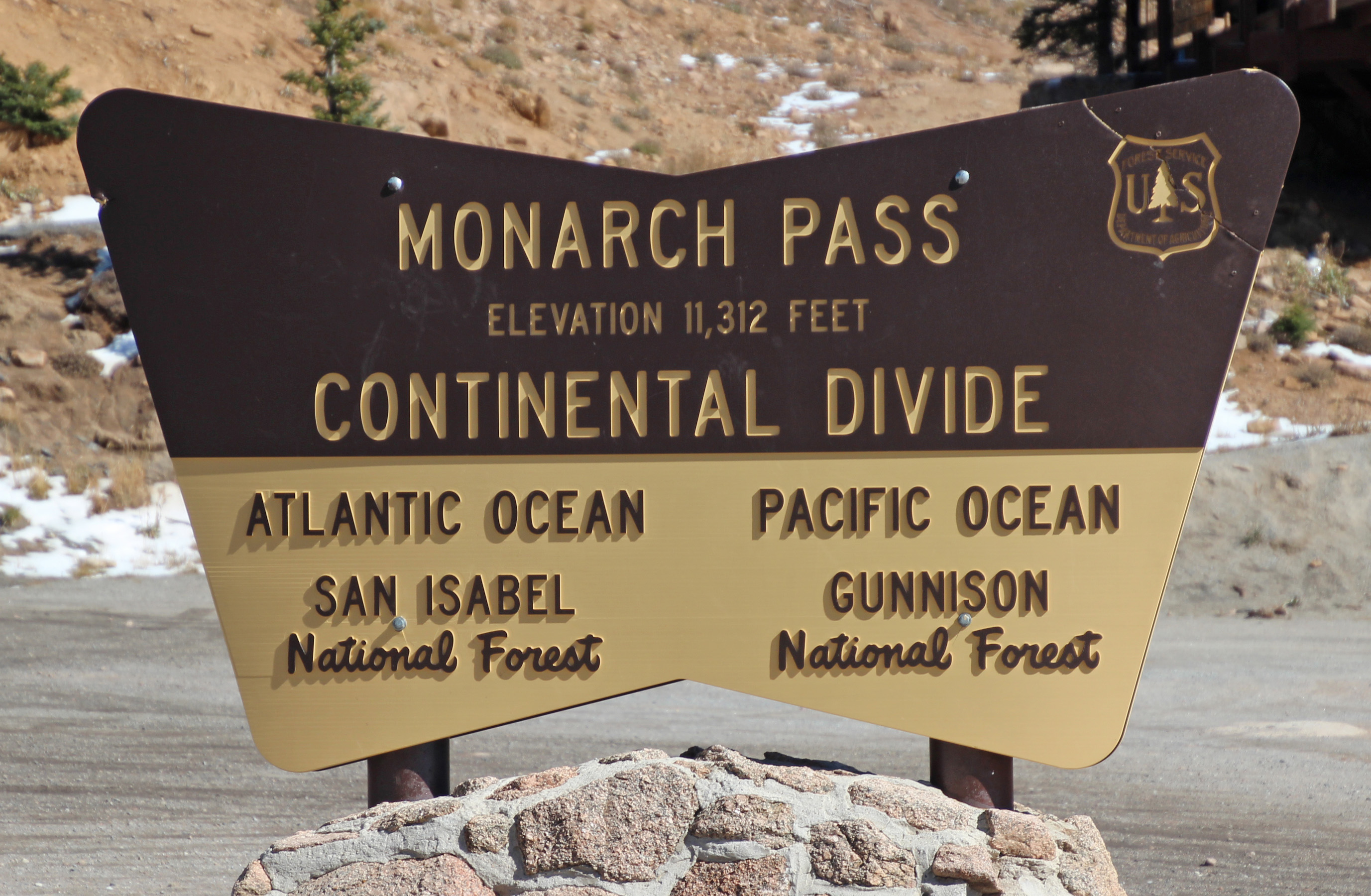
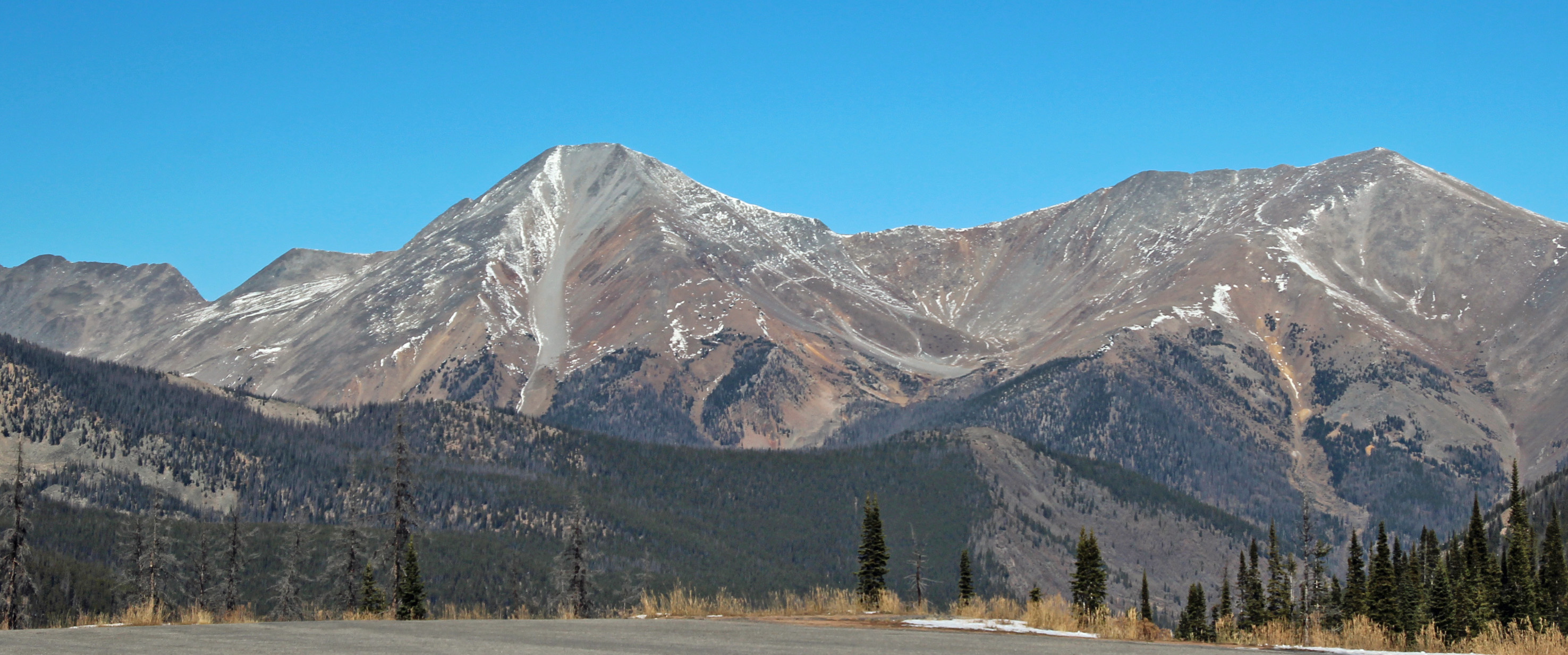
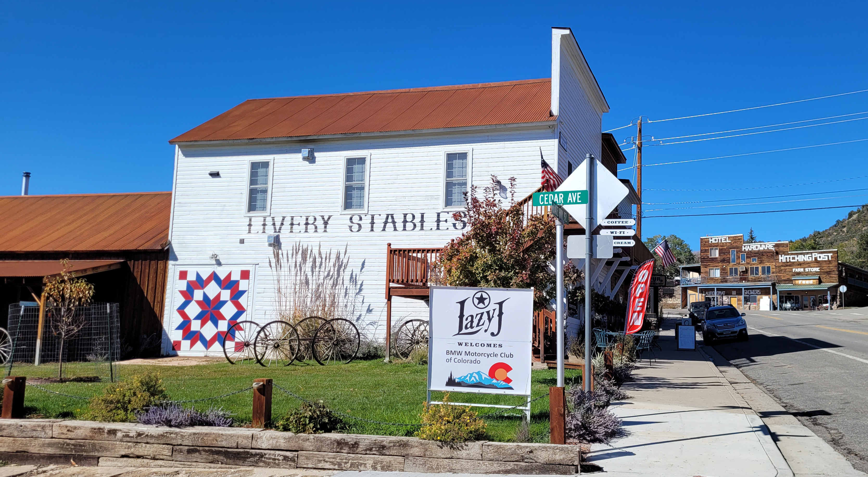
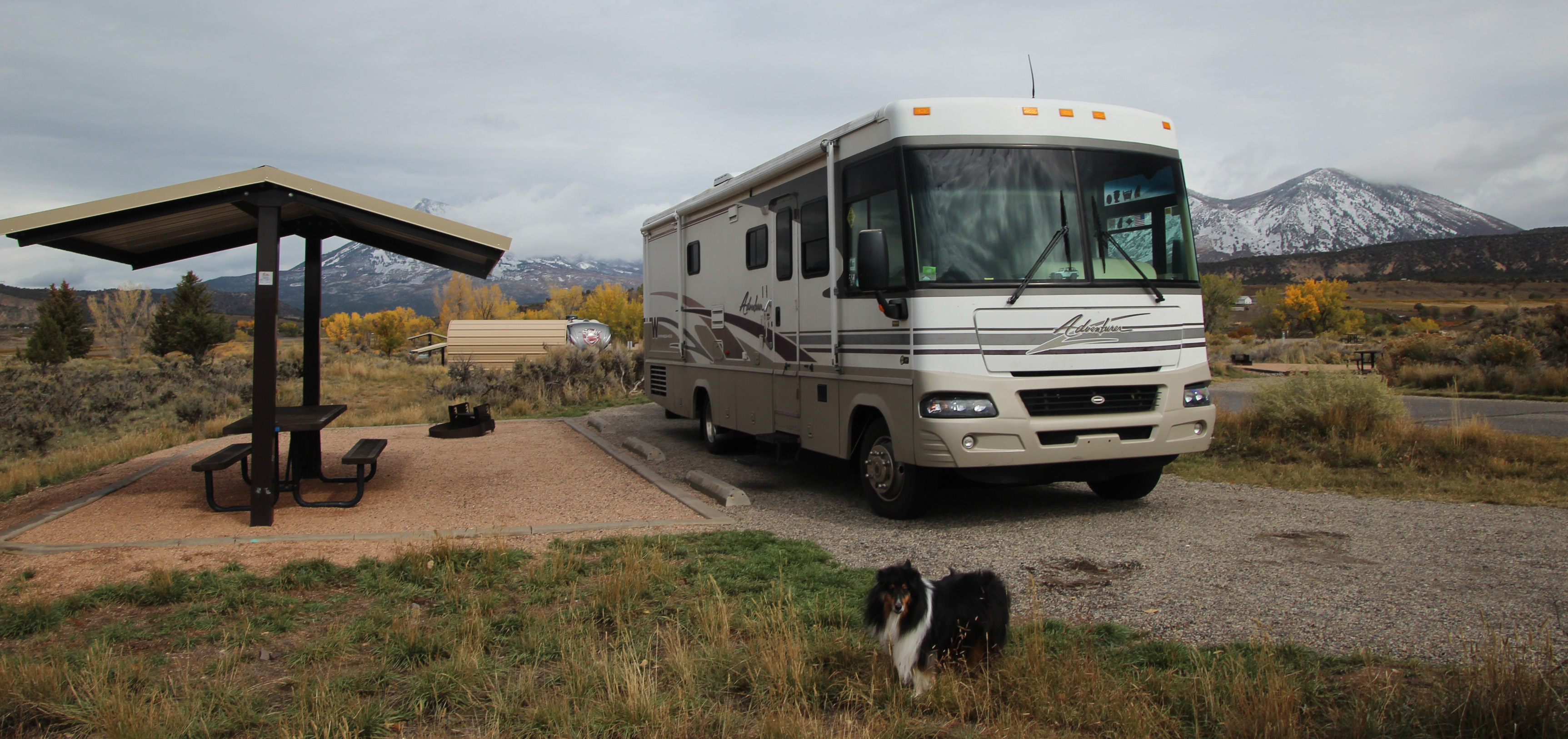
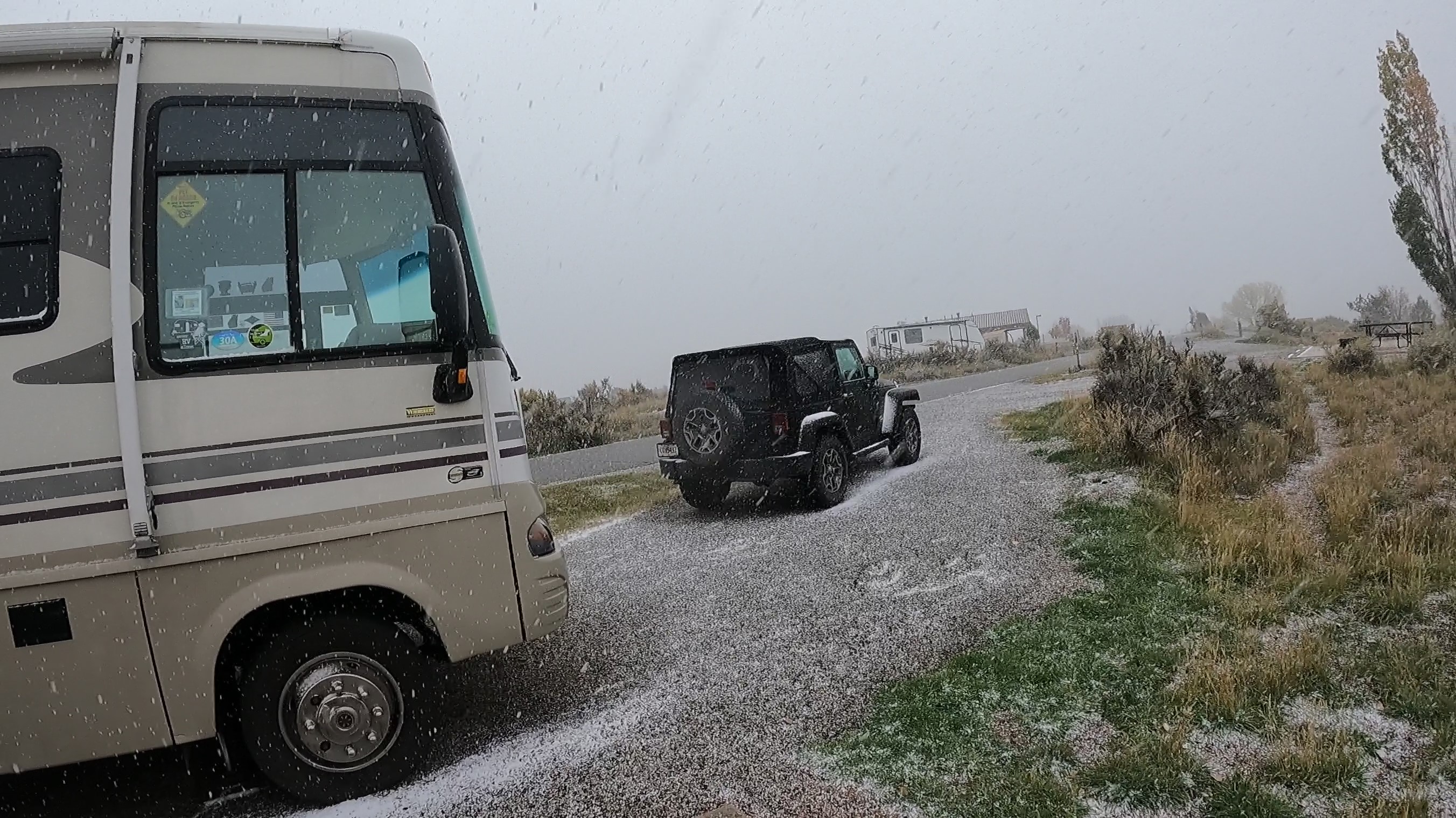
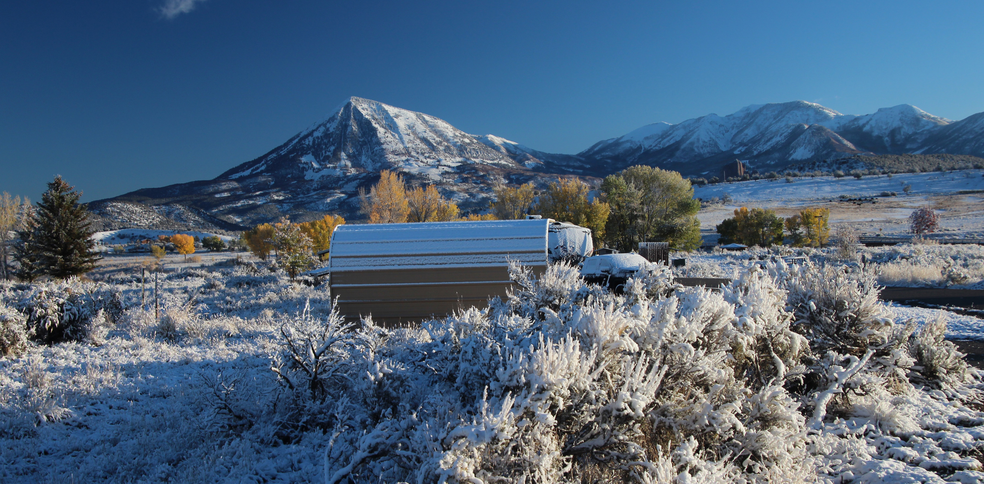
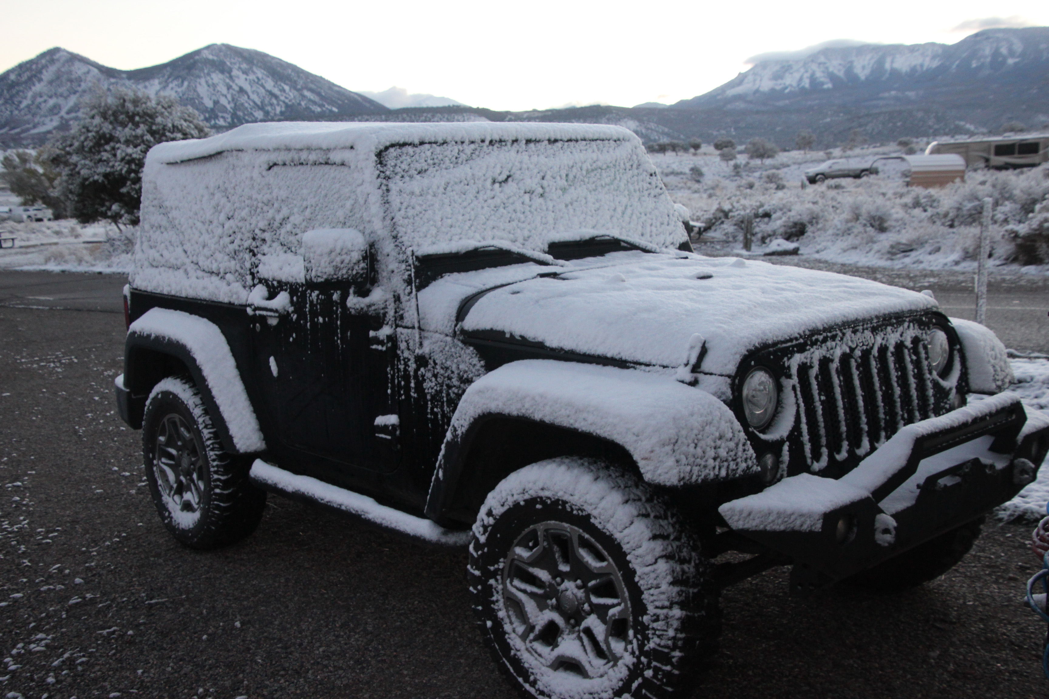
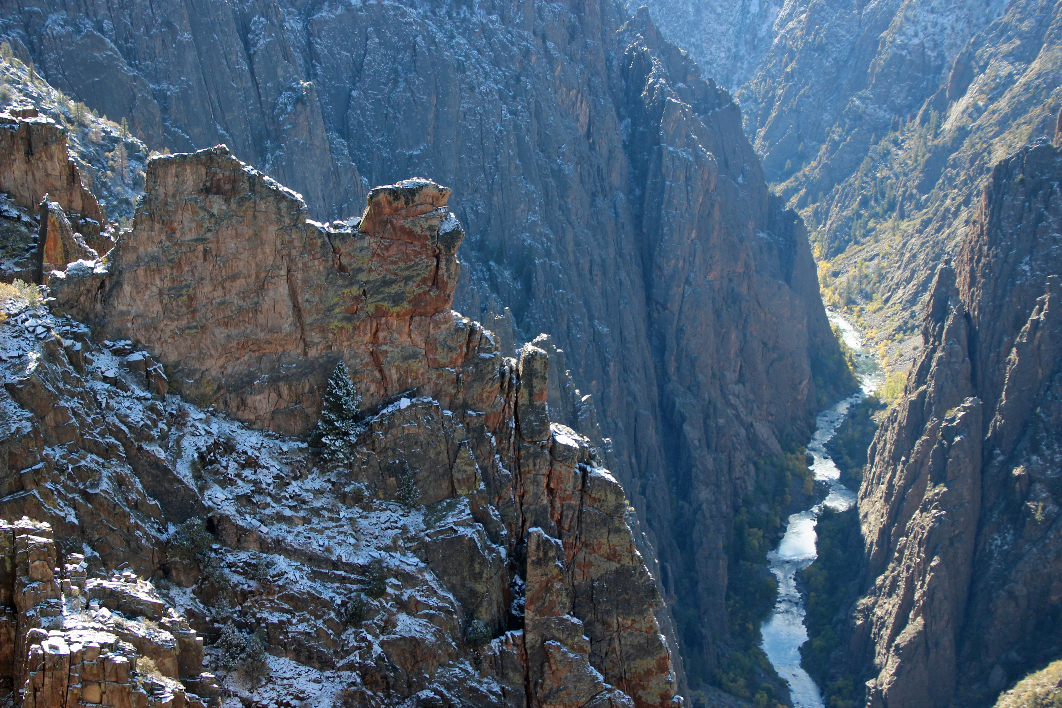
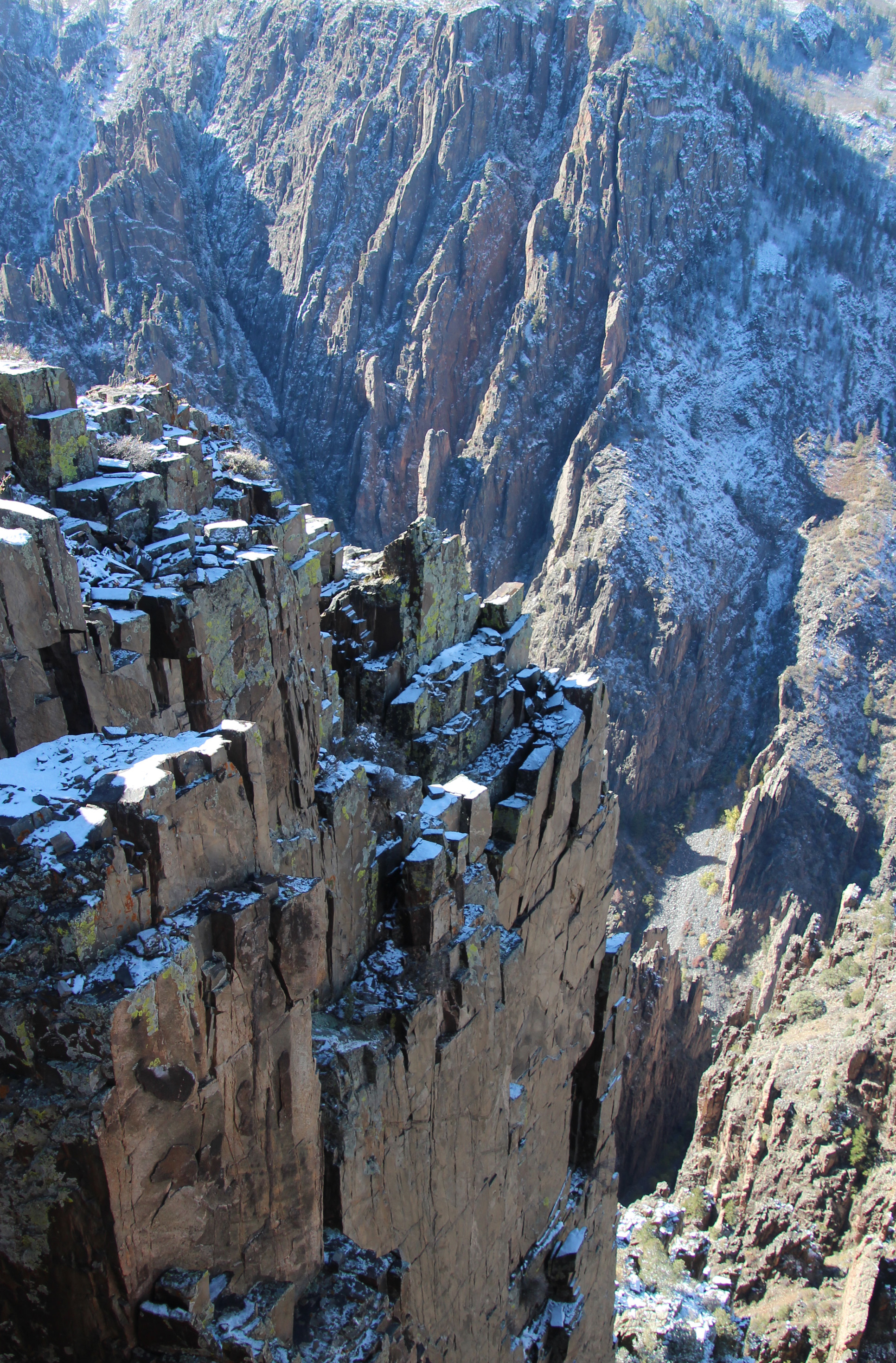
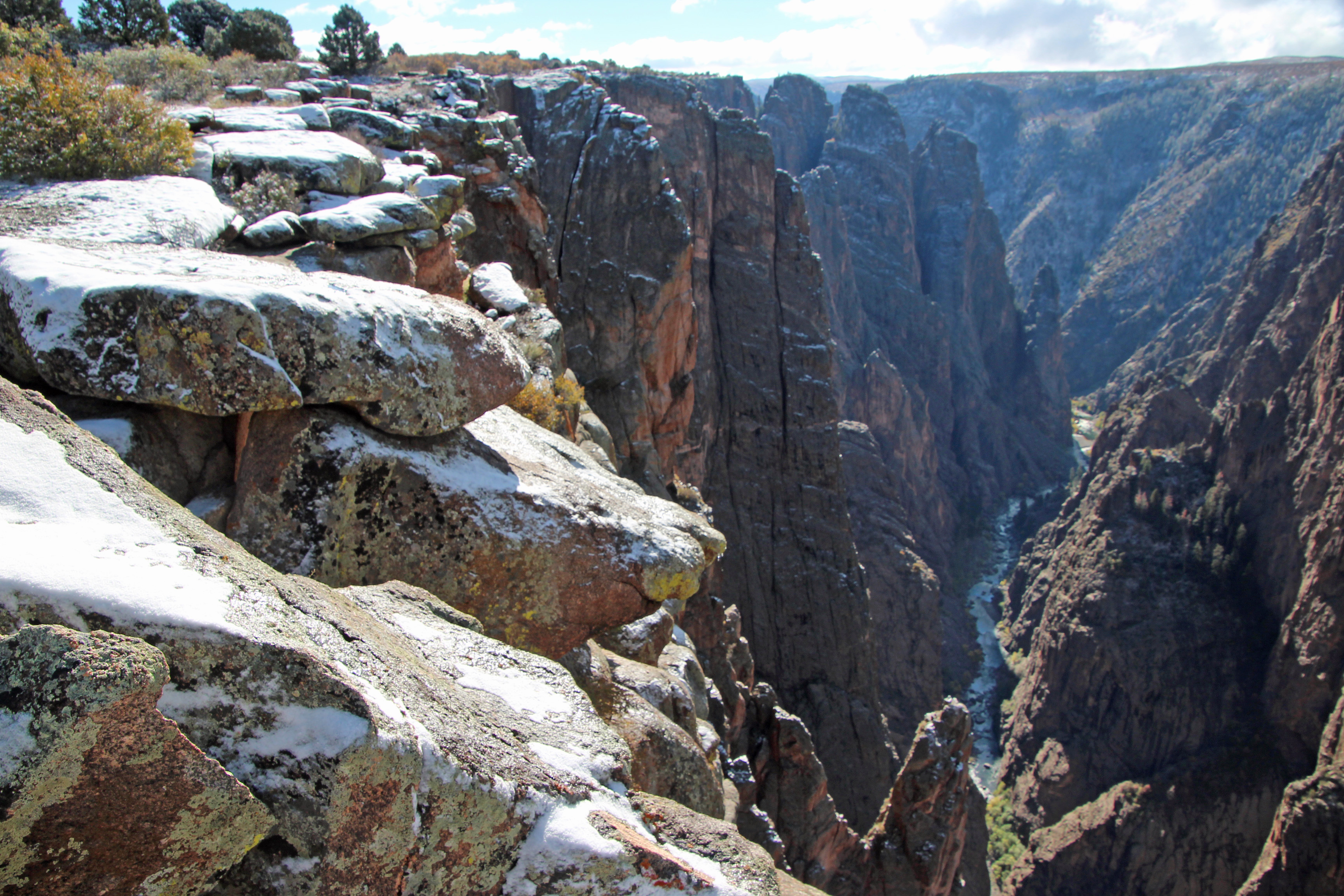
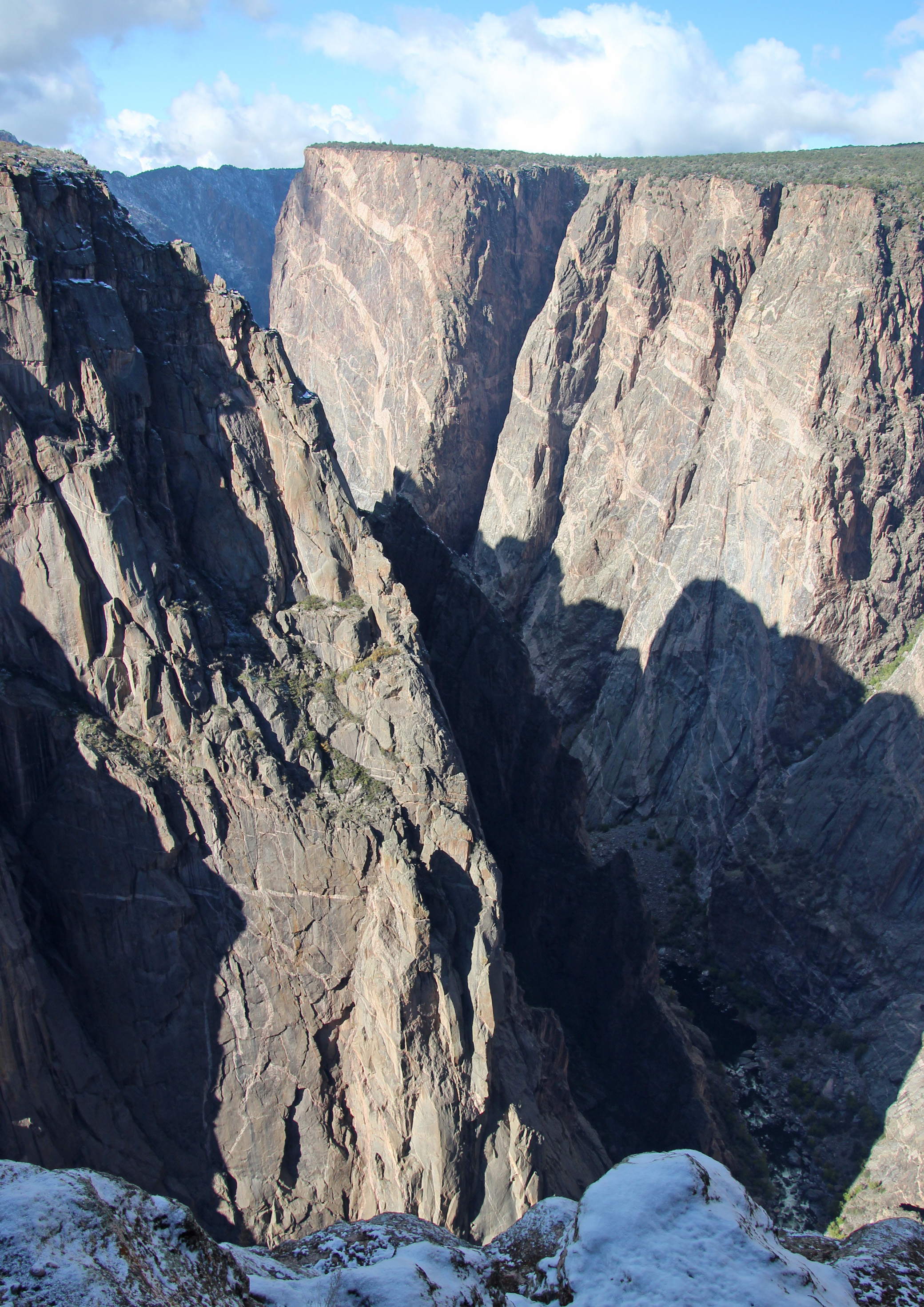
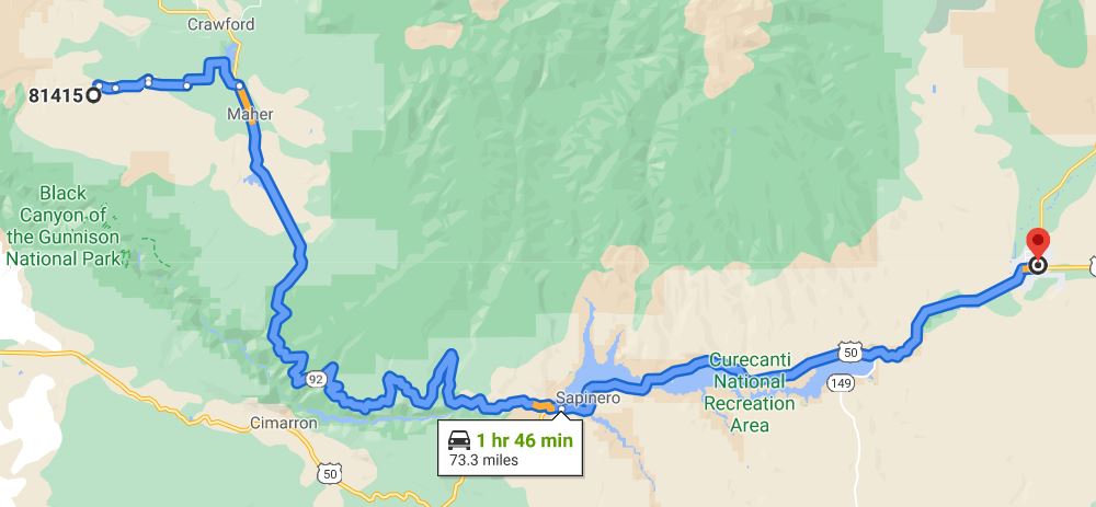
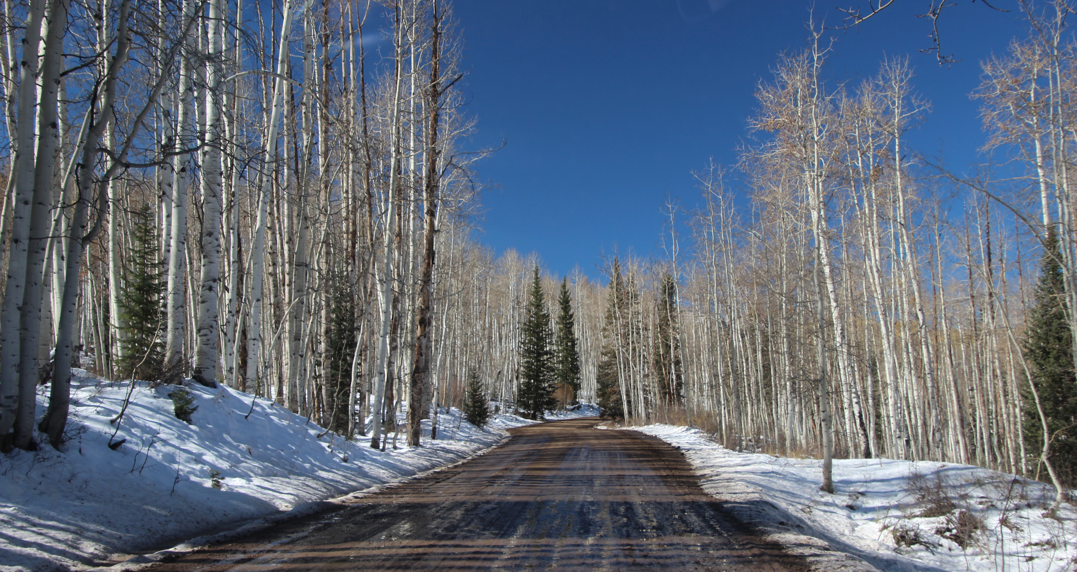
Snow Day in Colorado (Crawford, CO)

Part of our big western trip in September and October, 2021 – we were camped in Crawford Lake State Park, Colorado and planned to visit the nearby Black Canyon of the Gunnison National Park. But an afternoon sleet storm postponed that till the next day – which turned out to be our second snowy day of the trip. Absolutely gorgeous and made for a nice trip over to the Canyon later in the day. We were a bit worried about the 19 degree overnight temperature, but everything worked out fine.

Corona Arch / Bowtie Arch Trail Hike (Moab, Utah)

A fall 2021 hike to the Corona Arch and Bowtie Arch outside Moab, Utah. This 3 mile out-and-back hike was surprisingly tricky for a Sunday morning, traversing some dry washes, rocky climbs and slickrock outcroppings with cables and ladders. But the view and interaction with Corona Arch was worth the effort, though, and in some ways more spectacular than similar ones in Arches. Easy access from a parking lot along the Colorado River and a good addition to a drive along the Potash Road/Shafer Trail.

Shafer Trail / Potash Road (Canyonlands, Moab, Utah)

This was an amazing down-the-canyon drive even the video can’t fully capture. A trip from the Dead Horse Point State Park and Canyonlands National Park to the Colorado River outside Moab, Utah. The GoPro Hero9 is so good at image stabilization that it looks like a smooth ride – and it was anything but. No guard rails, either, so you had to hope you didn’t run into someone coming the other way!

Long Canyon Road (Canyonlands, Moab, Utah)

Another “bucket list” off-road drive not to be missed in Canyonlands outside Moab, Utah. Who wouldn’t want to experience “Pucker Pass” and this massive chunk of rock you drive under … very slowly. Watch for Jackie to jump out for a closer look (that I missed on editing). We love our new Jeep.

Bryce Canyon Hike (Utah)

An otherworldly landscape that we experienced on a beautiful, crisp fall day. The day was perfect and the scenery was breathtaking – literally, since we were huffing and puffing our way along the 3 mile hike that dropped down about 600 feet at the 8,000 ft. elevation — and then back up again along some challenging switchbacks. You don’t want to miss the Wall Street section of the Queen’s Garden/Navajo Loop trail. The next day we left the area in a snowstorm that dropped about 6 inches of snow, so our day turned out to be the best chance for hiking.

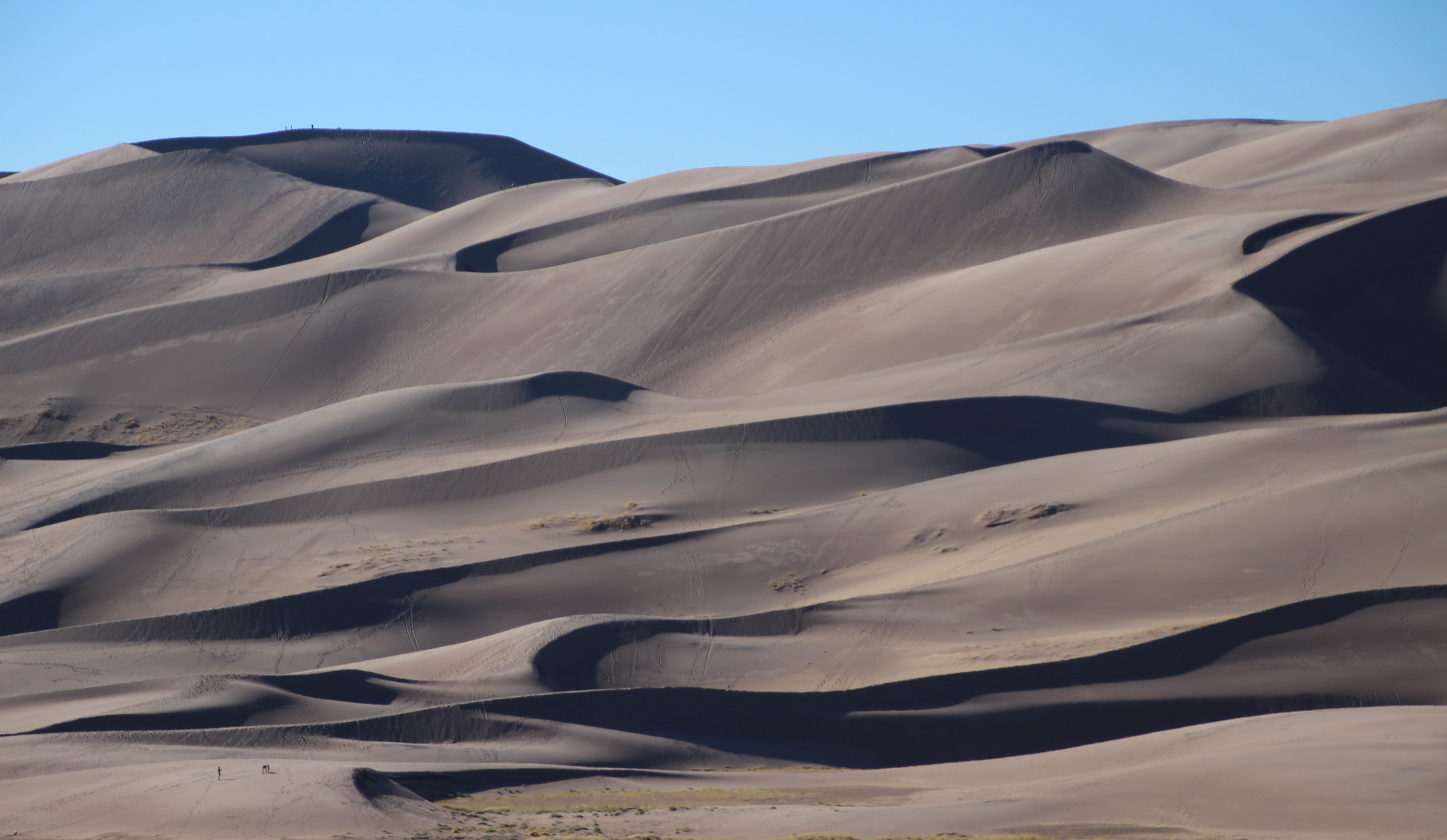
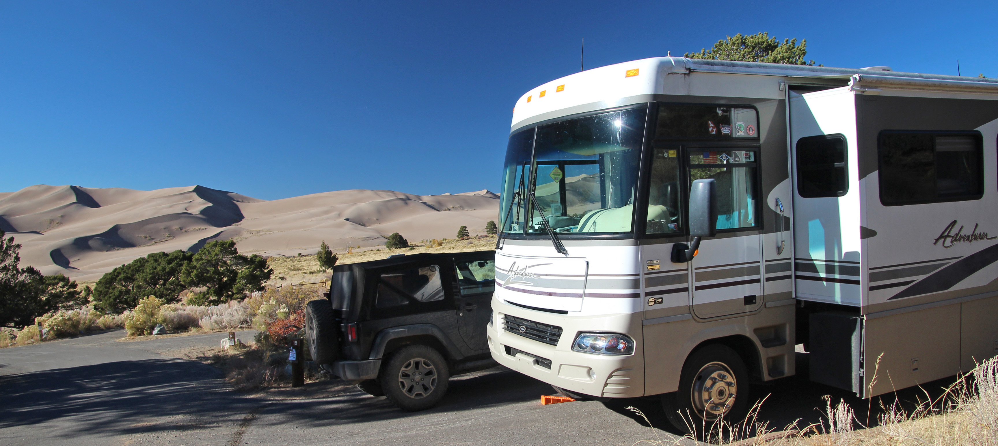
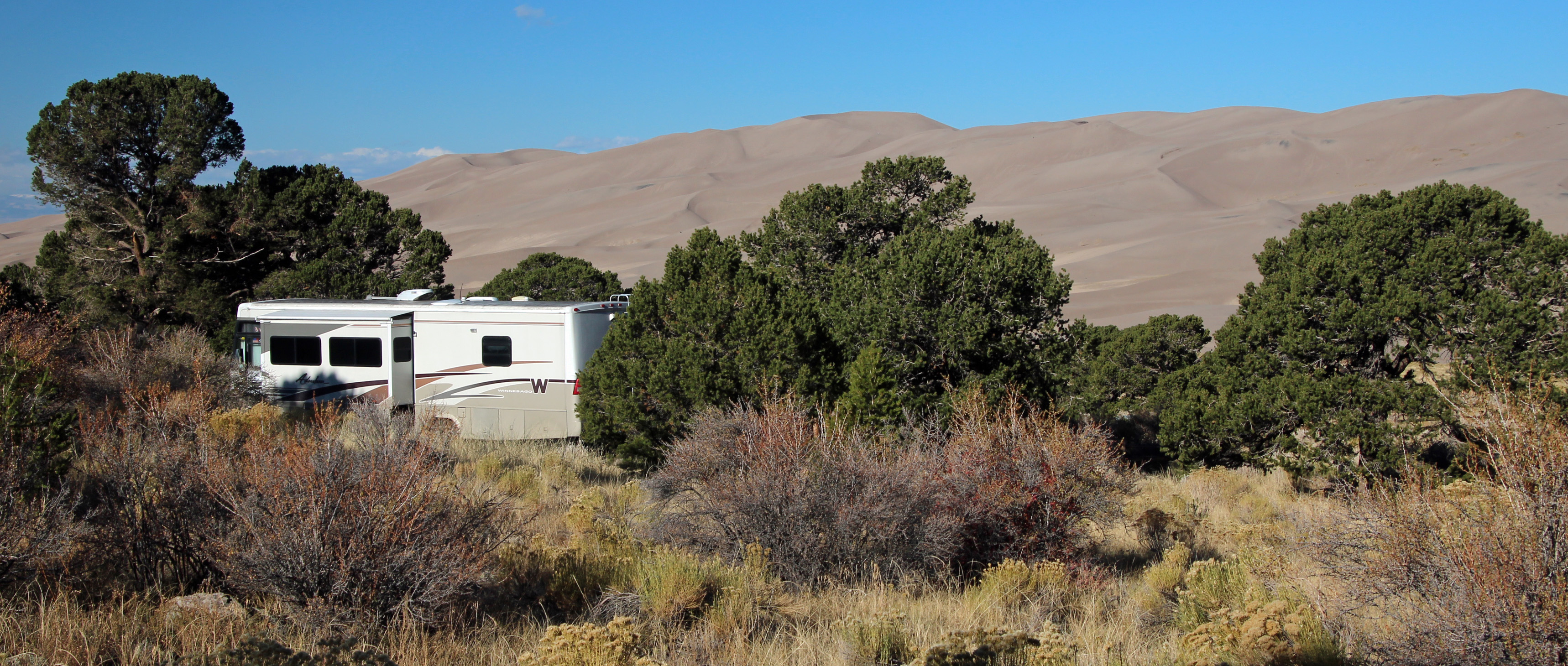
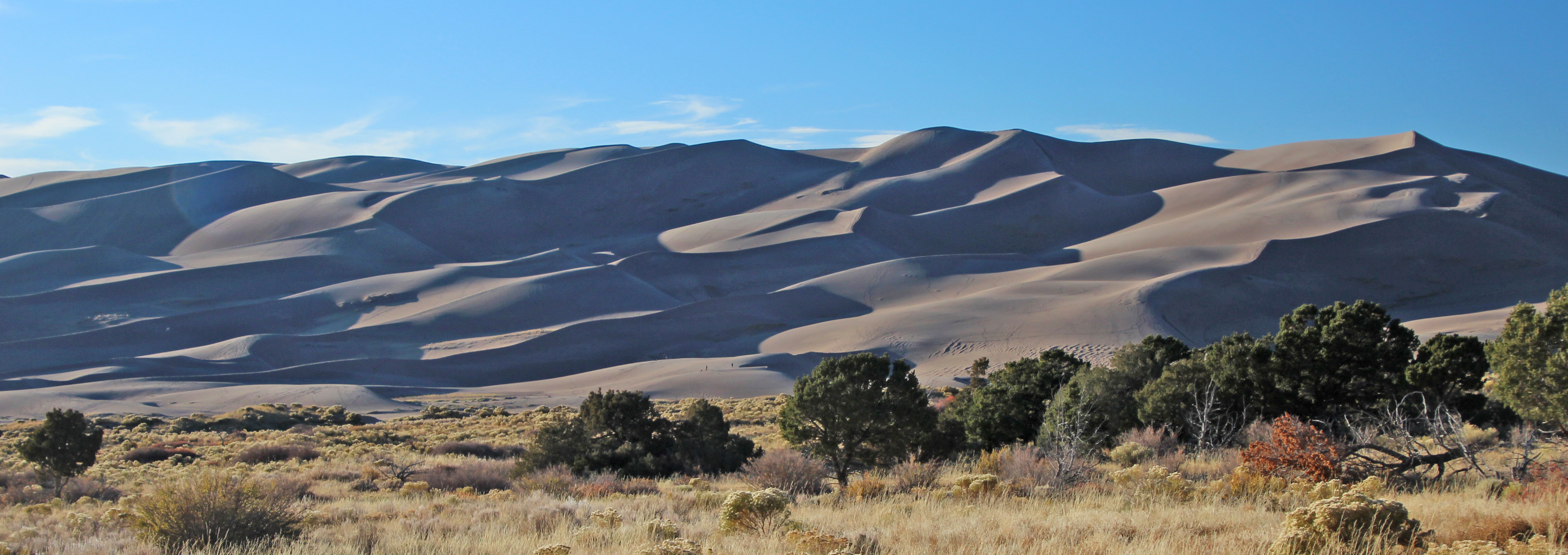
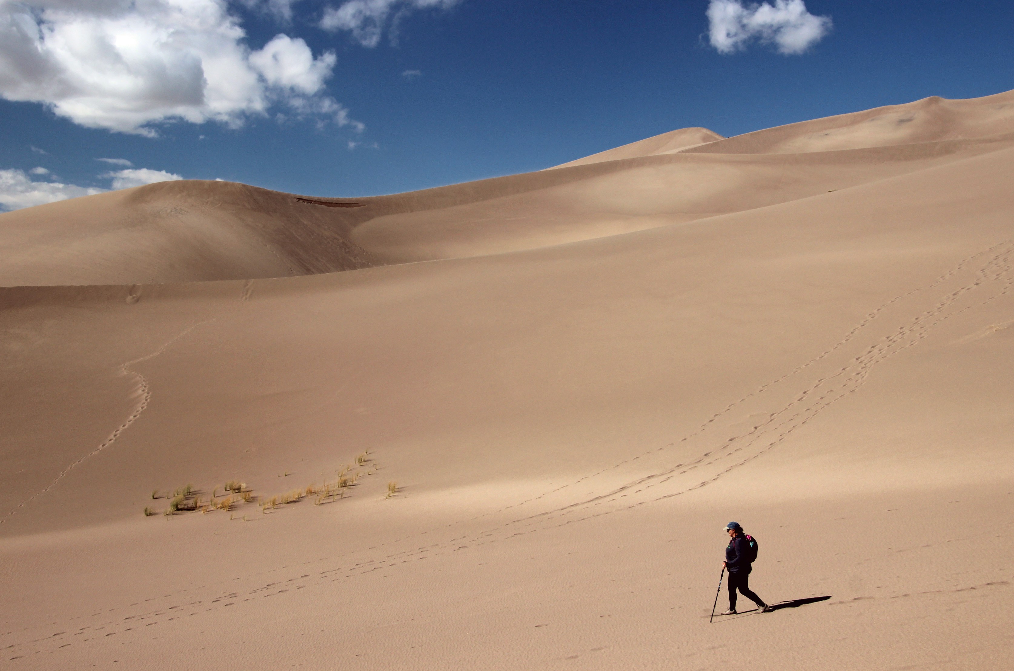
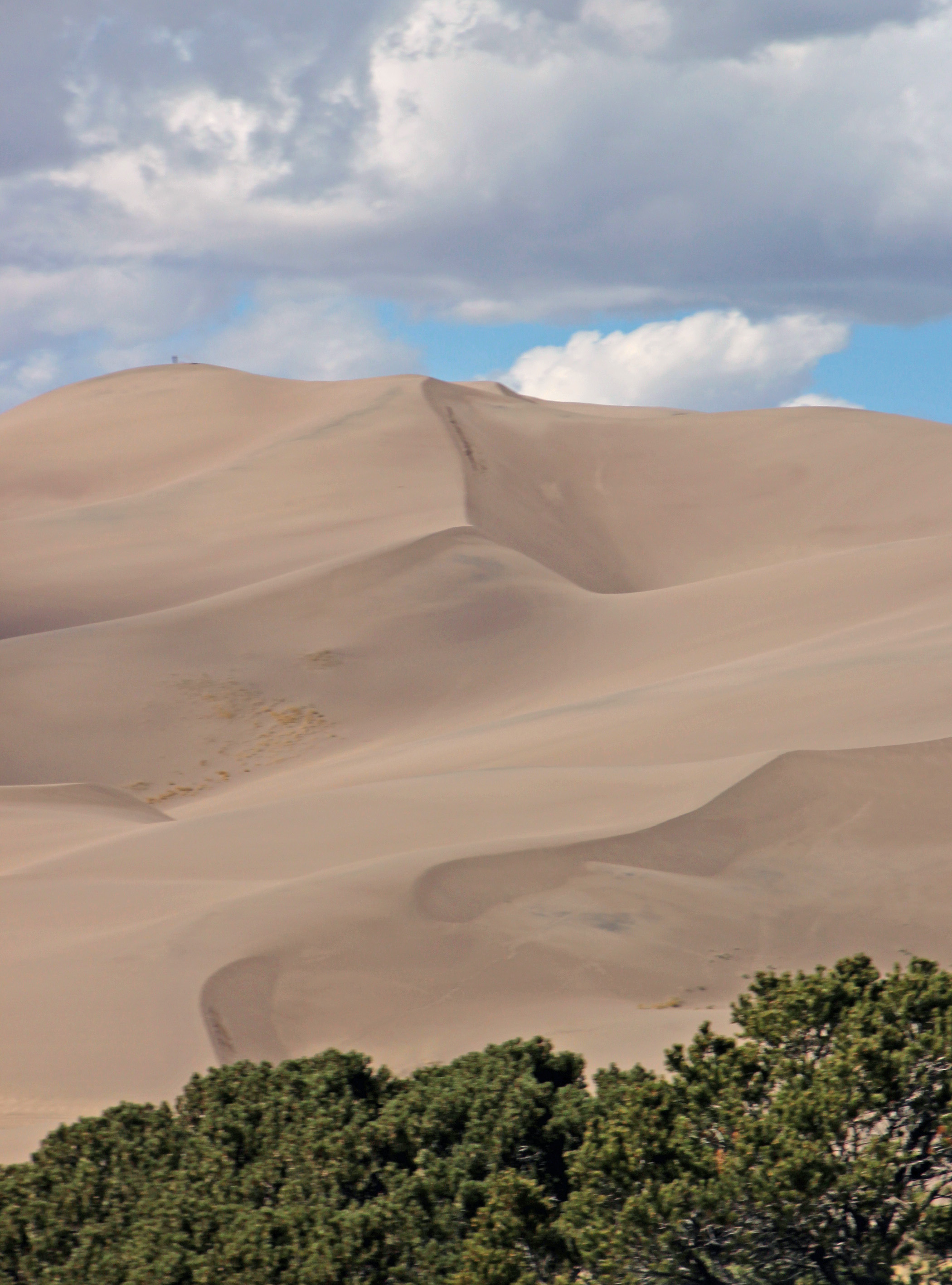
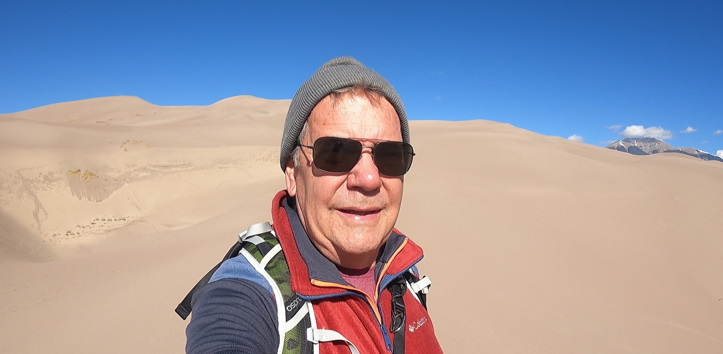
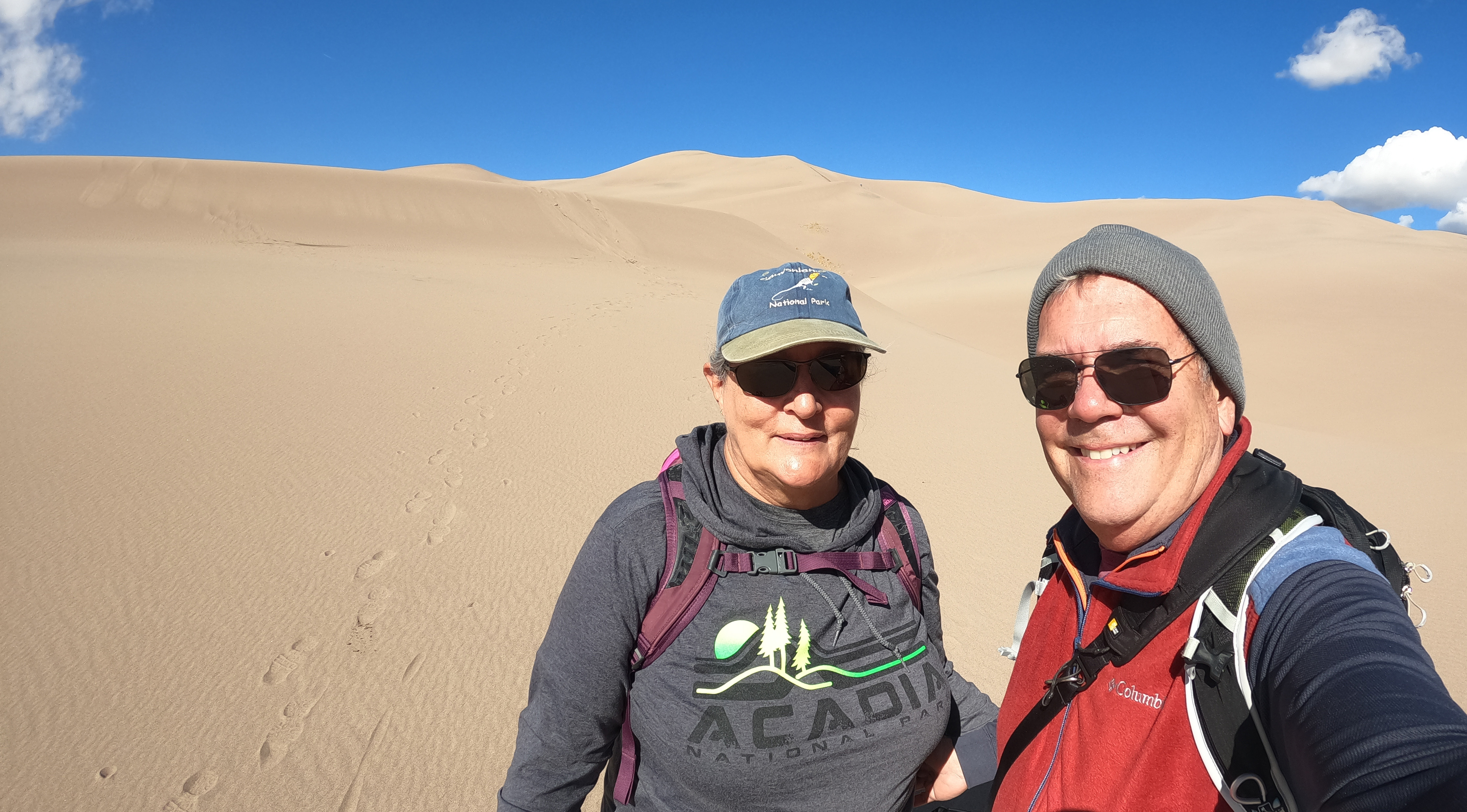
Great Sand Dunes Hike (Colorado)

While camping at Great Sand Dunes National Park we headed out to hike up to the summit of the dunes. Well, it was a pretty cold start to the day, about 35 degrees, and gradually became more windy. But we hiked our way about halfway to the top, we figure maybe a 450 foot elevation gain. Given that we were already at about 8,200 feet elevation, it was a surprisingly “breathless” hike – plus, we learned that sand dunes are not the easiest to climb. One unintentional glitch was with the lens shade I put on the GoPro. I was hoping to cut down on lens flare, but in the widescreen mode it caught it in the edges of the picture. Ah well, another learning experience. The hike was worth it though – seemed like something out of Star Wars – how the heck did C3PO do it?

More videos to come …

Categories: Outdoor Adventures | Tags: , , , , , , , , , , , , , , , , , , , , , | Leave a comment

Sand Dunes in Colorado?

You bet! And they are spectacular.

Funny how maps only show you so much – depending on how closely you look.  The trip from Crawford down to Great Sand Dunes NP looked as though our trickiest part was going to be the drive to Gunnison.  How wrong we were.  We did opt to take the route up and around to the west, going through Delta and Montrose down to Gunnison, reasoning that the easterly route we had traveled the day before was just too mountainous, curvy, icy … all of that, and the westerly route was not closed for construction on the weekend, and this was Sunday.

That was a smart move, since it was pretty much the same time and a much easier drive.  The narrow pass where the rock sides of the road were being blasted back to widen the passage was tricky but not a problem.  So as we drove alongside the beautiful, if low, Blue Mesa reservoir we were thinking we were finally out of the mountains and into smooth valley roads.  That was until we were to pass over the Rocky Mountains and the continental divide toward Poncha Springs.  We passed a tire chain spot and wondered about that, and then a sign announced the Monarch Pass Summit was 10 miles ahead.  Yep, 10 miles of unrelenting 6 – 8% uphill grade.  It was a slow go and as the engine temperature started to climb I pulled over to a nice paved pullout.  We decided to have lunch while the very hot engine cooled down.  Kinda thought it would be good to disconnect the Jeep if we were level enough, so back we went to pull the pins and disconnect.  The last pin gave us some trouble, but we cheered when we finally pulled it out. And, hey, the Jeep is rolling backward … I quickly grabbed the bumper and dug in, Jackie ran around to jump in and mash the brakes and pulled the emergency brake up one more good click (it HAD been on) and we saved the Jeep from rolling off the hillside.  Yeah, that woulda been fun.

So Jackie drove behind me as we slowly made our way up – this was an elevation change of 6,000 ft from where we started.  At the top we paused once again at almost 12,000 ft, surrounded by spruce and alpine hillsides.  Then down we went, shifting into low gear, heater blasting to peel off some of the heat load.  With our 2-way radios Jackie said she would just keep driving the rest of the way and we figured we were home free until the road started climbing again with “Poncha Summit 7 miles” sign staring at us and another 6% climb.  But without the Jeep attached the motorhome did not overheat and we made it back down the other side.  Then the road became the straightest, flattest, most boring road ever through the valley.  A couple of turns and we were at the park, headed for our campsite in Pinyon Flats campground.  Pinyon trees, yes, flat, no.  Tight spots, yes.  Backed in like an expert – yes.

What a view!  Across from our site was a mountain of tan sand dunes, hundreds of feet high.  Shadows played across the dunes and it just seemed so out of place.  The prevailing winds from the west long ago blew the sand from the ancient dry flat lake bottom across to the base of the Sangre De Cristo mountains, where lighter winds from the east blew it back into dunes.  Awesome.

We were set for the night, this being a dry site we had plenty of water and were prepared for no electricity.  We earlier figured out how to power Jackie’s BiPap machine from the house batteries and we were using the propane heater.  If needed, we could fire up the generator to make coffee and charge the devices.

Overnight was not as cold, only got to 34 degrees, and by 9 or so we were out starting our hike to the dunes.  We were layered up, hats and gloves, had water and walking sticks and were going to do our best to climb that sand.  Yep.  Going up, trying to stay on the ridgeline, no real path to follow, soft sand making for slow going.  Many “catch your breath spots” as we are at about 8,500 ft and even tying your shoes gets you winded.  We set a goal of a dune crest that was more than halfway up and figured that would be enough.  I think the summit is about an 800 ft climb.  Since we didn’t have sandboards to slide down, we just slid/stepped our way back down the sandhill.  Loads of fun going down.  And at the bottom we emptied out about a cup of sand from our shoes and socks.  At least I did.

Check out a video of the hike here: Great Sand Dunes Hike

After lunch we hopped in the Jeep to drive back to Visitor’s Center and then to try a 4WD roadway that went up the mountain slope.  They caution you to use 4L and to drive quickly across the soft sand, and lucky for us no one else was on the track.  It was fun as you drove through tight turns banked up the sides and then across pretty deep sandy stretches.  We turned around at the aptly named “Point of No Return” and did it all again.  Had we been serious about going further we would have had to deflate the tires a bit, but with no compressor to refill them, not gonna happen.  On the way back we finally saw a couple of Mule Deer bucks on the roadside, and despite ALL the whitetail deer we see at home, it was still cool.

Tomorrow we start the journey back home and plans are a little fuzzy.  We called in a reservation at a campground in Lamar, Colorado for tomorrow night and are trying to figure whether to drop down to Oklahoma or keep heading east to Wichita, Kansas.  I think we want to eventually drop down to Memphis rather than across to St. Louis, but we shall see.

Thanks for sticking with our western adventure.  I know I can get a little wordy sometimes, but if you ever consider doing the sort of travel we do, you ought to know what to expect – great and not-so-great.

And I have to think that Mom and Dad are looking down on us and helping smooth the way for our adventures – they loved camping, travel and the outdoors so much I am sure they are with us on this adventure.

Categories: Outdoor Adventures | Tags: , , , , , , | 1 Comment

Colorado Chill

Ok then, where did we leave off?  Ah, yes, we were in Fruita, Colorado enjoying some beer at three breweries.  We started off at Monumental Beer Works in Grand Junction and had some very good brews in a flight or so.  I really enjoyed one they brewed with some Pinot Noir that had a very distinctive flavor.  Next stop was back in Fruita at Suds Brothers Brewery where we had two pizzas to share (yay it was pizza special night) and some honey wheat beer.  Third stop was at Copper Canyon for a flight of beer and then back the 2 miles or so to camp.  Campground here is excellent – paved sites that are clean and level, with the Colorado River just a short walk away.  Kodi loved the lush green grass, a nice change from the rocks and sand of the desert landscapes we just left.  He probably didn’t get as excited about the afternoon grooming and nail clipping that he got.

I have to share something from the day before.  Driving through a stretch of Utah we had another road sign warning “Eagles on Roadway.”  Really.  Not the shoulders, not in the sky, but on the roadway?  “Next 5 miles”  Of course we didn’t see the eagles, just tire retreads.

Overnight was rain once again, but clear by morning and cold.  Some of the dust grime got washed off the jeep and motorhome, but that will probably soon change.  We didn’t have an especially long drive today, so breakfast was pancakes and we savored two cups of coffee.  Grand Junction had fairly reasonable gas prices ($3.50 instead of $3.99) so we filled up and drove south to Delta, where we took Hwy 92 southeast toward Crawford instead of Hwy 50 toward Montrose.  Ok, that probably makes no sense to you, but months ago we read about the construction on 50 south of Montrose that shut down the road for hours at a time, sometimes half a day.  We routed ourselves on 92 to avoid that delay and thus would be on the north rim of Black Canyon instead of the more popular south rim.  And frankly, the road and drive has been easy so far.

Oops, spoke too soon.  There was a warning about an accident ahead and rather soon flashing lights and police cars had the road blocked and we were sent across the railroad tracks on a detour around this accident.  Smaller 2-lane farm road then, the kind that goes in rectangular directions around the farms, with sharp right angle turns and non-existent shoulders.  That was tolerable, but the first mile or so was an elevation change of 1,000 ft up on switchbacks that were not fun.  I was doing my best at 10 – 15 mph, but we made it up and across and around and down, making it back to the original highway with no idea of this accident.  Exactly the kind of thing we were trying to avoid, however.

The towns of Hotchkiss and Crawford were cute and soon we saw these huge looming mountains – I think Saddleback Mountain, that were draped in snow and clouds, part of the southern Rockies.  The contrast of the golden yellow cottonwoods against the grey blue of the mountains was spectacular.  Ok, well we were soon in Crawford State Park with a campsite lakeside, but no water in the reservoir.  No matter, it is a level site that has a shelter and gravel and nice view of the mountains.  Unhitched, jump started the Jeep and had lunch.  We figured we ought to go straight to the Black Canyon of the Gunnison that was almost across the street (10 miles) so we grabbed coats and such and hopped in the Jeep. 

Oh my, it was suddenly a sleet storm that was blowing a ton of sleet around.  Visibility was bad and the icy bits were sticking to everything but the road.  Well, wouldn’t see much in that storm, so we changed plans and rode it out for a bit in the motorhome.

It cleared up finally and since it was only 2:00 our change in plans meant we would drive to Hotchkiss, hang a right and head toward Paonia.  There were a couple of things on my checklist I wanted to see.  Big B’s Orchard and Hard Cider was one stop.  Crazy place of U-Pick orchards and cider house.  We had a bourbon barrel aged hard cider and a cherry apple hard cider that were pretty darn good.  Not as refined as Etta Place, but perfect for the weather.  Not done yet, though.  Just a couple miles ahead in Paonia we were looking for the Paonia Bread Works and Paonia United Brewing.  Well, bread shop closed early, but brewery was just opening, so guess where we went?  Cute little place in a converted church of all things.  Jackie had some samplings and I had their Belgian Tripel, which was awesome.  We checked in on wifi and chatted with some of the locals, who were clearly regulars.  Talked about the weather just as another snow shower came through and the locals all shrugged it off. 

And back to camp we drove, through another snow shower and some gorgeous scenery.  Stunning mountains.  We might try this drive in two days as a connection up to Crested Butte, but the road through the mountains is dirt, so it depends on weather. It is cold, expected to get into the 20’s overnight with some more precipitation, but tomorrow is expected to be sunny.  Who knows?  The forecast is only good for a couple of hours it seems.  But the plan is for Black Canyon tomorrow and drive (98 miles) to Crested Butte the next day. Check out a bit of video of this unexpected weather: Snow Day in Colorado.

Well the weather prediction was right.  It got down to 19 degrees and once again we had an overnight snowstorm that left us with 2 plus inches of snow.  Everything was coated with snow, but the sky was clear and we started out for Black Canyon of the Gunnison.  Yep, the roads got a bit slippery and the final 6 miles were dirt covered with packed powder, so we popped it into 4WD.  Did manage to see several mule deer in the snow, no bucks though. We drove along the north rim, stopping at overlooks and short walks to the canyon rim. 2,700 feet down sheer black walls was the Gunnison River.  It was a bit dizzying and breathtaking at the rim – this is one of the narrowest and deepest sheer canyons in the US and it does not disappoint.  Hard to capture the depth on camera, since the black rock is also mostly in shadow.  How this river has carved down through this rock is simply unbelievable.

When we turned back towards camp the mountains ahead were brilliant in the sunlight, covered in fresh snow.  The Jeep however was covered in fresh mud.  As temperatures rose the snow turned to mud ruts and … well, it is a Jeep and should be used to this.  I did give it a quick blast of water when in camp to get the worst of the mud off.  Got gas nearby, walked the one block of Crawford, then spent the afternoon relaxing at camp as temps rose into the 40’s.  Grilling steak and roasting brussel sprouts for dinner, then tucking in for another cold night.

We got a nice surprise just as I started grilling:  flocks of sandhill cranes flew overhead and soon dropped down into the dry areas of the reservoir.  I turned down the grill, grabbed my camera and drove closer down the road.  Caught some pictures as they cranes all gathered along the shore.  Not as clear pics as I like, but as it happens we got up early enough next day to catch them before they flew off.  Very cool.

And that was a cold morning again, 21 degrees.  Big drive today around the West Elk Loop – basically driving south to Gunnison, then north to Crested Butte.  About 100 miles one way.  It was a good thing to drive this, as we both decided this was NOT the road to take to Gunnison.  Too much of a mountain road for the motorhome.  So we will instead drive around the Black Canyon by way of Delta, Montrose and down into Gunnison.  That construction we spoke of does not happen on weekends, and our day to drive is Sunday. Ok, matter settled, change of plans for tomorrow.

Back to Gunnison and Crested Butte.  Gunnison seems like more of a working town, CB is more touristy, kind of a Bohemian outpost.  It was a great day, temps heading into 60’s as we walked about.  Stopped in to have a beer and lunch at the Eldo Brewery.  Sat upstairs and warmed up as Jackie had a scotch ale and I had a strawberry lime sour.  Soup, dumplings and orange chicken to eat. 

We wanted to try a “shortcut” of 30 miles back to Paonia and Crawford called the Kebler Pass.  This goes from the 8,900 ft elevation of CB to about 10,000 ft through mountain passes filled with the largest stand of aspen in the US.  Partially paved but mostly dirt/gravel road.  Why not?  And the trip was spectacular.  Awesome drive through aspen and spruce, even though the aspen had already dropped their golden leaves.  Yes, mud, dirt, packed snow, slush and winding turns, but much better than 100 miles around the other way.  Oh, and no sign to warn us of “sheep in the road” this time … guess they don’t rate their own sign. 

When we reached Paonia we checked on the bread works, still closed, but found Chrysalis Barrel Aged Beer was open, so we just HAD to try some.  Aged apricot sour for me and Bourbon Barrel Aged Stout for Jackie.  Definitely delicious and a great way to relax from the drive.

Down (we hope) to Gunnison and on to Great Sand Dunes NP tomorrow, another long drive.  Should be nice sunny weather for the drive.  Will try to post this sometime soon – you know, the whole wifi connection thing.  Thanks for joining us.  See you soon. 

Categories: Outdoor Adventures | Tags: , , , , , , , , , , , , , , , , , , , , | 3 Comments

Blog at WordPress.com.

%d bloggers like this: